Category:Nantucket Shoals
an area of dangerously shallow water off the Massachusetts coast, USA  _Nantucket_Shoals.jpg) | |||||
| Upload media | |||||
| Instance of | |||||
|---|---|---|---|---|---|
| Part of | |||||
| Named after | |||||
| Location | Massachusetts | ||||
| Significant event |
| ||||
 | |||||
Subcategories
This category has only the following subcategory.
L
Media in category "Nantucket Shoals"
The following 15 files are in this category, out of 15 total.
-
 A chart of Nantucket shoals (3045498021).jpg 2,000 × 1,316; 2.45 MB
-
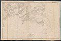
 A new chart of Nantucket Shoals & George's Bank with the adjacent coast LOC 2008624040.jpg 15,059 × 10,247; 19.48 MB
-
 A new chart of Nantucket Shoals & George's Bank with the adjacent coast LOC 2008624040.tif 15,059 × 10,247; 441.48 MB
-
 A new chart of Nantucket Shoals & Georges Bank with the adjacent coast (8249585191).jpg 2,000 × 1,368; 2.07 MB
-
 Admiralty Chart No 2489 Nantucket Sound Eastern Part and Approaches, Published 1955.jpg 11,056 × 16,249; 44.99 MB
-
 Admiralty Chart No 2890 Nantucket Shoal to Block Island, Published1862.jpg 13,086 × 8,678; 14.67 MB
-
 Argo Merchant run aground.jpg 400 × 206; 20 KB
-
 Chart of the Vineyard Sound and Nantucket Shoals (10212586913).jpg 800 × 521; 67 KB
-
 Chart USCGS 1107 (NOAA 13200) Nantucket Shoals.jpg 6,911 × 4,955; 1.77 MB
-
 From Monomoy and Nantucket Shoals to Muskeget Channel, Mass. (8250932658).jpg 1,499 × 2,000; 2.03 MB
-

-
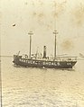 Nantucket Shoals Lightship no. 66.jpg 3,430 × 4,406; 1.53 MB
-
 Nantucket Shoals NOAA chart 12300.gif 762 × 746; 46 KB
-
 Nantucket Shoals, Mass. (3120016807).jpg 1,639 × 2,000; 2.47 MB
-

.jpg)

.jpg)


.jpg)
.jpg)
.jpg)

.jpg)
