Category:Narrowboats in West Yorkshire
Ceremonial counties of England: Bedfordshire · Berkshire · Buckinghamshire · Cambridgeshire · Cheshire · Derbyshire · Devon · East Riding of Yorkshire · Essex · Gloucestershire · Greater London · Greater Manchester · Hampshire · Hertfordshire · Kent · Lancashire · Leicestershire · Lincolnshire · Merseyside · Norfolk · North Yorkshire · Northamptonshire · Nottinghamshire · Oxfordshire · Shropshire · Somerset · South Yorkshire · Staffordshire · Suffolk · Surrey · Warwickshire · West Midlands · West Sussex · West Yorkshire · Wiltshire · Worcestershire
City-counties: Bristol ·
Former historic counties:
Other former counties:
City-counties: Bristol ·
Former historic counties:
Other former counties:
Subcategories
This category has the following 7 subcategories, out of 7 total.
Media in category "Narrowboats in West Yorkshire"
The following 156 files are in this category, out of 156 total.
-
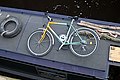
 A narrowboater's bike - geograph.org.uk - 4232945.jpg 4,000 × 2,666; 2.18 MB
-
 Abandon ship^ - geograph.org.uk - 678715.jpg 640 × 406; 87 KB
-

-
 ADM Mills, Knottingley - geograph.org.uk - 579193.jpg 427 × 640; 77 KB
-
 Aire and Calder Navigation - geograph.org.uk - 1725.jpg 640 × 480; 215 KB
-

-
 Aire and Calder towpath - geograph.org.uk - 1828816.jpg 640 × 480; 253 KB
-
 Aire ^ Calder Navigation at Castleford - geograph.org.uk - 4446033.jpg 1,600 × 1,062; 507 KB
-
 Aire ^ Calder Navigation at Castleford - geograph.org.uk - 4446042.jpg 1,600 × 1,062; 1.18 MB
-
 Akaliko on the Knottingley ^ Goole Navigation - geograph.org.uk - 4120425.jpg 1,600 × 1,237; 732 KB
-
 An 'Art Installation' ^ - geograph.org.uk - 4077800.jpg 1,024 × 681; 136 KB
-
 And then there were three (geograph 5649817).jpg 4,608 × 3,072; 3.34 MB
-

-
 Apperley Bridge Marina (Taken by Flickr user 9th of February 2013).jpg 1,469 × 2,057; 2.04 MB
-
 Approaching Huddersfield - geograph.org.uk - 2117.jpg 640 × 480; 50 KB
-

-
 Approaching Stanley Ferry Aqueduct - geograph.org.uk - 827592.jpg 640 × 411; 82 KB
-
 Aspley Basin - geograph.org.uk - 241350 (cropped).jpg 640 × 360; 60 KB
-
 Aspley Basin RLH.jpg 1,400 × 786; 215 KB
-
 Aspley Basin, Huddersfield (5398841233).jpg 2,708 × 3,693; 5.31 MB
-
 Aspley Marina - geograph.org.uk - 779411.jpg 640 × 480; 81 KB
-
 Aspley Marina Huddersfield RLH.jpg 2,284 × 800; 1.57 MB
-
 Baloo (6756812437).jpg 3,628 × 2,210; 4.51 MB
-
 Barge "Bertie", Brighouse Basin (6276523419).jpg 2,555 × 3,668; 7.4 MB
-
 Barge in the Leeds & Liverpool Canal, Bingley (6th November 2010).jpg 2,268 × 1,869; 4.43 MB
-

-
 Barges in Salterhebble Basin (5246984041).jpg 1,599 × 1,066; 1.75 MB
-
 Barges in the Leeds and Liverpool Canal, Bingley (6th November 2010).jpg 1,731 × 1,731; 2.8 MB
-
 Barges on the Canal - geograph.org.uk - 708912.jpg 640 × 480; 82 KB
-
 Basil, Rochdale Canal, Todmorden, Yorkshire (24719054075).jpg 4,454 × 2,883; 6.56 MB
-

-

-
 Bike on a narrowboat - geograph.org.uk - 881679.jpg 640 × 429; 94 KB
-
 Bingley 5-rise Locks - geograph.org.uk - 387279.jpg 480 × 640; 103 KB
-
 Blow It (5495122554).jpg 2,672 × 3,343; 4.12 MB
-
 Blow It in the Leeds and Liverpool Canal at Shipley (7315244504).jpg 2,496 × 3,242; 4.77 MB
-
 Blue Barge in the Calder and Hebble Navigation (5235188647).jpg 2,473 × 1,905; 4.18 MB
-
 Blue Barge, Brighouse Basin (13339343825).jpg 3,456 × 3,456; 10.84 MB
-
 Borage - a narrowboat on the Leeds and Liverpool Canal in Bingley (6th November 2010).jpg 2,243 × 1,469; 3.23 MB
-

-
 Bridge over the River Calder (7190626796).jpg 4,233 × 2,547; 7.9 MB
-
 Brighouse - geograph.org.uk - 5173.jpg 640 × 480; 95 KB
-
 Brighouse Basin (15498880248).jpg 4,374 × 2,460; 7.87 MB
-
 Brighouse Basin (25590175521).jpg 2,322 × 3,493; 5.67 MB
-
 Brighouse Top Basin - geograph.org.uk - 1403315.jpg 640 × 480; 84 KB
-

-
 Broadbottom Bridge 13, Rochdale Canal - geograph.org.uk - 759900.jpg 640 × 408; 72 KB
-
 Calder and Hebble Canal - geograph.org.uk - 946860.jpg 640 × 480; 97 KB
-
 Calder and Hebble Navigation - geograph.org.uk - 1403296.jpg 375 × 500; 76 KB
-
 Calder and Hebble Navigation - geograph.org.uk - 1403303.jpg 640 × 480; 82 KB
-
 Calder and Hebble Navigation - geograph.org.uk - 739729.jpg 600 × 450; 219 KB
-

-
-

-

-
-
-

-
 Canal Basin, Salterhebble (2564448045).jpg 1,923 × 1,920; 3.9 MB
-
 Canal Boat - geograph.org.uk - 749849.jpg 640 × 426; 99 KB
-
 Canal traffic - geograph.org.uk - 960018.jpg 480 × 640; 66 KB
-
 Canal Warehouse by the Calder and Hebble Navigation (8221979192).jpg 2,604 × 3,255; 4.55 MB
-
 Canal work boat - geograph.org.uk - 749676.jpg 640 × 514; 131 KB
-
 Canalside at Stanley Ferry - geograph.org.uk - 3837691.jpg 4,035 × 2,900; 1.54 MB
-
 Clarence Dock waterfront festival (3712688447).jpg 3,008 × 2,000; 1.12 MB
-

-

-
 Cruising under the M1 motorway - geograph.org.uk - 732651.jpg 640 × 383; 67 KB
-
 Dewsbury Canal Basin - geograph.org.uk - 1296743.jpg 640 × 488; 67 KB
-
 Dewsbury Canal Basin - geograph.org.uk - 440257.jpg 640 × 427; 177 KB
-
 Edward Kilner Lock - geograph.org.uk - 391799.jpg 640 × 465; 109 KB
-
 Fall Ing Lock - geograph.org.uk - 184728.jpg 640 × 471; 82 KB
-
 Fall Ing, Wakefield (7584717912).jpg 2,630 × 2,104; 4.56 MB
-
 Flats on the River Aire, Leeds (10th April 2010).jpg 3,648 × 2,736; 2.17 MB
-
 Footbridge over the Calder - geograph.org.uk - 1385585.jpg 640 × 428; 94 KB
-
 Freda Carless (1) - geograph.org.uk - 1501110.jpg 640 × 480; 87 KB
-
 Gamebird (27147095490).jpg 1,944 × 1,944; 4.08 MB
-
 Geograph - Silsden - Canal.jpg 640 × 480; 91 KB
-
 Harker's Shipyard, Knottingley (27391242151).jpg 3,412 × 2,958; 6.62 MB
-
 Harkers Shipyard - geograph.org.uk - 563644.jpg 640 × 480; 71 KB
-
 Hebden Bridge 5 (4266924028).jpg 2,345 × 1,858; 2.64 MB
-
 Hepworth footbridge - geograph.org.uk - 1507089.jpg 640 × 480; 105 KB
-
 Hepworth footbridge - geograph.org.uk - 1507091.jpg 640 × 480; 94 KB
-
 High tide^ - geograph.org.uk - 678722.jpg 640 × 340; 87 KB
-

-
 House boat.jpg 3,264 × 2,448; 3.08 MB
-
 Huddersfield Canal near Linthwaite - geograph.org.uk - 2210.jpg 480 × 360; 39 KB
-
 Huddersfield Canal, Slaithwaite - geograph.org.uk - 165031.jpg 640 × 480; 120 KB
-
 Huddersfield Narrow canal - geograph.org.uk - 2119.jpg 640 × 480; 48 KB
-

-
 Inside Tuel Lane Lock.jpg 3,008 × 2,000; 2.41 MB
-
 Jacksons Bridge - geograph.org.uk - 563650.jpg 640 × 480; 96 KB
-
 Jammin' at Slaithwaite (28576821442).jpg 3,658 × 3,000; 8.2 MB
-
 Knottingley (27394669730).jpg 3,947 × 2,819; 9.43 MB
-
 Knottingley (27754375374).jpg 3,766 × 2,870; 7.24 MB
-
 Knottingley (28370944495).jpg 3,879 × 2,586; 9.64 MB
-
 Knottingley - geograph.org.uk - 5186.jpg 640 × 480; 51 KB
-
 Laura enters Bank Dole Lock, Knottingley - geograph.org.uk - 4118834.jpg 1,600 × 1,064; 773 KB
-
 Laura in Bank Dole Lock, Knottingley - geograph.org.uk - 4118844.jpg 1,600 × 1,064; 702 KB
-

-
-
 Leeds and Liverpool Canal, Calverley (24028015880).jpg 2,312 × 1,651; 3.52 MB
-
 Leeds and Liverpool Canal.jpg 1,552 × 1,164; 434 KB
-
 Libbyanna at Horbury Bridge - geograph.org.uk - 1144072.jpg 640 × 480; 99 KB
-
 Lock No 17E, Huddersfield Narrow Canal - geograph.org.uk - 849574.jpg 640 × 429; 137 KB
-
 Looking back down Bingley Five Rise Locks - geograph.org.uk - 90860.jpg 480 × 640; 131 KB
-

-
 Mill, Thornhill Lees - geograph.org.uk - 60519.jpg 596 × 640; 93 KB
-
 Moorings (5796543009).jpg 800 × 1,200; 765 KB
-
 Moorings, Stanley Ferry - geograph.org.uk - 1080738.jpg 640 × 466; 74 KB
-
 Narrow Boat and Tow Path - geograph.org.uk - 79571.jpg 480 × 640; 135 KB
-

-
 Narrowboat "Inertia" in the Rochdale Canal, Walsden (5819174914).jpg 3,656 × 2,775; 6.56 MB
-
 Narrowboat 'Spirit of the Age' - geograph.org.uk - 1501144.jpg 640 × 480; 128 KB
-
 Narrowboat 'Thistle Doo Nicely' - geograph.org.uk - 1501135.jpg 640 × 480; 124 KB
-
 Narrowboat Alice in Aspley Basin, Huddersfield (8742091344).jpg 2,780 × 2,780; 6.38 MB
-
 Narrowboat at Sowerby Bridge (11937045814).jpg 3,168 × 3,965; 9.57 MB
-
 Narrowboat at Sowerby Bridge Wharf (8224339299).jpg 3,780 × 2,520; 8.47 MB
-
 Narrowboat Bilbo Baggins in Salterhebble Basin (9111876040).jpg 2,920 × 2,920; 6.9 MB
-
 Narrowboat Escape in the Calder and Hebble Navigation, Mirfield (10632393975).jpg 3,484 × 2,489; 9.4 MB
-
 Narrowboat in the Rochdale Canal, Hebden Bridge (12038134854).jpg 2,976 × 2,381; 7.6 MB
-
 Narrowboat in the Rochdale Canal, Hebden Bridge (5707549229).jpg 3,000 × 4,000; 8.89 MB
-
 Narrowboat Juno at Todmorden (24514849309).jpg 2,389 × 2,043; 4.63 MB
-
 Narrowboat Oasis in the Halifax Arm (8170367602).jpg 2,684 × 2,564; 4.45 MB
-
 Narrowboats at Elland (6767598963).jpg 2,063 × 1,780; 2.57 MB
-
 Narrowboats in Salterhebble Basin (9146040658).jpg 2,519 × 2,519; 4.96 MB
-
 Narrowboats in the Rochdale Canal at Hebden Bridge (12092578065).jpg 4,338 × 2,892; 15.01 MB
-
 Narrowboats in the Rochdale Canal, Hebden Bridge (8109542300).jpg 2,481 × 3,722; 9.16 MB
-
 Newly renovated Barge (geograph 5649819).jpg 4,608 × 3,072; 3.79 MB
-
 Nomad Rush at Fall Ing, Wakefield (7576500174).jpg 2,749 × 3,849; 8.03 MB
-
 Outdoor seating - geograph.org.uk - 1321257.jpg 640 × 457; 280 KB
-

-
 River Aire from the South bank (10th May 2010).jpg 3,648 × 2,736; 2.95 MB
-
 Rochdale Canal - geograph.org.uk - 1250170.jpg 640 × 427; 100 KB
-
 Rochdale Canal - geograph.org.uk - 1355010.jpg 640 × 480; 78 KB
-

-
 Huddersfield Narrow Canal - Slaithwaite - geograph.org.uk - 915183.jpg 640 × 511; 259 KB
-
 Snow in Shipley, 26 January 2013 (Taken by Flickr user).jpg 2,861 × 3,645; 4.85 MB
-
 Sowerby Long Bridge No.2 Rochdale Canal - geograph.org.uk - 3219315.jpg 2,078 × 1,413; 1,007 KB
-
 Standedge Tunnel - geograph.org.uk - 2082.jpg 640 × 480; 64 KB
-
 Stanley Ferry Marina - geograph.org.uk - 823405.jpg 640 × 358; 58 KB
-
 Stanley Ferry moorings - geograph.org.uk - 1321265.jpg 640 × 480; 316 KB
-
 Stanley Ferry moorings - geograph.org.uk - 1321276.jpg 640 × 460; 302 KB
-
 Stanley Ferry moorings - geograph.org.uk - 1321289.jpg 640 × 480; 301 KB
-
 Stranded barge - geograph.org.uk - 739734.jpg 600 × 450; 215 KB
-
 The Aire Calder Navigation - geograph.org.uk - 1312568.jpg 640 × 480; 66 KB
-
 The Greetland Lady - geograph.org.uk - 732655.jpg 640 × 368; 81 KB
-
 The pink narrowboat - geograph.org.uk - 749674.jpg 640 × 373; 80 KB
-

-
 Todmorden - geograph.org.uk - 4098.jpg 640 × 480; 77 KB
-
 Two forms of transport - geograph.org.uk - 1887779.jpg 1,024 × 768; 208 KB
-
 UK canal barge and canal.jpg 3,008 × 2,000; 3.02 MB
-
 Walsden - geograph.org.uk - 4096.jpg 640 × 480; 81 KB
-
 Woodnock Lock, Aire and Calder - geograph.org.uk - 499499.jpg 640 × 449; 59 KB
-
 Wrecked narrowboat 2.JPG 3,000 × 4,000; 5.35 MB
-
 Wrecked Narrowboat.JPG 4,000 × 3,000; 4.78 MB


.jpg)

.jpg)


.jpg)

.jpg)

.jpg)
.jpg)
.jpg)

.jpg)
.jpg)

.jpg)


.jpg)
.jpg)
.jpg)
.jpg)
.jpg)

.jpg)

.jpg)
.jpg)


.jpg)


.jpg)


.jpg)


.jpg)
.jpg)

_-_geograph.org.uk_-_1501110.jpg)
.jpg)

.jpg)

.jpg)


.jpg)
.jpg)
.jpg)
.jpg)


.jpg)


.jpg)


.jpg)


.jpg)
.jpg)
.jpg)
.jpg)
.jpg)
.jpg)
.jpg)
.jpg)
.jpg)
.jpg)
.jpg)
.jpg)
.jpg)
.jpg)
.jpg)


.jpg)


.jpg)


