Category:Nassington
village and civil parish in Northamptonshire, United Kingdom .jpg)  | |||||
| Upload media | |||||
| Instance of | |||||
|---|---|---|---|---|---|
| Location | North Northamptonshire, Northamptonshire, East Midlands, England | ||||
| Said to be the same as | Nassington (Wikimedia duplicated page, civil parish) | ||||
 | |||||
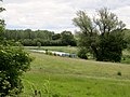
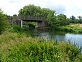
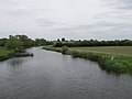
Nassington is a village in Northamptonshire.
Subcategories
This category has the following 3 subcategories, out of 3 total.
N
P
T
Media in category "Nassington"
The following 200 files are in this category, out of 242 total.
(previous page) (next page)-
 21 Station Road, Nassington (geograph 7473658).jpg 1,024 × 677; 116 KB
-
 39 metre spot height, Apethorpe Road - geograph.org.uk - 2743646.jpg 1,024 × 768; 144 KB
-
 39 Station Road, Nassington (geograph 7473662).jpg 1,024 × 768; 143 KB
-
 45 Church Street, Nassington (geograph 7462559).jpg 1,024 × 768; 164 KB
-
 61 and 63 Station Road, Nassington (geograph 7461611).jpg 1,024 × 768; 145 KB
-
 A bend in the river from Mill Rd, June 2013 - panoramio.jpg 4,000 × 3,000; 1.81 MB
-
 A little dear for the little deer^ - geograph.org.uk - 4579710.jpg 4,320 × 3,240; 5.64 MB
-
 A Muntjac deer in Nassington - geograph.org.uk - 4582903.jpg 2,880 × 2,160; 2.99 MB
-
 Across the meadows - Nassington - April 2014 - panoramio.jpg 4,000 × 3,000; 1.96 MB
-
 Across the Nene Valley - May 2014 - panoramio.jpg 4,000 × 3,000; 1.42 MB
-
 Across the Nene Valley between Yarwell ^ Nassingon - June 2013 - panoramio.jpg 4,000 × 3,000; 1.67 MB
-
 Across the Nene Valley from Mill Rd near Nassington - April 2014 - panoramio.jpg 4,000 × 3,000; 2.09 MB
-
 Across the river near Yarwell - June 2013 - panoramio.jpg 4,000 × 3,000; 1.55 MB
-
 Across the river valley - Nassington - April 2014 - panoramio.jpg 4,000 × 3,000; 2.48 MB
-
 Apethorpe Road - geograph.org.uk - 2743628.jpg 1,024 × 768; 101 KB
-
 Apethorpe Road, Nassington (geograph 4136984).jpg 640 × 480; 66 KB
-
 Approaching farm bridge at Nassington - June 2013 - panoramio.jpg 4,000 × 3,000; 2.18 MB
-
 Approaching Nassington as the sun starts setting - April 2014 - panoramio.jpg 4,000 × 3,000; 1.59 MB
-
 Approaching Yarwell Mill Lock - June 2013 - panoramio.jpg 4,000 × 3,000; 2.18 MB
-
 Beside the Poplars - Yarwell - August 2012 - panoramio.jpg 3,000 × 4,000; 2.84 MB
-
 Beware of horses along Apethorpe Road - geograph.org.uk - 2743674.jpg 1,024 × 768; 166 KB
-
 Blocked byway between Nassington and Woodnewton - geograph.org.uk - 4613413.jpg 4,320 × 3,240; 5.99 MB
-
 Boat on the River Nene from close to Bridge - August 2012 - panoramio.jpg 4,000 × 3,000; 6.7 MB
-
 Boats moored near Nassington - panoramio.jpg 4,000 × 3,000; 1.96 MB
-

-
 Bridge over The River Nene at Nassington - geograph.org.uk - 4579738.jpg 4,320 × 3,240; 5.47 MB
-
 Bridge over The River Nene near Nassington - geograph.org.uk - 4579729.jpg 4,320 × 3,240; 6.06 MB
-
 Bridleway along the edge of Little Morton Sale - geograph.org.uk - 6227009.jpg 1,024 × 768; 315 KB
-
 Bridleway and ditch - geograph.org.uk - 4136966.jpg 640 × 480; 63 KB
-
 Bridleway and industrial park entrance - geograph.org.uk - 4576560.jpg 4,320 × 3,240; 6.1 MB
-
 Bridleway through Great Morton Sale - geograph.org.uk - 6227003.jpg 1,024 × 768; 275 KB
-
 Byway Ford at Nassington - geograph.org.uk - 3019781.jpg 3,264 × 2,448; 4.37 MB
-
 Byway going away from Park Spinney - geograph.org.uk - 1319947.jpg 640 × 480; 88 KB
-
 Cattle in the meadow by Nassington - May 2014 - panoramio.jpg 4,000 × 3,000; 1.99 MB
-
 Cattle on the meadows - near Nassington - August 2012 - panoramio.jpg 4,000 × 3,000; 5.63 MB
-
 Church Street, Nassington (geograph 3696252).jpg 800 × 450; 278 KB
-
 Church Street, Nassington (geograph 4136992).jpg 640 × 480; 76 KB
-
 Church Street, Nassington (geograph 4137001).jpg 640 × 480; 80 KB
-
 Cottages in Church Street, Nassington (geograph 2957304).jpg 4,000 × 3,000; 3.95 MB
-
 Cottages, Nassington (geograph 7473648).jpg 1,024 × 768; 135 KB
-
 Country lane at Little Orchard - geograph.org.uk - 4900035.jpg 800 × 558; 114 KB
-
 Course of dismantled railway - geograph.org.uk - 4218340.jpg 1,600 × 1,067; 549 KB
-
 Crop field and hedgerow - geograph.org.uk - 4137027.jpg 640 × 480; 105 KB
-
 Crop field near Lyveden Farm - geograph.org.uk - 4137029.jpg 640 × 480; 99 KB
-
 Downstream towards Yarwell Mill - geograph.org.uk - 1319731.jpg 640 × 480; 45 KB
-
 East Northamptonshire farmland - geograph.org.uk - 3696263.jpg 800 × 450; 229 KB
-
 Edge of large field, south of Apethorpe Road - geograph.org.uk - 2743710.jpg 1,024 × 768; 219 KB
-
 Electricity pole in a stubble field - geograph.org.uk - 6250239.jpg 1,024 × 768; 151 KB
-
 End of the old railway embankment between Yarwell ^ Nassington - June 2013 - panoramio.jpg 4,000 × 3,000; 1.95 MB
-
 Evening near Nassington - April 2014 - panoramio.jpg 4,000 × 3,000; 1.74 MB
-
 Evening on the Nene - April 2014 - panoramio.jpg 4,000 × 3,000; 1.9 MB
-
 Farm bridge near Nassington - June 2013 - panoramio.jpg 4,000 × 3,000; 1.42 MB
-
 Farm track off Fotheringhay Road - geograph.org.uk - 2957264.jpg 4,000 × 3,000; 4.32 MB
-
 Farm track on Newton Hill - geograph.org.uk - 3696258.jpg 800 × 450; 209 KB
-
 Farm track, Newton Hill - geograph.org.uk - 6335000.jpg 1,024 × 768; 261 KB
-
 Farmland and hedgerow - geograph.org.uk - 4136976.jpg 640 × 480; 86 KB
-
 Farmland near Homefield - geograph.org.uk - 2743633.jpg 1,024 × 768; 175 KB
-
 Farmland near Old Sulehay - geograph.org.uk - 1228155.jpg 640 × 457; 160 KB
-
 Farmland south of Bedford Purlieus - geograph.org.uk - 3019598.jpg 640 × 480; 44 KB
-
 Farmland track on Newton Hill - geograph.org.uk - 4580041.jpg 4,320 × 3,240; 5.43 MB
-
 Farmland track south of Nassington - geograph.org.uk - 4579950.jpg 4,320 × 3,240; 5.92 MB
-
 Farmland west of Fotheringhay Road - geograph.org.uk - 4137007.jpg 640 × 480; 76 KB
-
 Farmland, Lyveden Farm - geograph.org.uk - 4137021.jpg 640 × 480; 67 KB
-
 Farmland, Old Sulehay - geograph.org.uk - 3019608.jpg 640 × 474; 61 KB
-

-
 Field access track, Nassington - geograph.org.uk - 1319849.jpg 640 × 480; 71 KB
-
 Field off Woodnewton Road - geograph.org.uk - 4136968.jpg 640 × 480; 61 KB
-
 Fields beside the lane to Nassington - May 2014 - panoramio.jpg 4,000 × 3,000; 2.86 MB
-
 Fields beside the Nene at Nassington - April 2014 - panoramio.jpg 4,000 × 3,000; 2.17 MB
-
 Fields close to Yarwell - May 2014 - panoramio.jpg 4,000 × 3,000; 2.01 MB
-
 Flat farmland near the Nene - geograph.org.uk - 3696225.jpg 800 × 450; 209 KB
-
 Flood flow over the lock gates at Yarwell - May 2014 - panoramio.jpg 4,000 × 3,000; 1.6 MB
-
 Footbridge - geograph.org.uk - 1258685.jpg 640 × 480; 109 KB
-
 Footpath from Apethorpe Road to Nassington - geograph.org.uk - 2743640.jpg 1,024 × 768; 144 KB
-
 Footpath gate near Lyveden Farm - geograph.org.uk - 4580031.jpg 4,320 × 3,240; 5.46 MB
-
 Footpath next to Shortwood Lodge - geograph.org.uk - 4580542.jpg 4,320 × 3,240; 6.04 MB
-
 Footpath through oilseed rape - geograph.org.uk - 1258695.jpg 640 × 465; 134 KB
-
 Ford and damaged bridge in Nassington - geograph.org.uk - 4579687.jpg 4,320 × 3,240; 5.83 MB
-
 Ford at the Yarwell end of Nassington - May 2014 - panoramio.jpg 3,000 × 4,000; 2.07 MB
-
 Ford at Yarwell - deep fast water - August 2012 - panoramio.jpg 4,000 × 3,000; 4.3 MB
-
 Ford in Nassington - May 2014 - panoramio.jpg 4,000 × 3,000; 3.34 MB
-
 Ford near Nassington - May 2014 - panoramio.jpg 3,000 × 4,000; 1.7 MB
-
 Ford near the old station in Nassington - geograph.org.uk - 4579680.jpg 4,320 × 3,240; 5.54 MB
-
 Former farmhouse, Nassington (geograph 7462572).jpg 1,024 × 768; 170 KB
-
 Fotheringhay Road - geograph.org.uk - 3696244.jpg 800 × 450; 226 KB
-
 Fotheringhay Road - geograph.org.uk - 4137013.jpg 640 × 480; 78 KB
-
 From the bridge - downstream - August 2012 - panoramio.jpg 3,000 × 4,000; 7.44 MB
-
 From the bridge - Upstream - Yarwell August 2012 - panoramio.jpg 4,000 × 3,000; 4.42 MB
-
 Full flow over the weir at Yarwell Mill - May 2014 - panoramio.jpg 4,000 × 2,000; 1.49 MB
-
 Gate and field entrance near Nassington - geograph.org.uk - 4580562.jpg 4,320 × 3,240; 5.85 MB
-
 Gateposts but no gate - geograph.org.uk - 2743688.jpg 1,024 × 768; 196 KB
-
-
 Glorious English summer - Yarwell - August 2012 - panoramio.jpg 4,000 × 3,000; 2.8 MB
-
 Heading south away from Nassington - June 2013 - panoramio.jpg 4,000 × 3,000; 1.29 MB
-
 Heading up stream from Nassington - August 2012 - panoramio.jpg 3,000 × 4,000; 3.6 MB
-
 Is it a bird^ Is it a plane^ - geograph.org.uk - 2743655.jpg 1,024 × 768; 167 KB
-

-
 Lane in Nassington - May 2014 - panoramio.jpg 4,000 × 3,000; 1.75 MB
-
 Lane leading to the village of Elton - geograph.org.uk - 4900039.jpg 800 × 573; 130 KB
-
 Large crop field, north of Apethorpe road - geograph.org.uk - 2743651.jpg 1,024 × 768; 167 KB
-
 Leaving Nassington behind - June 2013 - panoramio.jpg 4,000 × 3,000; 1.45 MB
-
 Little Bridge at Yarwell - April 2014 - panoramio.jpg 4,000 × 3,000; 2.16 MB
-
 LNWR Railway bridge - geograph.org.uk - 3613360.jpg 3,264 × 2,448; 4.93 MB
-
 Lock closed to navigation - Yarwell - May 2014 - panoramio.jpg 3,000 × 4,000; 2.25 MB
-
 Lock reversed at Yarwell - May 2014 - panoramio.jpg 4,000 × 3,000; 2.11 MB
-
 Looking towards Nassington - June 2013 - panoramio.jpg 4,000 × 3,000; 1.46 MB
-
 Looking towards Swan's Nest - geograph.org.uk - 2957267.jpg 4,000 × 3,000; 4.25 MB
-
 Lot of water flowing past - April 2014 - panoramio.jpg 4,000 × 3,000; 2.53 MB
-
 Mail Box, Little Morton Sale - geograph.org.uk - 6327836.jpg 1,024 × 768; 281 KB
-
 Manor House in Nassington - geograph.org.uk - 4580620.jpg 4,320 × 3,240; 5.81 MB
-
 Meadow towards Nassington - August 2012 - panoramio.jpg 4,000 × 3,000; 3.13 MB
-
 Meadows and moorings - April 2014 - panoramio.jpg 4,000 × 3,000; 2.34 MB
-
 Meadows close to Nassington - April 2014 - panoramio.jpg 4,000 × 3,000; 2.26 MB
-
 Minor road towards Elton - geograph.org.uk - 4137025.jpg 640 × 480; 104 KB
-
 Moored at Nassington - Old Railway Line - April 2014 - panoramio.jpg 4,000 × 3,000; 3.07 MB
-
 Mooring point - Nassington - August 2013 - panoramio.jpg 4,000 × 3,000; 1.94 MB
-
 Nassington - August 2013 - panoramio (1).jpg 2,796 × 3,392; 1.6 MB
-
 Nassington - August 2013 - panoramio.jpg 4,000 × 3,000; 1.79 MB
-
 Nassington - evening - August 2013 - panoramio (1).jpg 4,000 × 3,000; 2.2 MB
-
 Nassington - geograph.org.uk - 900249.jpg 640 × 480; 317 KB
-
 Nassington - geograph.org.uk - 900255.jpg 640 × 356; 219 KB
-
 Nassington - geograph.org.uk - 900263.jpg 480 × 640; 120 KB
-
 Nassington - geograph.org.uk - 900268.jpg 640 × 480; 352 KB
-
 Nassington - geograph.org.uk - 900274.jpg 640 × 480; 387 KB
-
 Nassington - River Nene - June 2013 - panoramio.jpg 4,000 × 3,000; 1.65 MB
-
 Nassington across the fields - April 2014 - panoramio.jpg 4,000 × 3,000; 1.62 MB
-
 Nassington Church - from meadow close to Yarwell - August 2012 - panoramio.jpg 3,000 × 4,000; 3.78 MB
-
 Nassington Ford - geograph.org.uk - 3009712.jpg 3,264 × 2,448; 4.64 MB
-
 Nassington from the green lane to Yarwell - May 2014 - panoramio.jpg 2,986 × 3,988; 1.23 MB
-
 Nassington from the path to Elton - April 2014 - panoramio.jpg 4,000 × 3,000; 2 MB
-
 Nassington House (geograph 7473639).jpg 1,024 × 768; 278 KB
-
 Nassington moorings - August 2013 - panoramio.jpg 4,000 × 3,000; 1.75 MB
-
 Nassington PE8, UK - panoramio (1).jpg 4,000 × 2,326; 1.31 MB
-
 Nassington PE8, UK - panoramio (2).jpg 3,000 × 4,000; 3.3 MB
-
 Nassington PE8, UK - panoramio (5).jpg 2,340 × 2,880; 1.27 MB
-
 Nassington PE8, UK - panoramio.jpg 3,000 × 4,000; 1.62 MB
-
 Nassington post office ... (3505586572).jpg 3,072 × 2,304; 2.77 MB
-
 Nassington pumping station - geograph.org.uk - 4218337.jpg 1,600 × 1,068; 585 KB
-
 Nassington through the bridge - June 2013 - panoramio.jpg 4,000 × 3,000; 1.91 MB
-
 Nassington, St. Mary and All Saints' Church - geograph.org.uk - 5173043.jpg 3,678 × 2,456; 4.67 MB
-
 Nassington, St. Mary and All Saints' Church - geograph.org.uk - 5173044.jpg 3,648 × 2,409; 4.22 MB
-

-
-

-

-

-

-

-

-

-

-

-

-

-

-

-

-
 Nassington, St. Mary and All Saints' Church, The nave 1 - geograph.org.uk - 5173095.jpg 5,430 × 3,542; 7.52 MB
-

-
 Nassington, St. Mary and All Saints' Church, The organ - geograph.org.uk - 5173099.jpg 2,760 × 4,185; 5.03 MB
-
 Near Nassington - May 2014 - panoramio.jpg 4,000 × 3,000; 1.88 MB
-
 Nene nassington.jpg 3,456 × 2,592; 3 MB
-
 Nene Valley - geograph.org.uk - 4112531.jpg 1,024 × 683; 223 KB
-
 Nene Valley between Nassington ^ Elton - April 2014 - panoramio.jpg 4,000 × 2,000; 1.13 MB
-
 Nene Valley close to Nassington - June 2013 - panoramio.jpg 4,000 × 3,000; 2.05 MB
-
 Nene Valley near Nassington - April 2014 - panoramio (1).jpg 4,000 × 3,000; 1.76 MB
-
 Nene Valley near Nassington - April 2014 - panoramio.jpg 4,000 × 3,000; 2.05 MB
-
 Nene Way by the Yarwell Mill - geograph.org.uk - 4218420.jpg 1,600 × 1,068; 480 KB
-
 Nene Way towards Nassington - geograph.org.uk - 1319837.jpg 640 × 480; 84 KB
-
 New houses, Nassington (geograph 4136982).jpg 640 × 480; 73 KB
-
 Norman Cross Telecommunications - from meadow near Nassington - August 2012 - panoramio.jpg 4,000 × 3,000; 3.13 MB
-
 North along Fotheringhay Road - geograph.org.uk - 4900029.jpg 800 × 567; 107 KB
-
 Northern edge of large field - geograph.org.uk - 2743695.jpg 1,024 × 768; 172 KB
-
 Oak Cottage, Nassington (geograph 7473960).jpg 1,024 × 768; 167 KB
-
 Off-shoot of the River Nene - Yarwell - August 2012 - panoramio.jpg 4,000 × 3,000; 4.86 MB
-
 Old railway bridge on the lane into Nassington - panoramio.jpg 4,000 × 3,000; 3.63 MB
-
 Old railway bridge support by the Nene at Nassington - April 2014 - panoramio.jpg 4,000 × 2,236; 1.84 MB
-
 Old railway embankment - June 2013 - panoramio.jpg 4,000 × 3,000; 1.92 MB
-
 Old shed at Nassington - geograph.org.uk - 1319753.jpg 640 × 480; 86 KB
-
 Old stepping stones - August 2012 - panoramio.jpg 4,000 × 3,000; 7.39 MB
-
 Ordnance Survey Flush Bracket S8745 (geograph 4110372).jpg 4,000 × 3,000; 3.84 MB
-
 Power lines by the footpath to Yarwell - geograph.org.uk - 4218413.jpg 1,200 × 1,600; 358 KB
-
 Preventing off-roaders - geograph.org.uk - 3696238.jpg 800 × 450; 229 KB
-
 Public byway on Newton Hill heading to Park Spinney - geograph.org.uk - 4613397.jpg 4,320 × 3,240; 5.74 MB
-
 Railway embankment - geograph.org.uk - 1258638.jpg 640 × 309; 69 KB
-
 Remains of railway bridge in Nassington - geograph.org.uk - 4579673.jpg 4,320 × 3,240; 5.45 MB
-
 Ripening rapeseed near to Nassington - geograph.org.uk - 4561989.jpg 4,320 × 3,240; 5.22 MB
-
 River Nene - geograph.org.uk - 4218410.jpg 1,600 × 1,068; 436 KB
-
 River Nene - geograph.org.uk - 4218417.jpg 1,600 × 1,067; 400 KB
-
 River Nene - geograph.org.uk - 4218424.jpg 1,600 × 1,067; 412 KB
-
 River Nene at Nassington - April 2014 - panoramio (1).jpg 4,000 × 3,000; 2.75 MB
-
 River Nene between Nassington ^ Yarwell - April 2014 - panoramio.jpg 4,000 × 3,000; 2.29 MB
-
 River Nene near Yarwell - April 2014 - panoramio.jpg 4,000 × 3,000; 3.04 MB
-
 River Nene near Yarwell Mill - April 2014 - panoramio.jpg 4,000 × 2,365; 1.53 MB
-
 River Nene, near Nassington.jpg 3,456 × 2,592; 3.05 MB
-
 Road to industrial estate - geograph.org.uk - 3019603.jpg 640 × 480; 97 KB
-
 Roman Road towards Wansford - geograph.org.uk - 3019605.jpg 640 × 480; 103 KB
-
 Roman Road towards Wansford - geograph.org.uk - 3019610.jpg 640 × 480; 105 KB
-
 Side of bridge over dismantled railway - geograph.org.uk - 1819400.jpg 640 × 480; 122 KB
-

.jpg)

.jpg)
.jpg)
.jpg)


.jpg)


.jpg)
.jpg)
.jpg)
.jpg)
.jpg)


.jpg)


.jpg)

.jpg)


.jpg)

.jpg)
.jpg)
.jpg)

.jpg)


.jpg)


.jpg)


.jpg)


.jpg)


.jpg)


