Category:Nateby, Cumbria
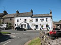
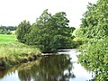
English: Nateby is a village in the Eden district of Cumbria, England. It is situated very near the town of Kirkby Stephen. The small village also is near the River Eden and on the border of the Yorkshire Dales and North Yorkshire. Nearby are the Nine Standards Rigg hills. The village contains a popular country pub - The Black Bull Inn - and a family run garage and small metal-yard both of which are owned by families resident in the village.
village and civil parish in Cumbria, England  | |||||
| Upload media | |||||
| Instance of | |||||
|---|---|---|---|---|---|
| Located in protected area | |||||
| Location | Eden, Cumbria, North West England, England | ||||
 | |||||
Subcategories
This category has the following 2 subcategories, out of 2 total.
C
- Croglam Castle (2 F)
N
- Nine Standards Rigg (20 F)
Media in category "Nateby, Cumbria"
The following 200 files are in this category, out of 266 total.
(previous page) (next page)-
 'The Old School' - geograph.org.uk - 4277971.jpg 1,024 × 685; 177 KB
-
 'Thringill' beside B6259 - geograph.org.uk - 4195378.jpg 1,024 × 683; 184 KB
-
 'Wellhead Cottage' and outbuilding - geograph.org.uk - 4278057.jpg 1,024 × 683; 241 KB
-
 A683 - geograph.org.uk - 188716.jpg 640 × 480; 116 KB
-

-
 Alderson's Garage, Nateby - geograph.org.uk - 1980150.jpg 3,872 × 2,494; 2.91 MB
-
 Approaching Nateby from the north - geograph.org.uk - 1980032.jpg 3,872 × 2,480; 2.69 MB
-
 Are 'ewe' posing^ - geograph.org.uk - 5838217.jpg 4,320 × 3,240; 2.65 MB
-
 At the back of the village - geograph.org.uk - 4139467.jpg 4,320 × 3,240; 3.54 MB
-
 B6259 approaching Nateby from the south - geograph.org.uk - 4277932.jpg 1,024 × 683; 159 KB
-
 B6259 entering Nateby - geograph.org.uk - 2960046.jpg 640 × 427; 67 KB
-
 B6259 south from Sleighgate Hill - geograph.org.uk - 2960398.jpg 640 × 480; 125 KB
-
 B6259 south passed Blea Pots Lumb - geograph.org.uk - 2960400.jpg 640 × 493; 60 KB
-
 B6259, Nateby - geograph.org.uk - 1981952.jpg 640 × 427; 276 KB
-
 B6270 - geograph.org.uk - 3877124.jpg 640 × 427; 58 KB
-
 B6270 crossing Nateby Common at Seave Rigg - geograph.org.uk - 5063403.jpg 1,024 × 683; 210 KB
-
 Beck and clapper bridge, Nateby - geograph.org.uk - 4139457.jpg 3,240 × 4,320; 3.58 MB
-
 Benchmark on 'The Old School' - geograph.org.uk - 4277954.jpg 683 × 1,024; 265 KB
-
 Benchmark on 'Thringill' - geograph.org.uk - 4195373.jpg 683 × 1,024; 251 KB
-
 Benchmark on 'Wellhead Cottage' outbuilding - geograph.org.uk - 4277999.jpg 683 × 1,024; 290 KB
-
 Benchmark on house opposite Methodist Chapel - geograph.org.uk - 4278202.jpg 683 × 1,024; 234 KB
-
 Benchmark on rock beside B6270 at Ore Hill - geograph.org.uk - 5071995.jpg 683 × 1,024; 311 KB
-
 Benchmark on rock in wall set back from B6270 - geograph.org.uk - 5070113.jpg 1,024 × 683; 301 KB
-

-
 Benchmark on rock on Tailbridge Mire - geograph.org.uk - 5063459.jpg 1,024 × 683; 341 KB
-
 Benchmark on Stenkrith Bridge - geograph.org.uk - 4195692.jpg 683 × 1,024; 220 KB
-
 Benchmark on wall above Middleber Sike - geograph.org.uk - 5063334.jpg 683 × 1,024; 298 KB
-
 Bield on Tailbridge Hill - geograph.org.uk - 1761832.jpg 640 × 480; 83 KB
-
 Birkett Hill - geograph.org.uk - 3471456.jpg 640 × 480; 74 KB
-
 Birkett Hill - geograph.org.uk - 3969156.jpg 640 × 425; 176 KB
-
 Birkett Hill in the spotlight - geograph.org.uk - 2595981.jpg 1,024 × 719; 137 KB
-
 Black Bull Inn, Nateby - geograph.org.uk - 1223363.jpg 640 × 480; 58 KB
-
 Bollam Bridge - geograph.org.uk - 2181836.jpg 640 × 480; 113 KB
-
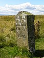 Border of Westmorland and Yorkshire - geograph.org.uk - 519394.jpg 450 × 600; 97 KB
-
 Boundary stone beside B6259 at Watergate Bottom - geograph.org.uk - 4195364.jpg 1,024 × 683; 266 KB
-
 Boundary stone near White Brackens House - geograph.org.uk - 1817377.jpg 480 × 640; 197 KB
-

-

-
 Bridge over dismantled railway - geograph.org.uk - 2678799.jpg 640 × 425; 205 KB
-
 Bridge over dismantled railway - geograph.org.uk - 2678805.jpg 640 × 425; 208 KB
-
 Bridge over former railway - geograph.org.uk - 2340888.jpg 1,024 × 768; 201 KB
-
 Bridge over the disused railway - geograph.org.uk - 3750743.jpg 640 × 480; 145 KB
-
 Bridleway to Mire Close Bridge - geograph.org.uk - 1817409.jpg 640 × 480; 149 KB
-
 Bridleway, Nateby - geograph.org.uk - 1817866.jpg 640 × 480; 138 KB
-
 Buildings at White Bracken House - geograph.org.uk - 2960406.jpg 640 × 460; 73 KB
-
 By two Birkett Hills - geograph.org.uk - 4139443.jpg 4,320 × 3,240; 2.88 MB
-
 Cairn on Tailbridge Hill - geograph.org.uk - 1046240.jpg 640 × 480; 74 KB
-
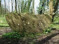 Carved stone on Poetry Path - geograph.org.uk - 5361063.jpg 1,024 × 768; 378 KB
-
 Cattle grid by Watergate Bottom - geograph.org.uk - 3201838.jpg 1,500 × 1,004; 139 KB
-
 Centre of Nateby by phone box - geograph.org.uk - 2960047.jpg 640 × 454; 84 KB
-
 Clapper bridge at Nateby - geograph.org.uk - 1412570.jpg 640 × 480; 150 KB
-
 Clapper bridge, Nateby - geograph.org.uk - 3963629.jpg 425 × 640; 160 KB
-
 Coast to Coast route ( winter). - geograph.org.uk - 1920931.jpg 3,648 × 2,736; 1.82 MB
-
 Disused Quarry - geograph.org.uk - 1223333.jpg 640 × 480; 49 KB
-
 Disused quarry near Nateby - geograph.org.uk - 4639606.jpg 800 × 533; 125 KB
-
 Disused quarry near Nateby - geograph.org.uk - 4639609.jpg 533 × 800; 177 KB
-
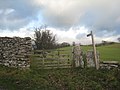
 Dry stone wall and gate - geograph.org.uk - 3337996.jpg 2,048 × 1,536; 989 KB
-

-
 Dukerdale from Reigill - geograph.org.uk - 1128675.jpg 640 × 480; 72 KB
-
 Eden fields - geograph.org.uk - 1412596.jpg 640 × 480; 194 KB
-
 Enclosures on Butterbers Hills - geograph.org.uk - 1223357.jpg 640 × 480; 57 KB
-
 Ewe with a view - geograph.org.uk - 5838229.jpg 4,320 × 3,240; 2.9 MB
-
 Farm track passing under former railway - geograph.org.uk - 2340865.jpg 1,024 × 768; 184 KB
-
 Farmland east of Nateby - geograph.org.uk - 4022889.jpg 2,592 × 1,944; 1.15 MB
-
 Floods on the B6259 south of Nateby - geograph.org.uk - 3152740.jpg 800 × 600; 113 KB
-
 Footbridge over former railway - geograph.org.uk - 4639557.jpg 800 × 533; 186 KB
-
 Footbridge over Ladthwaite Beck - geograph.org.uk - 2181845.jpg 640 × 480; 136 KB
-
 Footbridge over Thringill Beck - geograph.org.uk - 2017226.jpg 640 × 480; 150 KB
-
 Footpath near Nateby - geograph.org.uk - 1817578.jpg 640 × 481; 148 KB
-
 Footpath to Nateby - geograph.org.uk - 1817627.jpg 640 × 480; 159 KB
-
 Footpath to Nateby - geograph.org.uk - 2177571.jpg 1,024 × 768; 173 KB
-
 Footpath to Nateby - geograph.org.uk - 2821836.jpg 3,264 × 2,448; 2.27 MB
-
 Footpath, gated entrance - geograph.org.uk - 4055819.jpg 3,648 × 2,736; 4.18 MB
-
 Ford at Nateby - geograph.org.uk - 5719289.jpg 4,032 × 3,024; 5.17 MB
-
 Ford over Broad Ing Sike - geograph.org.uk - 4639561.jpg 800 × 533; 197 KB
-
 Former railway, now a path - geograph.org.uk - 2340848.jpg 1,024 × 768; 224 KB
-
 From Tailbridge Hill - geograph.org.uk - 2781789.jpg 640 × 480; 75 KB
-
 From the car park to the railway path - geograph.org.uk - 2340418.jpg 1,024 × 768; 151 KB
-
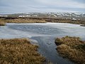 Frozen Tarn - geograph.org.uk - 1761686.jpg 640 × 480; 75 KB
-
 Gate in the wall, Nateby - geograph.org.uk - 1817593.jpg 480 × 640; 184 KB
-
 Gate on the Coast to Coast Walk - geograph.org.uk - 255507.jpg 640 × 480; 103 KB
-
 Gateway, Nateby Common - geograph.org.uk - 3969168.jpg 640 × 425; 130 KB
-
 Grassy slope with rushes and wall rising on Tailbridge Hill - geograph.org.uk - 2385286.jpg 1,500 × 1,125; 1.46 MB
-
 Green Hill - geograph.org.uk - 4022872.jpg 2,592 × 1,944; 1.12 MB
-
 Hamlet of Birkdale Boundary Stone - geograph.org.uk - 2823331.jpg 2,448 × 3,264; 2.65 MB
-
 Higher ground near Nateby - geograph.org.uk - 1980137.jpg 3,872 × 2,592; 4.18 MB
-
 Houses at north end of Nateby beside B6259 - geograph.org.uk - 5063325.jpg 1,024 × 668; 168 KB
-
 Houses on the east side of the B6259 - geograph.org.uk - 4278258.jpg 683 × 1,024; 156 KB
-
 Houses south of Kirkby Stephen - geograph.org.uk - 5362222.jpg 1,024 × 768; 180 KB
-
 Hunger Hills - geograph.org.uk - 5847377.jpg 2,048 × 1,536; 1,005 KB
-
 Just stick the new name on - geograph.org.uk - 2823288.jpg 3,264 × 2,448; 1.7 MB
-
 Kirkby Stephen Poetry Path - geograph.org.uk - 2670174.jpg 640 × 425; 232 KB
-
 Ladthwaite Beck - geograph.org.uk - 1412466.jpg 640 × 480; 174 KB
-
 Ladthwaite Beck - geograph.org.uk - 1982712.jpg 427 × 640; 295 KB
-
 Ladthwaite Beck - geograph.org.uk - 3969157.jpg 640 × 425; 188 KB
-
 Ladthwaite Beck - geograph.org.uk - 4139434.jpg 3,240 × 4,320; 3.16 MB
-
 Lime stone on Lamps Moss - geograph.org.uk - 1920943.jpg 3,648 × 2,736; 1.84 MB
-
 Limekiln - geograph.org.uk - 459051.jpg 640 × 480; 92 KB
-
 Limestone and Tarn, Lamps Moss - geograph.org.uk - 1983455.jpg 427 × 640; 305 KB
-
 Limestone Outcrops, Tailbridge - geograph.org.uk - 1983458.jpg 640 × 427; 301 KB
-
 Limestone Pavement - geograph.org.uk - 1761681.jpg 480 × 640; 114 KB
-
 Lockthwaite - geograph.org.uk - 1980058.jpg 3,872 × 2,592; 4.46 MB
-
 Lockthwaite - geograph.org.uk - 1982679.jpg 427 × 640; 281 KB
-
 Lockthwaite - geograph.org.uk - 2385307.jpg 1,500 × 1,005; 1.47 MB
-
 Lockthwaite from the east - geograph.org.uk - 1412500.jpg 640 × 480; 135 KB
-
 Lockthwaite from the north-east - geograph.org.uk - 1412493.jpg 640 × 480; 137 KB
-
 Looking across the Eden - geograph.org.uk - 5809054.jpg 4,608 × 2,560; 4.07 MB
-
 Looking down on Lockthwaite - geograph.org.uk - 4139449.jpg 4,320 × 3,240; 3.19 MB
-
 Looking down to Ladthwaite - geograph.org.uk - 1961875.jpg 640 × 480; 81 KB
-
 Looking over Nateby - geograph.org.uk - 4633730.jpg 800 × 498; 120 KB
-
 Looking south west from Nateby Common - geograph.org.uk - 5882180.jpg 4,320 × 3,068; 1.08 MB
-
 Looking up the Eden Valley - geograph.org.uk - 2177574.jpg 1,024 × 768; 119 KB
-
 Methodist Chapel, Nateby - geograph.org.uk - 5486251.jpg 1,024 × 780; 169 KB
-
 Millennium footbridge, Stenkrith - geograph.org.uk - 5361072.jpg 1,024 × 768; 319 KB
-
 Mire Close Bridge - geograph.org.uk - 1028139.jpg 640 × 480; 132 KB
-
 Mire Close Bridge over the River Eden - geograph.org.uk - 5781684.jpg 1,600 × 1,200; 1.03 MB
-
 Moorland at Ore Hill - geograph.org.uk - 5072007.jpg 1,024 × 683; 254 KB
-
 Moorland view of Nateby Common - geograph.org.uk - 5063690.jpg 1,024 × 683; 242 KB
-
 Nateby - geograph.org.uk - 27897.jpg 640 × 480; 189 KB
-
 Nateby - geograph.org.uk - 27901.jpg 640 × 480; 110 KB
-
 Nateby - geograph.org.uk - 30193.jpg 640 × 480; 82 KB
-
 Nateby - geograph.org.uk - 5847373.jpg 2,048 × 1,536; 1.31 MB
-
 Nateby Common - geograph.org.uk - 272905.jpg 640 × 480; 79 KB
-
 Nateby Common - geograph.org.uk - 4022876.jpg 2,592 × 1,944; 1.16 MB
-
 Nateby Ford - geograph.org.uk - 3892619.jpg 3,872 × 2,592; 4.61 MB
-
 Nateby Inn - geograph.org.uk - 5486245.jpg 1,024 × 786; 174 KB
-
 Nateby Milkchurn Stand - geograph.org.uk - 1343468.jpg 640 × 480; 115 KB
-
 Nateby sheep and a Chinook - geograph.org.uk - 2596087.jpg 748 × 960; 141 KB
-
 Nateby Village - geograph.org.uk - 1223366.jpg 640 × 480; 72 KB
-
 Nateby Village - geograph.org.uk - 1796043.jpg 640 × 480; 110 KB
-
 Nateby village. - geograph.org.uk - 5317698.jpg 640 × 417; 119 KB
-
 North Yorkshire- Cumbria boundary. - geograph.org.uk - 5405564.jpg 640 × 480; 45 KB
-

-
 Old and new boundary markers beside B6270 - geograph.org.uk - 5063199.jpg 1,024 × 683; 174 KB
-
 Old railway bridge - geograph.org.uk - 3750747.jpg 640 × 480; 108 KB
-
 Old railway footpath - geograph.org.uk - 3750741.jpg 640 × 480; 161 KB
-
 On Lamps Moss - geograph.org.uk - 1761676.jpg 640 × 480; 84 KB
-
 On Nateby Common - geograph.org.uk - 5882192.jpg 4,320 × 2,798; 1.04 MB
-
 On Tailbridge Hill - geograph.org.uk - 1046246.jpg 640 × 480; 74 KB
-
 On Tailbridge Hill - geograph.org.uk - 1761838.jpg 640 × 480; 76 KB
-
 Ordnance Survey Flush Bracket G2369 - geograph.org.uk - 2982726.jpg 3,264 × 2,448; 2.78 MB
-
 Path to Nine Standards Rigg - geograph.org.uk - 426509.jpg 480 × 640; 79 KB
-
 Pile of stones, Tailbridge Hill - geograph.org.uk - 5838225.jpg 4,320 × 2,560; 2.27 MB
-
 Platelayers hut on former railway - geograph.org.uk - 2340985.jpg 1,024 × 768; 119 KB
-
 Platelayers' hut - geograph.org.uk - 3750745.jpg 640 × 480; 79 KB
-
 Podgill Viaduct - geograph.org.uk - 1961863.jpg 640 × 480; 80 KB
-
 Podgill Viaduct - geograph.org.uk - 1982688.jpg 427 × 640; 280 KB
-
 Podgill viaduct - geograph.org.uk - 5809061.jpg 4,608 × 2,560; 3.39 MB
-
 Pond, Mire Close Bridge - geograph.org.uk - 1958904.jpg 640 × 480; 95 KB
-
 Railway hut - geograph.org.uk - 2285607.jpg 3,264 × 2,448; 2.76 MB
-
 Rakehead - geograph.org.uk - 1412563.jpg 640 × 480; 116 KB
-
 Rakehead Farm, Nateby - geograph.org.uk - 4022892.jpg 2,592 × 1,944; 1.16 MB
-
 Red barn at Rakehead - geograph.org.uk - 1412553.jpg 640 × 480; 165 KB
-
 Ridding House - geograph.org.uk - 2017212.jpg 640 × 480; 68 KB
-
 Rigg Beck - geograph.org.uk - 1961885.jpg 640 × 480; 105 KB
-
 River Eden - geograph.org.uk - 1981937.jpg 640 × 427; 275 KB
-
 River Eden at Lammerside - geograph.org.uk - 1028133.jpg 640 × 480; 75 KB
-
 River Eden below Stenkrith Bridge - geograph.org.uk - 5361088.jpg 768 × 1,024; 407 KB
-
 Road south from Stenkrith Bridge - geograph.org.uk - 2960045.jpg 640 × 452; 122 KB
-
 Roadside barn - geograph.org.uk - 187839.jpg 640 × 480; 132 KB
-
 Rock with benchmark beside B6270 at Seave Rigg - geograph.org.uk - 5063394.jpg 1,024 × 683; 366 KB
-
 Shake Hole - geograph.org.uk - 1761684.jpg 480 × 640; 70 KB
-

-
 Sheep, Nateby - geograph.org.uk - 1817612.jpg 640 × 480; 177 KB
-
 Sheepfold on Hartley Fell - geograph.org.uk - 260380.jpg 640 × 480; 114 KB
-
 Silage making - geograph.org.uk - 188026.jpg 640 × 480; 98 KB
-
 South across Nateby Common - geograph.org.uk - 5882188.jpg 4,319 × 2,233; 1,019 KB
-
 South of Nateby the B6259 - geograph.org.uk - 2821856.jpg 3,264 × 2,448; 1.54 MB
-
 Spring near Lockthwaite - geograph.org.uk - 1412518.jpg 640 × 480; 276 KB
-
 Stenkrith Bridge, Nateby Road - geograph.org.uk - 4195721.jpg 1,024 × 683; 221 KB
-
 Stenkrith waterfall - geograph.org.uk - 3750739.jpg 640 × 480; 104 KB
-
 Stenkrith ^ Millennium Bridges - geograph.org.uk - 2670162.jpg 425 × 640; 238 KB
-
 Stenkrith ^ Millennium Bridges - geograph.org.uk - 2670165.jpg 425 × 640; 229 KB
-
 Stenkrith ^ Millennium Bridges - geograph.org.uk - 2670169.jpg 640 × 425; 201 KB
-
 Stone wall beside B6270 east of Nateby - geograph.org.uk - 5063344.jpg 1,024 × 660; 286 KB
-
 Summer meadow near Nateby - geograph.org.uk - 1412454.jpg 640 × 480; 124 KB
-
 Summit area of Tailbridge Hill, with summit cairn - geograph.org.uk - 2385260.jpg 1,500 × 1,125; 1.12 MB
-
 Summit cairn, Tailbridge Hill - geograph.org.uk - 5838232.jpg 4,319 × 2,575; 1.96 MB
-
 Sunlight on Birkett Hill - geograph.org.uk - 2593634.jpg 960 × 698; 127 KB
-
 Swallow hole at Butterbers Hills - geograph.org.uk - 5063351.jpg 1,024 × 683; 218 KB
-
 Tailbridge Hill with view to the south - geograph.org.uk - 5838245.jpg 4,320 × 2,567; 2.03 MB
-
 Tailbridge Hill with view to the south west - geograph.org.uk - 5838241.jpg 4,320 × 2,488; 2.05 MB
-
 Tailbridge Hill, Nateby Common - geograph.org.uk - 5063428.jpg 1,024 × 683; 191 KB
-
 Tarn on Lamps Moss - geograph.org.uk - 1046260.jpg 640 × 480; 74 KB
-
 Tarn on Lamps Moss - geograph.org.uk - 1921079.jpg 3,648 × 2,736; 1.81 MB
-
 Telephone box, Nateby - geograph.org.uk - 1817861.jpg 640 × 480; 130 KB
-
 The B6259 at Nateby - geograph.org.uk - 3152734.jpg 800 × 586; 86 KB
-
 The B6270 heading for Nateby - geograph.org.uk - 4022883.jpg 2,592 × 1,944; 1.1 MB
-
 The B6270 heading for Nateby - geograph.org.uk - 4022887.jpg 2,592 × 1,944; 1 MB
-
 The B6270 on Nateby Common - geograph.org.uk - 4022850.jpg 2,592 × 1,944; 990 KB
-
 The B6270. - geograph.org.uk - 5405555.jpg 640 × 427; 53 KB
-
 The Birkdale Stone and Fells End - geograph.org.uk - 2823317.jpg 3,264 × 2,448; 2.55 MB
-
 The Black Bull at Nateby - geograph.org.uk - 1412573.jpg 640 × 480; 132 KB
-
 The Black Bull Inn, Nateby - geograph.org.uk - 1980042.jpg 3,872 × 2,592; 4.77 MB
-
 The border stone - geograph.org.uk - 4022867.jpg 1,816 × 2,423; 1.04 MB
-
 The Eden at Nateby - geograph.org.uk - 4139476.jpg 4,320 × 3,240; 4.02 MB
-
 The footpath to Ladthwaite - geograph.org.uk - 5809072.jpg 4,608 × 3,456; 6.93 MB
-
 The Nateby Inn - geograph.org.uk - 3658543.jpg 4,320 × 3,240; 3.15 MB
-
 The Old School, Nateby - geograph.org.uk - 1981948.jpg 640 × 427; 285 KB
-
 The River Eden at Lammerside - geograph.org.uk - 392413.jpg 640 × 480; 113 KB


._-_geograph.org.uk_-_1920931.jpg)


