Category:National Cycle Network route 56

runs from Chester to Liverpool in England  | |||||
| Upload media | |||||
| Instance of | |||||
|---|---|---|---|---|---|
| Part of | |||||
| Location |
| ||||
| Connects with | |||||
| |||||
English: National Cycle Network route 56 runs from Liverpool to Chester via the Wirral Peninsula
Subcategories
This category has the following 14 subcategories, out of 14 total.
D
L
M
Media in category "National Cycle Network route 56"
The following 37 files are in this category, out of 37 total.
-
 2016 Liverpool.jpg 2,288 × 1,520; 2.69 MB
-
 A damp day on the Mersey - geograph.org.uk - 3868849.jpg 640 × 618; 41 KB
-
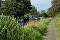
 A riverside walk - geograph.org.uk - 3251352.jpg 4,444 × 2,958; 7.59 MB
-
 All's quiet on the NCR 56 - geograph.org.uk - 2049963.jpg 640 × 426; 107 KB
-
 Along the towpath on NCR's 5 & 56 - geograph.org.uk - 1442829.jpg 640 × 426; 452 KB
-
 Beechwood, Birkenhead - DSC03594.JPG 2,736 × 3,648; 3.66 MB
-
 Bridleway off Heath Lane. - geograph.org.uk - 532409.jpg 640 × 480; 148 KB
-
 Canal bridge on NCR 5 and 56 - geograph.org.uk - 1442824.jpg 640 × 426; 386 KB
-
 CYCLE ROUTE 56 LIVERPOOL WATERFRONT JAN 2013 (8347785350).jpg 4,603 × 3,456; 10.29 MB
-
 Cycle-path to Wallasey-by-David-Quinn.jpg 640 × 480; 93 KB
-
 Graffiti-by-David-Quinn.jpg 640 × 480; 109 KB
-
 Little Sutton - Badgersrake Lane - geograph.org.uk - 253888.jpg 640 × 480; 429 KB
-
 National Cycle Network 56 Merseyside.jpg 1,579 × 895; 749 KB
-
 National Cycle Network 56 signpost Liverpool.jpg 1,370 × 1,189; 860 KB
-
 National Cycle Network 56 Trans Pennine.jpg 1,536 × 756; 794 KB
-

-
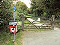
 National Cycle Network Route 56 Signpost-by-David-Quinn.jpg 640 × 480; 96 KB
-
 National Cycle Route 56 near Lea-by-Backford - geograph.org.uk - 3314501.jpg 4,000 × 3,000; 2.5 MB
-
 NCN 56 sign on Kings Parade, Liverpool.jpg 3,456 × 5,184; 5.33 MB
-
 NCR 5 - 56 goes beneath the M56 - geograph.org.uk - 1442845.jpg 640 × 426; 381 KB
-
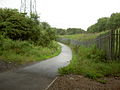
 NCR 5 - 56 near Stoak - geograph.org.uk - 1442850.jpg 640 × 426; 288 KB
-
 NCR 56 aka Wirral Way - geograph.org.uk - 2049985.jpg 640 × 426; 114 KB
-
 NCR 56 waymarker at Wallasey (geograph 2049999).jpg 425 × 640; 134 KB
-
 Plas Newton Parish Church - geograph.org.uk - 35743.jpg 640 × 485; 163 KB
-

-
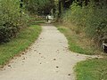
 Riverside walk - geograph.org.uk - 1882622.jpg 4,592 × 3,056; 4.51 MB
-
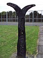
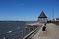
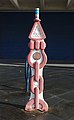 Rowe Millennium Milepost at Seacombe Ferry Terminal.jpg 3,037 × 4,937; 18.01 MB
-
 Rowe Millennium Milepost at Thornton Hough village green.jpg 3,462 × 5,198; 21.48 MB
-
 Sefton Park - National Cycle Way Marker - geograph.org.uk - 1710810.jpg 480 × 640; 232 KB
-
 Shropshire Union Canal - geograph.org.uk - 48235.jpg 640 × 420; 98 KB
-

-

-
 Wirral Way - NCR No56 - geograph.org.uk - 2042258.jpg 640 × 480; 158 KB
-
 Wirral Way, Heath Lane, Willaston.JPG 3,648 × 2,736; 3.56 MB
-
 Wirral Way, Willaston 3.JPG 3,648 × 2,736; 3.57 MB
-
 Wirral Way, Willaston 6.JPG 3,648 × 2,736; 3.54 MB
-
 Wirral Way, Willaston 7.JPG 3,648 × 2,736; 3.54 MB


.jpg)


.jpg)


