Category:National Cycle Network route 657

National Cycle Network (NCN) Route 657 is a loop of the White Rose cycle route, NCN 65. It branches off the main route to connect the town of Thirsk to the National Cycle Network.  | |||||
| Upload media | |||||
| Instance of | |||||
|---|---|---|---|---|---|
| Part of | |||||
| Location |
| ||||
| Connects with | |||||
| official website | |||||
| |||||
Media in category "National Cycle Network route 657"
The following 12 files are in this category, out of 12 total.
-
 Bridge carrying the A168 bypass - geograph.org.uk - 860464.jpg 500 × 375; 47 KB
-
 Low bridge - geograph.org.uk - 1492445.jpg 640 × 370; 45 KB
-
 NCN Route Sign 657.svg 512 × 212; 7 KB
-
 NCN-route65-route-675-signs.jpg 2,988 × 2,988; 1.74 MB
-
 NCN-route71-route-657-signs.jpg 2,871 × 2,157; 1.75 MB
-
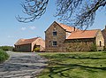 Quorndon Farm - geograph.org.uk - 419710.jpg 640 × 467; 133 KB
-
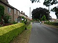 Sessay, North Yorkshire.jpg 640 × 479; 67 KB
-
 Spital Bridge - geograph.org.uk - 419723.jpg 640 × 480; 177 KB
-
 Turn left for Thirsk - geograph.org.uk - 1492438.jpg 640 × 480; 72 KB
-
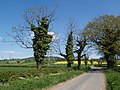 Upsall Lane - geograph.org.uk - 419967.jpg 640 × 480; 136 KB
-

-
 Village Green, South Kilvington.jpg 640 × 480; 92 KB


