Category:National Register of Historic Places in Independence County, Arkansas
Counties of Arkansas: Arkansas · Ashley · Baxter · Benton · Boone · Bradley · Calhoun · Carroll · Chicot · Clark · Clay · Cleburne · Cleveland · Columbia · Conway · Craighead · Crawford · Crittenden · Cross · Dallas · Desha · Drew · Faulkner · Franklin · Fulton · Garland · Grant · Greene · Hempstead · Hot Spring · Howard · Independence · Izard · Jackson · Jefferson · Johnson · Lafayette · Lawrence · Lee · Lincoln · Little River · Logan · Lonoke · Madison · Marion · Miller · Mississippi · Monroe · Montgomery · Nevada · Newton · Ouachita · Perry · Phillips · Pike · Poinsett · Polk · Pope · Prairie · Pulaski · Randolph · Saline · Scott · Searcy · Sebastian · Sevier · Sharp · St. Francis · Stone · Union · Van Buren · Washington · White · Woodruff · Yell
Wikimedia list article | |||||
| Upload media | |||||
| Instance of | |||||
|---|---|---|---|---|---|
| Location |
| ||||
| |||||
Subcategories
This category has the following 7 subcategories, out of 7 total.
Media in category "National Register of Historic Places in Independence County, Arkansas"
The following 35 files are in this category, out of 35 total.
-
 Adler House.jpg 4,928 × 3,264; 8.65 MB
-
 Akron Cemetery.JPG 4,608 × 3,456; 3.54 MB
-
 Batesville East Main Historic District, 2 of 6.jpg 4,928 × 3,264; 9.2 MB
-
 Batesville East Main Historic District, 3 of 6.jpg 4,928 × 3,264; 7.38 MB
-
 Batesville East Main Historic District, 4 of 6.jpg 4,928 × 3,264; 13.1 MB
-
 Batesville East Main Historic District, 6 of 6.jpg 4,928 × 3,264; 8.49 MB
-
 Bethel African Methodist Episcopal Church, Batesville, AR.jpg 4,928 × 3,264; 7.84 MB
-
 Big Bottom Slough Bridge (a.k.a. Padgett Island Bridge).JPG 4,608 × 3,456; 3.63 MB
-
 Cedar Creek Bridge.jpg 4,928 × 3,264; 8.25 MB
-
 Central Avenue Bridge.JPG 4,608 × 3,456; 3.48 MB
-
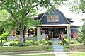
 Charles R. Handford House.jpg 4,928 × 3,264; 11.39 MB
-
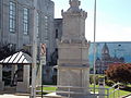 Confederate Monument and Courthouse Bell.JPG 4,608 × 3,456; 3.27 MB
-
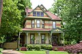
 Cook-Morrow House.jpg 4,928 × 3,264; 10.55 MB
-
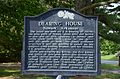 Dearing House, Historical Marker.jpg 4,928 × 3,264; 8.91 MB
-
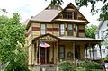
 Dearing House.jpg 4,928 × 3,264; 9.94 MB
-
 Edward Dickinson House.jpg 4,928 × 3,264; 10.62 MB
-
 Glenn House.jpg 4,928 × 3,264; 9.21 MB
-
 Hankins' Store.JPG 4,608 × 3,456; 3.32 MB
-
 James S. Handford House.jpg 4,928 × 3,264; 8.12 MB
-
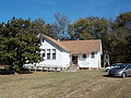 Jamestown School.JPG 4,608 × 3,456; 3.66 MB
-
 Kirk House 11 June 2016.jpg 3,456 × 4,608; 3.66 MB
-
 Lee's Chapel and Masonic Hall by Cemetery.JPG 4,608 × 3,456; 3.21 MB
-
 Luster Urban Farmstead.JPG 4,608 × 3,456; 3.07 MB
-
 Mitchell House, Batesville, AR.jpg 4,928 × 3,264; 10.42 MB
-
 Moorefield School.JPG 4,608 × 3,456; 3.41 MB
-
 Morrowhall.png 528 × 396; 445 KB
-
 National Guard Armory Batesville, Arkansas.JPG 4,608 × 3,456; 3.58 MB
-
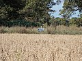
 Ruddell Mill Site.JPG 4,608 × 3,456; 3.53 MB
-
 St. Paul's Parish Church Batesville, Arkansas.JPG 4,608 × 3,456; 3.65 MB
-
 The Dondy Building.JPG 4,608 × 3,456; 3.51 MB
-
 The Wheel Store.JPG 4,608 × 3,456; 3.37 MB
-
 Thida Grove School.JPG 4,608 × 3,456; 3.32 MB
-
 Walnut Grove Cemetery on Walden Road where the Jackson Military Road built in 1830 ran.JPG 4,608 × 3,456; 3.55 MB
-
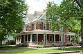
 Wyatt House.JPG 4,608 × 3,456; 3.39 MB
-
 Wycough-Jones House.JPG 4,608 × 3,456; 3.43 MB


.JPG)


