Category:Native American villages and towns
Subcategories
This category has the following 57 subcategories, out of 57 total.
A
C
- Chief Cornstalk's Village (3 F)
- Chilhowee (Cherokee town) (9 F)
- Citico (Cherokee town) (4 F)
- Cusseta (tribal town) (1 F)
F
- Fatherland site (20 F)
- Fort Blount-Williamsburg site (16 F)
G
- Great Tellico (7 F)
- Greentown Delaware Village (5 F)
H
- Hatwai Village Site (2 F)
- Hickory Ground (3 F)
- Hillabee (2 F)
I
- Iroquoian Village (62 F)
J
- Joara (7 F)
K
- Kuskusky (3 F)
L
M
- Mialoquo (Cherokee town) (3 F)
- Mocoso (4 F)
- Murry Site (1 F)
N
O
- Old Chillicothe (4 F)
P
- Prophetstown, Illinois (6 F)
- Puvunga (3 F)
S
- Sunwatch village (2 F)
T
- Tallassee (Cherokee town) (7 F)
- Tohopeka (6 F)
- Toqua (Cherokee town) (7 F)
- Turkeytown (Cherokee town) (6 F)
W
- Werowocomoco (8 F)
- Wyandot Indian Mill (9 F)
- Wyandot Mission Church (7 F)
Y
- Yuchi Town Site (2 F)
Media in category "Native American villages and towns"
The following 87 files are in this category, out of 87 total.
-

-

-
 1813 Map of the Rapids of Miami, showing Fort Meigs.jpg 1,397 × 930; 193 KB
-
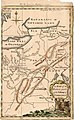 A Map of the Western parts of the Colony of Virginia, 1754.jpg 952 × 1,544; 1.78 MB
-

-

-

-
 An Indian Town, Residence of a Chief.jpg 328 × 231; 26 KB
-
 Archives nationales d’outre-mer - Louisiane - Jacques-Nicolas Bellin - 1744 - 001.jpg 5,262 × 3,921; 3.73 MB
-

-
 Battle of Horseshoe Bend.jpg 2,988 × 5,312; 4.92 MB
-
 BattleOfFlintRiver.jpg 1,776 × 807; 484 KB
-
 Batz-ChickasawVillages1736 SEM236C F329014.jpg 2,679 × 3,920; 1.09 MB
-
 Bub gb IGk3AQAAMAAJ 0030.jpg 2,500 × 3,750; 800 KB
-

-
 Chaussée et village des Hurons, Jeune-Lorette (Canada) (BAnQ 2630205).jpg 1,914 × 1,231; 429 KB
-
 ChickasawWars.jpg 490 × 809; 155 KB
-
 Collections - State Historical Society of Wisconsin (1854) (14773023821).jpg 2,408 × 1,552; 842 KB
-
 Cornstalk Town.JPG 1,280 × 960; 221 KB
-
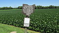
 Cottonport - Williamson County Historical Society sign.JPG 2,892 × 1,976; 1.68 MB
-
 Coushatta Indian Village Merryville,Louisiana 470.JPG 640 × 480; 118 KB
-
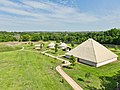 Cultural-center-village.jpg 1,140 × 855; 297 KB
-
 Cupeño map svg.svg 512 × 337; 22 KB
-
 Cupeño village of Cupa.png 944 × 578; 437 KB
-

-
 DeSoto Map Leg 2 HRoe 2008.jpg 600 × 470; 290 KB
-
 DumontMemoiresLouisianeMap.jpg 644 × 789; 180 KB
-

-
 Fort Hull map.jpg 1,384 × 735; 153 KB
-
 Frontier of NY in Revolution2.png 1,000 × 796; 780 KB
-
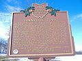
 Goiogouen Historical Marker.png 2,016 × 1,512; 4.75 MB
-
 Great-hiwassee-site-411.jpg 1,809 × 1,089; 496 KB
-
 Guashna village recognition, Tongva populated place, Southern California.jpg 3,024 × 4,032; 5.57 MB
-
 Heckewelder Map.jpg 13,360 × 7,627; 13.53 MB
-

-

-
 Illinois 1718.jpg 589 × 737; 232 KB
-
 Indian Village Chippewa-nung 1836 2017-05-17 135.jpg 2,176 × 3,264; 2.74 MB
-
 Indian village north of Opelousas on 1820 map of Louisiana.jpg 750 × 1,393; 1,006 KB
-
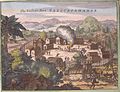
 Indian Village of Pomeiooc Theodor de Bry 1590.jpg 794 × 1,024; 880 KB
-

-
 Indians NW of South Carolina.jpg 1,770 × 1,217; 294 KB
-
 John White - The town of Pomeiooc, 1906,0509.1.8.jpg 2,500 × 2,428; 831 KB
-
 Kane Lake Huron Oil.jpg 736 × 482; 70 KB
-
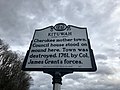 Kituwah Historical Marker, Ela, NC (45922084404).jpg 4,032 × 3,024; 2.03 MB
-
 Little Crow's Village on the Mississippi.jpg 480 × 305; 28 KB
-
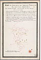
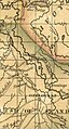
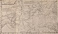
 Map of northern la Florida 1584.png 1,032 × 627; 1.18 MB
-

-

-

-
 Michigan 1718.jpg 1,006 × 625; 374 KB
-
 Mission San Luis.jpg 600 × 729; 96 KB
-
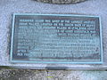
 Monasukapanough - Monacan village historical marker, Dec 2013.jpg 4,128 × 2,322; 4.7 MB
-

-
 Narratives of the Indian wars, 1675-1699 (1913) (14598000359).jpg 3,143 × 2,630; 999 KB
-
 NativeTowns Pittsburgh.png 713 × 441; 52 KB
-
 Nearby Communities P9121104.jpg 1,442 × 2,583; 293 KB
-
 North carolina algonkin-dorf.jpg 1,258 × 1,630; 3.08 MB
-
 Ohio Country de.png 1,217 × 920; 1.42 MB
-
 Olentangy Battle Monument.jpg 4,032 × 3,024; 4.4 MB
-

-
 Overhill-cherokee-little-tennessee.jpg 510 × 220; 41 KB
-
 Parkin Archeological State Park Parkin AR 29.jpg 1,024 × 768; 675 KB
-
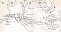
 Parkin phase sites HRoe 2008.jpg 700 × 400; 215 KB
-
 Pickaway Settlements Battlesite.jpg 2,816 × 2,112; 2.8 MB
-
 PickawayPlains3.JPG 4,608 × 2,592; 3.76 MB
-
 Picture III 213.jpg 1,600 × 1,200; 588 KB
-
 PiNpa, California.png 479 × 333; 147 KB
-
 Ponca-stammens vandring - Ponca migration.png 3,040 × 2,748; 244 KB
-
 RamapoughVillage.jpg 382 × 452; 98 KB
-
 Royce-areas-ohio.jpg 1,567 × 1,661; 522 KB
-
 Sandusky sites.PNG 243 × 174; 9 KB
-
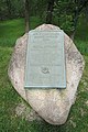
 Shikellamys Stone (7497900788).jpg 1,669 × 2,431; 3.12 MB
-
 SusquehannockFort sm.jpg 361 × 277; 66 KB
-
 Tallapoosa County - Horseshoe Bend National Military Park - 20220711145800.jpg 3,024 × 4,032; 4.11 MB
-
 The Deercreek Frontier.JPG 640 × 480; 84 KB
-
 The Village of White Hair mural 2006-07-03.jpg 2,972 × 1,364; 1.52 MB
-

-

-
-

-

-
 View of Mendota Seth Eastman 1848.jpg 630 × 450; 146 KB
-
 Virginia-Algonkin.png 1,100 × 936; 1.48 MB
-
 Washington and Gist visit Queen Aliquippa (1754) LCCN2007681711.jpg 1,536 × 1,245; 323 KB
-
 White - Hulton 1984, fig. 023.jpg 1,228 × 884; 936 KB
-
 Zanesfield-ohio-limits.jpg 3,000 × 1,057; 827 KB

_-_Geographicus_-_CarolinaGeorgia-bowen-1747.jpg)


_from_Illustrations_of_the_manners,_customs,_and_condition_of_the_North_American_Indians._(1866_ed.).jpg)


_(BAnQ_2630205).jpg)

_(14773023821).jpg)


_(14776624422).jpg)


_(14578482980).jpg)


.JPG)
_(14784263142).jpg)


).png)


.jpg)


.jpg)


_(14598000359).jpg)


.jpg)


.jpg)
.jpg)
.jpg)
.jpg)


_LCCN2007681711.jpg)

.jpg)