Category:Nayland
English: Nayland is a village in the Stour Valley on the Suffolk side of the border between Suffolk and Essex in England.
village in Suffolk, England, UK  | |||||
| Upload media | |||||
| Instance of | |||||
|---|---|---|---|---|---|
| Location | Nayland-with-Wissington, Babergh, Suffolk, East of England, England | ||||
 | |||||
Subcategories
This category has the following 6 subcategories, out of 6 total.
A
- Alston Court (3 F)
- Anchor Inn, Nayland (4 F)
B
- Nayland Bridge (4 F)
J
- St James' Church, Nayland (8 F)
N
- Nayland War Memorial (3 F)
W
- White Hart, Nayland (1 F)
Media in category "Nayland"
The following 39 files are in this category, out of 39 total.
-
 20 Court Street, Nayland - geograph.org.uk - 4792595.jpg 640 × 480; 102 KB
-
 7 and 9, High Street, Nayland - geograph.org.uk - 4792224.jpg 640 × 480; 112 KB
-

-

-
 Birch Street, Nayland - geograph.org.uk - 1352821.jpg 640 × 480; 63 KB
-

-
 Fen Street, Nayland - geograph.org.uk - 1352840.jpg 640 × 480; 76 KB
-
 Fen Street, Nayland - geograph.org.uk - 1352854.jpg 640 × 480; 104 KB
-
 Flood warning sign, Nayland - geograph.org.uk - 4792529.jpg 640 × 480; 103 KB
-
 Footpath, west of Nayland - geograph.org.uk - 2339393.jpg 3,648 × 2,736; 1.38 MB
-
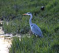 Heron Evening Fishing on the Stour at Nayland - geograph.org.uk - 1810021.jpg 2,165 × 1,923; 2.83 MB
-

-
 Larch Grove, Nayland - geograph.org.uk - 2280089.jpg 640 × 480; 85 KB
-
 Mile Post and horse drinking trough - geograph.org.uk - 4509589.jpg 768 × 1,024; 380 KB
-
 Mill Street, Nayland - geograph.org.uk - 4792642.jpg 640 × 480; 116 KB
-
 Nayland fire station - geograph.org.uk - 1910310.jpg 640 × 427; 221 KB
-
 Nayland Post Office CO6, 1978 - Flickr - sludgegulper.jpg 2,693 × 1,752; 518 KB
-
 Obelisk Distance Post - geograph.org.uk - 1964858.jpg 1,200 × 1,600; 380 KB
-

-
 Old fuel pump seen in an outbuilding, Nayland - geograph.org.uk - 4668077.jpg 2,680 × 3,350; 3.7 MB
-
 Outbuilding housing fuel pump, Nayland - geograph.org.uk - 4668082.jpg 1,600 × 1,067; 473 KB
-
 Part of Bear Street in Nayland - geograph.org.uk - 846198.jpg 640 × 480; 65 KB
-
 River Stour, near Bear Street, Nayland - geograph.org.uk - 4185232.jpg 3,648 × 2,736; 2.61 MB
-
 Swan at Nayland - geograph.org.uk - 186550.jpg 640 × 480; 93 KB
-

-
 Apple orchards at Leavenheath - geograph.org.uk - 478011.jpg 640 × 480; 112 KB
-
 Burnt Dick Hill - geograph.org.uk - 552505.jpg 640 × 480; 118 KB
-
 Campion Hill, near Nayland, Suffolk - geograph.org.uk - 145309.jpg 640 × 480; 64 KB
-
 Church House, Nayland, Suffolk - geograph.org.uk - 145304.jpg 640 × 480; 54 KB
-
 Crossroads near Stoke Priory - geograph.org.uk - 288453.jpg 640 × 479; 148 KB
-
-
 Field next to Wiston Road, Nayland - geograph.org.uk - 217535.jpg 640 × 426; 36 KB
-
 Gravel Lane - geograph.org.uk - 378264.jpg 640 × 452; 83 KB
-
 River Stour at Nayland - geograph.org.uk - 186541.jpg 640 × 480; 142 KB
-

-

-
 River Stour, Suffolk-Essex border - geograph.org.uk - 302208.jpg 640 × 479; 127 KB
-
 Road to Brunning's Farm - geograph.org.uk - 374034.jpg 640 × 424; 55 KB
-
 The B1087 looking towards Nayland - geograph.org.uk - 378117.jpg 640 × 425; 64 KB


