This category is about media of any type related to Naylor, Georgia
<nowiki>نیلور، جورجیا; Naylor; Naylor; Naylor; Naylor; نیلور; 內勒 (喬治亞州); Naylor; アミリカ合衆国ぬ非法人集落; établissement humain, comté de Lowndes, Géorgie, États-Unis; Ort im US-Bundesstaat Georgia; lungsod sa Estados Unidos, Georgia; یک منطقهٔ مسکونی در جورجیا در ایالات متحدهٔ آمریکا; unincorporated community in Lowndes County, Georgia, United States; luech te i Stac Unii; Naylor, Georgia; Naylor, GA; نیلور، جورجیا</nowiki>
Naylor
unincorporated community in Lowndes County, Georgia, United States


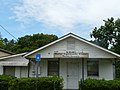 Naylor Community Center front view.jpg 3,264 × 2,448; 1.88 MB
 Naylor Community Center.jpg 3,072 × 2,304; 1.4 MB
 Naylor limits, US84 WB.JPG 4,320 × 3,240; 4.57 MB
 Naylor Park.jpg 3,072 × 2,304; 1.13 MB
 Naylor Post Office.jpg 3,072 × 2,304; 1.13 MB
 NaylorFD.jpg 3,072 × 2,304; 1.29 MB
 NaylorPark.jpg 3,072 × 2,304; 2.04 MB


