Category:Nederlands Hervormde Kerk, Nieuwolda
| Object location | | View all coordinates using: OpenStreetMap |
|---|
church building in Oldambt, Netherlands  | |||||
| Upload media | |||||
| Instance of | |||||
|---|---|---|---|---|---|
| Location | Nieuwolda, Groningen, Netherlands | ||||
| Street address |
| ||||
| Heritage designation |
| ||||
| Inception |
| ||||
| Significant event |
| ||||
 | |||||
|
This is a category about rijksmonument number 30564
|
| Address |
|
Media in category "Nederlands Hervormde Kerk, Nieuwolda"
The following 24 files are in this category, out of 24 total.
-
 Exterieur noordgevel - Nieuwolda - 20165589 - RCE.jpg 1,200 × 815; 284 KB
-
 Exterieur oost zijde - Nieuwolda - 20165599 - RCE.jpg 961 × 1,200; 237 KB
-
 Exterieur vanuit het zuiden - Nieuwolda - 20165594 - RCE.jpg 836 × 1,200; 199 KB
-
 Exterieur zuid-oost zijde - Nieuwolda - 20165593 - RCE.jpg 1,200 × 800; 207 KB
-
 Exterieur zuid-oost zijde - Nieuwolda - 20165598 - RCE.jpg 971 × 1,200; 257 KB
-
 Interieur - Nieuwolda - 20322783 - RCE.jpg 1,200 × 783; 157 KB
-
 Interieur naar het noord-oosten - Nieuwolda - 20165600 - RCE.jpg 1,200 × 970; 174 KB
-
 Interieur naar het westen - Nieuwolda - 20165596 - RCE.jpg 828 × 1,200; 147 KB
-
 Interieur naar het westen - Nieuwolda - 20165603 - RCE.jpg 969 × 1,200; 183 KB
-
 Interieur naar het zuid-oosten - Nieuwolda - 20165601 - RCE.jpg 1,200 × 964; 174 KB
-

-
 Kerk Nieuwolda.JPG 2,304 × 3,072; 1.2 MB
-
 Nieuwolda - kerk (2).jpg 5,668 × 3,779; 4.13 MB
-
 Nieuwolda - kerk.jpg 4,691 × 3,864; 4.14 MB
-
 Nieuwolda Kerk 01.JPG 2,816 × 2,112; 2.89 MB
-
 Nieuwolda Kerk 02.JPG 2,112 × 2,816; 1.35 MB
-
 Nieuwolda Kerk 03.JPG 2,112 × 2,816; 1.46 MB
-
 Overzicht vanuit het zuidoosten - Nieuwolda - 20322782 - RCE.jpg 1,200 × 785; 188 KB
-
 Preekstoel - Nieuwolda - 20165597 - RCE.jpg 891 × 1,200; 173 KB
-
 Preekstoel - Nieuwolda - 20165602 - RCE.jpg 961 × 1,200; 197 KB
-
 Toren west-zijde - Nieuwolda - 20165590 - RCE.jpg 804 × 1,200; 170 KB
-
 Toren west-zijde - Nieuwolda - 20165592 - RCE.jpg 812 × 1,200; 196 KB
-
 Toren west-zijde ingang - Nieuwolda - 20165591 - RCE.jpg 812 × 1,200; 252 KB
-
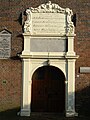
 West ingang - Nieuwolda - 20165595 - RCE.jpg 835 × 1,200; 223 KB


.jpg)


