Category:Nederlands Hervormde Kerk, Reeuwijk
| Object location | | View all coordinates using: OpenStreetMap |
|---|
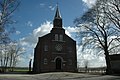
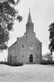
Nederlands: Dorpskerk, Nederlands Hervormde Kerk uit 1871, Kerkweg 2-4 in Reeuwijk-Brug
Subcategories
This category has only the following subcategory.
Media in category "Nederlands Hervormde Kerk, Reeuwijk"
The following 40 files are in this category, out of 40 total.
-
 Exterieur achtergevel - Reeuwijk - 20185052 - RCE.jpg 942 × 1,200; 253 KB
-
 Exterieur voorgevel - Reeuwijk - 20185049 - RCE.jpg 954 × 1,200; 244 KB
-
 Interieur naar 't orgel - Reeuwijk - 20185054 - RCE.jpg 1,200 × 957; 182 KB
-
 Interieur naar preekstoel - Reeuwijk - 20185053 - RCE.jpg 1,200 × 958; 166 KB
-
 Interieur, avondmaalsbekers - Reeuwijk - 20374759 - RCE.jpg 1,183 × 1,200; 239 KB
-
 Interieur, avondmaalsbekers - Reeuwijk - 20374762 - RCE.jpg 1,190 × 1,200; 228 KB
-
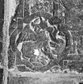
 Interieur, grafzerk in koor - Reeuwijk - 20374711 - RCE.jpg 1,192 × 1,200; 487 KB
-
 Interieur, grafzerk in koor, - Reeuwijk - 20374722 - RCE.jpg 1,193 × 1,200; 527 KB
-
 Interieur, grafzerk in koor, - Reeuwijk - 20374757 - RCE.jpg 1,190 × 1,200; 475 KB
-

-
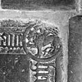
 Interieur, grafzerk in koor, A.M. Ravesteyn - Reeuwijk - 20374749 - RCE.jpg 1,192 × 1,200; 522 KB
-

-
 Interieur, grafzerk in koor, detail - Reeuwijk - 20374758 - RCE.jpg 1,197 × 1,200; 481 KB
-

-

-
-

-

-

-

-

-

-
-

-

-
 Interieur, naar de preekstoel - Reeuwijk - 20374706 - RCE.jpg 1,176 × 1,200; 205 KB
-
 Interieur, naar het orgel - Reeuwijk - 20374707 - RCE.jpg 1,192 × 1,200; 235 KB
-
 Interieur, schenkkannen - Reeuwijk - 20374764 - RCE.jpg 1,200 × 1,200; 138 KB
-
 Lijkhuisje - Reeuwijk - 20374774 - RCE.jpg 1,183 × 1,200; 482 KB
-
 Linker zijgevel - Reeuwijk - 20185051 - RCE.jpg 1,200 × 960; 278 KB
-
 Overzicht boerderij - Reeuwijk - 20374944 - RCE.jpg 1,185 × 1,200; 367 KB
-
 Overzicht met dorp - Reeuwijk - 20185047 - RCE.jpg 1,200 × 942; 139 KB
-
 Overzicht, zaalkerk met geveltoren - Reeuwijk - 20374700 - RCE.jpg 1,200 × 939; 326 KB
-

-

-
 Rechter zijgevel - Reeuwijk - 20185050 - RCE.jpg 1,200 × 960; 307 KB
-
 ReeuwijkDorpKerkGeref.JPG 3,008 × 2,000; 1.48 MB
-
 Voor- en linkerzijgevel - Reeuwijk - 20374702 - RCE.jpg 798 × 1,200; 265 KB
-
 Voorgevel en toren - Reeuwijk - 20374704 - RCE.jpg 956 × 1,200; 292 KB
-
 Voorzijde - Reeuwijk - 20185048 - RCE.jpg 954 × 1,200; 265 KB


,_in_hoek_priesterzerk._-_Reeuwijk_-_20374732_-_RCE.jpg)
,_in_hoek_priesterzerk._-_Reeuwijk_-_20374733_-_RCE.jpg)
,_in_hoek_priesterzerk._-_Reeuwijk_-_20374738_-_RCE.jpg)
,_in_hoek_priesterzerk._-_Reeuwijk_-_20374743_-_RCE.jpg)


