Category:Nederlands Hervormde Kerk, Voorthuizen
| Object location | | View all coordinates using: OpenStreetMap |
|---|
 | |||||
| Upload media | |||||
| Instance of |
| ||||
|---|---|---|---|---|---|
| Location | Voorthuizen, Gelderland, Netherlands | ||||
| Street address |
| ||||
| Located on street |
| ||||
| Heritage designation |
| ||||
 | |||||
|
This is a category about rijksmonument number 8629
|
| Address |
|
Media in category "Nederlands Hervormde Kerk, Voorthuizen"
The following 26 files are in this category, out of 26 total.
-
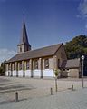
 2006-06-02 16.38 Voorthuizen, kerk.JPG 1,704 × 2,272; 1.14 MB
-
 20151222 hervormde kerk Voorthuizen.jpg 4,896 × 3,672; 2.22 MB
-
 GLAS IN LOODRAAM westzijde toren - Voorthuizen - 20354600 - RCE.jpg 783 × 1,200; 125 KB
-
 GLAS IN LOODRAAM westzijde toren - Voorthuizen - 20354601 - RCE.jpg 791 × 1,200; 114 KB
-
 Interieur torenportaal, gewelf met sluitsteen - Voorthuizen - 20351784 - RCE.jpg 1,183 × 1,200; 230 KB
-
 Interieur torenportaal, gewelf, sluitsteen - Voorthuizen - 20351785 - RCE.jpg 1,195 × 1,200; 259 KB
-

-

-

-
 Interieur torenportaal, grafsteen bevestigd aan muur - Voorthuizen - 20351772 - RCE.jpg 1,183 × 1,200; 386 KB
-
 Interieur torenportaal, kist - Voorthuizen - 20351771 - RCE.jpg 1,180 × 1,200; 227 KB
-

-

-
 Interieur torenportaal, urn - Voorthuizen - 20351773 - RCE.jpg 1,188 × 1,200; 292 KB
-
 Interieur, aanzicht orgel, orgelnummer 1579 - Voorthuizen - 20417100 - RCE.jpg 886 × 1,200; 158 KB
-
 Interieur, overzicht richting het balkon, het westen - Voorthuizen - 20351768 - RCE.jpg 1,171 × 1,200; 270 KB
-
 Interieur, overzicht richting het orgel, het oosten - Voorthuizen - 20351767 - RCE.jpg 1,181 × 1,200; 268 KB
-
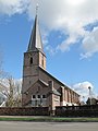
 Kerk Voorthuizen (31290211202).jpg 3,000 × 4,000; 1.54 MB
-

-

-
-

-

-
 Toren, aanzicht - Voorthuizen - 20246766 - RCE.jpg 807 × 1,200; 173 KB
-
 Voorthuizen, kerk2 foto1 RM8629 2012-03-11 13.19.JPG 3,312 × 4,416; 8.69 MB
-


.jpg)


