Category:Negroland
sub-Saharan region of West Africa | |||||
| Upload media | |||||
| Instance of | |||||
|---|---|---|---|---|---|
| Said to be the same as | Sudan | ||||
| |||||
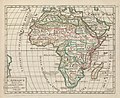
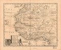
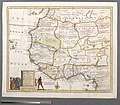
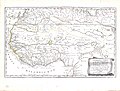
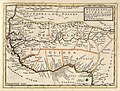
English: Also known as Nigrita, Nigritia, Nigri Tartaria ("Negro Tartary"), Black Africa, Darkest Africa, &c., an imprecisely defined region in West Africa, located south of the Sahara and north of the Guinea coast (inclusive of modern Cote d'Ivoire, Ghana, and Nigeria), largely an early modern European adaptation of the Arab concept of the region of Bilad as-Sudan (the Land of the Blacks) in sub-Saharan Africa but general restricted to its western side.
Subcategories
This category has the following 2 subcategories, out of 2 total.
B
- Burgerzaal map (24 F)
Media in category "Negroland"
The following 47 files are in this category, out of 47 total.
-

-

-
 Carte de Afrique - DPLA - 64312b9c029b8e0923ef437223de91f2.jpg 1,000 × 998; 318 KB
-
 Map - Special Collections University of Amsterdam - OTM- HB-KZL 31-02-47.tif 7,503 × 6,259; 134.36 MB
-
 Map - Special Collections University of Amsterdam - OTM- HB-KZL 31-02-43.tif 7,303 × 6,277; 131.15 MB
-
 Map - Special Collections University of Amsterdam - OTM- HB-KZL 31-02-44.tif 7,320 × 6,659; 139.46 MB
-
 Map - Special Collections University of Amsterdam - OTM- HB-KZL 31-02-45.tif 7,730 × 6,687; 147.89 MB
-
 Map - Special Collections University of Amsterdam - OTM- HB-KZL 31-02-46.tif 7,653 × 6,633; 145.23 MB
-
 Map - Special Collections University of Amsterdam - OTM- HB-KZL 31-02-48.tif 7,779 × 6,621; 147.36 MB
-
 Afrique - DPLA - 30f87a4501730f95862768d989104577.jpg 1,000 × 820; 266 KB
-
 1813 Thomson Map of Africa - Geographicus - Africa-thomson-1813.jpg 5,000 × 4,420; 6.23 MB
-

-
-
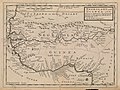
 A new and accurate map of Negroland and the Adjacent Countries.jpg 8,910 × 7,764; 14.34 MB
-

-
 A-3-37-18-North-Africa-Guinea.jpg 3,000 × 2,281; 807 KB
-
 Abissinie. - DPLA - e80611f4f6375d79554d014338ce5c67.jpg 596 × 1,000; 166 KB
-

-
 Afm0002151.jpg 4,000 × 3,023; 2.88 MB
-
 Africa - DPLA - e3e70b9d1bcdf52ea5722c1448b74f5e.jpg 1,000 × 849; 274 KB
-
 AMH-7760-KB Map of the west coast of Africa.jpg 2,400 × 1,623; 892 KB
-
 Cartouche in a Negroland map by Bowen.jpg 2,671 × 1,467; 1.12 MB
-

-
 Dury Atlas Map 6 Africa.jpg 2,980 × 2,550; 1.81 MB
-
 Eastern hemisphere - Google Art Project.jpg 4,837 × 4,837; 3.63 MB
-

-

-

-

-
 Negroland and Guinea - DPLA - 0301aeb562206a56672aaab9ba66bc75.jpg 1,000 × 756; 257 KB
-
 Negroland and Guinea with the European Settlements, 1736.jpg 1,200 × 894; 1.55 MB
-

-
-
 Negroland and Guinea.jpg 3,391 × 2,547; 2.73 MB
-
 Negroland; (IA negroland01jone).pdf 987 × 1,545, 546 pages; 44.98 MB
-
 New & Accurate Map of Negroland - DPLA - 4c1e7a939c99adfc779e5ac80ada9d1d.jpg 1,000 × 780; 256 KB
-
 New & Accurate Map of Negroland.jpg 4,000 × 3,117; 3.09 MB
-
 Nigritia - DPLA - 0dec62dc2286c4cbaf2213539bbb4d84.jpg 1,000 × 828; 218 KB
-
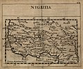 Nigritia - DPLA - 1e2212361430ad547950d8a9092ce998.jpg 1,000 × 832; 210 KB
-
 Nigritia - DPLA - 9ef8fc1aedf7dbdc488eb81356a158f9.jpg 1,000 × 932; 249 KB
-
 Nigritia, Guinea & c. - DPLA - e5e7463438d23b14f045e4a3a222fb1e.jpg 1,000 × 779; 303 KB
-

-

-
 Soudan or Nigritia from Court Game of Geography MET DP862896.jpg 808 × 1,202; 315 KB
-
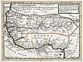
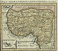 Moll Map of Zaara, Negro-Land, Guinea &c. 1701 UTA.jpg 2,299 × 2,002; 2.34 MB
-
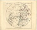
 Nouvel atlas portatif 1806 (138990158).jpg 5,957 × 5,191; 27.39 MB
-
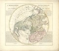
 Nouvel atlas portatif 1806 (138991336).jpg 6,021 × 5,166; 27.01 MB
.jpg)
.10.(28).jpg)


.jpg)


.jpg)


.jpg)


_Robert_de_Vaugondy_G%C3%A9ographe_ord(inaire)_du..._-_btv1b550137444_(133_of_183).jpg)


.jpg)
.jpg)