Category:Neptune Township, New Jersey
| Object location | | View all coordinates using: OpenStreetMap |
|---|
| Authority control |
This category is about media of any type related to Neptune Township, New Jersey
township in New Jersey, United States   | |||||
| Upload media | |||||
| Instance of | |||||
|---|---|---|---|---|---|
| Location | Monmouth County, New Jersey | ||||
| Population |
| ||||
| Area |
| ||||
| Elevation above sea level |
| ||||
| Different from | |||||
| official website | |||||
 | |||||
Subcategories
This category has the following 7 subcategories, out of 7 total.
Media in category "Neptune Township, New Jersey"
The following 6 files are in this category, out of 6 total.
-
 APPbuilding2.jpg 1,078 × 733; 327 KB
-
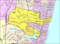 Census Bureau map of Neptune Township, New Jersey.png 575 × 425; 79 KB
-
 MRC-1 James Lee.jpg 5,472 × 3,648; 2.69 MB
-
 Neptune twp nj 025.png 680 × 580; 66 KB
-
 Shark River and Bridge Loop Trail at Shark River County Park.jpg 4,032 × 3,024; 6.65 MB
-
 Shark River at Shark River County Park.jpg 4,032 × 3,024; 5.41 MB


