Category:Netherfield, Nottinghamshire
English: Netherfield is a small town three miles east of Nottingham. It lies just outside the city boundary in the Borough of Gedling. It is between Colwick and Carlton in the NG4 postcode area, and near the River Trent.
town in Nottinghamshire, UK  | |||||
| Upload media | |||||
| Instance of | |||||
|---|---|---|---|---|---|
| Location | Gedling, Nottinghamshire, East Midlands, England | ||||
| Different from | |||||
 | |||||
Subcategories
This category has the following 3 subcategories, out of 3 total.
R
- Rectory Junction Viaduct (12 F)
Media in category "Netherfield, Nottinghamshire"
The following 25 files are in this category, out of 25 total.
-
 Ashwell Street - geograph.org.uk - 1760384.jpg 640 × 480; 70 KB
-
 AshwellStreetSchool.png 403 × 325; 344 KB
-
 Bell on St Paul's - geograph.org.uk - 1739816.jpg 683 × 1,024; 198 KB
-
 Burton Road - geograph.org.uk - 1071711.jpg 640 × 427; 84 KB
-
 Burton Road, Carlton - geograph.org.uk - 793944.jpg 640 × 426; 134 KB
-
 Carlton Square shopping precinct - geograph.org.uk - 793888.jpg 426 × 640; 93 KB
-
-
 ChandosBoysSchoolSign.png 287 × 199; 98 KB
-
 ChandosStreetSecondarySchool.png 1,100 × 901; 2.38 MB
-
 Conway Street - geograph.org.uk - 793890.jpg 640 × 426; 137 KB
-
 Fox and Hounds - geograph.org.uk - 1163649.jpg 640 × 470; 129 KB
-
 Manor Close - geograph.org.uk - 793889.jpg 640 × 426; 167 KB
-
 Midland Road, Netherfield - geograph.org.uk - 1144263.jpg 640 × 479; 211 KB
-
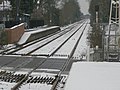
 Netherfield Junction - geograph.org.uk - 312689.jpg 640 × 415; 107 KB
-
 Ouse Dyke near Netherfield - geograph.org.uk - 1389784.jpg 479 × 640; 160 KB
-
 Railway remains - geograph.org.uk - 1389786.jpg 479 × 640; 116 KB
-
 Recreation area off Cavendish Road - geograph.org.uk - 793953.jpg 640 × 426; 152 KB
-
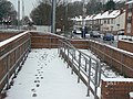 Snowy ramp - geograph.org.uk - 1163678.jpg 640 × 479; 117 KB
-
 Terraced housing, Netherfield - geograph.org.uk - 312667.jpg 640 × 427; 102 KB
-
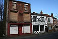
 The Black's Head, Carlton - geograph.org.uk - 793886.jpg 640 × 411; 174 KB
-
 The Willows Medical Centre - geograph.org.uk - 1739833.jpg 1,024 × 683; 400 KB
-
 Victoria Street, Netherfield - geograph.org.uk - 1163685.jpg 640 × 479; 106 KB
-

-

-
 Oakdale Road, Bakersfield, Nottingham - geograph.org.uk - 312609.jpg 640 × 420; 84 KB


