Category:Netherlands in the 1860s
Countries of Europe: Austria · Azerbaijan‡ · Belarus · Belgium · Bulgaria · Croatia · Czech Republic · Denmark · Estonia · Finland · France‡ · Georgia‡ · Germany · Greece · Hungary · Iceland · Republic of Ireland · Italy · Kazakhstan‡ · Latvia · Lithuania · Luxembourg · Malta · Monaco · Netherlands‡ · Norway · Poland · Portugal‡ · Romania · Russia‡ · Serbia · Slovakia · Slovenia · Spain‡ · Sweden · Switzerland · Turkey‡ · Ukraine · United Kingdom
Specific status: Faroe Islands · Gibraltar
‡: partly located in Europe
Specific status: Faroe Islands · Gibraltar
‡: partly located in Europe

Wikimedia category | |||||
| Upload media | |||||
| Instance of | |||||
|---|---|---|---|---|---|
| Category combines topics | |||||
| Follows | |||||
| Followed by | |||||
 | |||||
Subcategories
This category has the following 24 subcategories, out of 24 total.
Media in category "Netherlands in the 1860s"
The following 21 files are in this category, out of 21 total.
-
 1866spotprentart53.jpg 837 × 1,061; 680 KB
-

-
 Humoristisch Album 1861.JPG 480 × 634; 95 KB
-
 Netherlands, Abbenbroek, map of 1867.jpg 2,576 × 2,127; 1.6 MB
-
 Netherlands, Alkemade, map of 1865.PNG 2,423 × 1,977; 7.33 MB
-

-
 Netherlands, Deventer, map of 1867.JPG 2,425 × 3,089; 1.14 MB
-
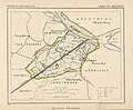
 Netherlands, Geervliet, map, around 1865-1870.jpg 2,560 × 2,135; 1.69 MB
-
 Netherlands, Gieten, map of 1867.jpg 1,200 × 1,075; 517 KB
-
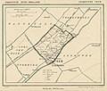
 Netherlands, Heenvliet, map of 1867.jpg 2,508 × 2,071; 1.61 MB
-
 Netherlands, Leeuwarden, map of 1866.jpg 1,400 × 1,197; 513 KB
-
 Netherlands, Leiderdorp, map of 1867.png 2,448 × 2,048; 7.52 MB
-
 Netherlands, Nederhemert, map of 1867.jpg 1,200 × 1,504; 524 KB
-
 Netherlands, Noordbroek, map of 1867.jpg 1,400 × 1,235; 351 KB
-
 Netherlands, Noordeloos, map of 1867.JPG 1,960 × 2,484; 769 KB
-
 Netherlands, Veur, map of 1867.jpg 2,340 × 1,996; 1.79 MB
-
 Netherlands, Warmond, map, around 1865-1870.jpg 2,304 × 1,948; 1.88 MB
-
 Netherlands, Zoeterwoude, map of 1867.jpg 2,053 × 2,534; 2.35 MB
-
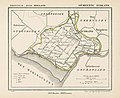 Netherlands, Zuidland, map of 1866.jpg 2,549 × 2,074; 1.74 MB
-
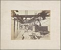 Noorderzeehoofd, herstel na stormschade, Bestanddeelnr 422.jpg 5,767 × 4,742; 2.64 MB
-
 VVeen-fig27.jpg 1,052 × 492; 176 KB


,_map,_around_1865-1870.jpg)


