Category:New Luce (civil parish)
Scottish parish in Dumfries and Galloway, Scotland, UK | |||||
| Upload media | |||||
| Instance of | |||||
|---|---|---|---|---|---|
| Named after | |||||
| Location |
| ||||
| Population |
| ||||
| Area |
| ||||
 | |||||
Media in category "New Luce (civil parish)"
The following 200 files are in this category, out of 976 total.
(previous page) (next page)-
 44871 ^ 45407 Leave Glenwhilly - geograph.org.uk - 3957749.jpg 640 × 387; 87 KB
-
 A Galloway Dyke - geograph.org.uk - 3906487.jpg 1,600 × 900; 523 KB
-
 A Hut Circle on Stab Hill - geograph.org.uk - 3503740.jpg 640 × 480; 110 KB
-
 Altibrair - geograph.org.uk - 6100316.jpg 2,976 × 1,984; 2.95 MB
-
 Anchor Point for Footbridge - geograph.org.uk - 3138287.jpg 2,272 × 1,704; 681 KB
-
 Approaching Kilgallioch Wind Farm - geograph.org.uk - 6274233.jpg 2,000 × 1,333; 250 KB
-
 Approaching New Luce - geograph.org.uk - 3129266.jpg 2,272 × 1,704; 703 KB
-
 Approaching New Luce - geograph.org.uk - 5295765.jpg 2,592 × 1,728; 3.39 MB
-
 Arecleoch View - geograph.org.uk - 3504862.jpg 640 × 479; 93 KB
-
 Artfield Farm - geograph.org.uk - 3632301.jpg 640 × 480; 84 KB
-
 Artfield Fell - geograph.org.uk - 3301170.jpg 1,594 × 1,192; 907 KB
-
 Artfield Fell Power Line - geograph.org.uk - 3632065.jpg 640 × 480; 89 KB
-
 Artfield Fell summit - geograph.org.uk - 3745754.jpg 1,600 × 1,067; 234 KB
-
 Artfield Fell Wind Farm - geograph.org.uk - 3632114.jpg 640 × 480; 77 KB
-
 Ayr to Stranraer Railway Line near New Luce - geograph.org.uk - 3138213.jpg 2,272 × 1,704; 771 KB
-
 Ayr to Stranraer Railway Line near New Luce - geograph.org.uk - 3138219.jpg 2,272 × 1,704; 727 KB
-
 Balmurrie - geograph.org.uk - 3614026.jpg 640 × 424; 70 KB
-
 Balmurrie Moors - geograph.org.uk - 3611335.jpg 640 × 424; 52 KB
-
 Barlure - geograph.org.uk - 6100472.jpg 2,910 × 1,887; 632 KB
-
 Barlure Farm - geograph.org.uk - 3613396.jpg 640 × 424; 76 KB
-
 Barlure Farm - geograph.org.uk - 3910963.jpg 1,920 × 1,280; 1.33 MB
-
 Barlure Farm - geograph.org.uk - 5652834.jpg 3,984 × 2,656; 3.85 MB
-
 Barlure Farm - geograph.org.uk - 5652836.jpg 3,984 × 2,656; 3.12 MB
-
 Barnshangan - geograph.org.uk - 6222243.jpg 2,000 × 1,333; 372 KB
-
 Bell Tower, New Luce Church - geograph.org.uk - 5295694.jpg 2,592 × 1,728; 1.61 MB
-
 Bend in road near to plantation - geograph.org.uk - 3570219.jpg 2,000 × 1,500; 1.26 MB
-
 Bennan Hill - geograph.org.uk - 1060619.jpg 640 × 480; 73 KB
-
 Black Struminoch View - geograph.org.uk - 3503632.jpg 640 × 451; 81 KB
-
 Black Struminoch View - geograph.org.uk - 3503639.jpg 640 × 454; 81 KB
-
 Boundary Fence - geograph.org.uk - 3611411.jpg 640 × 424; 65 KB
-
 Boundary Fence - geograph.org.uk - 3614096.jpg 640 × 424; 90 KB
-
 Boundary Fencing - geograph.org.uk - 3611433.jpg 640 × 424; 64 KB
-
 Boundary Wall - geograph.org.uk - 3900894.jpg 640 × 424; 72 KB
-
 Bridge crossing Tarf Water, Kilgallioch Forest - geograph.org.uk - 6285799.jpg 2,000 × 1,333; 606 KB
-
 Bridge over Cross Water of Luce - geograph.org.uk - 5295718.jpg 2,592 × 1,728; 3.39 MB
-
 Bridge over Cross Water of Luce - geograph.org.uk - 5652955.jpg 3,984 × 2,656; 2.09 MB
-
 Bridge over the White Burn - geograph.org.uk - 1875428.jpg 640 × 480; 108 KB
-
 Bridges to Marklach - geograph.org.uk - 2694823.jpg 2,048 × 1,536; 754 KB
-
 Brough Hill - geograph.org.uk - 3632476.jpg 640 × 480; 108 KB
-
 Burn by Horse Hill - geograph.org.uk - 3632606.jpg 640 × 424; 112 KB
-
 Burn near Kilhern - geograph.org.uk - 3129720.jpg 2,272 × 1,704; 694 KB
-
 Burn to Tarf Water - geograph.org.uk - 3632052.jpg 640 × 480; 120 KB
-
 Burnt Mound near Bennan Hill - geograph.org.uk - 3129684.jpg 2,272 × 1,704; 675 KB
-
 Cairn on Quarter Fell - geograph.org.uk - 3146520.jpg 3,872 × 2,592; 2.47 MB
-
 Cairns, Mid Gleniron - geograph.org.uk - 3600572.jpg 1,600 × 900; 406 KB
-
 Carscreugh Croft - geograph.org.uk - 2313890.jpg 640 × 480; 80 KB
-
 Carscreugh Croft - geograph.org.uk - 5993942.jpg 2,976 × 1,984; 1.71 MB
-
 Carscreugh Fell - geograph.org.uk - 5993903.jpg 2,976 × 1,984; 2.59 MB
-
 Cattle Feeders - geograph.org.uk - 5993947.jpg 2,976 × 1,984; 2.01 MB
-
 Cattle Feeding - geograph.org.uk - 5993945.jpg 2,976 × 1,984; 2.63 MB
-
 Cattle grazing near Lucewater House - geograph.org.uk - 6265758.jpg 2,000 × 1,333; 435 KB
-
 Cattle Grid - geograph.org.uk - 3614445.jpg 640 × 424; 61 KB
-
 Cattle Grid at Miltonise - geograph.org.uk - 6273088.jpg 2,976 × 1,984; 2.53 MB
-
 Cattle Grid on Road to Barrhill near Stair Lodge - geograph.org.uk - 3910944.jpg 1,920 × 1,280; 1.4 MB
-
 Cattle Grid on the Barrhill Road - geograph.org.uk - 3504728.jpg 640 × 475; 88 KB
-
 Cattle grid on the road to Balmurrie - geograph.org.uk - 6265779.jpg 2,000 × 1,333; 420 KB
-
 Cattle grid south of Kilmacfadzean - geograph.org.uk - 6274203.jpg 2,000 × 1,333; 324 KB
-
 Cattle near Stair Lodge - geograph.org.uk - 6273107.jpg 2,976 × 1,984; 3.27 MB
-
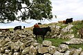
 Cattle on the Moor - geograph.org.uk - 3129520.jpg 2,272 × 1,704; 739 KB
-
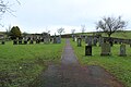
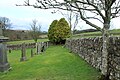
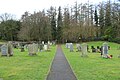
 Cemetery, New Luce - geograph.org.uk - 5295752.jpg 2,592 × 1,728; 3.43 MB
-
 Cemetery, New Luce - geograph.org.uk - 5295770.jpg 2,592 × 1,728; 2.59 MB
-
 Cemetery, New Luce - geograph.org.uk - 5295773.jpg 2,592 × 1,728; 2.91 MB
-
 Cemetery, New Luce - geograph.org.uk - 5295777.jpg 2,592 × 1,728; 2.73 MB
-
 Cemetery, New Luce - geograph.org.uk - 5295784.jpg 2,592 × 1,728; 4.37 MB
-
 Cemetery, New Luce - geograph.org.uk - 5295791.jpg 2,592 × 1,728; 3.22 MB
-
 Cemetery, New Luce - geograph.org.uk - 5296092.jpg 2,592 × 1,728; 3.47 MB
-
 Cemetery, New Luce - geograph.org.uk - 5296098.jpg 2,592 × 1,728; 3.2 MB
-
 Cemetery, New Luce - geograph.org.uk - 5296102.jpg 2,592 × 1,728; 3.51 MB
-
 Cemetery, New Luce - geograph.org.uk - 5296106.jpg 2,592 × 1,728; 3.6 MB
-
 Cemetery, New Luce - geograph.org.uk - 5296110.jpg 2,592 × 1,728; 3.33 MB
-
 Chirmorie Loch - geograph.org.uk - 1875724.jpg 640 × 480; 56 KB
-
 Church of Scotland - New Luce - geograph.org.uk - 3412501.jpg 1,023 × 1,250; 560 KB
-
 Claygugan Ree - geograph.org.uk - 1875402.jpg 640 × 480; 110 KB
-
 Claygugan Ree - geograph.org.uk - 1875410.jpg 640 × 480; 128 KB
-
 Clearing in Kilgallioch Forest - geograph.org.uk - 6280094.jpg 2,000 × 1,333; 374 KB
-
 Clearing NE of Gled Knowes - geograph.org.uk - 896701.jpg 640 × 428; 69 KB
-
 Close-Up of Kilhern - geograph.org.uk - 3129765.jpg 2,272 × 1,704; 867 KB
-
 Close-Up of Kilhern - geograph.org.uk - 3129794.jpg 2,272 × 1,704; 854 KB
-
 Closs - geograph.org.uk - 3146920.jpg 3,872 × 2,592; 3.11 MB
-
 Closs - geograph.org.uk - 3146952.jpg 3,872 × 2,592; 2.98 MB
-
 Closs - geograph.org.uk - 3146999.jpg 3,872 × 2,592; 3.73 MB
-
 Closs - stonework detail - geograph.org.uk - 3146965.jpg 3,872 × 2,592; 3.36 MB
-
 Corn drying kiln at Closs abandoned settlement - geograph.org.uk - 3146934.jpg 3,872 × 2,592; 2.61 MB
-
 Cow on the Rocks - geograph.org.uk - 6273105.jpg 2,976 × 1,984; 2.53 MB
-
 Craig - geograph.org.uk - 2263781.jpg 640 × 480; 116 KB
-
 Craig - geograph.org.uk - 2263783.jpg 640 × 480; 102 KB
-
 Craig Fell - geograph.org.uk - 2263711.jpg 640 × 480; 91 KB
-
 Craig Fell - geograph.org.uk - 2263737.jpg 640 × 480; 81 KB
-
 Craig-gork - geograph.org.uk - 3632427.jpg 640 × 480; 144 KB
-
 Craigbirnoch Fell - geograph.org.uk - 5652863.jpg 3,984 × 2,656; 3.94 MB
-
 Cross Water Bridge - geograph.org.uk - 2262523.jpg 640 × 480; 66 KB
-
 Cross Water Bridge - geograph.org.uk - 2262539.jpg 640 × 480; 125 KB
-
 Cross Water Bridge - New Luce - (1) - geograph.org.uk - 3412507.jpg 826 × 1,250; 1.1 MB
-
 Cross Water Bridge - New Luce - (2) - geograph.org.uk - 3412510.jpg 884 × 1,250; 1.1 MB
-
 Cross Water of Luce - geograph.org.uk - 3130496.jpg 2,272 × 1,704; 672 KB
-
 Cross Water of Luce - geograph.org.uk - 3130499.jpg 2,272 × 1,704; 686 KB
-
 Cross Water of Luce - geograph.org.uk - 3503624.jpg 640 × 479; 95 KB
-
 Cross Water of Luce - geograph.org.uk - 3504573.jpg 640 × 480; 77 KB
-
 Cross Water of Luce - geograph.org.uk - 3504577.jpg 640 × 449; 74 KB
-
 Cross Water of Luce - geograph.org.uk - 3504702.jpg 640 × 480; 80 KB
-
 Cross Water of Luce - geograph.org.uk - 3504724.jpg 640 × 480; 91 KB
-
 Cross Water of Luce - geograph.org.uk - 3613563.jpg 640 × 424; 64 KB
-
 Cross Water of Luce - geograph.org.uk - 3613570.jpg 640 × 424; 103 KB
-
 Cross Water of Luce - geograph.org.uk - 3614497.jpg 640 × 424; 83 KB
-
 Cross Water of Luce - geograph.org.uk - 4445084.jpg 640 × 478; 89 KB
-
 Cross Water of Luce - geograph.org.uk - 5295722.jpg 2,592 × 1,728; 3.49 MB
-
 Cross Water of Luce - geograph.org.uk - 5295726.jpg 2,592 × 1,728; 3.45 MB
-
 Cross Water of Luce - geograph.org.uk - 5652858.jpg 3,984 × 2,656; 5.3 MB
-
 Cross Water of Luce - geograph.org.uk - 5652860.jpg 3,984 × 2,656; 5.74 MB
-
 Cross Water of Luce - geograph.org.uk - 5652866.jpg 3,984 × 2,656; 1.1 MB
-
 Cross Water of Luce - geograph.org.uk - 5652869.jpg 3,984 × 2,656; 2.9 MB
-
 Cross Water of Luce - geograph.org.uk - 5652912.jpg 3,984 × 2,656; 3.68 MB
-
 Cross Water of Luce - geograph.org.uk - 5652914.jpg 3,984 × 2,656; 4.46 MB
-
 Cross Water of Luce - geograph.org.uk - 5652956.jpg 3,984 × 2,656; 5.17 MB
-
 Cross Water of Luce - geograph.org.uk - 5652959.jpg 3,984 × 2,656; 4.44 MB
-
 Cross Water of Luce - geograph.org.uk - 6273093.jpg 2,976 × 1,984; 1.29 MB
-
 Cross Water of Luce at Marklach - geograph.org.uk - 3911240.jpg 1,920 × 1,280; 1.56 MB
-
 Cross Water of Luce at Marklach - geograph.org.uk - 3911248.jpg 1,920 × 1,280; 1.53 MB
-
 Cross Water of Luce from Cross Water Bridge - geograph.org.uk - 3664108.jpg 4,000 × 3,000; 3.39 MB
-
 Cross Water of Luce from Dirniemow Bridge - geograph.org.uk - 3911121.jpg 1,920 × 1,280; 1.26 MB
-
 Cross Water of Luce from Dirniemow Bridge - geograph.org.uk - 3911125.jpg 1,920 × 1,280; 1.37 MB
-
 Cross Water of Luce near Barleoch - geograph.org.uk - 3911071.jpg 1,920 × 1,280; 1.56 MB
-
 Cross Water of Luce near Barnshangan - geograph.org.uk - 3130430.jpg 2,272 × 1,704; 721 KB
-
 Cross Water of Luce near Miltonise - geograph.org.uk - 3911313.jpg 1,920 × 1,280; 1.6 MB
-
 Cross Water of Luce near Pultadie - geograph.org.uk - 3911081.jpg 1,920 × 1,280; 1.28 MB
-
 Crossing The Water Of Luce - geograph.org.uk - 4747910.jpg 640 × 431; 165 KB
-
 Cruise Bridge - geograph.org.uk - 3664109.jpg 4,000 × 3,000; 3.78 MB
-
 Cruise Farm - geograph.org.uk - 3138318.jpg 2,272 × 1,704; 722 KB
-
 Cruise Farm - geograph.org.uk - 4747919.jpg 640 × 378; 98 KB
-
 Cruise Fell - geograph.org.uk - 2263615.jpg 640 × 480; 87 KB
-
 Cruise Fell - geograph.org.uk - 2263624.jpg 640 × 480; 84 KB
-
 Cruise Fell - geograph.org.uk - 2263686.jpg 640 × 480; 77 KB
-
 Davenholme Burn - geograph.org.uk - 3504510.jpg 640 × 480; 109 KB
-
 Dernemuillie - geograph.org.uk - 1060357.jpg 640 × 480; 75 KB
-
 Dernemuillie - geograph.org.uk - 1060531.jpg 640 × 378; 43 KB
-
 Derry Hill - geograph.org.uk - 3614524.jpg 640 × 424; 80 KB
-
 Dirniemow Bridge - geograph.org.uk - 3503816.jpg 640 × 480; 88 KB
-
 Dirniemow Bridge - geograph.org.uk - 3504581.jpg 640 × 480; 69 KB
-
 Dirniemow Bridge - geograph.org.uk - 4356170.jpg 640 × 480; 51 KB
-
 Dirniemow Bridge over the Cross Water of Luce - geograph.org.uk - 3911142.jpg 1,920 × 1,280; 1.69 MB
-
 Dirniemow Bridge over the Cross Water of Luce - geograph.org.uk - 3911146.jpg 1,920 × 1,280; 1.75 MB
-
 Dirniemow Bridge, north of New Luce - geograph.org.uk - 5470327.jpg 640 × 480; 101 KB
-
 Dougrie - geograph.org.uk - 3146848.jpg 3,872 × 2,592; 2.61 MB
-
 Dougrie - geograph.org.uk - 3146858.jpg 3,872 × 2,592; 2.88 MB
-
 Dranigower - geograph.org.uk - 1517331.jpg 640 × 428; 36 KB
-
 Dranigower Bridge - geograph.org.uk - 3614473.jpg 640 × 424; 85 KB
-
 Dranigower Burn - geograph.org.uk - 3130349.jpg 2,272 × 1,704; 655 KB
-
 Dranigower Burn - geograph.org.uk - 3130365.jpg 2,272 × 1,704; 717 KB
-
 Dranigower Farm - geograph.org.uk - 3614537.jpg 640 × 424; 68 KB
-
 Drumanee View - geograph.org.uk - 3498425.jpg 640 × 426; 134 KB
-
 Drumanee View - geograph.org.uk - 3498440.jpg 640 × 426; 116 KB
-
 Drumbays - geograph.org.uk - 3632530.jpg 480 × 640; 164 KB
-
 Drumdarraghy - geograph.org.uk - 3614640.jpg 640 × 424; 105 KB
-
 Drumdown - geograph.org.uk - 3632445.jpg 640 × 480; 185 KB
-
 Drumdown Bank - geograph.org.uk - 2262641.jpg 640 × 480; 69 KB
-
 Drumdown Bank - geograph.org.uk - 2262650.jpg 640 × 480; 73 KB
-
 Drumpail Bridge - geograph.org.uk - 2313806.jpg 640 × 480; 68 KB
-
 Drumpail Bridge - geograph.org.uk - 5993920.jpg 2,976 × 1,984; 2.29 MB
-
 Drumpail Burn - geograph.org.uk - 2313814.jpg 640 × 480; 104 KB
-
 Drumpail Burn - geograph.org.uk - 2313825.jpg 640 × 480; 90 KB
-
 Drumpail Burn - geograph.org.uk - 5993910.jpg 2,976 × 1,984; 1.4 MB
-
 Drumpail Burn - geograph.org.uk - 5993916.jpg 2,976 × 1,984; 3.88 MB
-
 Dry Stane Dyke - geograph.org.uk - 5993922.jpg 2,976 × 1,984; 905 KB
-

-
 Drystane dyke SW of Maurs Cairn - geograph.org.uk - 1509559.jpg 640 × 428; 62 KB
-
 Drystane dyke ^ improved grazing SW of Quarter Fell - geograph.org.uk - 3146785.jpg 3,872 × 2,592; 2.41 MB
-
 Drystane dyke ^ moorland east of Dirniemow Fell - geograph.org.uk - 3146431.jpg 3,872 × 2,592; 2.89 MB
-
 Drystane dyke ^ moorland NW of Kilmacfadzean - geograph.org.uk - 3146893.jpg 3,872 × 2,592; 2.92 MB
-
 Drystane dyke ^ tree below Closs Hill - geograph.org.uk - 3146980.jpg 3,872 × 2,592; 2.69 MB
-

-
 Drystane dykes ^ moorland west of Brown Hill - geograph.org.uk - 3146874.jpg 3,872 × 2,592; 2.65 MB
-
 Drystone dyke - geograph.org.uk - 3599272.jpg 1,024 × 683; 303 KB
-
 East of White Hill - geograph.org.uk - 3632071.jpg 640 × 480; 104 KB
-
 Eastward view from Quarter Fell - geograph.org.uk - 3146511.jpg 3,872 × 2,592; 2.54 MB
-
 Enclosure south of High Murdonochee - geograph.org.uk - 1507945.jpg 640 × 428; 55 KB
-
 Entrance to Cruise Farm - geograph.org.uk - 3129340.jpg 2,272 × 1,704; 709 KB
-
 Entrance to New Luce Cemetery - geograph.org.uk - 5295757.jpg 2,592 × 1,728; 3.66 MB
-
 Exchange of token Glenwhilly - geograph.org.uk - 2902531.jpg 1,250 × 1,224; 436 KB
-
 Farm Track near Knockcraven - geograph.org.uk - 3130234.jpg 2,272 × 1,704; 749 KB
-
 Farm Track near Knockcraven - geograph.org.uk - 3130284.jpg 2,272 × 1,704; 737 KB
-
 Farmland and Moorland near Kilhern - geograph.org.uk - 3130156.jpg 2,272 × 1,704; 730 KB
-
 Farmland and Woodland - geograph.org.uk - 5993998.jpg 2,976 × 1,984; 2.56 MB
-
 Farmland at Bank Hill - geograph.org.uk - 5993984.jpg 2,976 × 1,984; 2.47 MB
-
 Farmland at Bar Hill - geograph.org.uk - 5652845.jpg 3,984 × 2,656; 5.01 MB
-
 Farmland at Bar Hill - geograph.org.uk - 5652851.jpg 3,984 × 2,656; 6.52 MB
-
 Farmland at Benlaight - geograph.org.uk - 5993899.jpg 2,976 × 1,984; 2.72 MB
-
 Farmland at Benlaight - geograph.org.uk - 5993900.jpg 2,976 × 1,984; 2.82 MB
-
 Farmland at Cruise Bridge - geograph.org.uk - 3129300.jpg 2,272 × 1,704; 743 KB
-
 Farmland at Derwindle Hill - geograph.org.uk - 5994004.jpg 2,976 × 1,984; 2.69 MB
-
 Farmland at Derwindle Hill - geograph.org.uk - 5994007.jpg 2,976 × 1,984; 2.28 MB
-
 Farmland at Flow Wood - geograph.org.uk - 5994006.jpg 2,976 × 1,984; 2.33 MB
-
 Farmland at Glenchamber - geograph.org.uk - 5993995.jpg 2,976 × 1,984; 1.89 MB
-
 Farmland at Laginamour - geograph.org.uk - 5296113.jpg 2,592 × 1,728; 2.32 MB
-
 Farmland at Laginamour - geograph.org.uk - 5296116.jpg 2,592 × 1,728; 2.22 MB
-
 Farmland at Laginamour - geograph.org.uk - 5296120.jpg 2,592 × 1,728; 1.96 MB
-
 Farmland at Laginamour - geograph.org.uk - 5296152.jpg 2,592 × 1,728; 2.28 MB
-
 Farmland at Laginamour - geograph.org.uk - 5296191.jpg 2,592 × 1,728; 2.4 MB
-
 Farmland at Miltonise - geograph.org.uk - 3504705.jpg 640 × 480; 108 KB
-
 Farmland at New Luce - geograph.org.uk - 5296155.jpg 2,592 × 1,728; 761 KB
-
 Farmland at Torwood - geograph.org.uk - 5993992.jpg 2,976 × 1,984; 2.52 MB


_-_geograph.org.uk_-_3412507.jpg)
_-_geograph.org.uk_-_3412510.jpg)


&filefrom=Farmland+near+Airyolland+Wood+-+geograph.org.uk+-+3138280.jpg#mw-category-media)