Category:New Mexico State Road 599
 | number: | (five hundred ninety-nine) |
|---|---|---|
| State highways in New Mexico: | 581 · 584 · 585 · 590 · 597 · 599 · 601 · 602 · 603 · 605 · 609 · 610 · 612 |
state highway in Santa Fe County, New Mexico, United States  | |||||
| Upload media | |||||
| Instance of | |||||
|---|---|---|---|---|---|
| Location | Santa Fe County, New Mexico | ||||
| Transport network | |||||
| Owned by | |||||
| Maintained by | |||||
| Length |
| ||||
| |||||
English: Media related to New Mexico State Road 599, a 14.019-mile (22.561 km) state highway Santa Fe County in New Mexico, United States, that is also known as both the Santa Fe Relief Route and the Veterans Memorial Highway.
Subcategories
This category has only the following subcategory.
Media in category "New Mexico State Road 599"
The following 7 files are in this category, out of 7 total.
-
 New Mexico 599.svg 750 × 750; 15 KB
-
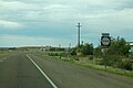
 New Mexico 599 southbound, Santa Fe NM.jpg 3,072 × 2,304; 1.74 MB
-
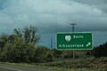
 New Mexico State Road 599 at I 25.jpg 3,264 × 2,448; 1.99 MB
-
 NM599 South Sign Evening (36379746660).jpg 2,400 × 1,600; 1.4 MB
-
 NM599nRoad-ToCR62sign (36606602892).jpg 2,400 × 1,600; 1.46 MB
-
 NM599nRoadSign (36729470126).jpg 2,400 × 1,600; 1.63 MB
-
 NM599sRoad-Int25sSignFaded (36637487631).jpg 2,400 × 1,600; 1.47 MB

.jpg)
.jpg)
.jpg)
.jpg)