Category:Newby and Scalby
English: Newby and Scalby is a civil parish in the Scarborough district of North Yorkshire, England.
civil parish in Scarborough, England  | |||||
| Upload media | |||||
| Instance of | |||||
|---|---|---|---|---|---|
| Location | Scarborough, North Yorkshire, Yorkshire and the Humber, England | ||||
| Population |
| ||||
| Area |
| ||||
| official website | |||||
 | |||||
Subcategories
This category has the following 6 subcategories, out of 6 total.
Media in category "Newby and Scalby"
The following 200 files are in this category, out of 702 total.
(previous page) (next page)-
 A glimpse of Scarborough Castle - geograph.org.uk - 5333410.jpg 1,024 × 768; 196 KB
-
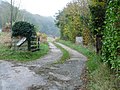
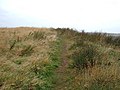
 A new footpath to Scalby - geograph.org.uk - 2178586.jpg 800 × 600; 255 KB
-
 A very old bend in a river - geograph.org.uk - 4608782.jpg 3,008 × 2,000; 878 KB
-
 A165 Burniston Road heading north - geograph.org.uk - 4732221.jpg 640 × 480; 54 KB
-
 A165 Burniston Road heads north - geograph.org.uk - 4732234.jpg 640 × 480; 38 KB
-
 A165 Burniston Road nears Cross Lane - geograph.org.uk - 4732216.jpg 640 × 480; 57 KB
-
 Access to Nature Hide, Burniston Rd - geograph.org.uk - 1909032.jpg 640 × 430; 138 KB
-
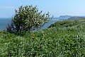
 Across North Bay - geograph.org.uk - 6244450.jpg 1,024 × 768; 805 KB
-
 Allotments by Scalby Bridge - geograph.org.uk - 1905528.jpg 640 × 430; 124 KB
-
 Allotments, Scalby Bridge - geograph.org.uk - 4845489.jpg 640 × 480; 63 KB
-
 Autumn colours, High Barmer - geograph.org.uk - 2698120.jpg 1,024 × 768; 154 KB
-
 Autumnal bank of bracken - geograph.org.uk - 2698499.jpg 1,024 × 768; 162 KB
-
 Barmoor Lane - geograph.org.uk - 4845612.jpg 640 × 480; 61 KB
-
 Barmoor Lane - geograph.org.uk - 4845620.jpg 640 × 480; 64 KB
-
 Baron's Leisure Centre - geograph.org.uk - 1939836.jpg 640 × 427; 267 KB
-
 Beach and Rocks - geograph.org.uk - 2785973.jpg 3,264 × 2,448; 2.02 MB
-
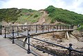
 Beach at Scalby Mills - geograph.org.uk - 6155819.jpg 5,202 × 3,465; 3.53 MB
-
 Beach at Scalby Ness - geograph.org.uk - 6003452.jpg 800 × 494; 126 KB
-
 Beacon Brow Road - geograph.org.uk - 3961694.jpg 2,720 × 1,943; 859 KB
-
 Beacon Cottage Farm - geograph.org.uk - 2401715.jpg 640 × 427; 250 KB
-
 Beacon Cottage Farm on Beacon Brow Road - geograph.org.uk - 5248980.jpg 1,200 × 799; 250 KB
-
 Beacon Cottage Farm on Beacon Brow Road - geograph.org.uk - 5248983.jpg 1,200 × 799; 223 KB
-
 Beacon Farm on Beacon Brow Road - geograph.org.uk - 5248975.jpg 1,200 × 799; 233 KB
-
 Beacon Plantation - geograph.org.uk - 6173303.jpg 2,048 × 1,536; 785 KB
-
 Beam me up, Scotty - geograph.org.uk - 2697025.jpg 1,024 × 768; 55 KB
-
 Beer garden, Scalby Manor Hotel - geograph.org.uk - 1898654.jpg 640 × 430; 159 KB
-
 Being modernised again - geograph.org.uk - 1971392.jpg 4,000 × 3,000; 3.57 MB
-
 Bench by Field Lane - geograph.org.uk - 1904121.jpg 640 × 430; 122 KB
-
 Bench mark on St Mark's churchyard wall - geograph.org.uk - 4625572.jpg 2,736 × 3,648; 4.68 MB
-
 Benches by Church Beck - geograph.org.uk - 1905432.jpg 640 × 430; 150 KB
-
 Beware escaping cows - geograph.org.uk - 2698490.jpg 1,024 × 768; 172 KB
-
 Boulder clay cliff by the Cleveland Way - geograph.org.uk - 1908935.jpg 640 × 430; 128 KB
-
 Boulder Clay cliff, Scalby Ness - geograph.org.uk - 1908882.jpg 640 × 430; 131 KB
-
 Boulder Clay cliffs north of Scalby Ness - geograph.org.uk - 1898435.jpg 640 × 430; 142 KB
-
 Bowling Green, Scalby - geograph.org.uk - 1905272.jpg 640 × 430; 131 KB
-
 Briardene Avenue - geograph.org.uk - 1898939.jpg 640 × 430; 147 KB
-
 Bridge over beck, Scalby - geograph.org.uk - 4845512.jpg 640 × 480; 86 KB
-
 Bridge over Scalby Beck (Sea cut) - geograph.org.uk - 1898280.jpg 640 × 430; 163 KB
-
 Bridge over Scalby Beck - geograph.org.uk - 3662312.jpg 3,648 × 2,736; 4.84 MB
-

-
 Bridleway from Beacon Brow Road - geograph.org.uk - 3961773.jpg 2,816 × 2,112; 1.23 MB
-
 Bungalows in Barmoor Green - geograph.org.uk - 2698055.jpg 1,024 × 768; 148 KB
-
 Bungalows on Coldyhill Lane, Newby - geograph.org.uk - 4844467.jpg 640 × 375; 37 KB
-
 Bungalows on The Green, Newby - geograph.org.uk - 4844488.jpg 640 × 409; 44 KB
-
 Burniston Beck from Cow Wath Bridge - geograph.org.uk - 1904963.jpg 640 × 430; 206 KB
-
 Burniston Beck, Cow Wath Bridge - geograph.org.uk - 1916430.jpg 640 × 430; 205 KB
-
 Burniston Rd (A165) heading south - geograph.org.uk - 1897964.jpg 640 × 430; 149 KB
-
 Burniston Rd (A165) heading south - geograph.org.uk - 1898960.jpg 640 × 430; 129 KB
-
 Burniston Rd - geograph.org.uk - 1912774.jpg 640 × 430; 149 KB
-
 Burniston Rd crosses Scalby Beck - geograph.org.uk - 1897995.jpg 640 × 430; 163 KB
-
 Burniston Road (A165) - geograph.org.uk - 4848732.jpg 640 × 480; 64 KB
-
 Burniston Road (A165) - geograph.org.uk - 4848737.jpg 640 × 480; 90 KB
-
 Burniston Road - geograph.org.uk - 3662375.jpg 3,648 × 2,736; 4.36 MB
-
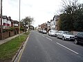
 Burniston Road, Scarborough - geograph.org.uk - 4837348.jpg 2,592 × 1,944; 1.28 MB
-
 Bus Shelter, Moor Lane - geograph.org.uk - 1547082.jpg 640 × 480; 112 KB
-
 Bus stop and shelter on Moor Lane - geograph.org.uk - 4844483.jpg 640 × 480; 53 KB
-

-

-
 Bus stop on Burniston Road - geograph.org.uk - 4835314.jpg 640 × 480; 83 KB
-
 Bus stop on Coldyhill Lane, Newby - geograph.org.uk - 4844471.jpg 640 × 480; 92 KB
-
 Bus stop on Cross Lane - geograph.org.uk - 4835301.jpg 640 × 480; 106 KB
-
 Bus stop on Scalby Road (A171) - geograph.org.uk - 4845601.jpg 640 × 480; 60 KB
-
 Bus stop on Scalby Road, Newby - geograph.org.uk - 4844476.jpg 640 × 480; 69 KB
-
 Bus stop on Scalby Road, Newby - geograph.org.uk - 4844497.jpg 640 × 480; 74 KB
-
 Bus stop on Station Road, Scalby - geograph.org.uk - 4845594.jpg 640 × 480; 84 KB
-
 Bus stop on the A171, Newby - geograph.org.uk - 4844472.jpg 640 × 480; 60 KB
-
 Bus stop, Burniston Rd - geograph.org.uk - 1916351.jpg 640 × 430; 106 KB
-
 Bus stop, Field Lane - geograph.org.uk - 1897947.jpg 640 × 430; 139 KB
-
 Bus stop, Field Lane - geograph.org.uk - 1916357.jpg 640 × 430; 156 KB
-
 Bus stop, Field Lane - geograph.org.uk - 1916359.jpg 640 × 430; 102 KB
-

-
 Car park, Scalby Manor Hotel - geograph.org.uk - 1898663.jpg 640 × 430; 139 KB
-
 Cattle grazing by Field Lane - geograph.org.uk - 1919676.jpg 640 × 430; 138 KB
-
 Cattle near the bridleway to Prospect Farm - geograph.org.uk - 3966261.jpg 2,814 × 2,010; 982 KB
-
 Church Hill, Scalby - geograph.org.uk - 4846425.jpg 640 × 480; 71 KB
-
 Church Hill, Scalby - geograph.org.uk - 4846428.jpg 3,648 × 2,736; 4.62 MB
-
 Cinder Track footpath-cycleway looking southwards - geograph.org.uk - 6160530.jpg 5,202 × 3,465; 5.12 MB
-
 Cinder Track near Newby - geograph.org.uk - 6168761.jpg 5,202 × 3,465; 5.31 MB
-
 Cleveland Way - geograph.org.uk - 3790250.jpg 1,600 × 1,200; 286 KB
-
 Cleveland Way at Scalby Ness - geograph.org.uk - 6003476.jpg 800 × 535; 156 KB
-
 Cleveland Way Footpath - geograph.org.uk - 1473094.jpg 640 × 480; 89 KB
-
 Cleveland Way Footpath - geograph.org.uk - 1473105.jpg 640 × 480; 90 KB
-
 Cleveland Way Footpath - geograph.org.uk - 1473118.jpg 640 × 480; 97 KB
-
 Cleveland Way northwards near Cromer Point - geograph.org.uk - 6155899.jpg 5,202 × 3,465; 4.16 MB
-
 Cleveland Way steps to Long Nab - geograph.org.uk - 4016283.jpg 2,000 × 1,415; 1.04 MB
-
 Cliffs south of Scalby Ness - geograph.org.uk - 1916110.jpg 640 × 430; 126 KB
-
 Close up, Elizabeth II postbox on Coldyhill Lane - geograph.org.uk - 4845269.jpg 1,446 × 2,772; 1.65 MB
-
 Close up, Elizabeth II postbox on Hay Brow Crescent - geograph.org.uk - 4847795.jpg 1,610 × 3,043; 1.63 MB
-
 Close up, Elizabeth II postbox on Limestone Road, Cumboots - geograph.org.uk - 4846578.jpg 1,688 × 2,518; 1.99 MB
-
 Close up, Elizabeth II postbox on Moor Lane, Scarborough - geograph.org.uk - 4846171.jpg 2,275 × 2,835; 2.91 MB
-
 Close up, George V postbox on Jubilee Terrace, Scalby - geograph.org.uk - 4846837.jpg 1,957 × 3,471; 2.87 MB
-
 Close up, Victorian postbox on Carr Lane, Scalby - geograph.org.uk - 4846420.jpg 1,927 × 1,510; 1.3 MB
-
 Coastline along the Cleveland Way - geograph.org.uk - 6003753.jpg 800 × 541; 184 KB
-
 Coastline back toward Scalby Ness - geograph.org.uk - 2785986.jpg 3,264 × 2,448; 2.08 MB
-
 Coastline near Scalby Ness - geograph.org.uk - 6003751.jpg 800 × 532; 146 KB
-
 Coastline north of Scalby Ness - geograph.org.uk - 1898446.jpg 640 × 430; 126 KB
-
 Coastline north of Scalby Ness - geograph.org.uk - 1908897.jpg 640 × 430; 114 KB
-
 Coastline north of Scalby Ness - geograph.org.uk - 1916113.jpg 640 × 430; 99 KB
-
 Coldyhill Lane - geograph.org.uk - 4845271.jpg 3,648 × 2,736; 4.55 MB
-
 Coldyhill Lane - geograph.org.uk - 4845274.jpg 3,648 × 2,736; 5.01 MB
-
 Coldyhill Lane off Cross Lane - geograph.org.uk - 1903859.jpg 640 × 430; 131 KB
-
 Coldyhill Lane, Newby - geograph.org.uk - 4844464.jpg 640 × 480; 64 KB
-
 Coldyhill Lane, Newby - geograph.org.uk - 4844470.jpg 640 × 480; 72 KB
-
 Colescliffe Rd - geograph.org.uk - 1903837.jpg 640 × 430; 169 KB
-
 Commemorative Fountain - geograph.org.uk - 1905375.jpg 640 × 430; 169 KB
-
 Coomboots Farm - geograph.org.uk - 1162162.jpg 640 × 480; 83 KB
-
 Costcutter, Wreyfield Drive - geograph.org.uk - 1903795.jpg 640 × 430; 132 KB
-
 Cow Wath Bridge - geograph.org.uk - 1904960.jpg 640 × 430; 136 KB
-
 Cows sitting in a meadow, Scalby - geograph.org.uk - 1905463.jpg 640 × 430; 158 KB
-
 Crest on Scalby Manor's former gatehouse - geograph.org.uk - 2698061.jpg 1,024 × 768; 267 KB
-
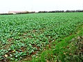
 Crop field and hedgerow off the A165 - geograph.org.uk - 4848375.jpg 640 × 480; 59 KB
-
 Crop field at the edge of Scarborough's suburbs - geograph.org.uk - 2698069.jpg 1,024 × 768; 232 KB
-
 Crop field off Limestone Road - geograph.org.uk - 4846519.jpg 640 × 480; 56 KB
-
 Cross Lane - geograph.org.uk - 1898917.jpg 640 × 430; 118 KB
-
 Cross Lane - geograph.org.uk - 1903875.jpg 640 × 430; 127 KB
-
 Cross Lane - geograph.org.uk - 1903996.jpg 640 × 430; 176 KB
-
 Cross Lane - geograph.org.uk - 1904040.jpg 640 × 430; 180 KB
-
 Cross Lane bridge over the cinder track. - geograph.org.uk - 6168764.jpg 5,202 × 3,465; 4.8 MB
-
 Cross Lane Hospital - geograph.org.uk - 1903990.jpg 640 × 430; 150 KB
-
 Cross Lane Hospital entrance - geograph.org.uk - 1903974.jpg 640 × 430; 179 KB
-
 Cross Lane Hospital entrance lodge - geograph.org.uk - 1903981.jpg 640 × 430; 145 KB
-
 Cross Lane off Cross Lane - geograph.org.uk - 1903891.jpg 640 × 430; 155 KB
-
 Cross Lane, Newlands - geograph.org.uk - 4835306.jpg 640 × 480; 94 KB
-
 Cross Lane, Scarborough - geograph.org.uk - 4837376.jpg 2,592 × 1,944; 1.06 MB
-
 Cross Lane, Scarborough - geograph.org.uk - 4837377.jpg 640 × 480; 94 KB
-
 Crossroads in Scalby - geograph.org.uk - 1905287.jpg 640 × 430; 134 KB
-
 Crossroads on Limestone Road - geograph.org.uk - 4846489.jpg 640 × 480; 33 KB
-
 Cruck A frame roof timbers - geograph.org.uk - 1971409.jpg 4,000 × 3,000; 2.74 MB
-
 Cumboots Brow - geograph.org.uk - 1506482.jpg 640 × 480; 128 KB
-
 Cumboots Brow - geograph.org.uk - 6173305.jpg 2,048 × 1,536; 1.3 MB
-
 Cumboots Farm - geograph.org.uk - 2401701.jpg 640 × 427; 243 KB
-
 Cumboots Farm - geograph.org.uk - 2401709.jpg 640 × 427; 226 KB
-

-
 Cypher, Elizabeth II postbox on Cross Lane, Scarborough - geograph.org.uk - 4837372.jpg 1,287 × 1,365; 529 KB
-
 Cypher, Elizabeth II postbox on Scalby Road, Newby - geograph.org.uk - 4844689.jpg 1,619 × 1,582; 1.1 MB
-
 Cypher, George V postbox on Hackness Road, Newby - geograph.org.uk - 4844773.jpg 1,695 × 1,864; 1.47 MB
-
 Cypher, George VI postbox on High Street, Scalby - geograph.org.uk - 4846812.jpg 1,623 × 1,435; 922 KB
-
 Cypher, George VI postbox on The Whins, Scarborough - geograph.org.uk - 4846143.jpg 1,655 × 1,815; 1.31 MB
-
 Cypher, Victorian postbox on Burniston Road, Scarborough - geograph.org.uk - 4837343.jpg 1,270 × 1,084; 360 KB
-
 Cypher, Victorian postbox on Station Road, Scalby - geograph.org.uk - 4846434.jpg 1,830 × 1,379; 970 KB
-
 Danger, concealed entrance - geograph.org.uk - 2698379.jpg 1,024 × 768; 193 KB
-

-
 Detail, Elizabeth II postbox on Cross Lane, Scarborough - geograph.org.uk - 4837373.jpg 1,195 × 1,683; 553 KB
-
 Detail, Elizabeth II postbox on Scalby Road, Newby - geograph.org.uk - 4844691.jpg 1,987 × 1,965; 1.35 MB
-
 Detail, George V postbox on Hackness Road, Newby - geograph.org.uk - 4844777.jpg 1,387 × 2,252; 1.09 MB
-
 Detail, George VI postbox on High Street, Scalby - geograph.org.uk - 4846815.jpg 1,070 × 1,737; 713 KB
-
 Detail, George VI postbox on The Whins, Scarborough - geograph.org.uk - 4846147.jpg 1,393 × 2,300; 1.49 MB
-
 Detail, Victorian postbox on Burniston Road, Scarborough - geograph.org.uk - 4837344.jpg 1,146 × 1,740; 763 KB
-
 Detail, Victorian postbox on Carr Lane, Scalby - geograph.org.uk - 4846422.jpg 1,192 × 1,867; 1,002 KB
-
 Detail, Victorian postbox on Station Road, Scalby - geograph.org.uk - 4846436.jpg 1,434 × 2,236; 1.25 MB
-
 Dinosaur footprints - geograph.org.uk - 3000738.jpg 1,064 × 1,600; 399 KB
-
 Duck pond, Scalby - geograph.org.uk - 4845606.jpg 640 × 480; 111 KB
-
 Dunwell Avenue - geograph.org.uk - 4844478.jpg 640 × 480; 57 KB
-
 Early morning on the golf course - geograph.org.uk - 4308039.jpg 4,608 × 3,456; 4.74 MB
-
 East Park Rd - geograph.org.uk - 1905269.jpg 640 × 430; 139 KB
-
 East Park Road, Scalby - geograph.org.uk - 4845589.jpg 640 × 480; 79 KB
-
 Edge of Raincliffe Wood - geograph.org.uk - 1900839.jpg 640 × 279; 54 KB
-
 Elizabeth II postbox off Newlands Park Drive, Scarborough - geograph.org.uk - 4838728.jpg 1,741 × 2,910; 1.94 MB
-

-

-

-
 Elizabeth II postbox on Cross Lane, Scarborough - geograph.org.uk - 4837370.jpg 1,309 × 2,433; 820 KB
-
 Elizabeth II postbox on Hay Brow Crescent - geograph.org.uk - 4847794.jpg 2,513 × 2,417; 2.88 MB
-

-
 Elizabeth II postbox on Moor Lane, Scarborough - geograph.org.uk - 4846167.jpg 1,761 × 2,200; 2 MB
-

-
 Endcliff Crescent - geograph.org.uk - 4843243.jpg 640 × 480; 96 KB
-
-
 Entering Newby on the A171 - geograph.org.uk - 1916448.jpg 640 × 430; 164 KB
-
 Entering Scarborough on the A165 - geograph.org.uk - 1897979.jpg 640 × 430; 151 KB
-

-

-
 Entrance to High Mill Farm - geograph.org.uk - 1904965.jpg 640 × 430; 146 KB
-

-

-
 Fallow field south of the Sea Cut - geograph.org.uk - 1905697.jpg 640 × 430; 151 KB
-
 Farm track near Scalby Lodge - geograph.org.uk - 5011883.jpg 1,600 × 1,200; 633 KB
-
 Farm track, Scalby Hayes - geograph.org.uk - 4846468.jpg 640 × 480; 78 KB
-
 Farmland near Scalby Lodge - geograph.org.uk - 1473107.jpg 640 × 480; 75 KB
-

-
 Farmland south off the Sea Cut - geograph.org.uk - 1905643.jpg 640 × 430; 105 KB
-
 Farmland south off the Sea Cut - geograph.org.uk - 1905724.jpg 640 × 430; 109 KB
-
 Field Close Rd - geograph.org.uk - 1904990.jpg 640 × 430; 133 KB
-
 Field entrance near Cumboots - geograph.org.uk - 4846471.jpg 640 × 480; 72 KB
-
 Field entrance off Barmoor Lane - geograph.org.uk - 4845618.jpg 640 × 480; 64 KB
-
 Field entrance off Limestone Road - geograph.org.uk - 4846487.jpg 640 × 480; 70 KB
-
 Field entrance, Scalby Hayes - geograph.org.uk - 4846470.jpg 640 × 457; 61 KB
-
 Field gate with two footpath waymarks - geograph.org.uk - 2698481.jpg 1,024 × 768; 140 KB
-
-
 Field Lane - geograph.org.uk - 1904132.jpg 640 × 430; 139 KB
-
 Field Lane - geograph.org.uk - 1909043.jpg 640 × 430; 119 KB
-
 Field Lane - geograph.org.uk - 1916353.jpg 640 × 430; 117 KB
-
 Field Lane entering Scalby - geograph.org.uk - 1904146.jpg 640 × 430; 132 KB
-
 Field Lane, Scalby - geograph.org.uk - 1919675.jpg 640 × 430; 132 KB
-
 Field Lane, westward - geograph.org.uk - 1904097.jpg 640 × 430; 133 KB
-
 Field with manhole - geograph.org.uk - 5333660.jpg 1,024 × 768; 205 KB
-
 Fields by the Cinder Track footpath-cycleway - geograph.org.uk - 6160520.jpg 5,202 × 3,465; 3.75 MB
-
 Filling Station, Burniston Rd - geograph.org.uk - 1898119.jpg 640 × 430; 137 KB
-
 Flat rocks on the foreshore - geograph.org.uk - 1908931.jpg 640 × 430; 130 KB
-
 Flood gauge at the dry ford, Barmoor Lane - geograph.org.uk - 2698096.jpg 1,024 × 768; 111 KB


_-_geograph.org.uk_-_1898280.jpg)


_heading_south_-_geograph.org.uk_-_1897964.jpg)
_heading_south_-_geograph.org.uk_-_1898960.jpg)


_-_geograph.org.uk_-_4848732.jpg)
_-_geograph.org.uk_-_4848737.jpg)


_-_geograph.org.uk_-_4845601.jpg)


_crosses_Burniston_Beck,_Cow_Wath_Bridge_-_geograph.org.uk_-_1916428.jpg)


