Category:Newcastle Higher
community in Bridgend County Borough, Wales, UK  | |||||
| Upload media | |||||
| Pronunciation audio | |||||
|---|---|---|---|---|---|
| Instance of | |||||
| Location | Bridgend County Borough, Wales | ||||
| Population |
| ||||
| Area |
| ||||
 | |||||
Subcategories
This category has the following 2 subcategories, out of 2 total.
A
P
Media in category "Newcastle Higher"
The following 200 files are in this category, out of 260 total.
(previous page) (next page)-

-

-

-
 A view towards Mynydd Baedan - geograph.org.uk - 2031152.jpg 640 × 447; 114 KB
-

-
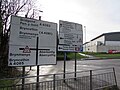
 A4063 direction sign, Tondu - geograph.org.uk - 6040132.jpg 1,024 × 758; 130 KB
-

-
 Aberkenfig - geograph.org.uk - 5762559.jpg 640 × 360; 48 KB
-
 Aberkenfig - geograph.org.uk - 6414280.jpg 640 × 507; 55 KB
-
 Aberkenfig - geograph.org.uk - 6414283.jpg 640 × 511; 58 KB
-
 Aberkenfig - geograph.org.uk - 6414294.jpg 640 × 500; 59 KB
-
 Aberkenfig Bridgend Road - geograph.org.uk - 6107254.jpg 640 × 360; 39 KB
-
 Aberkenfig Conservative Club - geograph.org.uk - 3391573.jpg 640 × 573; 102 KB
-
 Aberkenfig Heol Persondy - geograph.org.uk - 6396997.jpg 640 × 360; 42 KB
-
 Aberkenfig Pandy Road - geograph.org.uk - 6402228.jpg 640 × 360; 54 KB
-
 Aberkenfig police station - geograph.org.uk - 3386583.jpg 640 × 512; 84 KB
-
 Aberkenfig Post Office - geograph.org.uk - 3385272.jpg 640 × 634; 115 KB
-
 Aberkenfig Social ^ Athletic Club - geograph.org.uk - 3385225.jpg 640 × 468; 71 KB
-
 Aberkenfig square - geograph.org.uk - 6103537.jpg 640 × 482; 81 KB
-
 Aberkenfig St Brides Road - geograph.org.uk - 6402230.jpg 640 × 360; 47 KB
-
 Aberkenfig Welfare Hall - geograph.org.uk - 3387448.jpg 640 × 429; 64 KB
-

-
 Alma Terrace, Aberkenfig - geograph.org.uk - 3395172.jpg 640 × 498; 100 KB
-

-
 Baker's D.I.Y. Aberkenfig - geograph.org.uk - 3385939.jpg 640 × 380; 59 KB
-
 Beulah Mission Hall, Aberkenfig - geograph.org.uk - 3395225.jpg 640 × 519; 96 KB
-

-

-
 Boardwalk in the woods above Tondu - geograph.org.uk - 3129828.jpg 2,288 × 1,712; 1.39 MB
-
 Boulder on the track - Parc Slip Nature Park - geograph.org.uk - 2069779.jpg 1,500 × 996; 1.76 MB
-
 Boulders near the M4 bridge, Pen-y-fai - geograph.org.uk - 3395297.jpg 640 × 550; 140 KB
-

-
 Brick houses, Clôs Gwaith Brics, Tondu - geograph.org.uk - 6040091.jpg 1,024 × 651; 135 KB
-

-
 Bridge over M4 in Ffwyl Wood - geograph.org.uk - 5843998.jpg 1,600 × 1,025; 615 KB
-
 Bridge over the M4 - geograph.org.uk - 3683146.jpg 640 × 430; 27 KB
-
 Bridge under rail line - geograph.org.uk - 2211638.jpg 3,264 × 2,448; 1.27 MB
-
 Bridgend , Angelton Villa - geograph.org.uk - 4155440.jpg 4,288 × 2,848; 6.1 MB
-
 Bridgend , Bridgend Road A4063 - geograph.org.uk - 4155439.jpg 4,288 × 2,848; 6.33 MB
-
 Bridgend , Grassy Path - geograph.org.uk - 4155444.jpg 4,288 × 2,848; 6.26 MB
-
 Bridgend , Grassy Path - geograph.org.uk - 4155447.jpg 4,288 × 2,848; 6.2 MB
-
 Bridgend , Renault Dealership - geograph.org.uk - 4155426.jpg 4,288 × 2,848; 4.19 MB
-
 Bridgend , Tondu Road A4063 - geograph.org.uk - 4155418.jpg 4,288 × 2,848; 6.03 MB
-
 Bridgend , Tondu Road A4063 - geograph.org.uk - 4155421.jpg 4,288 × 2,848; 6.93 MB
-
 Bridgend District , Countryside Scenery - geograph.org.uk - 3928343.jpg 4,288 × 2,848; 5.6 MB
-
 Bridgend District , The M4 Motorway - geograph.org.uk - 3926641.jpg 4,288 × 2,848; 4.59 MB
-
 Bridgend District , The M4 Motorway - geograph.org.uk - 3926644.jpg 4,288 × 2,848; 4.6 MB
-
 Bridgend District , The M4 Motorway - geograph.org.uk - 3926648.jpg 4,288 × 2,848; 4.59 MB
-
 Bridgend District , The M4 Motorway - geograph.org.uk - 3928336.jpg 4,288 × 2,848; 5.18 MB
-
 Bridgend District , The M4 Motorway - geograph.org.uk - 3928338.jpg 4,288 × 2,848; 5.35 MB
-
 Bridgend District , The M4 Motorway - geograph.org.uk - 3928341.jpg 2,848 × 4,288; 5.2 MB
-
 Bridgend Pupil Referral Unit, Aberkenfig - geograph.org.uk - 3812819.jpg 800 × 564; 116 KB
-

-

-

-
 Bridgend Road houses, Aberkenfig - geograph.org.uk - 3391567.jpg 640 × 480; 79 KB
-
 Bridleway in Parc Slip Nature Park - geograph.org.uk - 2031127.jpg 480 × 640; 122 KB
-
 Bulrushes - Parc Slip Nature Park - geograph.org.uk - 2069894.jpg 1,500 × 996; 2.24 MB
-

-
 Cemetery at Glanrhyd Hospital - geograph.org.uk - 2715594.jpg 1,536 × 2,048; 1.21 MB
-
 Chapel at Glanrhyd Hospital - geograph.org.uk - 5180800.jpg 3,095 × 2,299; 1.43 MB
-
 Children's play area, Aberkenfig - geograph.org.uk - 3391650.jpg 640 × 414; 81 KB
-
 Clôs Gwaith Brics, Tondu - geograph.org.uk - 5611855.jpg 800 × 789; 112 KB
-
 Coal Dram - geograph.org.uk - 2697063.jpg 4,032 × 3,024; 2.68 MB
-
 Coot at Park Pond Nature Reserve - Tondu - geograph.org.uk - 2069885.jpg 1,500 × 1,025; 969 KB
-

-
 Coronation Street, Aberkenfig - geograph.org.uk - 3387424.jpg 640 × 618; 90 KB
-
 Cwrt Colman Hotel - geograph.org.uk - 5125560.jpg 3,264 × 2,448; 1.72 MB
-

-
 Dan-y-coed flats, Aberkenfig - geograph.org.uk - 3385936.jpg 640 × 437; 61 KB
-
 Dan-y-Lan houses, Aberkenfig - geograph.org.uk - 3395485.jpg 640 × 584; 96 KB
-
 Dan-y-Lan, Aberkenfig - geograph.org.uk - 3395458.jpg 640 × 640; 95 KB
-
 Derelict Barn at Court Colman - geograph.org.uk - 2731894.jpg 1,536 × 2,048; 1.36 MB
-
 Directions and distances signs in Tondu - geograph.org.uk - 5611909.jpg 800 × 600; 117 KB
-

-
 Doctor surgery - geograph.org.uk - 5791308.jpg 640 × 361; 72 KB
-

-
 Downstream along the Ogmore, Pen-y-cae - geograph.org.uk - 4592059.jpg 800 × 600; 191 KB
-

-
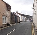 Dunraven Street, Aberkenfig - geograph.org.uk - 3385561.jpg 640 × 602; 89 KB
-

-

-

-

-

-
 Ffordd Antwn name sign, Tondu - geograph.org.uk - 6040191.jpg 1,024 × 854; 167 KB
-
 Field boundary - geograph.org.uk - 2311489.jpg 640 × 480; 117 KB
-

-
 Footpath - geograph.org.uk - 5125542.jpg 3,264 × 2,448; 3.5 MB
-
 Footpath beneath railway line in Tondu - geograph.org.uk - 5707039.jpg 5,184 × 3,888; 6.56 MB
-

-

-
 Fountain Cottages, Aberkenfig - geograph.org.uk - 3812548.jpg 800 × 512; 123 KB
-
 Fountain Crossing - geograph.org.uk - 6223084.jpg 4,032 × 1,908; 3.15 MB
-
 Fountain level crossing near Aberkenfig - geograph.org.uk - 3812595.jpg 800 × 594; 152 KB
-

-
 Fountain Road to Tondu - geograph.org.uk - 2069873.jpg 1,500 × 1,025; 1.24 MB
-
 Fountain Road towards Tondu - geograph.org.uk - 3812684.jpg 800 × 502; 137 KB
-

-
 From 20 to 30, Ffordd Antwn, Tondu - geograph.org.uk - 6040220.jpg 1,024 × 763; 159 KB
-
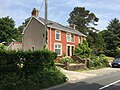 Fron Haul - geograph.org.uk - 4985743.jpg 3,264 × 2,448; 3.22 MB
-

-
 Glanrhyd Hospital - geograph.org.uk - 2715579.jpg 1,536 × 2,048; 1.23 MB
-
 Glanrhyd Hospital Chapel, Bridgend - geograph.org.uk - 4458285.jpg 800 × 568; 117 KB
-

-

-

-
 Hafan Deg flats, Aberkenfig - geograph.org.uk - 3385214.jpg 640 × 401; 66 KB
-
 Heol Persondy houses, Aberkenfig - geograph.org.uk - 3387479.jpg 640 × 440; 69 KB
-

-
 Highland Electrix, Aberkenfig - geograph.org.uk - 3395383.jpg 640 × 440; 78 KB
-

-

-

-

-
 Icy Footpath - geograph.org.uk - 5242954.jpg 3,264 × 2,448; 4.59 MB
-

-

-

-
 Junction in Pen-y-fai - geograph.org.uk - 4636484.jpg 800 × 593; 191 KB
-
 Junction of the B4281 at Fountain - geograph.org.uk - 2069701.jpg 1,500 × 996; 973 KB
-
 Just a LIDL further, Ffordd Antwn, Tondu - geograph.org.uk - 6040226.jpg 1,024 × 568; 149 KB
-

-
 Lane at Court Colman Farm - geograph.org.uk - 2731889.jpg 1,536 × 2,048; 1.25 MB
-
 Lane at Court Colman Farm - geograph.org.uk - 2935233.jpg 640 × 480; 74 KB
-
-

-
 Left for Parc Tondu - geograph.org.uk - 4222957.jpg 800 × 663; 162 KB
-
 Level Crossing - Fountain - geograph.org.uk - 2069731.jpg 1,500 × 996; 1.54 MB
-
 Level crossing near Fountain - geograph.org.uk - 2622910.jpg 640 × 480; 84 KB
-
 Lidl name sign alongside Ffordd Antwn, Tondu - geograph.org.uk - 6040199.jpg 960 × 1,024; 197 KB
-
 Lidl supermarket, Tondu - geograph.org.uk - 5611884.jpg 800 × 475; 74 KB
-
 Llansantffraid church Aberkenfig - geograph.org.uk - 5814802.jpg 640 × 360; 65 KB
-

-
 M4 eastbound - geograph.org.uk - 2448400.jpg 640 × 480; 39 KB
-
 M4 eastbound - geograph.org.uk - 2448406.jpg 640 × 481; 39 KB
-
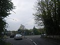
 M4 looking east - geograph.org.uk - 2448379.jpg 640 × 481; 40 KB
-

-
 M4 motorway bridge, Pen-y-fai - geograph.org.uk - 3395281.jpg 640 × 443; 81 KB
-
 Maesteg Road houses in Tondu - geograph.org.uk - 4222991.jpg 800 × 560; 110 KB
-
 Maesteg Road semis, Tondu - geograph.org.uk - 5611793.jpg 777 × 800; 135 KB
-
 Mr Mattress, Aberkenfig - geograph.org.uk - 3391790.jpg 640 × 424; 70 KB
-

-
 Narrower pavement ahead, Pen-y-fai - geograph.org.uk - 4636525.jpg 800 × 600; 184 KB
-

-
 National Cycle Route 4 by Tondu (2) - geograph.org.uk - 3170827.jpg 480 × 640; 156 KB
-
 National Cycle Route 4 by Tondu - geograph.org.uk - 3169527.jpg 640 × 480; 163 KB
-
 Nature Reserve - geograph.org.uk - 4985726.jpg 3,264 × 2,448; 2.07 MB
-
 New bridge construction Aberkenfig November 1980 - geograph.org.uk - 5200677.jpg 1,316 × 1,051; 446 KB
-

-
 New Road looking west - geograph.org.uk - 2622914.jpg 640 × 480; 99 KB
-
 New Street, Aberkenfig - geograph.org.uk - 3391577.jpg 626 × 640; 105 KB
-
 No footway for ½ mile, B4281, Aberkenfig - geograph.org.uk - 3384906.jpg 640 × 573; 139 KB
-

-
 North side of Lidl, Tondu - geograph.org.uk - 6040122.jpg 1,024 × 558; 114 KB
-

-

-

-

-
 Old School House Nursery - geograph.org.uk - 4298165.jpg 300 × 225; 10 KB
-
 Old School House Nursery - geograph.org.uk - 4298172.jpg 2,048 × 1,536; 739 KB
-
 Ordnance Survey Cut Mark - geograph.org.uk - 4856985.jpg 480 × 640; 78 KB
-
 Ordnance Survey Cut Mark - geograph.org.uk - 4856998.jpg 480 × 640; 106 KB
-

-

-

-
 Parapet of M4 bridge over Ogmore River - geograph.org.uk - 5844006.jpg 1,600 × 999; 600 KB
-
 Parc Slip Nature Park Centre - Tondu - geograph.org.uk - 2069866.jpg 1,500 × 1,025; 1.01 MB
-
 Parc Slip nature park lake - Fountain - geograph.org.uk - 2069746.jpg 1,500 × 996; 1.53 MB
-
 Parc Slip Nature Reserve - geograph.org.uk - 2697102.jpg 2,288 × 1,712; 2.05 MB
-
 Parc Slip Nature Reserve - geograph.org.uk - 4985733.jpg 3,264 × 2,448; 3.24 MB
-
 Park Pond Nature Reserve - Tondu - geograph.org.uk - 2069881.jpg 3,603 × 2,165; 5.26 MB
-
 Park Slip - geograph.org.uk - 6134476.jpg 640 × 360; 96 KB
-
 Park Slip nature reserve - geograph.org.uk - 6134775.jpg 640 × 360; 86 KB
-

-
-
 Path under the railway, Aberkenfig - geograph.org.uk - 3391602.jpg 640 × 510; 131 KB
-

-
 Pen y Cae Bridge - geograph.org.uk - 4439154.jpg 1,600 × 1,067; 940 KB
-
 Pentre Felin information board, Tondu - geograph.org.uk - 6040157.jpg 1,024 × 797; 142 KB
-
 Pentre Felin Retail Park nameboards, Tondu - geograph.org.uk - 6040174.jpg 1,024 × 810; 167 KB
-
-
 Pleasant View houses, Aberkenfig - geograph.org.uk - 3395237.jpg 640 × 420; 73 KB
-
 Pleasant View, Aberkenfig - geograph.org.uk - 3395666.jpg 640 × 449; 74 KB
-
 Police Station, Aberkenfig - geograph.org.uk - 4333863.jpg 3,552 × 2,000; 2.19 MB
-
 Port Talbot to the valleys - Fountain - geograph.org.uk - 2069723.jpg 1,500 × 996; 1.78 MB
-

-
 Private Shop, Aberkenfig - geograph.org.uk - 3385261.jpg 640 × 595; 88 KB
-

-

-

-

-

-
 Railway crossing, Aberkenfig - geograph.org.uk - 2639669.jpg 640 × 481; 183 KB
-

-
 Right turn traffic use both lanes, Tondu - geograph.org.uk - 6040245.jpg 1,024 × 666; 164 KB
-
 River scene, Aberkenfig - geograph.org.uk - 1974916.jpg 3,648 × 2,056; 1.98 MB
-
 Riverside bend, Aberkenfig - geograph.org.uk - 3395349.jpg 640 × 480; 79 KB
-
 Riverside houses, Aberkenfig - geograph.org.uk - 3395352.jpg 640 × 467; 65 KB
-
 Riverside houses, Aberkenfig - geograph.org.uk - 3395368.jpg 640 × 480; 69 KB


_-_geograph.org.uk_-_3170827.jpg)


_-_geograph.org.uk_-_4856976.jpg)
_-_geograph.org.uk_-_4856964.jpg)


