Category:Newmills, County Tyrone
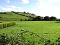
English: Newmills is a small village in east County Tyrone, Northern Ireland, three miles from Dungannon and two miles from Coalisland. Newmills gets its name from a corn mill and kilns that formerly stood in the area. Local amenities include a primary school, a local shop and a number of churches. It currently has a population of approximately 400 people. The River Torrent flows through the village.
village in east County Tyrone, Northern Ireland, United Kingdom  | |||||
| Upload media | |||||
| Instance of | |||||
|---|---|---|---|---|---|
| Location | Northern Ireland | ||||
 | |||||
Subcategories
This category has the following 2 subcategories, out of 2 total.
N
- Newmills Church of Ireland (4 F)
- Newmills Presbyterian Church (4 F)
Media in category "Newmills, County Tyrone"
The following 22 files are in this category, out of 22 total.
-
 Agharan Orange Hall - geograph.org.uk - 259051.jpg 640 × 479; 53 KB
-
 Agharan Road - geograph.org.uk - 259055.jpg 640 × 479; 53 KB
-
 Ballymenagh Townland - geograph.org.uk - 259032.jpg 640 × 479; 62 KB
-
 Bloomhill Townland - geograph.org.uk - 274561.jpg 640 × 479; 54 KB
-
 Bridge in Newmills - geograph.org.uk - 100779.jpg 567 × 425; 125 KB
-
 Cross dog at Shergrim - geograph.org.uk - 259067.jpg 640 × 479; 56 KB
-
 Curran Townland - geograph.org.uk - 259003.jpg 640 × 479; 71 KB
-
 Derry Townland - geograph.org.uk - 275065.jpg 640 × 479; 80 KB
-
 Derry Townland - geograph.org.uk - 275067.jpg 640 × 479; 64 KB
-
 Gatehouse - geograph.org.uk - 259061.jpg 640 × 479; 87 KB
-
 Newmills - geograph.org.uk - 259036.jpg 640 × 479; 64 KB
-
 Newmills Orange Hall - geograph.org.uk - 259034.jpg 640 × 479; 54 KB
-
 Road at Shergrim - geograph.org.uk - 259065.jpg 640 × 277; 26 KB
-
 Road at Sherrigrim - geograph.org.uk - 274558.jpg 640 × 323; 28 KB
-
 Road at Whitetown - geograph.org.uk - 274564.jpg 640 × 479; 98 KB
-
 Roughan Lough - geograph.org.uk - 274572.jpg 640 × 479; 54 KB
-
 Sheerygroom Orange Hall - geograph.org.uk - 259063.jpg 640 × 479; 40 KB
-
 Sherrigrim Townland - geograph.org.uk - 274556.jpg 640 × 479; 70 KB
-
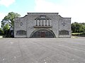 St Malachy's dance hall, Edendork - geograph.org.uk - 259005.jpg 640 × 475; 51 KB
-
 Tullaghmore - geograph.org.uk - 274578.jpg 640 × 479; 55 KB
-
 Tullaghmore Townland - geograph.org.uk - 274576.jpg 640 × 478; 35 KB
-
 Whitetown Townland - geograph.org.uk - 274565.jpg 640 × 479; 81 KB


