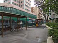
Category:Ngau Tau Kok Road Children's Playground
| Object location | | View all coordinates using: OpenStreetMap |
|---|
 | |||||
| Upload media | |||||
| Instance of | |||||
|---|---|---|---|---|---|
 | |||||
中文:牛頭角道兒童遊樂場
Subcategories
This category has only the following subcategory.
T
Media in category "Ngau Tau Kok Road Children's Playground"
The following 11 files are in this category, out of 11 total.
-
 General-View WEST NTKR KTGPSA.JPG 3,068 × 2,300; 1.68 MB
-
 Ngau Tau Kok Road Children's Playground 01.jpg 4,160 × 3,120; 7.39 MB
-
 Ngau Tau Kok Road Children's Playground 02.jpg 4,160 × 3,120; 7.41 MB
-
 Ngau Tau Kok Road Children's Playground 03.jpg 4,160 × 3,120; 8.25 MB
-
 Ngau Tau Kok Road Children's Playground 04.jpg 4,160 × 3,120; 7.88 MB
-
 Ngau Tau Kok Road Children's Playground 05.jpg 4,160 × 3,120; 8.03 MB
-
 Ngau Tau Kok Road Children's Playground 06.jpg 4,160 × 3,120; 7.75 MB
-
 Ngau Tau Kok Road Children's Playground 07.jpg 4,160 × 3,120; 7.23 MB
-
 Ngau Tau Kok Road Children's Playground 08.jpg 4,160 × 3,120; 6.52 MB
-
 Ngau Tau Kok Road Children's Playground 09.jpg 4,160 × 3,120; 6.91 MB
-
 Tai Wong Temple, Ngau Tau Kok 09.jpg 4,160 × 3,120; 8.34 MB


