Category:Nieuwlande (Drenthe)
| Object location | | View all coordinates using: OpenStreetMap |
|---|
human settlement    | |||||
| Upload media | |||||
| Instance of | |||||
|---|---|---|---|---|---|
| Location |
| ||||
 | |||||
Media in category "Nieuwlande (Drenthe)"
The following 136 files are in this category, out of 136 total.
-
 Locatie Nieuwlande.png 280 × 130; 7 KB
-

-

-

-
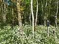
 0543.Wilde.Narcis.Nieuwlande.UitWeiland.Afkokmstig.Narcisus.Pseudo.jpg 1,800 × 1,200; 490 KB
-
 0544.Wilde.Narcis.Nieuwlande.UitWeiland.Afkokmstig.Narcisus.Pseudo.jpg 1,800 × 1,200; 520 KB
-
 Boerderij BUR MON ZORG 14-1 - Nieuwlande - 20476373 - RCE.jpg 1,200 × 900; 219 KB
-
 Boerderij BUR MOND ZORG 14-2 - Nieuwlande - 20476374 - RCE.jpg 1,200 × 900; 207 KB
-
 Bossen Elim Hollandscheveld 18 56 06 394000.jpeg 4,032 × 3,024; 6.17 MB
-
 Bossen Elim Hollandscheveld 18 57 05 681000.jpeg 4,032 × 3,024; 5.31 MB
-
 Bossen Elim Hollandscheveld 19 07 26 397000.jpeg 4,032 × 3,024; 4.64 MB
-
 Bossen Elim Hollandscheveld 19 07 54 696000.jpeg 4,032 × 3,024; 6.46 MB
-
 Bossen Elim Hollandscheveld 19 08 36 847000.jpeg 4,032 × 3,024; 5.48 MB
-
 Bossen Elim Hollandscheveld 19 09 15 655000.jpeg 4,032 × 3,024; 6.86 MB
-
 Bossen Elim Hollandscheveld 19 09 52 018000.jpeg 4,032 × 3,024; 4.76 MB
-
 Bossen Elim Hollandscheveld 19 10 53 384000.jpeg 4,032 × 3,024; 6.55 MB
-
 Bossen Elim Hollandscheveld.jpeg 3,024 × 4,032; 5.46 MB
-
 Brugstraat Nieuwlande.JPG 3,605 × 2,592; 5.28 MB
-

-

-

-

-

-

-

-
-

-

-

-

-

-
-

-

-

-
-

-
 Dalerpeel Dalerend De Kleine Staarman Veenontginningen Waterretentiegebied Nieuwlande.jpeg 4,032 × 3,024; 3.37 MB
-

-

-

-

-

-

-

-

-

-

-

-

-

-

-

-
-

-
-
 Elim Landgoed “Het Rechtuit” “Bossen Hollandsche veld” “Drents Landschap.jpeg 4,032 × 3,024; 5.36 MB
-

-
 Kleine Staarman Scheerse veld Dalerpeel Dalerend Dalen Waterretentie 20 39 15 309000.jpeg 3,024 × 4,032; 3.72 MB
-
 Kleine Staarman Scheerse veld Dalerpeel Dalerend Dalen Waterretentie 20 39 25 529000.jpeg 4,032 × 3,024; 4.71 MB
-
 Kleine Staarman Scheerse veld Dalerpeel Dalerend Dalen Waterretentie 20 39 38 447000.jpeg 4,032 × 3,024; 1.53 MB
-
 Kleine Staarman Scheerse veld Dalerpeel Dalerend Dalen Waterretentie 20 39 45 317000.jpeg 4,032 × 3,024; 4.26 MB
-
 Kleine Staarman Scheerse veld Dalerpeel Dalerend Dalen Waterretentie 20 39 56 160000.jpeg 3,024 × 4,032; 1.67 MB
-
 Kleine Staarman Scheerse veld Dalerpeel Dalerend Dalen Waterretentie 20 40 02 363000.jpeg 4,032 × 3,024; 5.27 MB
-

-
 Kleine Staarman Scheerse veld Dalerpeel Dalerend Dalen Waterretentie 20 40 29 616000.jpeg 4,032 × 3,024; 5.99 MB
-
-
 Kleine Staarman Scheerse veld Dalerpeel Dalerend Dalen Waterretentie 20 40 58 274000.jpeg 4,032 × 3,024; 4.67 MB
-
 Kleine Staarman Scheerse veld Dalerpeel Dalerend Dalen Waterretentie 20 41 10 664000.jpeg 4,032 × 3,024; 2.99 MB
-
 Kleine Staarman Scheerse veld Dalerpeel Dalerend Dalen Waterretentie 20 41 20 190000.jpeg 3,024 × 4,032; 2.52 MB
-
 Kleine Staarman Scheerse veld Dalerpeel Dalerend Dalen Waterretentie 20 41 27 560000.jpeg 3,024 × 4,032; 2.67 MB
-
 Kleine Staarman Scheerse veld Dalerpeel Dalerend Dalen Waterretentie 20 41 35 829000.jpeg 4,032 × 3,024; 6.31 MB
-
 Kleine Staarman Scheerse veld Dalerpeel Dalerend Dalen Waterretentie 20 41 54 372000.jpeg 4,032 × 3,024; 3.39 MB
-
 Kleine Staarman Scheerse veld Dalerpeel Dalerend Dalen Waterretentie 20 42 05 141000.jpeg 4,032 × 3,024; 4.79 MB
-
 Kleine Staarman Scheerse veld Dalerpeel Dalerend Dalen Waterretentie 20 42 18 043000.jpeg 4,032 × 3,024; 4.48 MB
-

-
 Kleine Staarman Scheerse veld Dalerpeel Dalerend Dalen Waterretentie 20 42 39 799000.jpeg 4,032 × 3,024; 4.19 MB
-
 Kleine Staarman Scheerse veld Dalerpeel Dalerend Dalen Waterretentie 20 42 52 195000.jpeg 4,032 × 3,024; 6.57 MB
-
 Kleine Staarman Scheerse veld Dalerpeel Dalerend Dalen Waterretentie 20 43 09 386000.jpeg 4,032 × 3,024; 5.75 MB
-
 Kleine Staarman Scheerse veld Dalerpeel Dalerend Dalen Waterretentie 20 43 24 338000.jpeg 4,032 × 3,024; 6.56 MB
-
 Kleine Staarman Scheerse veld Dalerpeel Dalerend Dalen Waterretentie 20 43 41 415000.jpeg 4,032 × 3,024; 3.85 MB
-
 Kleine Staarman Scheerse veld Dalerpeel Dalerend Dalen Waterretentie 20 43 52 603000.jpeg 4,032 × 3,024; 3.85 MB
-
 Kleine Staarman Scheerse veld Dalerpeel Dalerend Dalen Waterretentie.jpeg 4,032 × 3,024; 4.58 MB
-
 Lonen gramsbergen.jpeg 4,032 × 3,024; 2.63 MB
-

-
 Nieuwlande Verzetsmonument 01.JPG 2,112 × 2,816; 2.99 MB
-
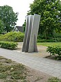 Nieuwlande Verzetsmonument 02.JPG 2,112 × 2,816; 2.81 MB
-
 Ooorlogsmonument Nieuwlande.jpg 1,431 × 1,073; 299 KB
-
 Plangebied Dalerend 18 42 59 321000.jpeg 4,032 × 3,024; 4.13 MB
-
 Plangebied Dalerend 18 43 31 084000.jpeg 4,032 × 3,024; 4.48 MB
-
 Plangebied Dalerend 18 44 18 497000.jpeg 4,032 × 3,024; 3.72 MB
-
 Plangebied Dalerend 18 44 52 904000.jpeg 4,032 × 3,024; 3.39 MB
-
 Plangebied Dalerend 18 45 17 480000.jpeg 4,032 × 3,024; 3.94 MB
-
 Plangebied Dalerend.jpeg 4,032 × 3,024; 3.69 MB
-

-
-

-

-
-

-
-

-
-

-

-

-

-
-

-

-
-
-

-
-

-
-

-

-

-

-
-
-

-

-

-

-
-
 Voormalig Gereformeerde Kerk in Nieuwlande Zijaanzicht.jpg 1,431 × 1,073; 336 KB
-
 Voormalig Gereformeerde Kerk in Nieuwlande. Voorzijde.jpg 805 × 1,073; 291 KB
-
 World War II Memorial Nieuwlande.jpg 1,200 × 1,600; 1.17 MB
-
 Yad Vashem-oorkonde van Nieuwlande met monument.jpg 1,431 × 1,073; 380 KB
-
 Yad Vashem-oorkonde van Nieuwlande Nederlandse vertaling bovenschrift.jpg 800 × 1,067; 128 KB
-

-
 Yad Vashem-oorkonde van Nieuwlande.jpg 805 × 1,073; 122 KB
-
 Monument 2061 Hoogeveen.jpg 5,212 × 3,468; 16.7 MB
-
 Monument 573 Hoogeveen.jpg 5,136 × 3,078; 16.67 MB


