Category:No entry road signs in London
Subcategories
This category has only the following subcategory.
Media in category "No entry road signs in London"
The following 86 files are in this category, out of 86 total.
-
 2 Posts To West Of Curtain Road.jpg 6,000 × 4,000; 7.66 MB
-
 London W4 bus route, Tottenham Green Workshops, High Road, Tottenham.jpg 5,009 × 3,757; 18.7 MB
-
 Algernon Road, West Hendon - geograph.org.uk - 1930511.jpg 1,600 × 1,051; 540 KB
-
 All Change at Reeves Corner (1) (geograph 2799963).jpg 3,678 × 2,462; 7.09 MB
-
 All Change at Reeves Corner (2) (geograph 2799971).jpg 3,678 × 2,462; 7.11 MB
-
 Allison Rd - geograph.org.uk - 3823955.jpg 640 × 430; 87 KB
-
 Au Morandarte Flickr IMG 7525 (15082594260).jpg 3,888 × 2,592; 3.75 MB
-
 Avenue Road at the junction of Newsam Avenue - geograph.org.uk - 4003337.jpg 2,304 × 1,728; 852 KB
-

-
 Bathurst Gardens, Kensal Green - geograph.org.uk - 1122239.jpg 638 × 480; 130 KB
-

-
 Blackfriars Lane, EC4 - geograph.org.uk - 701844.jpg 640 × 480; 81 KB
-
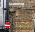 Britannia Street WC1 (12767674175).jpg 1,609 × 1,505; 1.6 MB
-
 Broadwater Farm Riot, Day 2, 004sm.jpg 1,000 × 645; 507 KB
-
 Bus Terminus, Manor Road Sainsbury's - geograph.org.uk - 5303652.jpg 1,600 × 1,116; 496 KB
-
 Buses Only, Pepys Road near Brockley - geograph.org.uk - 2490656.jpg 640 × 480; 89 KB
-
 Calderon Rd - geograph.org.uk - 5827307.jpg 1,024 × 681; 176 KB
-
 Central Street junction with Bastwick Street view south 01.jpg 3,648 × 2,736; 3.41 MB
-
 Cherrypicker in King Street - geograph.org.uk - 2211479.jpg 480 × 640; 121 KB
-
 City of London Police LS09 VGK, 23 October 2013.jpg 4,592 × 3,056; 2.1 MB
-

-
 Eccentric road restriction on Eastcote Lane - geograph.org.uk - 3093654.jpg 1,600 × 1,200; 569 KB
-
 Exmouth Market, Finsbury - geograph.org.uk - 1962561.jpg 1,280 × 960; 233 KB
-
 Falkland Rd - geograph.org.uk - 3823946.jpg 640 × 430; 100 KB
-
 Fearon Street, Greenwich - geograph.org.uk - 3850782.jpg 3,488 × 2,616; 1.83 MB
-
 Finch Lane, London EC3 - geograph.org.uk - 1706593.jpg 1,024 × 768; 336 KB
-

-
-
 Havant Rd - geograph.org.uk - 5933020.jpg 1,024 × 681; 167 KB
-
 Herne Rd - geograph.org.uk - 5710287.jpg 640 × 426; 69 KB
-
 Hillcrest Rd - geograph.org.uk - 4054394.jpg 640 × 429; 71 KB
-
 Holborn Police Station - geograph.org.uk - 5325845.jpg 1,200 × 1,600; 625 KB
-
 Holland Gardens, London W14 - geograph.org.uk - 1292536.jpg 640 × 414; 77 KB
-
 Holland Park Gardens - geograph.org.uk - 4143855.jpg 640 × 430; 131 KB
-

-

-

-
 Leonard Street junction with City Road view east 01.jpg 3,648 × 2,736; 3.56 MB
-
 Lewis Road, Richmond - geograph.org.uk - 4153675.jpg 2,304 × 1,728; 680 KB
-
 London - Elystan Street, glowing No entry sign.jpg 3,096 × 4,128; 1.83 MB
-
 London's style (14943499433).jpg 4,128 × 3,512; 3.26 MB
-

-
 Mackenzie Rd - geograph.org.uk - 2404209.jpg 640 × 430; 70 KB
-
 Mayfair, London, UK - panoramio (1).jpg 1,122 × 1,552; 570 KB
-
 Montem Road - geograph.org.uk - 3170644.jpg 640 × 480; 135 KB
-
 Nicholas Lane, EC4 - geograph.org.uk - 643357.jpg 640 × 480; 71 KB
-
 No entry - Holland Gardens - geograph.org.uk - 1529934.jpg 640 × 476; 79 KB
-
 No entry except cycles - geograph.org.uk - 3488659.jpg 1,024 × 768; 316 KB
-

-
 No entry signs Deptford.jpg 1,024 × 681; 120 KB
-
 No entry to Woolwich New Road - geograph.org.uk - 5289177.jpg 640 × 480; 144 KB
-
 No way through at Muscovy Street - geograph.org.uk - 976112.jpg 640 × 480; 90 KB
-
 North end of Windermere Road, Coulsdon - geograph.org.uk - 843788.jpg 640 × 429; 125 KB
-
 Onra Rd - geograph.org.uk - 5812908.jpg 1,024 × 681; 131 KB
-
 Orde Hall Street WC1 - geograph.org.uk - 1309649.jpg 479 × 640; 70 KB
-
 Point no-entry, Globe Street - geograph.org.uk - 3057615.jpg 1,024 × 768; 257 KB
-
 Portland Terrace - geograph.org.uk - 2888542.jpg 1,024 × 675; 280 KB
-
 Pre-Worboys No Entry, Kenton - geograph.org.uk - 1282069.jpg 640 × 480; 46 KB
-
 Prince Charles Cinema, Leicester Square, WC2 (2355497573).jpg 1,280 × 960; 331 KB
-
 Purley, UK - panoramio (18).jpg 3,264 × 2,448; 2.76 MB
-
 Ravenscroft Rd - geograph.org.uk - 2404201.jpg 640 × 430; 79 KB
-
 Repainted no entry sign by Kenton Library - geograph.org.uk - 3956809.jpg 1,600 × 1,200; 527 KB
-
 Road sign in Lyall Street - geograph.org.uk - 2122397.jpg 640 × 480; 78 KB
-
 Roman Road.Reza 02.jpg 3,000 × 4,000; 4.88 MB
-

-
 St Paul's Church - geograph.org.uk - 5385291.jpg 640 × 426; 110 KB
-
 St Thomas's Street - geograph.org.uk - 5768572.jpg 640 × 426; 74 KB
-
 Stoneleigh Road Southern carpark.jpg 2,608 × 1,957; 1,024 KB
-
 Temple Avenue, EC4 - geograph.org.uk - 911020.jpg 553 × 465; 92 KB
-
 The Ritz, Arlington Street - geograph.org.uk - 834473.jpg 640 × 462; 93 KB
-
 Tottenham Hale Retail Park 2024-02-01.jpg 4,592 × 3,448; 9.72 MB
-
 Tram at Reeves Corner, Croydon - geograph.org.uk - 2253283.jpg 1,871 × 2,794; 3.04 MB
-
 Tram in Church Street, Croydon (5405217947).jpg 1,296 × 717; 959 KB
-
 Upper Marsh, Lambeth - geograph.org.uk - 1172679.jpg 479 × 637; 107 KB
-
 View along Clifford Street ^2 - geograph.org.uk - 2929086.jpg 3,456 × 2,592; 2.96 MB
-
 View down Warwick Street - geograph.org.uk - 4435664.jpg 3,052 × 2,043; 815 KB
-
 View of shutter art on Princelet Street - geograph.org.uk - 5166182.jpg 3,872 × 2,592; 3.05 MB
-
 View of the Christ Church Spitalfields from Brick Lane - geograph.org.uk - 3961586.jpg 2,592 × 1,944; 2.05 MB
-
 View of the Christ Church Spitalfields from Brick Lane ^2 - geograph.org.uk - 3961606.jpg 2,592 × 1,944; 1.16 MB
-
 View of the Gherkin from Mitre Street - geograph.org.uk - 3962224.jpg 2,592 × 1,944; 2.2 MB
-
 View up Chandos Street to Portland Place ^2 - geograph.org.uk - 2929455.jpg 3,456 × 2,592; 3.27 MB
-
 View up Fashion Street from White's Row - geograph.org.uk - 4872267.jpg 3,009 × 2,015; 1.09 MB
-
 Warham Road - geograph.org.uk - 4371666.jpg 640 × 480; 75 KB
-
 Westcombe Hill bus lane - geograph.org.uk - 2234238.jpg 640 × 480; 135 KB
-
 White Church Lane, Whitechapel - geograph.org.uk - 594562.jpg 640 × 427; 91 KB
-
 Wimbledon Station - geograph.org.uk - 5324958.jpg 2,181 × 1,639; 996 KB


_(geograph_2799963).jpg)
_(geograph_2799971).jpg)

.jpg)


.jpg)


_heritage_route_15_Byward_Street_13_April_2007.jpg)


_-_geograph.org.uk_-_2778259.jpg)


.jpg)


.jpg)


.jpg)
.jpg)


.jpg)


