Category:Noctorum, Birkenhead
human settlement in United Kingdom | |||||
| Upload media | |||||
| Instance of | |||||
|---|---|---|---|---|---|
| Location | Birkenhead, Wirral, Merseyside, North West England, England | ||||
 | |||||
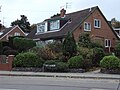
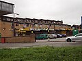
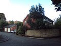
Noctorum, a suburb of Birkenhead, Wirral, Merseyside, England.

Subcategories
This category has the following 19 subcategories, out of 19 total.
- Benchmarks in Noctorum (11 F)
A
- St Andrew's centre, Noctorum (3 F)
F
N
P
- St Peter's Church, Noctorum (4 F)
R
T
W
- Wirral Hundred pub (3 F)
Media in category "Noctorum, Birkenhead"
The following 48 files are in this category, out of 48 total.
-
 Claughton Children's Centre, Noctorum.JPG 4,000 × 3,000; 2.85 MB
-
 Coniston Avenue post office, Noctorum.jpg 5,184 × 3,456; 7.42 MB
-
 Electricity pylon - geograph.org.uk - 531581.jpg 426 × 640; 129 KB
-
 Fender Way footpath - geograph.org.uk - 503676.jpg 640 × 480; 128 KB
-
 Hillside Primary School, Noctorum.JPG 4,000 × 3,000; 2.97 MB
-
 Noctorum Dell.jpg 4,955 × 3,300; 22.33 MB
-
 Noctorum, Birkenhead - DSC03630.JPG 3,648 × 2,736; 3.64 MB
-
 Noctorum, Birkenhead - DSC03631.JPG 3,648 × 2,736; 3.59 MB
-
 Noctorum, Birkenhead - DSC03632.JPG 3,648 × 2,736; 3.58 MB
-
 Noctorum, Birkenhead - DSC03634.JPG 3,648 × 2,736; 3.56 MB
-
 Noctorum, Birkenhead - DSC03635.JPG 3,648 × 2,736; 3.46 MB
-
 Noctorum, Birkenhead - DSC03636.JPG 3,648 × 2,736; 3.52 MB
-
 Noctorum, Birkenhead - DSC03637.JPG 3,648 × 2,736; 3.54 MB
-
 Noctorum, Birkenhead - DSC03638.JPG 3,648 × 2,736; 3.48 MB
-
 Noctorum, Birkenhead - DSC03639.JPG 3,648 × 2,736; 3.5 MB
-
 Noctorum, Birkenhead - DSC03640.JPG 3,648 × 2,736; 3.62 MB
-
 Noctorum, Birkenhead - DSC03641.JPG 3,648 × 2,736; 3.58 MB
-
 Noctorum, Birkenhead - DSC03642.JPG 3,648 × 2,736; 3.57 MB
-
 Noctorum, Birkenhead - DSC03643.JPG 3,648 × 2,736; 3.56 MB
-
 Noctorum, Birkenhead - DSC03646.JPG 3,648 × 2,736; 3.59 MB
-
 Noctorum, Birkenhead - DSC03647.JPG 3,648 × 2,736; 3.55 MB
-
 Noctorum, Birkenhead - DSC03649.JPG 3,648 × 2,736; 3.52 MB
-
 Noctorum, Birkenhead - DSC03650.JPG 3,648 × 2,736; 3.66 MB
-
 Noctorum, Birkenhead - DSC03655.JPG 3,648 × 2,736; 3.49 MB
-
 Noctorum, Birkenhead - DSC03656.JPG 2,736 × 3,648; 3.63 MB
-
 Noctorum, Birkenhead - DSC03657.JPG 3,648 × 2,736; 3.59 MB
-
 Noctorum, Birkenhead - DSC03658.JPG 3,648 × 2,736; 3.53 MB
-
 Noctorum, Birkenhead - DSC03659.JPG 3,648 × 2,736; 3.59 MB
-
 Noctorum, Birkenhead - DSC03660.JPG 3,648 × 2,736; 3.57 MB
-
 Noctorum, Birkenhead - DSC03661.JPG 3,648 × 2,736; 3.6 MB
-
 Noctorum, Birkenhead - DSC03662.JPG 2,736 × 3,648; 3.59 MB
-
 Noctorum, Birkenhead - DSC03667.JPG 3,648 × 2,736; 3.49 MB
-
 Noctorum, Birkenhead - DSC03669.JPG 3,648 × 2,736; 3.58 MB
-
 Noctorum, Birkenhead - DSC03670.JPG 2,736 × 3,648; 3.54 MB
-
 Pine Tree Avenue, Noctorum.JPG 4,320 × 3,240; 3.13 MB
-
 Pipistrelle Rise, Noctorum - DSC09352.jpg 3,648 × 2,736; 3.69 MB
-
 Pipistrelle Rise, Noctorum - DSC09353.jpg 3,648 × 2,736; 3.62 MB
-
 Post on Holm Lane.jpg 3,402 × 5,184; 18.76 MB
-
 Ridgeway High School, Noctorum.jpg 4,873 × 1,733; 8.23 MB
-
 Roundabout, Noctorum Way - geograph.org.uk - 1409425.jpg 640 × 446; 41 KB
-
 Sewer vent on Budworth Road, Noctorum.jpg 3,383 × 5,084; 21.97 MB
-
 Sharky's Liquor Shack, Wirral.jpg 800 × 600; 104 KB
-
 Shops just off Upton Road - geograph.org.uk - 531582.jpg 640 × 426; 141 KB
-
 St Peter's Way, Noctorum.JPG 4,000 × 3,000; 2.58 MB
-
 Thistles - geograph.org.uk - 503678.jpg 640 × 480; 118 KB
-
 View down Budworth Close - geograph.org.uk - 531813.jpg 640 × 426; 142 KB
-
 Wethersfield House, Noctorum.jpg 5,153 × 3,400; 22.47 MB
-
 Wethersfield Road, Noctorum - DSC09351.JPG 3,648 × 2,736; 3.57 MB


