Category:Nordelph
village in the United Kingdom  | |||||
| Upload media | |||||
| Instance of | |||||
|---|---|---|---|---|---|
| Location | King's Lynn and West Norfolk, Norfolk, East of England, England | ||||
| Population |
| ||||
| Area |
| ||||
 | |||||
Subcategories
This category has the following 2 subcategories, out of 2 total.
H
N
- Nordelph War Memorial (1 F)
Media in category "Nordelph"
The following 168 files are in this category, out of 168 total.
-
 "Car park" on Barroway Drove. - geograph.org.uk - 72240.jpg 640 × 480; 88 KB
-
 A cereal crop in Upwell Fen - geograph.org.uk - 1892309.jpg 640 × 480; 134 KB
-
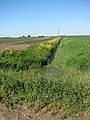 A ditch in the Fens - geograph.org.uk - 1892447.jpg 480 × 640; 137 KB
-
 A large field of wheat - geograph.org.uk - 1892450.jpg 640 × 480; 144 KB
-
 A1122 approaching Nordelph - geograph.org.uk - 1262106.jpg 640 × 511; 79 KB
-
 A1122 at Nordelph boundary - geograph.org.uk - 3639799.jpg 640 × 481; 47 KB
-
 A1122 near West Farm - geograph.org.uk - 3639836.jpg 640 × 481; 42 KB
-
 A1122 Outwell Road, Nordelph - geograph.org.uk - 6180580.jpg 4,000 × 3,000; 3.62 MB
-
 A1122 towards Outwell - geograph.org.uk - 6629779.jpg 640 × 480; 74 KB
-
 Aftermath of the harvest today. - geograph.org.uk - 70837.jpg 640 × 480; 221 KB
-
 Barroway Drove - geograph.org.uk - 3095581.jpg 4,320 × 3,240; 5.35 MB
-
 Barroway Drove - geograph.org.uk - 6629763.jpg 1,024 × 768; 209 KB
-
 Black shed at Nordelph Farm - geograph.org.uk - 3265610.jpg 4,320 × 3,240; 5.19 MB
-
 Bungalow overlooking Well Creek near Nordelph - geograph.org.uk - 3095528.jpg 4,320 × 3,240; 5.96 MB
-
 Buttercups and cow parsley - geograph.org.uk - 1892462.jpg 640 × 480; 144 KB
-
 Church Cottages, Nordelph - geograph.org.uk - 4589148.jpg 1,024 × 768; 162 KB
-
 Church Cottages, Nordelph - geograph.org.uk - 4589152.jpg 1,024 × 768; 171 KB
-
 Confluence of four ditches in Upwell Fen - geograph.org.uk - 1892307.jpg 640 × 480; 147 KB
-
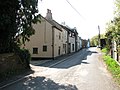
 Cottages in High Street, Nordelph - geograph.org.uk - 1830567.jpg 640 × 480; 117 KB
-
 Cottages in Nordelph - geograph.org.uk - 1820328.jpg 640 × 480; 108 KB
-
 Crop field towards East Farm - geograph.org.uk - 6629761.jpg 1,024 × 768; 233 KB
-
 Crop of sugar beet on Cock Fen near Lakes End - geograph.org.uk - 4261830.jpg 4,320 × 3,240; 5.84 MB
-
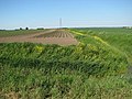 Cultivated fields in Upwell Fen - geograph.org.uk - 1892444.jpg 640 × 480; 133 KB
-
 Cygnets on Well Creek east of Nordelph. - geograph.org.uk - 72235.jpg 640 × 599; 158 KB
-
 Dead end lane over Upwell Fen - geograph.org.uk - 3266227.jpg 4,320 × 3,240; 5.72 MB
-
 Dike crossing Upwell Fen near Nordelph - geograph.org.uk - 3266196.jpg 4,320 × 3,240; 5.46 MB
-

-
 Dilapidated shed in Upwell Fen - geograph.org.uk - 1892311.jpg 640 × 480; 135 KB
-
 Ditch beside farm track - geograph.org.uk - 1892449.jpg 640 × 480; 176 KB
-
 Downham Road (A1122), Nordelph - geograph.org.uk - 6629770.jpg 1,024 × 768; 155 KB
-

-
 Entering Nordelph on the A1122 Outwell Road - geograph.org.uk - 6177978.jpg 4,608 × 3,456; 3.94 MB
-
 Farm bridge over the Well Creek - geograph.org.uk - 3409914.jpg 640 × 427; 289 KB
-
 Farm track in Upwell Fen - geograph.org.uk - 1892458.jpg 640 × 480; 154 KB
-
 Farm track south of Silt Road - geograph.org.uk - 1892456.jpg 640 × 480; 146 KB
-
 Farmland north of Welney Wildfowl Refuge - geograph.org.uk - 3266295.jpg 4,320 × 3,240; 5.48 MB
-
 Fen Drain - geograph.org.uk - 1893573.jpg 640 × 480; 92 KB
-
 Field by Claire View Farm - geograph.org.uk - 1892440.jpg 640 × 480; 138 KB
-
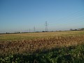
 Flat farm land and power lines - geograph.org.uk - 6629784.jpg 1,024 × 768; 126 KB
-
 From Silt Road, the pylon line again. - geograph.org.uk - 70839.jpg 640 × 480; 108 KB
-
 Garden shed, Nordelph. - geograph.org.uk - 72229.jpg 640 × 465; 109 KB
-
 Gated farm track off Squires Drove - geograph.org.uk - 3095773.jpg 4,320 × 3,240; 5.32 MB
-

-
 High Street Nordelph - geograph.org.uk - 1714589.jpg 1,600 × 1,200; 421 KB
-
 Hill Farm, Silt Road, Nordelph - geograph.org.uk - 3265589.jpg 4,320 × 3,240; 5.68 MB
-
 Home guard shelter - geograph.org.uk - 4403317.jpg 4,608 × 3,456; 3.3 MB
-
 House and rickety barn by the Well Creek - geograph.org.uk - 3409964.jpg 640 × 480; 303 KB
-
 House hidden by trees near Nordelph - geograph.org.uk - 5092840.jpg 4,320 × 3,240; 5.44 MB
-
 House on High Street, Nordelph - geograph.org.uk - 6629765.jpg 1,024 × 654; 114 KB
-
 Iced in for the winter - geograph.org.uk - 2222249.jpg 640 × 480; 147 KB
-

-
 Lane down into Upwell Fen - geograph.org.uk - 811304.jpg 640 × 480; 63 KB
-
 Lines on the ground and in the sky - geograph.org.uk - 3095753.jpg 4,320 × 3,240; 5.56 MB
-
 Looking over Well Creek - geograph.org.uk - 6629768.jpg 1,024 × 768; 202 KB
-
 Magnificent pylon - geograph.org.uk - 590041.jpg 2,000 × 3,008; 2.51 MB
-
 Nordelph - geograph.org.uk - 2061145.jpg 640 × 383; 79 KB
-
 Nordelph Farms Ltd - PRIVATE - No entry ^^^ - geograph.org.uk - 3266244.jpg 4,320 × 3,240; 5.39 MB
-
 Nordelph High Street - geograph.org.uk - 758881.jpg 640 × 431; 54 KB
-

-
 Nordelph Village Hall - geograph.org.uk - 3409938.jpg 640 × 480; 315 KB
-
 Nordelph Village Name sign - geograph.org.uk - 6178025.jpg 1,774 × 2,921; 1.85 MB
-
 Nordelph village sign - geograph.org.uk - 3409933.jpg 640 × 427; 271 KB
-
 Nordelph village sign - geograph.org.uk - 6804610.jpg 3,072 × 3,072; 1.24 MB
-
 Nordelph village sign - geograph.org.uk - 6804611.jpg 4,608 × 3,072; 5.88 MB
-
 Nordelph village sign - geograph.org.uk - 755902.jpg 640 × 429; 61 KB
-
 Nordelph Windmill converted to house-geograph.org.uk-3409962.jpg 640 × 427; 280 KB
-

-

-

-
 Nordelph, snow-covered field - geograph.org.uk - 2189997.jpg 640 × 480; 116 KB
-
 Old Bedford Sluice - geograph.org.uk - 685694.jpg 640 × 427; 66 KB
-
 Old diesel pump beside Well Creek - geograph.org.uk - 1830580.jpg 462 × 640; 185 KB
-
 Old Milepost - geograph.org.uk - 1714578.jpg 1,600 × 1,200; 667 KB
-
 On the bank of The Well Creek, Nordelph - geograph.org.uk - 5092816.jpg 4,320 × 3,240; 5.99 MB
-
 On the bank of Well Creek near Nordelph - geograph.org.uk - 3095554.jpg 4,320 × 3,240; 5.9 MB
-
 On the edge of Well Creek in Nordelph - geograph.org.uk - 3097272.jpg 4,320 × 3,240; 5.53 MB
-

-
 Pillbox - type 24 - geograph.org.uk - 4403300.jpg 4,608 × 3,456; 3.38 MB
-
 Pillbox at Nordelph - geograph.org.uk - 2226171.jpg 640 × 480; 168 KB
-
 Ploughed field off Silt Road - geograph.org.uk - 3265576.jpg 4,320 × 3,240; 5.53 MB
-
 Ploughed land near London Lode Farm - geograph.org.uk - 3265570.jpg 4,320 × 3,240; 5.36 MB
-
 Public footpath along a private farm track - geograph.org.uk - 3266251.jpg 4,320 × 3,240; 5.55 MB
-
 Pylon and power lines near Nordelph - geograph.org.uk - 3095744.jpg 4,320 × 3,240; 5.42 MB
-
 Pylon and power lines, Upwell Fen near Nordelph - geograph.org.uk - 3266282.jpg 4,320 × 3,240; 5.26 MB
-
 Pylons marching across the fens - geograph.org.uk - 1902712.jpg 640 × 480; 78 KB
-
 Reflections off the ice - geograph.org.uk - 2222263.jpg 640 × 480; 188 KB
-

-
 Salters Lode - geograph.org.uk - 3984.jpg 640 × 379; 38 KB
-
 Silt Road (B1094), Nordelph - geograph.org.uk - 6629766.jpg 1,024 × 768; 181 KB
-
 Soggy field and distant swans - geograph.org.uk - 3266214.jpg 4,320 × 3,240; 5.96 MB
-
 Squires Drove heading to Worlds End Farm near Nordelph - geograph.org.uk - 3095766.jpg 4,320 × 3,240; 5.81 MB
-
 Stubble field, Nordelph - geograph.org.uk - 6629773.jpg 1,024 × 768; 177 KB
-
 Sugar beet crop in Upwell Fen - geograph.org.uk - 1892454.jpg 640 × 480; 125 KB
-
 Sugar beet field south of Silt Road - geograph.org.uk - 1892452.jpg 640 × 480; 142 KB
-
 Swans on Upwell Fen near Nordelph - geograph.org.uk - 3266204.jpg 4,320 × 3,240; 5.45 MB
-

-

-

-

-

-

-
 The end of a track in Upwell Fen - geograph.org.uk - 1892313.jpg 640 × 480; 131 KB
-
 The end of the road - geograph.org.uk - 1893558.jpg 640 × 480; 70 KB
-

-

-

-
 The Well Creek at Nordelph - geograph.org.uk - 3097260.jpg 4,320 × 3,240; 5.65 MB
-
 The Well Creek near Nordelph - geograph.org.uk - 5092808.jpg 4,320 × 3,240; 6.11 MB
-
 The Well Creek west of Nordelph - geograph.org.uk - 5092830.jpg 4,320 × 3,240; 5.6 MB
-
 There's Orangey - geograph.org.uk - 2604418.jpg 2,592 × 1,944; 2.23 MB
-
 This way to Wisbech - geograph.org.uk - 1262125.jpg 640 × 480; 81 KB
-
 To Wisbech 9 - geograph.org.uk - 1714571.jpg 1,200 × 1,600; 786 KB
-
 Track beside drainage ditch - geograph.org.uk - 1892460.jpg 640 × 480; 147 KB
-
 Track to Silk Road - geograph.org.uk - 1892314.jpg 640 × 480; 129 KB
-
 Triangulation pillar by Well Creek - geograph.org.uk - 1262117.jpg 640 × 553; 100 KB
-
 Trig pillar on bank of Well Creek - geograph.org.uk - 6629775.jpg 768 × 1,024; 228 KB
-

-
 Underwater fence - geograph.org.uk - 590059.jpg 3,008 × 2,000; 4.26 MB
-
 Upwell Fen Pumping Station - geograph.org.uk - 590023.jpg 3,008 × 2,000; 3.15 MB
-
 Victoria Chapel in Nordelph - geograph.org.uk - 3097202.jpg 4,320 × 3,240; 5.47 MB
-
 Victoria Chapel, Nordelph - geograph.org.uk - 6629767.jpg 1,024 × 704; 193 KB
-
 View along Well Creek - geograph.org.uk - 1262101.jpg 640 × 480; 94 KB
-

-
 View over Well Creek near Nordelph - geograph.org.uk - 6629776.jpg 1,024 × 768; 232 KB
-

-
 Well Creek - geograph.org.uk - 1262111.jpg 640 × 480; 112 KB
-

-
 Well Creek east from Nordelph. - geograph.org.uk - 72233.jpg 480 × 640; 71 KB
-
 Well Creek west of Nordelph - geograph.org.uk - 3409903.jpg 640 × 427; 261 KB
-
 Well Creek, at Creek Farm. - geograph.org.uk - 73084.jpg 640 × 480; 68 KB
-
 Well Creek, Nordelph - geograph.org.uk - 6629769.jpg 1,024 × 768; 260 KB
-
 Wesley Chapel, Nordelph - geograph.org.uk - 6498518.jpg 691 × 1,024; 194 KB
-
 Willow on bank of Well Creek. - geograph.org.uk - 72227.jpg 480 × 640; 109 KB
-
 You have been warned - geograph.org.uk - 1820689.jpg 640 × 480; 178 KB
-
 At Pingle Lodge Farm. - geograph.org.uk - 71901.jpg 640 × 480; 92 KB
-
 Barge and landing stage - geograph.org.uk - 758892.jpg 640 × 410; 42 KB
-
 Bridge at Nordelph - geograph.org.uk - 758886.jpg 640 × 421; 52 KB
-
 By Newbridge Farm, Stow Bardolph Fen. - geograph.org.uk - 70436.jpg 640 × 480; 114 KB
-

-
 Clair View Farm - geograph.org.uk - 758743.jpg 640 × 406; 42 KB
-
 Country piles - geograph.org.uk - 752742.jpg 640 × 480; 58 KB
-
 Denver Sluice - geograph.org.uk - 3985.jpg 640 × 343; 39 KB
-
 Dog and Duck Farm - geograph.org.uk - 590194.jpg 2,000 × 3,008; 3.19 MB
-
 East from Nordelph. - geograph.org.uk - 73083.jpg 640 × 480; 55 KB
-

-
 Farm track and drainage ditch - geograph.org.uk - 752743.jpg 640 × 480; 59 KB
-
 Farmland that was once a fen. - geograph.org.uk - 72564.jpg 640 × 480; 97 KB
-
 Fen Cottage - geograph.org.uk - 710374.jpg 3,008 × 2,000; 3.26 MB
-
 Fenland farmland - geograph.org.uk - 590015.jpg 3,008 × 2,000; 3.43 MB
-
 Fenland farmland - geograph.org.uk - 590169.jpg 3,008 × 2,000; 3.43 MB
-
 Fenland fields near Nordelph - geograph.org.uk - 70429.jpg 640 × 428; 32 KB
-
 Footpath, gate, and bridge - geograph.org.uk - 590050.jpg 2,000 × 3,008; 4.26 MB
-
 Fordham Fen - geograph.org.uk - 654939.jpg 427 × 640; 68 KB
-
 Houses near Hill Farm, Upwell - geograph.org.uk - 602508.jpg 3,008 × 2,000; 2.19 MB
-
 Leads to White City Farm and Lode Farm. - geograph.org.uk - 72242.jpg 640 × 480; 117 KB
-
 Muddy track towards Worlds End Farm - geograph.org.uk - 281493.jpg 640 × 427; 66 KB
-
 Neatmoor Hall Farms - geograph.org.uk - 602473.jpg 3,008 × 2,000; 3.35 MB
-
 Nordelph. - geograph.org.uk - 72222.jpg 640 × 466; 92 KB
-
 Northern end of Barroway Drove. - geograph.org.uk - 73122.jpg 640 × 480; 105 KB
-
 Old Hundred Farm - geograph.org.uk - 590055.jpg 3,008 × 2,000; 3.37 MB
-
 Pond near Old Bedford River - geograph.org.uk - 590035.jpg 3,008 × 2,000; 4.33 MB
-
 Pump house by the Old Bedford River - geograph.org.uk - 590012.jpg 2,000 × 3,008; 2.74 MB
-
 Pumpkins for sale, Barroway Drove. - geograph.org.uk - 72253.jpg 640 × 480; 157 KB
-
 Road from church at Nordelph, Norfolk - geograph.org.uk - 472952.jpg 640 × 479; 111 KB
-
 Road to church at Nordelph, Norfolk - geograph.org.uk - 472950.jpg 640 × 479; 102 KB
-

-
 Track to Venney Farm - geograph.org.uk - 654941.jpg 640 × 427; 97 KB
-
 View from Holy Trinity, Nordelph, Norfolk - geograph.org.uk - 472945.jpg 640 × 428; 106 KB


,_Nordelph_-_geograph.org.uk_-_6629770.jpg)


_-_geograph.org.uk_-_2189994.jpg)


_and_Well_Creek_at_the_Ordnance_Survey_Triangulation_Pillar_-_geograph.org.uk_-_4254766.jpg)


,_Nordelph_-_geograph.org.uk_-_6629766.jpg)


_-_geograph.org.uk_-_3409922.jpg)


