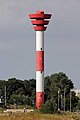
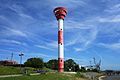
Category:Nordenham range rear
| Object location | | View all coordinates using: OpenStreetMap |
|---|
lighthouse in Germany  | |||||
| Upload media | |||||
| Instance of | |||||
|---|---|---|---|---|---|
| Part of | |||||
| Made from material | |||||
| Location | Nordenham, Wesermarsch, Lower Saxony, Germany | ||||
| Located in or next to body of water | |||||
| Has use |
| ||||
| Inception |
| ||||
| Height |
| ||||
 | |||||
Media in category "Nordenham range rear"
The following 5 files are in this category, out of 5 total.
-
 Lighthouse 2 (4067466461).jpg 3,648 × 2,736; 2.13 MB
-
 Nordenham Of 20120816 1.jpg 720 × 1,080; 254 KB
-
 Nordenham range rear 0305.jpg 5,472 × 3,648; 6.32 MB
-
 Nordenham range rear 0615.jpg 5,472 × 3,648; 5.01 MB
-
 Nordenham range rear 0618.jpg 5,472 × 3,648; 5.23 MB
.jpg)


