Category:Normanton on Soar
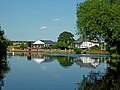
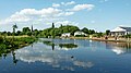
English: Normanton on Soar (known to locals as just "Normanton") is a village in the south of Nottinghamshire in England near the river Soar.
فارسی: نوئمانتونآنسوآ( IPA: /ˈnɔrməntən ən ˈsɔr/) (که بومیان آن را نوئمانتون مینامند) روستایی در جنوب نوتینگهامشیر در انگلستان است که نزدیک رود سوآر میباشد.
village in the United Kingdom  | |||||
| Upload media | |||||
| Instance of | |||||
|---|---|---|---|---|---|
| Location | Rushcliffe, Nottinghamshire, East Midlands, England | ||||
| official website | |||||
 | |||||
Subcategories
This category has the following 3 subcategories, out of 3 total.
Media in category "Normanton on Soar"
The following 177 files are in this category, out of 177 total.
-
 65 Main Street, Normanton on Soar.jpg 1,024 × 768; 166 KB
-
 75 Main Street, Normanton on Soar - geograph.org.uk - 3989206.jpg 1,280 × 960; 332 KB
-
 A6006 at Hathern Station - geograph.org.uk - 4000996.jpg 1,280 × 960; 297 KB
-
 A6006 at Moor Lane junction - geograph.org.uk - 3604121.jpg 640 × 481; 61 KB
-
 A6006 at Travell's Hill junction - geograph.org.uk - 3604139.jpg 640 × 481; 56 KB
-
 A6006 eastbound at lay-by - geograph.org.uk - 3604157.jpg 640 × 480; 50 KB
-
 A6006 near Cold Harbour Farm - geograph.org.uk - 3604133.jpg 640 × 481; 58 KB
-
 A6006 nearing Trowell Lane junction - geograph.org.uk - 3604127.jpg 640 × 481; 63 KB
-
 A606 heading east - geograph.org.uk - 4037320.jpg 640 × 480; 78 KB
-

-
 Approaching Normanton along the River Soar - geograph.org.uk - 3988828.jpg 806 × 1,280; 245 KB
-
 Approaching Normanton on Soar - geograph.org.uk - 552000.jpg 640 × 435; 115 KB
-
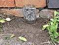
 Bench mark, St James' Church, Normanton - geograph.org.uk - 3989224.jpg 883 × 1,280; 467 KB
-
 Beware of ducks^ - geograph.org.uk - 715882.jpg 640 × 468; 77 KB
-
 Bowley's Bridge - geograph.org.uk - 3303820.jpg 1,024 × 768; 240 KB
-
 Brickyard Lane near Travell's Hill - geograph.org.uk - 1775230.jpg 640 × 427; 87 KB
-
 Bridleway towards Grange Farm - geograph.org.uk - 3606560.jpg 640 × 480; 85 KB
-
 Broken Hedge - geograph.org.uk - 1298692.jpg 640 × 480; 192 KB
-
 Butt Lane - geograph.org.uk - 3606553.jpg 640 × 480; 94 KB
-
 Butt Lane over the railway - geograph.org.uk - 6309245.jpg 900 × 1,600; 538 KB
-
 Butt Lane, Normanton on Soar - geograph.org.uk - 3985655.jpg 1,600 × 1,063; 531 KB
-
 Butt Lane, Normanton on Soar - geograph.org.uk - 3985863.jpg 1,600 × 1,063; 768 KB
-
 Butt Lane, Normanton-on-Soar - geograph.org.uk - 5803987.jpg 1,280 × 960; 351 KB
-
 Chain Ferry - geograph.org.uk - 3303826.jpg 1,200 × 1,600; 740 KB
-
-

-
 Churchyard jetty - geograph.org.uk - 3989216.jpg 960 × 1,280; 406 KB
-
 Cold Harbour Farm - geograph.org.uk - 2787516.jpg 3,648 × 2,736; 2.84 MB
-
 Cold Harbour trig pillar - geograph.org.uk - 4000999.jpg 960 × 1,280; 428 KB
-
 Communications mast at Pit Hole - geograph.org.uk - 5803992.jpg 1,280 × 960; 389 KB
-
 Communications mast near Whitehills Farm - geograph.org.uk - 2795796.jpg 3,648 × 2,736; 3.25 MB
-

-
 Country Road - geograph.org.uk - 1319759.jpg 640 × 427; 83 KB
-
 Distant view across the fields - geograph.org.uk - 1502097.jpg 640 × 427; 99 KB
-

-

-
 Entrance to Limekiln Plantation - geograph.org.uk - 1298634.jpg 640 × 480; 201 KB
-
 Farm track (footpath) - geograph.org.uk - 3606556.jpg 640 × 480; 62 KB
-

-
 Farm track south of Rempstone Road - geograph.org.uk - 4037323.jpg 640 × 480; 114 KB
-
 Farmland near Normanton on Soar - geograph.org.uk - 4755239.jpg 640 × 426; 40 KB
-
 Farmland off Moor Lane - geograph.org.uk - 3606548.jpg 640 × 480; 69 KB
-
 Fingerpost, Travell's Hill-Brickyard Lane - geograph.org.uk - 3989199.jpg 960 × 1,280; 414 KB
-
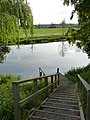
 Fish pond - geograph.org.uk - 5884512.jpg 1,280 × 960; 627 KB
-

-
-

-
 Footpath to Normanton on Soar - geograph.org.uk - 4914476.jpg 1,280 × 960; 829 KB
-
 Footpath to St James' - geograph.org.uk - 4961831.jpg 1,280 × 960; 706 KB
-
 Fox on the line - geograph.org.uk - 3975941.jpg 1,600 × 939; 669 KB
-
 Gates to the fields - geograph.org.uk - 1502030.jpg 640 × 427; 76 KB
-
 Grange farm - geograph.org.uk - 1298617.jpg 640 × 480; 172 KB
-
 Heron at Normanton on Soar - geograph.org.uk - 552269.jpg 593 × 640; 142 KB
-
 Hills Farm - geograph.org.uk - 1775180.jpg 640 × 427; 68 KB
-
 Hillside above the railway - geograph.org.uk - 1813208.jpg 1,024 × 768; 139 KB
-
 Inside Limekiln Plantation - geograph.org.uk - 1298656.jpg 640 × 480; 182 KB
-
 Inside Limekiln Plantation - geograph.org.uk - 1298673.jpg 640 × 480; 204 KB
-
-

-
-

-

-
 Large lay-by on the Rempstone Road - geograph.org.uk - 2795799.jpg 3,648 × 2,736; 2.43 MB
-
 Lay-by on the A6006 - geograph.org.uk - 5803991.jpg 1,280 × 960; 349 KB
-
 Lay-by on the A6006 - geograph.org.uk - 5915068.jpg 6,032 × 4,014; 6.58 MB
-
 Leaving Normanton on Soar - geograph.org.uk - 6309240.jpg 1,600 × 900; 382 KB
-
 Limekiln Plantation - geograph.org.uk - 1298640.jpg 640 × 480; 176 KB
-

-
 Looking back to Limekiln Plantation - geograph.org.uk - 1298711.jpg 640 × 480; 186 KB
-
 Looking back to Limekiln Plantation - geograph.org.uk - 1298722.jpg 640 × 480; 191 KB
-
 Main Line at Normanton on Soar - geograph.org.uk - 18786.jpg 640 × 618; 190 KB
-
 Main Street, Normanton on Soar - geograph.org.uk - 3606555.jpg 640 × 480; 84 KB
-
 Moor Lane, Normanton on Soar - geograph.org.uk - 3606549.jpg 640 × 480; 62 KB
-
 Network Rail access - geograph.org.uk - 3987254.jpg 1,600 × 1,063; 725 KB
-
 Normanto on Soar Village Hall.JPG 584 × 389; 59 KB
-
 Normanton Grange farm - geograph.org.uk - 1298595.jpg 640 × 480; 168 KB
-
 Normanton on Soar - geograph.org.uk - 1046900.jpg 640 × 426; 97 KB
-
 Normanton on Soar - geograph.org.uk - 1292078.jpg 640 × 480; 93 KB
-
 Normanton on Soar - geograph.org.uk - 1292093.jpg 640 × 480; 129 KB
-
 Normanton on Soar - geograph.org.uk - 1292111.jpg 640 × 480; 122 KB
-
 Normanton on Soar - geograph.org.uk - 1292118.jpg 640 × 480; 92 KB
-
 Normanton on Soar - Soar Lane (Slipway).jpg 6,000 × 4,000; 8.95 MB
-
 Normanton on Soar 2002 - geograph.org.uk - 551980.jpg 640 × 577; 174 KB
-
 Normanton on Soar fields and church - geograph.org.uk - 1292040.jpg 640 × 480; 98 KB
-
 Normanton on Soar footbridge - geograph.org.uk - 1292060.jpg 640 × 480; 65 KB
-
 Normanton on Soar geograph-3616708-by-Ben-Brooksbank.jpg 2,380 × 1,468; 2.93 MB
-
 Normanton on Soar path - geograph.org.uk - 1298930.jpg 640 × 480; 106 KB
-
 Normanton on Soar trees - geograph.org.uk - 1298573.jpg 640 × 480; 178 KB
-
 Normanton on Soar water trough - geograph.org.uk - 1292105.jpg 640 × 480; 121 KB
-
 Normanton on Soar, Nottinghamshire - geograph.org.uk - 551967.jpg 519 × 640; 124 KB
-
 Normanton Village Hall - geograph.org.uk - 3989227.jpg 1,280 × 960; 286 KB
-
 Normanton-on-Soar Post Office - geograph.org.uk - 662583.jpg 427 × 640; 186 KB
-
 Oilseed rape crop with poppies - geograph.org.uk - 4037319.jpg 640 × 480; 100 KB
-
 Old post office normanton.jpg 770 × 531; 168 KB
-
 Park Lane leading to Sutton Bonington - geograph.org.uk - 721179.jpg 640 × 480; 60 KB
-
 Park Lane-A6006 junction - geograph.org.uk - 2086518.jpg 640 × 480; 61 KB
-
 Path in Limekiln Plantation - geograph.org.uk - 1298660.jpg 640 × 480; 166 KB
-
 Path in Limekiln Plantation - geograph.org.uk - 1298668.jpg 640 × 480; 188 KB
-
 Path to Limekiln Plantation - geograph.org.uk - 1298623.jpg 640 × 480; 171 KB
-
 Path to Manor Farm - geograph.org.uk - 1298700.jpg 640 × 480; 179 KB
-
 Ploughed fields from the roadside - geograph.org.uk - 1502088.jpg 640 × 427; 70 KB
-

-
-
 Rail line near Normanton on Soar - geograph.org.uk - 551929.jpg 640 × 480; 125 KB
-
 Railway at Normanton on Soar - geograph.org.uk - 3988609.jpg 1,600 × 1,063; 678 KB
-
 Railway at Normanton on Soar - geograph.org.uk - 3988617.jpg 1,600 × 844; 544 KB
-
 Railway at Normanton on Soar - geograph.org.uk - 3988626.jpg 1,600 × 958; 511 KB
-
 Railway at Normanton on Soar - geograph.org.uk - 3988639.jpg 1,600 × 951; 525 KB
-
 Railway Cottage - geograph.org.uk - 4961808.jpg 1,280 × 960; 618 KB
-
 Railway heading south - geograph.org.uk - 3606557.jpg 640 × 480; 79 KB
-
 Rempstone Road (A606) - geograph.org.uk - 4037324.jpg 640 × 480; 77 KB
-
 Rempstone Road - geograph.org.uk - 2086605.jpg 640 × 480; 65 KB
-

-
 River Soar - geograph.org.uk - 3302517.jpg 800 × 600; 105 KB
-

-

-

-
-
 River Soar north of Loughborough in Leicestershire - geograph.org.uk - 5992589.jpg 1,440 × 960; 1.56 MB
-
 River Soar north of Loughborough, Leicestershire - geograph.org.uk - 5992593.jpg 960 × 1,280; 1.22 MB
-
 River Soar south of Normanton on Soar, Nottinghamshire - geograph.org.uk - 5992631.jpg 1,440 × 1,080; 1.3 MB
-
 River Soar, Normanton on Soar - geograph.org.uk - 3787416.jpg 1,280 × 851; 360 KB
-
 River south of Normanton on Soar, Nottinghamshire - geograph.org.uk - 5992766.jpg 1,280 × 960; 1.26 MB
-
 River, woodland and pylon near Normanton on Soar - geograph.org.uk - 5992634.jpg 960 × 1,280; 1.41 MB
-
 Riverside cottages, Normanton on Soar - geograph.org.uk - 6180393.jpg 1,600 × 900; 283 KB
-
 Riverside footpath, Normanton - geograph.org.uk - 3989221.jpg 1,280 × 960; 260 KB
-
 Sheep Spinney - geograph.org.uk - 5884521.jpg 1,280 × 960; 447 KB
-
 Soar Lane, Normanton on Soar - geograph.org.uk - 3456756.jpg 2,048 × 1,536; 731 KB
-
 Spring in moor lane 2.jpg 427 × 427; 64 KB
-
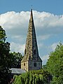
 St James's church - geograph.org.uk - 6309236.jpg 900 × 1,600; 415 KB
-
 The Cedars - geograph.org.uk - 1298605.jpg 640 × 480; 200 KB
-
 The Cedars, Normanton-on-Soar - geograph.org.uk - 5803986.jpg 1,280 × 960; 307 KB
-
 The entry to Limekiln Plantation - geograph.org.uk - 4001015.jpg 1,280 × 960; 429 KB
-
 The Midland main line looking north - geograph.org.uk - 1502903.jpg 640 × 434; 84 KB
-
 The Plough - geograph.org.uk - 6309248.jpg 1,600 × 900; 555 KB
-
 The railway bridge on Butt Lane - geograph.org.uk - 3985787.jpg 1,600 × 1,064; 491 KB
-
-

-
 The unnavigable River Soar, near Bishop's Meadow - geograph.org.uk - 6180387.jpg 1,913 × 1,435; 550 KB
-
 The Village Hall, Normanton on Soar, UK.JPG 415 × 212; 38 KB
-
 This way towards the A6006 - geograph.org.uk - 1502108.jpg 640 × 427; 82 KB
-
 Track to Hills Farm - geograph.org.uk - 4037325.jpg 640 × 480; 81 KB
-
 Travell's Hill - geograph.org.uk - 4037326.jpg 640 × 480; 82 KB
-
 Two straw bales - geograph.org.uk - 4755237.jpg 640 × 426; 41 KB
-
 View from the railway bridge, Hathern - geograph.org.uk - 4000991.jpg 1,280 × 951; 371 KB
-
 View towards Loughborough - geograph.org.uk - 4001003.jpg 1,280 × 960; 245 KB
-
 Wooden cottages at Normanton on Soar - geograph.org.uk - 3456740.jpg 2,048 × 1,536; 618 KB
-
 A6006 in Nottinghamshire - geograph.org.uk - 552007.jpg 410 × 640; 92 KB
-
 Cattle on the river bank - geograph.org.uk - 552237.jpg 640 × 420; 111 KB
-
 Corner of Main Street, Normanton on Soar - geograph.org.uk - 551990.jpg 640 × 586; 156 KB
-
 Countryside near Normanton on Soar - geograph.org.uk - 551948.jpg 640 × 480; 119 KB
-
 Far Lane - geograph.org.uk - 687723.jpg 480 × 640; 91 KB
-
 Farmland close to Normanton on Soar - geograph.org.uk - 552304.jpg 640 × 484; 103 KB
-
 Fields near Normanton on Soar - geograph.org.uk - 552005.jpg 640 × 467; 99 KB
-

-
 Footpath towards Normanton on Soar - geograph.org.uk - 720396.jpg 640 × 480; 78 KB
-
 House in Normanton on Soar - geograph.org.uk - 552282.jpg 640 × 449; 135 KB
-
 HST from Loughborough - geograph.org.uk - 6421.jpg 640 × 307; 86 KB
-
 Main Street, Normanton on Soar - geograph.org.uk - 551951.jpg 640 × 506; 116 KB
-
 Main Street, Normanton on Soar - geograph.org.uk - 551958.jpg 640 × 475; 119 KB
-
 Main Street, Normanton on Soar - geograph.org.uk - 551970.jpg 640 × 537; 127 KB
-
 Main Street, Normanton on Soar - geograph.org.uk - 551982.jpg 640 × 469; 121 KB
-
 Moor Lane, Normanton - geograph.org.uk - 687730.jpg 640 × 480; 91 KB
-
 Moor Lane, Normanton on Soar - geograph.org.uk - 551993.jpg 640 × 501; 96 KB
-
 Moorings at Normanton on Soar - geograph.org.uk - 552241.jpg 640 × 504; 99 KB
-
-
 Normanton on Soar - geograph.org.uk - 552274.jpg 640 × 606; 145 KB
-
 Zouch Road Bridge 43 - geograph.org.uk - 2354795.jpg 640 × 471; 102 KB
-
 Public footpath along the River Soar - geograph.org.uk - 552278.jpg 640 × 480; 128 KB
-
 River Soar at Normanton on Soar - geograph.org.uk - 552234.jpg 640 × 480; 122 KB
-
 River Soar from The Plough - geograph.org.uk - 662596.jpg 640 × 427; 164 KB
-
 River Soar near Normanton on Soar - geograph.org.uk - 552245.jpg 640 × 512; 155 KB
-
 River Soar north of Loughborough - geograph.org.uk - 552310.jpg 640 × 499; 139 KB
-
 Signpost at Normanton - geograph.org.uk - 687719.jpg 480 × 640; 144 KB
-
 Stanford Road near Normanton on Soar - geograph.org.uk - 551926.jpg 640 × 424; 106 KB
-
 The A6006 near Normanton on Soar - geograph.org.uk - 552010.jpg 640 × 478; 108 KB
-
 The River Soar from The Plough - geograph.org.uk - 662600.jpg 640 × 427; 145 KB


_-_geograph.org.uk_-_3606556.jpg)


.jpg)


_-_geograph.org.uk_-_4037324.jpg)


