Category:North Deighton
village in the United Kingdom .jpg) | |||||
| Upload media | |||||
| Instance of | |||||
|---|---|---|---|---|---|
| Location | Harrogate, North Yorkshire, Yorkshire and the Humber, England | ||||
| Population |
| ||||
 | |||||
English: North Deighton is a village and civil parish in the Harrogate district of North Yorkshire, England. It is near the A1 road and 3 miles north west of Wetherby.
Media in category "North Deighton"
The following 95 files are in this category, out of 95 total.
-
 'Tis the season for chipped windscreens - geograph.org.uk - 6496147.jpg 5,184 × 3,888; 5.42 MB
-
 A168 heading south - geograph.org.uk - 3798480.jpg 640 × 480; 89 KB
-
 A168 heading south - geograph.org.uk - 3798523.jpg 640 × 480; 61 KB
-
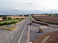
 A168 heading towards the A1M - geograph.org.uk - 4680856.jpg 1,024 × 688; 137 KB
-
 A168 near Deighton Grange Farm - geograph.org.uk - 6093340.jpg 1,024 × 683; 253 KB
-
 Access road to Manor Farm over The Green - geograph.org.uk - 5688925.jpg 2,300 × 1,722; 2.08 MB
-
 Access track to the sewage works - geograph.org.uk - 5959585.jpg 1,024 × 683; 225 KB
-
 Across Ox Close Lane - geograph.org.uk - 6379746.jpg 1,024 × 768; 683 KB
-
 B6264 heading north - geograph.org.uk - 3797088.jpg 640 × 480; 55 KB
-
 Blossom on the Green at North Deighton - geograph.org.uk - 3887962.jpg 4,320 × 3,240; 5.8 MB
-
 Bridge over A168 - geograph.org.uk - 3828814.jpg 3,520 × 2,681; 1.24 MB
-
 Bridge over the old A1 - geograph.org.uk - 290962.jpg 640 × 427; 63 KB
-
 Bridleway between Little Ribston and Ruddings Farm - geograph.org.uk - 5119856.jpg 1,600 × 1,067; 668 KB
-
 Bridleway near Crook Farm - geograph.org.uk - 4576635.jpg 1,920 × 1,440; 1.26 MB
-
 Bridleway near Crook Farm - geograph.org.uk - 4576640.jpg 1,920 × 1,297; 555 KB
-
 Bridleway near Crook Farm - geograph.org.uk - 5119857.jpg 1,600 × 1,067; 595 KB
-
 Bridleway to Black Stones - geograph.org.uk - 4576378.jpg 1,920 × 1,242; 730 KB
-
 Bridleway to the A168 - geograph.org.uk - 4576724.jpg 1,920 × 1,304; 875 KB
-
 Closes Lane Bridge, A168 - geograph.org.uk - 4793179.jpg 640 × 426; 25 KB
-
 Copse below Gospel Hill (1) - geograph.org.uk - 4887413.jpg 640 × 480; 107 KB
-
 Copse below Gospel Hill (2) - geograph.org.uk - 4887417.jpg 640 × 480; 83 KB
-
 Crimple Beck at Black Stones - geograph.org.uk - 5119853.jpg 1,600 × 1,067; 732 KB
-
 Crossing the Nidd - geograph.org.uk - 4576813.jpg 1,920 × 1,163; 525 KB
-
 Cycle-Pedestrian Path beside the A168 - geograph.org.uk - 5120333.jpg 1,600 × 1,067; 573 KB
-
 Daffodils on the Green, North Deighton - geograph.org.uk - 3887332.jpg 4,320 × 3,240; 5.5 MB
-
 Entrance to North Deighton - geograph.org.uk - 4740925.jpg 640 × 462; 86 KB
-
 Farm track off the A168 - geograph.org.uk - 3798473.jpg 640 × 480; 71 KB
-
 Farm track off the B6164 - geograph.org.uk - 3797087.jpg 640 × 480; 76 KB
-
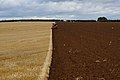
 Farmland by Ox Close Farm - geograph.org.uk - 3792894.jpg 3,458 × 2,036; 1.19 MB
-
 Farmland near Newsome Bridge - geograph.org.uk - 3797095.jpg 640 × 469; 37 KB
-
 Farmland off Knaresborough Road - geograph.org.uk - 3797097.jpg 640 × 480; 64 KB
-
 Farmland off the A168 - geograph.org.uk - 3798476.jpg 640 × 480; 69 KB
-
 Farmland off the B6164 - geograph.org.uk - 3797085.jpg 640 × 480; 72 KB
-
 Farmland south of Spofforth Lane - geograph.org.uk - 3797092.jpg 640 × 480; 61 KB
-

-
 Farmland towards the River Nidd - geograph.org.uk - 3798472.jpg 640 × 489; 67 KB
-
 Field by Ox Close Lane - geograph.org.uk - 3887986.jpg 4,320 × 3,240; 4.99 MB
-
 Field by the Crimple - geograph.org.uk - 4574643.jpg 1,920 × 1,361; 712 KB
-
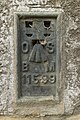 Flush Bracket Bench Mark, Howe Hill Farm - geograph.org.uk - 5918857.jpg 683 × 1,024; 312 KB
-
 Following Cycle-Pedestrian Path beside the A168 - geograph.org.uk - 5124252.jpg 1,600 × 1,067; 535 KB
-
 Footbridge by the Crimple - geograph.org.uk - 4426979.jpg 1,920 × 1,409; 1.08 MB
-
 Footpath approaching Westgate Farm - geograph.org.uk - 3887947.jpg 4,314 × 3,102; 4.97 MB
-
 Footpath over the Crimple - geograph.org.uk - 4576349.jpg 1,920 × 2,560; 1.43 MB
-
 Ford across the Crimple - geograph.org.uk - 4576332.jpg 1,920 × 1,323; 984 KB
-
 Ford over Crimple Beck - geograph.org.uk - 4426954.jpg 1,689 × 1,961; 694 KB
-
 Former northbound carriageway of A1 - geograph.org.uk - 2779068.jpg 3,264 × 2,448; 3.15 MB
-
 Houses in North Deighton - geograph.org.uk - 5918838.jpg 1,024 × 683; 214 KB
-
 Houses on Spofforth Lane North Deighton - geograph.org.uk - 5688938.jpg 1,455 × 1,115; 625 KB
-
 Knaresborough Road (B6164) - geograph.org.uk - 3797098.jpg 640 × 480; 51 KB
-
 Knaresborough Road - geograph.org.uk - 2979982.jpg 640 × 480; 87 KB
-
 Knaresborough Road, North Deighton - geograph.org.uk - 5918854.jpg 1,024 × 683; 232 KB
-
 Leftover vegetables - geograph.org.uk - 4887398.jpg 640 × 480; 148 KB
-
 Next to Ox Close Lane - geograph.org.uk - 2941644.jpg 640 × 480; 114 KB
-
 Old A1 - geograph.org.uk - 4076530.jpg 640 × 427; 78 KB
-
 Old A1 south - geograph.org.uk - 381111.jpg 640 × 480; 61 KB
-
 Outbuildings behind Woodlands Farm - geograph.org.uk - 3887292.jpg 4,320 × 3,240; 3.23 MB
-
 Ox Close Farm - geograph.org.uk - 1343062.jpg 640 × 480; 116 KB
-
 Ox Close Farm - geograph.org.uk - 249072.jpg 640 × 479; 71 KB
-
 Ox Close Lane - geograph.org.uk - 2779071.jpg 3,264 × 2,448; 2.74 MB
-
 Ox Close Lane - geograph.org.uk - 2941646.jpg 640 × 480; 128 KB
-
 Ox Close Lane - geograph.org.uk - 3797099.jpg 640 × 480; 60 KB
-
 Ox Close Lane - geograph.org.uk - 4680854.jpg 1,024 × 709; 197 KB
-
 Ox Close Lane - geograph.org.uk - 4680855.jpg 1,024 × 671; 203 KB
-
 Ox Close Lane - geograph.org.uk - 6379733.jpg 1,024 × 768; 574 KB
-
 Ox Close Lane approaching the A168 - geograph.org.uk - 6087515.jpg 1,024 × 683; 212 KB
-
 Ox Close Lane going west - geograph.org.uk - 5055538.jpg 4,194 × 2,778; 4.02 MB
-
 Path beside the A168 - geograph.org.uk - 3798478.jpg 640 × 480; 100 KB
-
 Path by the A168 - geograph.org.uk - 4576744.jpg 1,920 × 1,440; 1.01 MB
-
 Path by the A168 - geograph.org.uk - 4576757.jpg 1,920 × 1,194; 557 KB
-
 Path by the A168 - geograph.org.uk - 4576791.jpg 1,920 × 1,430; 716 KB
-
 Path leading to Kirk Deighton - geograph.org.uk - 4129925.jpg 1,600 × 1,064; 618 KB
-
 Path towards Gospel Hall - geograph.org.uk - 4129929.jpg 1,600 × 1,064; 840 KB
-
 Ploughing at Gospel Hill - geograph.org.uk - 4129935.jpg 1,600 × 1,064; 550 KB
-
 Ploughing at Gospel Hill - geograph.org.uk - 4129942.jpg 1,600 × 918; 549 KB
-
 Ploughing at Gospel Hill - geograph.org.uk - 4129954.jpg 1,600 × 1,064; 607 KB
-
 Retired Road - geograph.org.uk - 351377.jpg 640 × 480; 55 KB
-
 River Crimple at Black Stones - geograph.org.uk - 4576299.jpg 1,920 × 1,440; 1.23 MB
-
 River Crimple from Crimple Bridge - geograph.org.uk - 2979973.jpg 480 × 640; 94 KB
-
 River Crimple from Crimple Bridge - geograph.org.uk - 2979976.jpg 480 × 640; 109 KB
-
 River Crimple, Crimple Bridge - geograph.org.uk - 3797102.jpg 480 × 640; 106 KB
-
 River Nidd at Walshford Bridge - geograph.org.uk - 4576834.jpg 1,920 × 1,349; 686 KB
-
 Rocky Outcrop near North Deighton - geograph.org.uk - 249048.jpg 640 × 479; 88 KB
-
 Ruddings Farm - geograph.org.uk - 3798482.jpg 640 × 480; 79 KB
-
 Solitary Tree on Gospel Hill - geograph.org.uk - 3887056.jpg 4,320 × 3,240; 3.65 MB
-
 Spofforth Lane - geograph.org.uk - 3797094.jpg 640 × 480; 53 KB
-
 Spofforth Lane - geograph.org.uk - 3797096.jpg 640 × 480; 65 KB
-
 The Crimple and a footbridge - geograph.org.uk - 4576439.jpg 1,920 × 1,440; 1.09 MB
-
 The Crimple at Black Stones - geograph.org.uk - 4576362.jpg 1,920 × 1,440; 1.13 MB
-
 The Green - geograph.org.uk - 4076531.jpg 640 × 427; 76 KB
-
 The Green North Deighton - geograph.org.uk - 5688944.jpg 1,881 × 1,384; 1.39 MB
-
 The Green, North Deighton (geograph 2165378).jpg 640 × 480; 116 KB
-
 Track off Spofforth Lane - geograph.org.uk - 2165380.jpg 640 × 480; 108 KB
-
 Trees by the Crimple - geograph.org.uk - 4574771.jpg 1,920 × 1,349; 791 KB
-
 Victorian Postbox, North Deighton - geograph.org.uk - 5918842.jpg 683 × 1,024; 289 KB
-
 Woodland on Gospel Hill - geograph.org.uk - 4887424.jpg 640 × 480; 84 KB


_-_geograph.org.uk_-_4887413.jpg)
_-_geograph.org.uk_-_4887417.jpg)


_-_geograph.org.uk_-_3797098.jpg)


