Category:North Gosforth
village in United Kingdom  Les ruines d'une chapelle médiévale à North Gosforth. | |||||
| Upload media | |||||
| Instance of | |||||
|---|---|---|---|---|---|
| Location | Newcastle upon Tyne, Tyne and Wear, North East England, England | ||||
 | |||||
English: North Gosforth is a suburb and civil parish in the City of Newcastle upon Tyne in Tyne and Wear, England. It is north of the city centre, and has a population of 3,527.
Subcategories
This category has the following 4 subcategories, out of 4 total.
Media in category "North Gosforth"
The following 99 files are in this category, out of 99 total.
-
 A1 near Hazelrigg - geograph.org.uk - 2578894.jpg 640 × 439; 41 KB
-
 Alterations to Newcastle Racecourse - geograph.org.uk - 5106238.jpg 2,000 × 1,500; 444 KB
-
 Apartment block, Brunton Lane, Gosforth - geograph.org.uk - 5034009.jpg 2,000 × 1,500; 419 KB
-
 Arable land off Salters Lane - geograph.org.uk - 5089548.jpg 2,000 × 1,500; 558 KB
-
 Autumn in Gosforth Park NR - geograph.org.uk - 2747378.jpg 1,024 × 768; 396 KB
-
 Brandling House, Gosforth - geograph.org.uk - 3474518.jpg 640 × 422; 166 KB
-
 Brunton Lane - geograph.org.uk - 3649775.jpg 3,325 × 2,236; 1.12 MB
-
 Brunton Park, Newcastle Upon Tyne - geograph.org.uk - 4429918.jpg 3,072 × 1,562; 3.72 MB
-
 Bus stop on the Great North Road, Gosforth - geograph.org.uk - 5033996.jpg 2,000 × 1,500; 432 KB
-
 Climbing wall - geograph.org.uk - 2127327.jpg 1,216 × 1,824; 769 KB
-
 Club House of Parklands Golf Course , High Gosforth Park - geograph.org.uk - 5690470.jpg 4,971 × 2,797; 3.7 MB
-
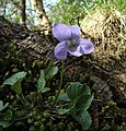 Common Dog Violet, Gosforth Park - geograph.org.uk - 2747357.jpg 769 × 800; 190 KB
-
 Crop field towards Gosforth Wood - geograph.org.uk - 3584000.jpg 640 × 480; 67 KB
-
 Cycle path beside the Great North Road - geograph.org.uk - 3583943.jpg 640 × 480; 104 KB
-

-
 Dunnock - geograph.org.uk - 2928949.jpg 511 × 640; 96 KB
-
 East gate to High Gosforth Park - geograph.org.uk - 5690494.jpg 5,234 × 2,744; 2.17 MB
-
 Eastern entrance to Gosforth Park - geograph.org.uk - 3767386.jpg 640 × 480; 91 KB
-
 Edge of Melton Park - geograph.org.uk - 3767349.jpg 640 × 480; 105 KB
-
 Emergency exit - geograph.org.uk - 2130083.jpg 1,824 × 1,216; 814 KB
-
 Entrance - geograph.org.uk - 2130577.jpg 1,824 × 1,216; 705 KB
-
 Entrance to Parklands, Gosforth Park - geograph.org.uk - 2817339.jpg 640 × 480; 97 KB
-
 Exit - geograph.org.uk - 2130588.jpg 1,824 × 1,216; 674 KB
-
 Farmland off Salter's Lane - geograph.org.uk - 3583976.jpg 640 × 480; 74 KB
-

-
 Feeding Area - geograph.org.uk - 2928958.jpg 640 × 480; 164 KB
-
 Feeding Station at Gosforth Park Nature Reserve - geograph.org.uk - 3236896.jpg 3,648 × 2,736; 2.08 MB
-
 Female Great Spotted Woodpecker - geograph.org.uk - 2928941.jpg 1,339 × 1,471; 1.09 MB
-
 Footbridge over the River Ouseburn - geograph.org.uk - 6256653.jpg 640 × 480; 326 KB
-
 Fork in tree - geograph.org.uk - 2127866.jpg 1,824 × 1,216; 744 KB
-
 Frost Clad Fungi - geograph.org.uk - 2790866.jpg 640 × 597; 166 KB
-
 Frosted Fungi - geograph.org.uk - 2747524.jpg 1,024 × 745; 256 KB
-
 Gateway - geograph.org.uk - 2129995.jpg 1,824 × 1,216; 828 KB
-
 Goldfinch on Feeder - geograph.org.uk - 2928946.jpg 1,256 × 1,717; 1.47 MB
-
 Gosforth Garden Centre - geograph.org.uk - 2697033.jpg 640 × 480; 49 KB
-
 Gosforth Golf Club - geograph.org.uk - 3767382.jpg 640 × 480; 89 KB
-
 Gosforth Golf Club - geograph.org.uk - 3767384.jpg 640 × 480; 105 KB
-
 Gosforth Golf Club - geograph.org.uk - 6464116.jpg 2,000 × 1,500; 2.34 MB
-
 Gosforth Lake - geograph.org.uk - 2747384.jpg 1,024 × 768; 198 KB
-
 Gosforth Nature Reserve - geograph.org.uk - 4817348.jpg 1,066 × 800; 170 KB
-
 Gosforth Park racecourse - geograph.org.uk - 2130703.jpg 1,824 × 1,216; 677 KB
-
 Gosforth, Wyevale Garden Centre - geograph.org.uk - 4936657.jpg 3,072 × 1,211; 1.72 MB
-
 Grandstand - geograph.org.uk - 2130736.jpg 1,824 × 1,216; 698 KB
-
 Grandstand - geograph.org.uk - 2130753.jpg 1,824 × 1,216; 689 KB
-
 Grandstand - geograph.org.uk - 2130782.jpg 1,824 × 1,216; 713 KB
-
 Grandstands - geograph.org.uk - 2130714.jpg 1,824 × 1,216; 658 KB
-
 Great Lime Road, B1319 - geograph.org.uk - 1804534.jpg 640 × 480; 50 KB
-
 Great North Road, Newcastle Upon Tyne - geograph.org.uk - 4429077.jpg 2,537 × 1,630; 2.58 MB
-
 Greys House, Norwood Avenue - geograph.org.uk - 3649761.jpg 4,011 × 2,203; 1.27 MB
-
 Heron on the path - geograph.org.uk - 6256486.jpg 640 × 480; 396 KB
-
 Home Farm, Gosforth - geograph.org.uk - 2726535.jpg 3,421 × 1,682; 1.05 MB
-
 Homes for Bats - geograph.org.uk - 2747402.jpg 882 × 1,024; 471 KB
-
 Houses on Norwood Avenue - geograph.org.uk - 3583935.jpg 640 × 480; 108 KB
-
 Houses, Brunton Lane, Gosforth - geograph.org.uk - 5034026.jpg 2,000 × 1,500; 465 KB
-
 Lane heading east, East Brunton - geograph.org.uk - 3583931.jpg 640 × 480; 92 KB
-
 Looking north along the A1 at Gosforth - geograph.org.uk - 5034048.jpg 2,000 × 1,500; 315 KB
-
 Maintenance vehicle at Gosforth Park - geograph.org.uk - 3767388.jpg 640 × 480; 106 KB
-
 McDonald's fast food restaurant, North Brunton - geograph.org.uk - 6252264.jpg 1,024 × 683; 181 KB
-
 Melton House Nursing Home, Melton Park, Gosforth - geograph.org.uk - 5175911.jpg 3,030 × 1,650; 863 KB
-
 Mica Ink Cap - Coprinus micaceus - geograph.org.uk - 2752551.jpg 640 × 480; 105 KB
-

-
 Netherwitton Way, Newcastle Great Park - geograph.org.uk - 5034035.jpg 2,000 × 1,500; 335 KB
-

-
 New housing, East Brunton - geograph.org.uk - 3583933.jpg 640 × 480; 87 KB
-
 Newcastle Marriott Hotel, Gosforth Park - geograph.org.uk - 3169704.jpg 4,320 × 3,240; 4.01 MB
-
 Newcastle Racecourse - geograph.org.uk - 2747395.jpg 1,024 × 423; 167 KB
-
 North Lodge, Gosforth Park - geograph.org.uk - 2817318.jpg 640 × 480; 90 KB
-
 Off the course - geograph.org.uk - 5657227.jpg 5,376 × 3,024; 6.74 MB
-
 Offices off Salters Lane - geograph.org.uk - 5089544.jpg 2,000 × 1,500; 366 KB
-
 Old Milepost (geograph 6098129).jpg 552 × 800; 139 KB
-
 Polwarth Drive, Gosforth - geograph.org.uk - 3649742.jpg 4,432 × 3,208; 1.79 MB
-
 Private road through Gosforth Park - geograph.org.uk - 2817336.jpg 640 × 480; 98 KB
-
 Racecourse Buildings, Gosforth Park - geograph.org.uk - 1207278.jpg 640 × 480; 67 KB
-
 Racecourse Buildings, Gosforth Park - geograph.org.uk - 1207293.jpg 640 × 480; 89 KB
-
 Rear of Scotts House Farm - geograph.org.uk - 5106219.jpg 4,000 × 3,000; 5.11 MB
-
 Restaurant in Gosforth Park - geograph.org.uk - 2130638.jpg 1,824 × 1,216; 653 KB
-
 Road to Newcastle Race Course - geograph.org.uk - 3202578.jpg 640 × 480; 84 KB
-
 Robin - geograph.org.uk - 2928953.jpg 640 × 498; 100 KB
-
 Sacred Heart Church - geograph.org.uk - 75126.jpg 640 × 475; 135 KB
-
 Salters Lane path - geograph.org.uk - 5106230.jpg 2,000 × 1,500; 719 KB
-
 Scout hut - geograph.org.uk - 2127339.jpg 1,824 × 1,216; 810 KB
-
 Snow in Gosforth Park, Newcastle - geograph.org.uk - 4325776.jpg 1,600 × 1,200; 616 KB
-
 Speckled Wood Butterfly - Gosforth Park - geograph.org.uk - 2747372.jpg 800 × 683; 206 KB
-
 St Aidan's parish church, Brunton Park, Gosforth - geograph.org.uk - 5175909.jpg 2,404 × 1,463; 545 KB
-
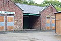
 Stable block - geograph.org.uk - 2130020.jpg 1,824 × 1,216; 785 KB
-
 Stable block - geograph.org.uk - 2130044.jpg 1,824 × 1,216; 903 KB
-
 Stream in Golf Course - geograph.org.uk - 3202430.jpg 640 × 480; 89 KB
-
 Tangled Wood - geograph.org.uk - 2928961.jpg 640 × 528; 182 KB
-
 The Great North Road, Gosforth - geograph.org.uk - 5033993.jpg 2,000 × 1,500; 589 KB
-
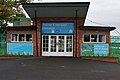
 The Main Entrance, Newcastle Racecourse - geograph.org.uk - 4165019.jpg 4,608 × 3,456; 3.28 MB
-
 Through the hedge - geograph.org.uk - 3661017.jpg 2,560 × 1,920; 2.34 MB
-
 Track through Golf Course - geograph.org.uk - 3202429.jpg 640 × 480; 153 KB
-
 Village Green, North Gosforth - geograph.org.uk - 3767346.jpg 640 × 480; 89 KB
-
 Western exit from Gosforth Park - geograph.org.uk - 3767350.jpg 640 × 480; 100 KB
-
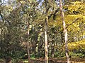
 Woodland in Gosforth Park - geograph.org.uk - 958271.jpg 640 × 480; 136 KB
-
 Woodland off Salter's Lane - geograph.org.uk - 3583998.jpg 576 × 640; 145 KB
-
 Woodland Trail through Gosforth Wood - geograph.org.uk - 963063.jpg 640 × 480; 145 KB
-
 Woodland within Gosforth Park - geograph.org.uk - 952869.jpg 480 × 640; 146 KB
-
 Young Buck Roe Deer - geograph.org.uk - 2747352.jpg 519 × 640; 124 KB


.jpg)


