Category:North Horsham
English: North Horsham is a civil parish in the district of Horsham in West Sussex, England, covering the northern part of the Horsham town area. According to the 2001 census the district had a population of 21,348.
civil parish in West Sussex, United Kingdom | |||||
| Upload media | |||||
| Instance of | |||||
|---|---|---|---|---|---|
| Location | Horsham, West Sussex, South East England, England | ||||
| Area |
| ||||
| official website | |||||
 | |||||
Subcategories
This category has the following 4 subcategories, out of 4 total.
Media in category "North Horsham"
The following 200 files are in this category, out of 352 total.
(previous page) (next page)-
 "The Norfolk Arms" PH - geograph.org.uk - 4840191.jpg 800 × 600; 164 KB
-
 A serious fence^ - geograph.org.uk - 2941331.jpg 640 × 430; 55 KB
-

-
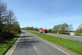 A264 towards Horsham - geograph.org.uk - 5753491.jpg 640 × 428; 94 KB
-
 Advert, Broadlands Business Campus - geograph.org.uk - 4027655.jpg 640 × 430; 110 KB
-
 Allotments on the edge of Horsham - geograph.org.uk - 4841313.jpg 800 × 600; 96 KB
-
 Approaching Moorhead Roundabout - geograph.org.uk - 4410882.jpg 640 × 426; 36 KB
-
 Avebury Close - geograph.org.uk - 4840236.jpg 800 × 600; 106 KB
-
 B2195 - geograph.org.uk - 4426579.jpg 640 × 426; 45 KB
-
 B2195 - geograph.org.uk - 4426585.jpg 640 × 426; 56 KB
-
 B2195 - geograph.org.uk - 4426600.jpg 640 × 426; 62 KB
-
 B2195 - geograph.org.uk - 4426616.jpg 640 × 426; 43 KB
-
 B2195 - geograph.org.uk - 4426621.jpg 640 × 426; 66 KB
-
 B2195 on the east side of Horsham - geograph.org.uk - 2959545.jpg 3,264 × 2,448; 5.48 MB
-
 B2195, Leechpool Wood - geograph.org.uk - 4426625.jpg 640 × 426; 68 KB
-

-
 Barrier across the footpath - geograph.org.uk - 4014895.jpg 640 × 430; 134 KB
-
 Bartholomew Way - geograph.org.uk - 4840228.jpg 800 × 600; 103 KB
-
 Beech Road, Roffey, Horsham - geograph.org.uk - 3330811.jpg 640 × 458; 266 KB
-
 Big barn at Moated House Farm - geograph.org.uk - 2871454.jpg 4,000 × 3,000; 3.43 MB
-
 Bluebells and coppicing, Morris's Wood - geograph.org.uk - 4015003.jpg 640 × 430; 153 KB
-
 Bluebells, Brookhurst Wood - geograph.org.uk - 4027692.jpg 640 × 430; 143 KB
-
 Bluebells, Graylands Plantation - geograph.org.uk - 4014926.jpg 640 × 430; 145 KB
-
 Bluebells, Graylands Plantation - geograph.org.uk - 4014945.jpg 640 × 430; 152 KB
-
 Bluebells, Morris's Wood - geograph.org.uk - 4014951.jpg 640 × 430; 119 KB
-
 Bramblehurst - geograph.org.uk - 4010859.jpg 640 × 430; 137 KB
-

-
 Bridge over Channells Brook - geograph.org.uk - 4840482.jpg 800 × 600; 197 KB
-
 Bridleway - geograph.org.uk - 4027726.jpg 640 × 430; 142 KB
-
 Bridleway by Great Brookhurst Gill - geograph.org.uk - 4027697.jpg 640 × 430; 142 KB
-
 Bridleway by the railway line - geograph.org.uk - 4027728.jpg 640 × 430; 139 KB
-

-
 Bridleway going east crosses stream - geograph.org.uk - 4840529.jpg 800 × 600; 174 KB
-
 Bridleway going east from Rusper Road - geograph.org.uk - 4840523.jpg 800 × 600; 204 KB
-

-
 Bridleway near the centre of Horsham - geograph.org.uk - 3041527.jpg 3,264 × 2,448; 5.61 MB
-
 Bridleway, Brookhurst Wood - geograph.org.uk - 4027712.jpg 640 × 430; 149 KB
-
 Broadlands Business Campus - geograph.org.uk - 4027664.jpg 640 × 430; 96 KB
-
 Broadlands Business Campus - geograph.org.uk - 4027667.jpg 640 × 430; 89 KB
-
 Broadlands Business Campus - geograph.org.uk - 4027671.jpg 640 × 418; 118 KB
-
 Broadlands Business Park on Langhurstwood Road - geograph.org.uk - 2867920.jpg 4,000 × 3,000; 4.17 MB
-
 Brookhurst Wood - geograph.org.uk - 4027661.jpg 640 × 430; 116 KB
-
 Brookhurst Wood - geograph.org.uk - 4027700.jpg 640 × 430; 138 KB
-
 Brookhurst Wood Landfill Site - geograph.org.uk - 4035095.jpg 640 × 430; 66 KB
-
 Brookhurst Wood Landfill Site - geograph.org.uk - 4035097.jpg 640 × 430; 78 KB
-
 Brookhurst Wood Landfill Site - geograph.org.uk - 4190119.jpg 640 × 430; 107 KB
-
 Brookhurst Wood Landfill Site - geograph.org.uk - 4190238.jpg 640 × 386; 68 KB
-
 Bus stop on Crawley Road - geograph.org.uk - 4846391.jpg 600 × 800; 117 KB
-

-
 Cattery on Langhurstwood Road - geograph.org.uk - 2867895.jpg 4,000 × 3,000; 3.56 MB
-
 Cedar Farm on Old Holbrook - geograph.org.uk - 2871299.jpg 4,000 × 3,000; 3.41 MB
-
 Channels Brook - culvert under the A264 - geograph.org.uk - 1972896.jpg 640 × 428; 172 KB
-
 Conveyor belt - geograph.org.uk - 4190245.jpg 640 × 430; 131 KB
-
 Conveyor belt - geograph.org.uk - 4190247.jpg 640 × 430; 120 KB
-
 Conveyor Belt by the railway line - geograph.org.uk - 4191511.jpg 640 × 275; 74 KB
-
 Conveyor over Langhurstwood Road - geograph.org.uk - 2867942.jpg 4,000 × 3,000; 3.52 MB
-
 Conveyor over Langhurstwood Road - geograph.org.uk - 4832807.jpg 800 × 600; 143 KB
-
 Conveyor, Langhurstwood Rd - geograph.org.uk - 4027681.jpg 640 × 430; 126 KB
-
 Cook Road bridge over Channels Brook - geograph.org.uk - 1972953.jpg 640 × 428; 174 KB
-
 Cottingham Avenue at the junction of Pondtail Road - geograph.org.uk - 5267567.jpg 2,048 × 1,536; 1.5 MB
-
 Covers on at Brookhurst Wood landfill site - geograph.org.uk - 2867955.jpg 4,000 × 3,000; 3.36 MB
-
 Crawley Road at the junction of Leith View Road - geograph.org.uk - 5268543.jpg 2,048 × 1,536; 1.5 MB
-
 Crawley Road, Horsham - geograph.org.uk - 2708766.jpg 4,320 × 3,240; 4.92 MB
-
 Crawley Road, Roffey - geograph.org.uk - 5753513.jpg 640 × 480; 150 KB
-
 Crawley Road, Roffey - geograph.org.uk - 5753524.jpg 640 × 428; 143 KB
-
 Crawley Road, Roffey - geograph.org.uk - 5753591.jpg 640 × 428; 92 KB
-
 Crawley Road, Roffey - geograph.org.uk - 5753604.jpg 640 × 480; 114 KB
-
 Crawley Road, Roffey - geograph.org.uk - 5753611.jpg 640 × 480; 117 KB
-
 Crawley Road, Roffey - geograph.org.uk - 5753619.jpg 640 × 480; 148 KB
-
 Crawley Road, Roffey - geograph.org.uk - 5753712.jpg 640 × 480; 125 KB
-
 Crawley Road, Roffey - geograph.org.uk - 5753760.jpg 640 × 480; 125 KB
-
 Crawley Road, Roffey - geograph.org.uk - 5753774.jpg 640 × 480; 150 KB
-
 Crawley Road, Roffey - geograph.org.uk - 5753783.jpg 640 × 428; 134 KB
-

-
 Crop field on Hurst Hill - geograph.org.uk - 2872527.jpg 4,000 × 3,000; 3.33 MB
-
 Cul-de-sac off Elgar Way - geograph.org.uk - 3313000.jpg 640 × 426; 42 KB
-
 Dale Close - geograph.org.uk - 51039.jpg 640 × 480; 119 KB
-
 Dead oak by Northlands Farm - geograph.org.uk - 1972414.jpg 640 × 428; 129 KB
-
 Disused brickworks - geograph.org.uk - 4190240.jpg 640 × 341; 48 KB
-
 Disused brickworks - geograph.org.uk - 4190244.jpg 640 × 430; 81 KB
-
 Disused building - geograph.org.uk - 4190242.jpg 640 × 430; 77 KB
-
 Disused building on the road to Graylands - geograph.org.uk - 2869557.jpg 4,000 × 3,000; 3.57 MB
-
 Elgar Way - geograph.org.uk - 3312996.jpg 640 × 426; 42 KB
-
 Enclosed footpath - geograph.org.uk - 4015078.jpg 640 × 430; 136 KB
-
 Entering Horsham - geograph.org.uk - 4426583.jpg 640 × 426; 58 KB
-
 Entering Horsham on the B2195 - geograph.org.uk - 5587315.jpg 3,433 × 2,573; 2.59 MB
-
 Entrance Lodge, Graylands - geograph.org.uk - 4010889.jpg 640 × 430; 89 KB
-
 Entrance to Broadlands Business Park - geograph.org.uk - 2867911.jpg 4,000 × 3,000; 4.1 MB
-
 Entrance to clay quarry - geograph.org.uk - 2867930.jpg 4,000 × 3,000; 4.28 MB
-

-
 Factory entrance - geograph.org.uk - 4027677.jpg 640 × 430; 96 KB
-
 Factory in the woods - geograph.org.uk - 4027732.jpg 640 × 430; 133 KB
-
 Farmland on the edge of Horsham - geograph.org.uk - 2751636.jpg 640 × 430; 34 KB
-
 Farmland, Pondtail Farm - geograph.org.uk - 4010825.jpg 640 × 430; 64 KB
-
 Farmland, Pondtail Farm - geograph.org.uk - 4010828.jpg 640 × 430; 66 KB
-
 Field at Moorhead Farm - geograph.org.uk - 4114155.jpg 640 × 427; 96 KB
-
 Field near Graylands - geograph.org.uk - 4014878.jpg 640 × 430; 89 KB
-
 Field near Graylands - geograph.org.uk - 4014910.jpg 640 × 430; 95 KB
-

-
 Flats on Blenheim Road, Horsham - geograph.org.uk - 5268257.jpg 1,998 × 1,468; 749 KB
-
 Flats on Blenheim Road, Horsham - geograph.org.uk - 5268262.jpg 2,010 × 1,484; 780 KB
-
 Flats on St Marks Lane, Littlehaven - geograph.org.uk - 5269740.jpg 2,006 × 1,478; 1.01 MB
-
 Footbridge with a view of house at Holbrook Park - geograph.org.uk - 2871413.jpg 4,000 × 3,000; 3.63 MB
-
 Footbridge, Great Brookhurst Gill - geograph.org.uk - 4014975.jpg 640 × 430; 141 KB
-
 Footpath 1573 through Graylands Plantation - geograph.org.uk - 2869587.jpg 4,000 × 3,000; 3.54 MB
-
 Footpath along the woodland edge - geograph.org.uk - 4014899.jpg 640 × 430; 119 KB
-
 Footpath arrives at Harwood Road - geograph.org.uk - 4846407.jpg 800 × 600; 182 KB
-
 Footpath junction on Langhurstwood Road - geograph.org.uk - 4832829.jpg 800 × 600; 147 KB
-
 Footpath junction on Rusper Road - geograph.org.uk - 4840492.jpg 800 × 600; 119 KB
-
 Footpath junction, Graylands Plantation - geograph.org.uk - 4014932.jpg 640 × 430; 128 KB
-
 Footpath off Langhurstwood Road - geograph.org.uk - 2961113.jpg 3,264 × 2,448; 4.02 MB
-
 Footpath sign by High Wood - geograph.org.uk - 4841307.jpg 800 × 600; 236 KB
-
 Footpath signpost - geograph.org.uk - 4015076.jpg 640 × 430; 152 KB
-
 Footpath stile by Old Holbrook - geograph.org.uk - 4832982.jpg 800 × 600; 148 KB
-
 Footpath to Graylands - geograph.org.uk - 4014872.jpg 640 × 430; 98 KB
-
 Footpath to Moated House Farm - geograph.org.uk - 2871444.jpg 4,000 × 3,000; 3.62 MB
-
 Footpath to Morris's Wood - geograph.org.uk - 2869619.jpg 4,000 × 3,000; 3.44 MB
-
 Footpath towards Graylands - geograph.org.uk - 1972393.jpg 640 × 428; 128 KB
-
 Footpath, Graylands Plantation - geograph.org.uk - 4014923.jpg 640 × 430; 144 KB
-
 Footpath, Graylands Plantation - geograph.org.uk - 4014940.jpg 640 × 430; 150 KB
-
 Footpath, Morris's Wood - geograph.org.uk - 4014993.jpg 640 × 430; 142 KB
-
 Footpath, Morris's Wood - geograph.org.uk - 4015023.jpg 640 × 430; 145 KB
-
 Footpath, Morris's Wood - geograph.org.uk - 4015032.jpg 640 × 430; 148 KB
-
 Footpath, Northlands Copse - geograph.org.uk - 4015046.jpg 640 × 430; 141 KB
-
 Footpath, Northlands Copse - geograph.org.uk - 4015063.jpg 640 × 430; 147 KB
-
 Footpath, Northlands Copse - geograph.org.uk - 4015075.jpg 640 × 430; 136 KB
-
 Forest Grange - geograph.org.uk - 3295884.jpg 640 × 478; 86 KB
-
 Forest Rd - geograph.org.uk - 3295870.jpg 640 × 419; 51 KB
-
 Forest Rd - geograph.org.uk - 3295880.jpg 640 × 426; 109 KB
-
 Forest Rd, Roffey - geograph.org.uk - 3295873.jpg 640 × 426; 76 KB
-
 Forest Road Horsham - geograph.org.uk - 2959729.jpg 3,264 × 2,448; 5.62 MB
-
 Former brickworks - geograph.org.uk - 4191513.jpg 640 × 316; 58 KB
-
 Former brickworks and conveyor belt - geograph.org.uk - 4191514.jpg 640 × 394; 64 KB
-
 Former clay pit - geograph.org.uk - 4027637.jpg 640 × 430; 124 KB
-
 Former clay pit - geograph.org.uk - 4027638.jpg 640 × 430; 127 KB
-
 Garages on Manor Road, Littlehaven - geograph.org.uk - 5268296.jpg 2,048 × 1,536; 968 KB
-
 Grayland Farm Barns - geograph.org.uk - 4010842.jpg 640 × 430; 54 KB
-
 Graylands - geograph.org.uk - 4014885.jpg 640 × 430; 66 KB
-
 Graylands - geograph.org.uk - 4014889.jpg 640 × 430; 103 KB
-
 Graylands - geograph.org.uk - 4014903.jpg 640 × 430; 86 KB
-
 Graylands - geograph.org.uk - 4014911.jpg 640 × 430; 72 KB
-

-
 Graylands Plantation - geograph.org.uk - 4014921.jpg 640 × 430; 136 KB
-
 Great Brookhurst Gill - geograph.org.uk - 4014978.jpg 640 × 430; 144 KB
-
 Great Brookhurst Gill - geograph.org.uk - 4014983.jpg 640 × 430; 153 KB
-
 Great Brookhurst Gill - geograph.org.uk - 4027689.jpg 640 × 430; 137 KB
-
 Great Brookhurst Gill - geograph.org.uk - 4027695.jpg 640 × 430; 143 KB
-
 Great Brookhurst Gill - geograph.org.uk - 4027715.jpg 640 × 430; 142 KB
-
 Green Lane going west - geograph.org.uk - 4827997.jpg 800 × 600; 175 KB
-
 Green Lane off Horsham Road - geograph.org.uk - 2872579.jpg 4,000 × 3,000; 3.54 MB
-
 Green Lane, Rusper - geograph.org.uk - 3664924.jpg 4,320 × 3,240; 4.71 MB
-
 Green's - geograph.org.uk - 4010813.jpg 640 × 430; 68 KB
-
 Gunbarn Crossing - geograph.org.uk - 4027737.jpg 640 × 430; 109 KB
-
 Harwood Road, Roffey - geograph.org.uk - 5269690.jpg 2,048 × 1,536; 1.5 MB
-
 Heather Close - geograph.org.uk - 1290926.jpg 640 × 430; 100 KB
-
 High Wood - geograph.org.uk - 3295882.jpg 640 × 426; 112 KB
-
 House by the railway line - geograph.org.uk - 2749669.jpg 640 × 430; 57 KB
-
 House on Littlehaven Lane - geograph.org.uk - 5268788.jpg 2,032 × 1,514; 789 KB
-
 House on Pondtail Road, Littlehaven - geograph.org.uk - 5269739.jpg 2,048 × 1,536; 1.57 MB
-
 Houses by the railway line - geograph.org.uk - 2749651.jpg 640 × 379; 56 KB
-
 Houses on Crawley Road, Roffey - geograph.org.uk - 5267652.jpg 2,048 × 1,536; 1.48 MB
-
 Houses on Crawley Road, Roffey - geograph.org.uk - 5268355.jpg 2,048 × 1,536; 1.5 MB
-
 Houses on Crawley Road, Roffey - geograph.org.uk - 5753704.jpg 640 × 480; 141 KB
-
 Houses on Horsham Road - geograph.org.uk - 2872573.jpg 4,000 × 3,000; 3.37 MB
-
 Houses on Parsonage Road, Horsham - geograph.org.uk - 5268791.jpg 2,048 × 1,536; 1.49 MB
-
 Hurst Hill - geograph.org.uk - 4406055.jpg 640 × 426; 87 KB
-
 Hurst Hill - geograph.org.uk - 4406363.jpg 3,008 × 1,872; 1.47 MB
-
 Junction at the west end of Green Lane - geograph.org.uk - 4827568.jpg 800 × 600; 161 KB
-
 Langhurst House entrance - geograph.org.uk - 4027632.jpg 640 × 430; 128 KB
-
 Langhurst Moat - geograph.org.uk - 4010855.jpg 640 × 430; 93 KB
-
 Langhurstwood Close - geograph.org.uk - 4015084.jpg 640 × 405; 91 KB
-
 Langhurstwood Rd - geograph.org.uk - 4010840.jpg 640 × 430; 88 KB
-
 Langhurstwood Rd - geograph.org.uk - 4010845.jpg 640 × 430; 100 KB
-
 Langhurstwood Rd - geograph.org.uk - 4010877.jpg 640 × 430; 114 KB
-
 Langhurstwood Rd - geograph.org.uk - 4010880.jpg 640 × 430; 121 KB
-
 Langhurstwood Rd - geograph.org.uk - 4010882.jpg 640 × 430; 110 KB
-
 Langhurstwood Rd - geograph.org.uk - 4010890.jpg 640 × 430; 130 KB
-
 Langhurstwood Rd - geograph.org.uk - 4014862.jpg 640 × 430; 101 KB
-
 Langhurstwood Rd - geograph.org.uk - 4015079.jpg 640 × 430; 129 KB
-
 Langhurstwood Rd - geograph.org.uk - 4015080.jpg 640 × 430; 116 KB
-
 Langhurstwood Rd - geograph.org.uk - 4027629.jpg 640 × 430; 108 KB
-
 Langhurstwood Rd - geograph.org.uk - 4027635.jpg 640 × 430; 118 KB
-
 Langhurstwood Rd - geograph.org.uk - 4027642.jpg 640 × 430; 121 KB
-
 Langhurstwood Road at the junction of the A264 - geograph.org.uk - 5846639.jpg 2,048 × 1,536; 1.53 MB
-
 Langhurstwood Road, Warnham - geograph.org.uk - 5846644.jpg 2,048 × 1,536; 1.86 MB
-
 Lansdown Close - geograph.org.uk - 4840204.jpg 800 × 600; 100 KB
-

-
 Lay-by A264 - geograph.org.uk - 4887783.jpg 640 × 480; 57 KB
-
 Leaving Horsham, Forest Rd - geograph.org.uk - 3295874.jpg 640 × 426; 79 KB
-
 Leechpool Lane at the junction of Crawley Road - geograph.org.uk - 5268358.jpg 2,048 × 1,536; 1.49 MB
-
 Leith View Road, Roffey - geograph.org.uk - 5268522.jpg 2,048 × 1,536; 1.5 MB
-
 Leith View Road, Roffey - geograph.org.uk - 5268527.jpg 2,048 × 1,536; 1.51 MB
-
 Leith View Road, Roffey - geograph.org.uk - 5268536.jpg 2,048 × 1,536; 1.24 MB
-
 Leith View Road, Roffey - geograph.org.uk - 5268538.jpg 2,048 × 1,536; 1.51 MB
-
 Lemmington Way, Horsham - geograph.org.uk - 2708921.jpg 4,320 × 3,240; 3.76 MB
-
 Lemmington Way, Horsham - geograph.org.uk - 2708928.jpg 4,320 × 3,240; 3.78 MB
-

-
 Level crossing for footpath - geograph.org.uk - 4840205.jpg 800 × 600; 199 KB
-
 Level Crossing on Parsonage Road - geograph.org.uk - 1911189.jpg 640 × 480; 114 KB
-
 Level crossing on Rusper Road - geograph.org.uk - 4579718.jpg 640 × 480; 92 KB


,_Wimland_Road,_Faygate,_West_Sussex_-_geograph.org.uk_-_27031.jpg)


