Category:North Moreton
village and civil parish in South Oxfordshire, England  | |||||
| Upload media | |||||
| Instance of | |||||
|---|---|---|---|---|---|
| Location | South Oxfordshire, Oxfordshire, South East England, England | ||||
| Area |
| ||||
| official website | |||||
 | |||||
English: North Moreton is a village and civil parish in South Oxfordshire. Until the 1974 reorganisation of local government it was part of Berkshire.
Subcategories
This category has the following 5 subcategories, out of 5 total.
Media in category "North Moreton"
The following 45 files are in this category, out of 45 total.
-
 A train on the down main to Didcot - geograph.org.uk - 2360646.jpg 1,500 × 1,000; 350 KB
-
 Abandoned benchmark on house on Dunsomer Hill - geograph.org.uk - 2001828.jpg 768 × 1,024; 174 KB
-
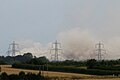
 Almost Set - geograph.org.uk - 4086723.jpg 1,024 × 656; 41 KB
-
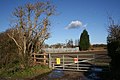
 At White Lees Farm - geograph.org.uk - 6299592.jpg 1,024 × 775; 238 KB
-
 Benchmark on Cherry Court, Wallingford Road - geograph.org.uk - 2001677.jpg 768 × 1,024; 315 KB
-

-

-
 Benchmark on The Corner House - geograph.org.uk - 6431767.jpg 1,024 × 832; 309 KB
-
 Benchmark on tower buttress of All Saints Church - geograph.org.uk - 6431801.jpg 1,024 × 956; 486 KB
-
 Benchmark on ^12 Dunsomer Hill - geograph.org.uk - 2007546.jpg 768 × 1,024; 233 KB
-
 Cleaned up cutting - geograph.org.uk - 1815628.jpg 1,024 × 768; 194 KB
-

-
 Elm Road, North Moreton - geograph.org.uk - 6461803.jpg 3,238 × 2,380; 1.99 MB
-
 Farmland north of North Moreton - geograph.org.uk - 6299846.jpg 1,024 × 777; 214 KB
-
 Frozen branches - geograph.org.uk - 3348433.jpg 1,024 × 683; 263 KB
-
 Going through the cut - geograph.org.uk - 1498502.jpg 640 × 427; 105 KB
-
 Grassland by Hadden Hill, North Moreton - geograph.org.uk - 6315555.jpg 1,920 × 1,280; 648 KB
-
 Hadden Hill, North Moreton - geograph.org.uk - 6315554.jpg 1,920 × 1,280; 805 KB
-
 Heading to the bridge - geograph.org.uk - 1815552.jpg 1,024 × 768; 133 KB
-
 Ice by White Lees Farm - geograph.org.uk - 2801121.jpg 3,648 × 2,700; 3.05 MB
-
 Ice covered tree - geograph.org.uk - 3348571.jpg 728 × 800; 185 KB
-
 Ice Tree - geograph.org.uk - 3348423.jpg 1,024 × 683; 278 KB
-
 In The Moreton Cutting - geograph.org.uk - 3945759.jpg 640 × 430; 62 KB
-
 Light Snow near North Moreton - geograph.org.uk - 2801097.jpg 3,492 × 2,460; 2.6 MB
-
 Little patch of woodland - geograph.org.uk - 921325.jpg 640 × 403; 101 KB
-
 Looking across the cutting - geograph.org.uk - 1815540.jpg 1,024 × 768; 157 KB
-
 Mill Brook and Kibble Ditch - geograph.org.uk - 3272310.jpg 2,560 × 1,920; 1.59 MB
-
 New View - geograph.org.uk - 6389274.jpg 1,600 × 1,067; 259 KB
-
 North Moreton from the Footpath - geograph.org.uk - 1815604.jpg 1,024 × 768; 209 KB
-
 Pink Elephant on Parade - geograph.org.uk - 4407190.jpg 1,024 × 683; 262 KB
-
 Playground at North Moreton - geograph.org.uk - 4821271.jpg 1,024 × 768; 173 KB
-
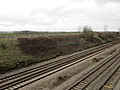
 Railway cutting at South Moreton - geograph.org.uk - 2360650.jpg 1,500 × 1,000; 270 KB
-
 Raised path in North Moreton - geograph.org.uk - 2360636.jpg 1,000 × 1,500; 463 KB
-
 Small wood on Hadden Hill - geograph.org.uk - 1353167.jpg 640 × 427; 72 KB
-
 The entrance to Wallingford Window Company - geograph.org.uk - 4980426.jpg 2,048 × 1,536; 1.44 MB
-
 The final moment - geograph.org.uk - 6241375.jpg 1,024 × 682; 84 KB
-
 The new bridge - geograph.org.uk - 1815526.jpg 1,024 × 768; 187 KB
-
 The road to the Wittenhams - geograph.org.uk - 6299825.jpg 768 × 1,024; 207 KB
-
 Tower of All Saints Church - geograph.org.uk - 6431833.jpg 668 × 1,024; 155 KB
-

-
 Vintage Tractor, Bear Lane, North Moreton - geograph.org.uk - 2785191.jpg 1,600 × 1,056; 552 KB
-
 Wallingford Window Company - geograph.org.uk - 4980467.jpg 2,048 × 1,536; 1.49 MB
-
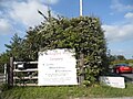
 Warnings on the gate - geograph.org.uk - 1056011.jpg 640 × 426; 72 KB
-
 Waste land by the track - geograph.org.uk - 1056021.jpg 640 × 426; 76 KB
-


