Category:North Mymms
village and civil parish in Hertfordshire, UK | |||||
| Upload media | |||||
| Instance of | |||||
|---|---|---|---|---|---|
| Location | Welwyn Hatfield, Hertfordshire, East of England, England | ||||
 | |||||
Subcategories
This category has the following 7 subcategories, out of 7 total.
B
F
- The Folly Arch (3 F)
N
- North Mymms Park, Hertfordshire (40 F)
- North Mymms War Memorial (2 F)
O
- The Old Maypole, North Mymms (3 F)
S
- St Mary's Church, North Mymms (14 F)
W
Media in category "North Mymms"
The following 200 files are in this category, out of 275 total.
(previous page) (next page)-
 "Old Maypole" public house, Water End, Hertfordshire - geograph.org.uk - 2003996.jpg 3,264 × 2,448; 746 KB
-
 A1(M) Motorway near Water End - geograph.org.uk - 1037146.jpg 640 × 480; 90 KB
-
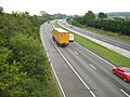
 A1(M) North. North Mymms. - geograph.org.uk - 111764.jpg 640 × 479; 70 KB
-
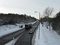
 A1(M) northbound - geograph.org.uk - 5682756.jpg 640 × 428; 96 KB
-
 A1(M) northbound - geograph.org.uk - 5682772.jpg 640 × 428; 99 KB
-
 A1(M) northbound near Water End - geograph.org.uk - 2513426.jpg 640 × 480; 41 KB
-
 A1(M) South. North Mymms. - geograph.org.uk - 111779.jpg 640 × 479; 76 KB
-
 A1(M), north - geograph.org.uk - 4646668.jpg 640 × 401; 48 KB
-
 A1(M), North Mymms - geograph.org.uk - 4646670.jpg 640 × 400; 44 KB
-
 A1000 and A1001 part company - geograph.org.uk - 6062925.jpg 1,024 × 684; 232 KB
-
 A1000, Great North Road - geograph.org.uk - 6062907.jpg 1,024 × 684; 317 KB
-
 A1001 overbridge, A1(M) - geograph.org.uk - 4646674.jpg 640 × 405; 50 KB
-
 A1001, South Way, Hatfield - geograph.org.uk - 2202602.jpg 640 × 480; 59 KB
-
 Approaching junction 2 northbound - geograph.org.uk - 2513444.jpg 640 × 480; 40 KB
-
 Barrier at the junction of Pooleys Lane and Travellers Close - geograph.org.uk - 4581375.jpg 2,512 × 1,854; 1.72 MB
-
 Blocked gateway, north side, Swanley Bar Lane - geograph.org.uk - 4431622.jpg 1,024 × 768; 149 KB
-
 Blue Bridge Road, Brookmans Park - geograph.org.uk - 4431419.jpg 1,024 × 768; 125 KB
-
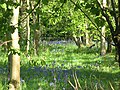 Bluebells in Cangsley Grove - geograph.org.uk - 1334198.jpg 640 × 480; 211 KB
-
 Bradmore Green, Brookmans Park - geograph.org.uk - 5353487.jpg 640 × 480; 80 KB
-
 Bradmore Lane, Water End - geograph.org.uk - 5136194.jpg 2,304 × 1,728; 812 KB
-
 Bradmore Lane, Water End - geograph.org.uk - 5136205.jpg 2,304 × 1,728; 785 KB
-
 Bradmore Lane, Water End - geograph.org.uk - 5136208.jpg 2,304 × 1,728; 837 KB
-

-
 Brick Kiln Woods, Water End - geograph.org.uk - 5136212.jpg 2,304 × 1,728; 1.99 MB
-
 Brookmans Park shops - geograph.org.uk - 2234785.jpg 1,600 × 1,200; 663 KB
-
 Brookmans Park station - geograph.org.uk - 2234812.jpg 1,600 × 1,200; 562 KB
-
 Brookmans Park station platform - geograph.org.uk - 2234817.jpg 1,600 × 1,200; 594 KB
-
 Buildings at the transmitting station - geograph.org.uk - 3018412.jpg 1,920 × 2,560; 1.09 MB
-
 Bull's Lane, Welham Green - geograph.org.uk - 2234675.jpg 1,600 × 1,200; 524 KB
-
 Bull's Lane, Welham Green - geograph.org.uk - 2234683.jpg 1,600 × 1,200; 500 KB
-
 Bullen's Green Lane, Roestock - geograph.org.uk - 4581616.jpg 2,560 × 1,920; 2.02 MB
-
 Bungalow on Swanland Road, Water End - geograph.org.uk - 5152514.jpg 2,304 × 1,728; 821 KB
-
 Bus stop and shelter on Station Road - geograph.org.uk - 5353494.jpg 640 × 480; 72 KB
-
 By the ECML - geograph.org.uk - 4143508.jpg 640 × 371; 40 KB
-
 By-way running parallel to the A1M - geograph.org.uk - 3018368.jpg 2,560 × 1,920; 1.06 MB
-
 Car Park at the Queen Mother Hospital for Animals - geograph.org.uk - 5990688.jpg 4,608 × 3,456; 3.88 MB
-

-

-
 Coal post - geograph.org.uk - 3368543.jpg 3,240 × 4,320; 4.07 MB
-
 Coal post - geograph.org.uk - 3368546.jpg 3,240 × 4,320; 3.79 MB
-
 Construction site, Brookmans Avenue (1) - geograph.org.uk - 4431297.jpg 1,024 × 768; 116 KB
-
 Construction site, Brookmans Avenue (2) - geograph.org.uk - 4431300.jpg 1,024 × 768; 158 KB
-
 Corporation of London coal-tax post, Well Lane - geograph.org.uk - 3426272.jpg 723 × 1,024; 319 KB
-
 Cottages on Tollgate Road, North Mymms - geograph.org.uk - 3407140.jpg 2,048 × 1,536; 1.57 MB
-

-
 Countryside south of Welham Green - geograph.org.uk - 4174470.jpg 640 × 360; 32 KB
-
 Cricket Ground, North Mymms. - geograph.org.uk - 111803.jpg 640 × 479; 77 KB
-

-
 Dellsome Lane, Welham Green - geograph.org.uk - 4581668.jpg 2,456 × 1,772; 1.14 MB
-
 Dellsome Lane, Welham Green - geograph.org.uk - 4581684.jpg 2,518 × 1,862; 1.05 MB
-
 Dixons Hill Road, North Mymms - geograph.org.uk - 111770.jpg 640 × 445; 73 KB
-
 Drain on the north side of Swanley Bar Lane - geograph.org.uk - 4431608.jpg 1,012 × 759; 218 KB
-
 East Coast Main Line - geograph.org.uk - 5353392.jpg 640 × 480; 79 KB
-
 East Coast Main Line, Brookmans Park - geograph.org.uk - 5353489.jpg 640 × 480; 62 KB
-

-
 East Lodge, North Mymms (25780822862).jpg 4,288 × 3,216; 4.09 MB
-
 Elizabeth II postbox on Holloways Lane, Welham Green - geograph.org.uk - 5358974.jpg 2,136 × 2,848; 1.22 MB
-
 Entrance to field on Shepherds Way - geograph.org.uk - 4591381.jpg 2,560 × 1,920; 2.07 MB
-
 Entrance to industrial site, Water End - geograph.org.uk - 5153304.jpg 2,304 × 1,728; 850 KB
-
 Entrance to Potters Bar Car Boot Sale site - geograph.org.uk - 4433216.jpg 1,024 × 768; 179 KB
-
 Entrance to Queenswood School - geograph.org.uk - 3283143.jpg 2,560 × 1,920; 1.12 MB
-
 Entrance to Ramsey Close - geograph.org.uk - 4433249.jpg 1,024 × 768; 172 KB
-
 Entrance to the Queen Mother Hospital for Animals - geograph.org.uk - 5990693.jpg 4,608 × 3,456; 3.85 MB
-
 Entrance to Welham Green station - geograph.org.uk - 2697443.jpg 1,600 × 1,200; 597 KB
-
 Exit gate of Queenswood School - geograph.org.uk - 2987240.jpg 2,560 × 1,920; 1.11 MB
-
 Exit of the Royal Veterinary College - geograph.org.uk - 5990696.jpg 4,608 × 3,456; 4.06 MB
-
 Exit only from Queenswood School - geograph.org.uk - 4433247.jpg 1,024 × 768; 147 KB
-
 Farmland between Brookmans Park and Potters Bar - geograph.org.uk - 4431571.jpg 1,024 × 768; 143 KB
-
 Farmland off Shepherds Way - geograph.org.uk - 5208145.jpg 640 × 480; 81 KB
-
 Farmland south of Hawkshead Road - geograph.org.uk - 4431565.jpg 1,024 × 768; 138 KB
-

-
 Farmland with hardstanding, off Hawkshead Road - geograph.org.uk - 4431427.jpg 1,024 × 768; 166 KB
-
 Field and pylons in Welham Green - geograph.org.uk - 4581384.jpg 2,560 × 1,920; 1.29 MB
-
 Field by Hawkshead Lane, Brookmans Park - geograph.org.uk - 5137413.jpg 2,304 × 1,728; 843 KB
-
 Field by Hawkshead Lane, Brookmans Park - geograph.org.uk - 5137417.jpg 2,304 × 1,728; 1.14 MB
-
 Field by Shepherds Way, Brookmans Park - geograph.org.uk - 4591392.jpg 2,514 × 1,858; 1.58 MB
-
 Field by Tollgate Road, Roestock - geograph.org.uk - 4581755.jpg 2,560 × 1,920; 2 MB
-
 Field by Westfield - geograph.org.uk - 4161419.jpg 2,474 × 1,798; 1.18 MB
-
 Field entrance by Hawkshead Lane - geograph.org.uk - 5137415.jpg 2,304 × 1,728; 831 KB
-
 Field in Welham Green - geograph.org.uk - 4581382.jpg 2,560 × 1,920; 1.35 MB
-
 Field, north side of Hawkshead Road - geograph.org.uk - 4431429.jpg 1,024 × 768; 125 KB
-
 Fields by Tollgate Road, Colney Heath - geograph.org.uk - 2285188.jpg 1,600 × 1,200; 524 KB
-
 Fields by Tollgate Road, Roestock - geograph.org.uk - 5620318.jpg 1,600 × 1,200; 542 KB
-
 Fields by Tollgate Road, Roestock - geograph.org.uk - 5620319.jpg 1,600 × 1,200; 602 KB
-
 Fields off Tollgate Road - geograph.org.uk - 1180237.jpg 640 × 480; 84 KB
-
 Fields off Tollgate Road - geograph.org.uk - 2210247.jpg 1,600 × 1,200; 486 KB
-
 Folly Arch, Gobians Wood Nature Reserve - geograph.org.uk - 5670596.jpg 3,672 × 4,896; 6.43 MB
-
 Foot bridge over the A1M - geograph.org.uk - 3018371.jpg 2,560 × 1,920; 1.17 MB
-
 Footbridge over the A1, Water End - geograph.org.uk - 1334140.jpg 640 × 480; 111 KB
-
 Footbridge, A1(M) - geograph.org.uk - 4646659.jpg 640 × 382; 45 KB
-
 Footbridge, A1(M) - geograph.org.uk - 4646672.jpg 640 × 392; 41 KB
-
 Footpath running between the Bull's Lane and Peplin's Wood - geograph.org.uk - 3018398.jpg 2,560 × 1,920; 1.06 MB
-
 Footpath through wheat field to Welham Green - geograph.org.uk - 3018386.jpg 2,560 × 1,920; 1.13 MB
-
 Footpath to Skimpan's Bridge - geograph.org.uk - 3018391.jpg 2,560 × 1,920; 1.11 MB
-
 Former North Mymms Parochial Schools building (1887) - geograph.org.uk - 2003980.jpg 2,448 × 3,264; 1.03 MB
-
 Frozen River, Tollgate Road, North Mymms. - geograph.org.uk - 111800.jpg 479 × 640; 147 KB
-
 Gate on Hertfordshire Way - geograph.org.uk - 5431013.jpg 5,202 × 3,465; 4.54 MB
-
 George's Wood Road - geograph.org.uk - 5208154.jpg 640 × 480; 74 KB
-
 George's Wood Road at a 102 metres spot height - geograph.org.uk - 4431291.jpg 1,024 × 768; 150 KB
-
 George's Wood Road, Brookmans Park - geograph.org.uk - 4431279.jpg 1,024 × 768; 123 KB
-
 Gobians Pond - geograph.org.uk - 5670602.jpg 4,896 × 3,672; 5.39 MB
-
 Gobians Wood - geograph.org.uk - 5670606.jpg 4,896 × 3,672; 5.43 MB
-
 Gobians Wood - geograph.org.uk - 5670609.jpg 4,896 × 3,672; 5.79 MB
-
 GOC Brookmans Park 006 Colne Cottage, Water End, North Mymms (26026537314).jpg 4,143 × 3,109; 4.02 MB
-

-
 GOC Brookmans Park 031 Church Cottage, North Mymms (26416598760).jpg 4,288 × 3,216; 3.9 MB
-
 Grassland running alongside The Legg - geograph.org.uk - 3018405.jpg 2,560 × 1,920; 1.1 MB
-
 Grazing north of Hawkshead Lane - geograph.org.uk - 5353393.jpg 640 × 480; 57 KB
-
 Grazing off Kentish Lane (B158) - geograph.org.uk - 5208155.jpg 640 × 480; 84 KB
-
 Grazing off Shepherds Way (B157) - geograph.org.uk - 5208148.jpg 640 × 480; 57 KB
-
 Great North Road (A1000) - geograph.org.uk - 5208152.jpg 640 × 480; 98 KB
-
 Great North Road (A1000) - geograph.org.uk - 5208153.jpg 640 × 480; 90 KB
-
 Great North Road (A1000), Welham Green - geograph.org.uk - 5353514.jpg 640 × 480; 108 KB
-
 Great North Road at junction of Church Road - geograph.org.uk - 2323768.jpg 1,594 × 1,103; 266 KB
-
 Greville Close, Welham Green - geograph.org.uk - 4581367.jpg 2,548 × 1,906; 1.19 MB
-
 Hawkshead Lane - geograph.org.uk - 5353388.jpg 640 × 480; 89 KB
-
 Hawkshead Lane, Brookmans Park - geograph.org.uk - 2236917.jpg 1,600 × 1,200; 672 KB
-
 Hawkshead Lane, Brookmans Park - geograph.org.uk - 5137414.jpg 2,304 × 1,728; 832 KB
-
 Hawkshead Lane, North Mymms - geograph.org.uk - 5990698.jpg 4,608 × 3,456; 3.95 MB
-
 Hawkshead Lane, North Mymms - geograph.org.uk - 5990699.jpg 4,608 × 3,456; 3.97 MB
-
 Hawkshead Lane, Water End - geograph.org.uk - 5136035.jpg 2,304 × 1,728; 811 KB
-
 Hawkshead Road, Little Heath - geograph.org.uk - 5136227.jpg 2,304 × 1,728; 819 KB
-

-
 Hertfordshire Way approaching Morven - geograph.org.uk - 5431017.jpg 5,202 × 3,465; 4.86 MB
-
 Holloways Lane, Welham Green - geograph.org.uk - 5358977.jpg 2,848 × 2,136; 1.41 MB
-
 House and buildings at Queenswood School exit - geograph.org.uk - 4433285.jpg 1,024 × 768; 166 KB
-
 House on Hawkshead Lane - geograph.org.uk - 5353386.jpg 640 × 480; 64 KB
-
 House on Kentish Lane (B158) - geograph.org.uk - 5208156.jpg 640 × 480; 92 KB
-
 House on Shepherds Way - geograph.org.uk - 5208144.jpg 640 × 480; 78 KB
-
 House opposite North Mymms Church - geograph.org.uk - 24814.jpg 640 × 480; 18 KB
-
 Houses on Great North Road (A1000) - geograph.org.uk - 5353517.jpg 640 × 480; 61 KB
-

-

-
 Houses on Pooleys Lane, Welham Green - geograph.org.uk - 4581421.jpg 2,496 × 1,832; 1.05 MB
-
 Houses on the east side of Blue Bridge Road - geograph.org.uk - 4431422.jpg 1,024 × 768; 140 KB
-
 Houses on the north side of Brookmans Avenue - geograph.org.uk - 4431304.jpg 1,024 × 768; 149 KB
-
 Houses on the west side of Blue Bridge Road - geograph.org.uk - 4431425.jpg 1,024 × 768; 109 KB
-
 Huggins Lane, Welham Green - geograph.org.uk - 4581688.jpg 2,560 × 1,904; 1.31 MB
-
 Junction in The Woods - geograph.org.uk - 2952987.jpg 2,560 × 1,920; 1.06 MB
-
 Kentish Lane (B158) - geograph.org.uk - 5208157.jpg 640 × 480; 107 KB
-
 Kentish Lane - geograph.org.uk - 5591143.jpg 640 × 480; 227 KB
-
 Kentish Lane at the junction of the A1000 - geograph.org.uk - 4160994.jpg 2,560 × 1,920; 2.02 MB
-
 Kissing gate on the footpath to Potters Bar - geograph.org.uk - 4431431.jpg 1,024 × 768; 107 KB
-
 Knolles Crescent, Welham Green - geograph.org.uk - 4581369.jpg 2,560 × 1,920; 1.99 MB
-
 Large satellite dish at transmitting station - geograph.org.uk - 3018419.jpg 2,560 × 1,920; 1.09 MB
-
 Largest Antenna at the transmitting station - geograph.org.uk - 3018429.jpg 2,560 × 1,920; 1.06 MB
-

-

-

-
 Looking across meadow towards Welham Green - geograph.org.uk - 3018182.jpg 2,560 × 1,920; 1.11 MB
-
 Looking east on Hawkshead Lane - geograph.org.uk - 5353397.jpg 640 × 480; 61 KB
-
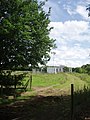
 Lower Farm at Bell Bar - geograph.org.uk - 35454.jpg 640 × 480; 34 KB
-
 Marginal land, north of Swanley Bar Lane - geograph.org.uk - 4431605.jpg 988 × 768; 145 KB
-
 Marshmoor - geograph.org.uk - 5353510.jpg 480 × 640; 129 KB
-
 Marshmoor Crescent, Welham Green - geograph.org.uk - 2202647.jpg 640 × 480; 74 KB
-
 Marshmoor Lane, Welham Green - geograph.org.uk - 2202668.jpg 640 × 480; 109 KB
-
 Marshmoor Lane, Welham Green - geograph.org.uk - 2234620.jpg 1,600 × 1,200; 606 KB
-
 Mimmshall Brook in Water End - geograph.org.uk - 1037519.jpg 640 × 480; 131 KB
-
 Mimmshall Brook, Hawkshead Lane bridge - geograph.org.uk - 1037603.jpg 640 × 480; 116 KB
-
 Mimmshall Brook, near Water End, Hertfordshire - geograph.org.uk - 2004010.jpg 2,448 × 3,264; 1.23 MB
-
 Mimmshall Brook, near Water End, Hertfordshire - geograph.org.uk - 2004027.jpg 2,448 × 3,264; 1.5 MB
-
 Nash's Corner Welham Green Herts - geograph.org.uk - 5318991.jpg 2,592 × 1,944; 1.71 MB
-
 New station on the ECML, Welham Green 1995 - geograph.org.uk - 4853971.jpg 2,389 × 1,426; 3.2 MB
-
 North Mymms Park, Hertfordshire - geograph.org.uk - 4548032.jpg 1,100 × 825; 888 KB
-
 North Mymms Park, Hertfordshire - geograph.org.uk - 4548033.jpg 1,100 × 825; 804 KB
-
 North Mymms Park, Hertfordshire - geograph.org.uk - 4548034.jpg 1,100 × 825; 885 KB
-
 North Mymms Park, Hertfordshire - geograph.org.uk - 4548036.jpg 1,100 × 825; 585 KB
-
 North Mymms Park, Hertfordshire - geograph.org.uk - 4548037.jpg 1,100 × 825; 622 KB
-
 North Mymms Park, Hertfordshire - geograph.org.uk - 4548717.jpg 1,100 × 825; 1.2 MB
-
 Northaw AGI, stn 647, Well Road - geograph.org.uk - 4433278.jpg 1,024 × 768; 243 KB
-
 Northbound A1(M) - geograph.org.uk - 5682678.jpg 640 × 428; 90 KB
-
 Northbound A1(M) - geograph.org.uk - 5682680.jpg 640 × 428; 81 KB
-
 Northbound A1(M) - geograph.org.uk - 5682681.jpg 640 × 428; 94 KB
-
 Old derestricted sign on Swanley Bar Lane - geograph.org.uk - 2696672.jpg 1,200 × 1,600; 598 KB
-
 Parked cars and houses in Ramsey Close - geograph.org.uk - 4433241.jpg 1,024 × 768; 179 KB
-
 Path between Welham Green and Hatfield - geograph.org.uk - 4581412.jpg 2,560 × 1,920; 1.97 MB
-
 Path from Welham Green to Hatfield - geograph.org.uk - 4581404.jpg 2,560 × 1,920; 1.76 MB
-
 Path from Welham Green to Hatfield - geograph.org.uk - 4581729.jpg 2,560 × 1,920; 2 MB
-
 Peplin Wood - geograph.org.uk - 2387392.jpg 640 × 333; 28 KB
-
 Peplins Wood - geograph.org.uk - 2380051.jpg 640 × 430; 28 KB
-
 Pooleys Lane, Welham Green - geograph.org.uk - 4581418.jpg 2,416 × 1,710; 1.14 MB
-
 Pooleys Lane, Welham Green - geograph.org.uk - 4581722.jpg 2,560 × 1,920; 2 MB
-

-
 Pre-Worboys 30mph on Bull's Lane, Welham Green - geograph.org.uk - 2234680.jpg 1,200 × 1,600; 499 KB
-
 Private track to the Royal Veterinary College - geograph.org.uk - 4431589.jpg 1,024 × 768; 131 KB
-

-
 Public footpath to Potters Bar - geograph.org.uk - 4431432.jpg 1,024 × 768; 134 KB
-
 Pylon by Tollgate Road, Roestock - geograph.org.uk - 4581746.jpg 1,920 × 2,560; 1.49 MB
-
 Queen Mother Hospital for Animals sign - geograph.org.uk - 5990704.jpg 2,416 × 1,805; 1.06 MB
-
 Queen Mother Hospital for Animals, North Mymms - geograph.org.uk - 5990701.jpg 4,608 × 3,456; 4 MB
-
 Really, it is uphill^ - geograph.org.uk - 1334197.jpg 640 × 480; 185 KB
-
 Restricted byway off Swanland Road - geograph.org.uk - 5353380.jpg 640 × 480; 116 KB
-
-

-
 River Colne, In spate at North Mymms - geograph.org.uk - 3514991.jpg 640 × 480; 88 KB
-

-

-
 Roofless bungalow, Brookmans Park - geograph.org.uk - 4431284.jpg 1,024 × 768; 146 KB
-
 Roundabout on South Way, Hatfield - geograph.org.uk - 2202600.jpg 640 × 480; 50 KB
-
 Route of very overgrown right of way - geograph.org.uk - 3018378.jpg 2,560 × 1,920; 1.14 MB

_Motorway_near_Water_End_-_geograph.org.uk_-_1037146.jpg)
_North._North_Mymms._-_geograph.org.uk_-_111764.jpg)
_northbound_-_geograph.org.uk_-_5682756.jpg)
_northbound_-_geograph.org.uk_-_5682772.jpg)
_northbound_near_Water_End_-_geograph.org.uk_-_2513426.jpg)
_South._North_Mymms._-_geograph.org.uk_-_111779.jpg)
,_north_-_geograph.org.uk_-_4646668.jpg)
,_North_Mymms_-_geograph.org.uk_-_4646670.jpg)


_-_geograph.org.uk_-_4646674.jpg)


_-_geograph.org.uk_-_4431297.jpg)
_-_geograph.org.uk_-_4431300.jpg)


.jpg)


_-_geograph.org.uk_-_4431560.jpg)


_-_geograph.org.uk_-_4646659.jpg)
_-_geograph.org.uk_-_4646672.jpg)


_-_geograph.org.uk_-_2003980.jpg)


.jpg)
.jpg)
.jpg)


_-_geograph.org.uk_-_5208155.jpg)
_-_geograph.org.uk_-_5208148.jpg)
_-_geograph.org.uk_-_5208152.jpg)
_-_geograph.org.uk_-_5208153.jpg)
,_Welham_Green_-_geograph.org.uk_-_5353514.jpg)


_-_geograph.org.uk_-_5208151.jpg)


_-_geograph.org.uk_-_5208156.jpg)


_-_geograph.org.uk_-_5353517.jpg)


_-_geograph.org.uk_-_5208157.jpg)


_-_geograph.org.uk_-_5682678.jpg)
_-_geograph.org.uk_-_5682680.jpg)
_-_geograph.org.uk_-_5682681.jpg)


