Category:North Weald Bassett

English: North Weald Bassett (locally known as "North Weald") is a civil parish south-east from the town of Harlow, and in the Epping Forest district of Essex, England. The parish includes the village of North Weald, and the hamlets of Foster Street, Hastingwood, Thornwood, Thornwood Common and Tyler's Green. At the north-west of the parish are the remains of Latton Priory.
village and civil parish in Essex, England, UK  | |||||
| Upload media | |||||
| Instance of | |||||
|---|---|---|---|---|---|
| Location | Epping Forest, Essex, East of England, England | ||||
| Population |
| ||||
| Area |
| ||||
 | |||||
Subcategories
This category has the following 15 subcategories, out of 15 total.
B
- Buses at North Weald Bassett (12 F)
C
- Church Lane Flood Meadow (11 F)
F
- Foster Street, Essex (2 F)
H
- Hastingwood (4 F)
K
- King's Head, North Weald (5 F)
L
- Latton Priory (6 F)
N
- St Andrew's Church, North Weald (16 F)
T
- Tylers Green (4 F)
W
- Weald Common Flood Meadows (8 F)
Media in category "North Weald Bassett"
The following 200 files are in this category, out of 415 total.
(previous page) (next page)-
 1 mile to junction 7, M11 - geograph.org.uk - 1978212.jpg 640 × 417; 72 KB
-
 1983 Ford Capri 2.8 Injection North Weald Essex England.jpg 5,472 × 3,648; 20.31 MB
-
 A Brace of Paths - geograph.org.uk - 5408773.jpg 424 × 640; 84 KB
-
 A frosty field - geograph.org.uk - 4294954.jpg 640 × 480; 113 KB
-
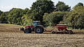 A Massey Ferguson Simba Horsch North Weald Bassett.jpg 5,378 × 3,027; 22.93 MB
-
 A Thornwood Springs Fishing Lake - geograph.org.uk - 5052800.jpg 640 × 424; 81 KB
-
 A414 crosses the M11 (Junction 7) - geograph.org.uk - 1978239.jpg 640 × 356; 69 KB
-
 A414 crosses the M11 (Junction 7) - geograph.org.uk - 1978244.jpg 640 × 338; 67 KB
-
 Abandoned cottages, North Weald - geograph.org.uk - 3506085.jpg 640 × 480; 87 KB
-
 Access road to Paris Hill Farm, Hastingwood - geograph.org.uk - 5506759.jpg 2,044 × 1,530; 878 KB
-
 Art Garden Nursery - geograph.org.uk - 800457.jpg 640 × 387; 56 KB
-
 B1393 High Road, Epping - geograph.org.uk - 6614357.jpg 1,920 × 1,440; 3.87 MB
-
 B1393 High Road, Epping - geograph.org.uk - 6614956.jpg 1,920 × 1,440; 3.9 MB
-
 B1393 London Road, Hastingwood - geograph.org.uk - 6614962.jpg 4,608 × 3,456; 3.78 MB
-
 B1393, Thornwood Common - geograph.org.uk - 5491061.jpg 640 × 480; 89 KB
-
 B181 at The Woodyard - geograph.org.uk - 2172957.jpg 640 × 480; 114 KB
-
 B181 at Woodside - geograph.org.uk - 2172975.jpg 640 × 480; 89 KB
-
 Bassett Millennium Walk - geograph.org.uk - 4915544.jpg 640 × 424; 83 KB
-
 Bend in the By Way - geograph.org.uk - 4915520.jpg 640 × 424; 113 KB
-
 Birds enjoying a dust bath. - geograph.org.uk - 1425557.jpg 640 × 425; 95 KB
-
 Blossom by the Bridleway - geograph.org.uk - 4915445.jpg 424 × 640; 60 KB
-
 Bobbingworth, Abandoned cottages - geograph.org.uk - 4515729.jpg 640 × 480; 80 KB
-
 Brambles. - geograph.org.uk - 1425616.jpg 640 × 385; 49 KB
-
 Brickfield Cottages - geograph.org.uk - 3895759.jpg 1,024 × 768; 248 KB
-
 Bridge across the M11 - geograph.org.uk - 1978217.jpg 640 × 385; 72 KB
-
 Bridge at North Weald - geograph.org.uk - 5003177.jpg 4,000 × 2,666; 7.58 MB
-
 Bridge over the M11 - geograph.org.uk - 1978252.jpg 640 × 355; 66 KB
-
 Bridge over the M11 - geograph.org.uk - 2640238.jpg 640 × 428; 77 KB
-
 Bridge over the M11 - geograph.org.uk - 4542756.jpg 4,000 × 3,000; 4.22 MB
-
 Bridleway near Bobbingworth - geograph.org.uk - 4915462.jpg 424 × 640; 63 KB
-
 Bridleway towards Toot hill - geograph.org.uk - 4104494.jpg 1,024 × 768; 324 KB
-

-

-
 Business Park in North Weald - geograph.org.uk - 6080961.jpg 1,920 × 1,280; 1.27 MB
-
 Busy M11 - geograph.org.uk - 2028268.jpg 640 × 303; 41 KB
-
 Byway to Church Lane - geograph.org.uk - 4915515.jpg 424 × 640; 101 KB
-

-
 Carved Seat in Roughtalleys Wood - geograph.org.uk - 5052941.jpg 424 × 640; 104 KB
-
 Cereal crop near Bridge House - geograph.org.uk - 6213929.jpg 800 × 600; 94 KB
-
 Cereal crop off Hastingwood Road - geograph.org.uk - 5488869.jpg 640 × 480; 69 KB
-
 Cereal crop off London Road (B1393) - geograph.org.uk - 5491064.jpg 640 × 480; 108 KB
-
 Cereal crop off Weald Bridge Road - geograph.org.uk - 6213925.jpg 800 × 600; 125 KB
-
 Church Lane Flood Meadow LNR - geograph.org.uk - 4915316.jpg 640 × 424; 61 KB
-
 Church Langley Water Tower - geograph.org.uk - 1978187.jpg 640 × 439; 85 KB
-
 Church Langley Water Tower - geograph.org.uk - 2724490.jpg 640 × 395; 40 KB
-
 Cladonia Chlorophaea growing on a Birch. - geograph.org.uk - 1425712.jpg 425 × 640; 134 KB
-

-
 Cold Hall Farm - geograph.org.uk - 4104489.jpg 640 × 480; 39 KB
-
 Confusion and Stort Valley Way - geograph.org.uk - 5408809.jpg 424 × 640; 90 KB
-
 Coopersale Common from under the railway bridge - geograph.org.uk - 5574253.jpg 4,000 × 3,000; 4.55 MB
-
 Cripsey Brook - geograph.org.uk - 4789709.jpg 640 × 480; 192 KB
-
 Cripsey Brook - geograph.org.uk - 5052728.jpg 424 × 640; 118 KB
-
 Cripsey Brook in Epping Forest - geograph.org.uk - 2147009.jpg 640 × 480; 147 KB
-
 Cripsey Brook in Epping Forest - geograph.org.uk - 2148392.jpg 640 × 480; 144 KB
-
 Crop field off Hastingwood Road - geograph.org.uk - 5488851.jpg 640 × 480; 101 KB
-
 Dead Tree ^ Track to Woodside - geograph.org.uk - 5052740.jpg 424 × 640; 101 KB
-
 Debt of Honour - geograph.org.uk - 270645.jpg 433 × 640; 94 KB
-

-
 Derelict Radio Shack^ - geograph.org.uk - 6489665.jpg 1,024 × 683; 219 KB
-
 Disused Railway line. - geograph.org.uk - 1422798.jpg 640 × 419; 124 KB
-
 Down the Forest Path. - geograph.org.uk - 1425623.jpg 640 × 425; 131 KB
-
 Drain and cereal crop - geograph.org.uk - 6213922.jpg 800 × 600; 107 KB
-
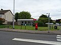
 Elizabeth II postbox on High Road, North Weald Bassett - geograph.org.uk - 6214896.jpg 2,375 × 3,605; 1.98 MB
-

-
 Elizabeth II postbox, Tyler's Green - geograph.org.uk - 6214876.jpg 2,906 × 4,046; 2.18 MB
-

-
 End of the line for now - geograph.org.uk - 2997401.jpg 2,337 × 2,337; 2.51 MB
-
 Entrance to Epping Forest from Forest Glade - geograph.org.uk - 2596289.jpg 3,648 × 2,736; 4 MB
-
 Entrance to North Weald Sewage Works - geograph.org.uk - 250665.jpg 640 × 451; 85 KB
-

-
 Epping Forest, Stump Road - geograph.org.uk - 2147002.jpg 640 × 480; 133 KB
-
 Epping Plain - geograph.org.uk - 5052864.jpg 640 × 424; 57 KB
-
 Epping Plain woodland - geograph.org.uk - 6213876.jpg 800 × 600; 219 KB
-
 Epping Road (B181) - geograph.org.uk - 6213881.jpg 800 × 600; 193 KB
-
 Epping Road - geograph.org.uk - 5574239.jpg 4,000 × 3,000; 5.02 MB
-
 Epping Road by The Woodyard - geograph.org.uk - 2926827.jpg 1,600 × 1,200; 571 KB
-
 Epping Road from under the M11 - geograph.org.uk - 5573708.jpg 4,000 × 3,000; 4.46 MB
-
 Epping Road in Epping Forest - geograph.org.uk - 5574243.jpg 4,000 × 3,000; 5.26 MB
-
 Epping Road passing under the M11 - geograph.org.uk - 5574240.jpg 4,000 × 3,000; 5.05 MB
-
 Epping Road, North Weald - geograph.org.uk - 2927456.jpg 1,600 × 1,200; 565 KB
-
 Epping Upper Clapton RFC - geograph.org.uk - 5052811.jpg 640 × 424; 50 KB
-
 Fallen Birch in Epping Plain - geograph.org.uk - 2596202.jpg 3,648 × 2,736; 4.42 MB
-
 Fallen Hornbeam in Wintry Wood - geograph.org.uk - 5052747.jpg 424 × 640; 113 KB
-
 Farm Track off the A414 - geograph.org.uk - 2376463.jpg 1,024 × 683; 489 KB
-
 Farm track towards Canes Farm - geograph.org.uk - 3894579.jpg 640 × 480; 100 KB
-
 Farm tracks off Upland Road - geograph.org.uk - 3884589.jpg 640 × 480; 159 KB
-

-

-

-

-
 Farmland by Epping Road - geograph.org.uk - 2724536.jpg 640 × 430; 63 KB
-
 Farmland by the M11 - geograph.org.uk - 3770931.jpg 640 × 373; 43 KB
-
 Farmland by the M25 - geograph.org.uk - 3770954.jpg 640 × 314; 30 KB
-
 Farmland near Canes Cottages - geograph.org.uk - 3770946.jpg 640 × 430; 43 KB
-
 Farmland north of Cold Hall Farm (2) - geograph.org.uk - 4243726.jpg 640 × 481; 100 KB
-
 Farmland south of North Weald Airfield - geograph.org.uk - 4445360.jpg 1,024 × 768; 170 KB
-
 Farmland, Church Langley - geograph.org.uk - 3770916.jpg 640 × 430; 47 KB
-
 Fenced-in trees, Roughtalley's Wood - geograph.org.uk - 4445354.jpg 1,024 × 768; 252 KB
-
 Field Boundary on Latton Priory Farm - geograph.org.uk - 5408849.jpg 424 × 640; 75 KB
-
 Field by Upland Road, Thornwood Common - geograph.org.uk - 5730403.jpg 2,048 × 1,536; 1.49 MB
-
 Field gate, Tyler's Green - geograph.org.uk - 4789717.jpg 640 × 480; 190 KB
-
 Field north of Rye Hill Road - geograph.org.uk - 6704142.jpg 1,024 × 768; 348 KB
-
 Field south of North Weald station - geograph.org.uk - 4104491.jpg 1,024 × 768; 109 KB
-
 Field west of A414, south of Harlow - geograph.org.uk - 4534022.jpg 1,600 × 1,064; 579 KB
-
 Footbridge over the M11 - geograph.org.uk - 1978192.jpg 640 × 362; 70 KB
-
 Footbridge over the M11 - geograph.org.uk - 2724494.jpg 640 × 433; 49 KB
-
 Footbridge to Hastingwood - geograph.org.uk - 5408504.jpg 424 × 640; 133 KB
-
 Footbridge, M11 - geograph.org.uk - 3770912.jpg 640 × 430; 51 KB
-
 Footpath at Upland Road - geograph.org.uk - 4470131.jpg 4,000 × 3,000; 4.42 MB
-
 Footpath from Foster Street - geograph.org.uk - 4542753.jpg 4,000 × 3,000; 4.13 MB
-
 Footpath from Foster Street to Shoe Lane - geograph.org.uk - 4542872.jpg 4,000 × 3,000; 4.01 MB
-
 Footpath on track near Tyler's Green, North Weald - geograph.org.uk - 6485086.jpg 3,642 × 2,251; 4.41 MB
-
 Footpath through Golf Course, nr Tyler's Green, North Weald - geograph.org.uk - 6485087.jpg 3,310 × 2,046; 1.65 MB
-
 Footpath to Thornwood Common - geograph.org.uk - 4470126.jpg 4,000 × 3,000; 4.21 MB
-
 Former London Underground Central Line - geograph.org.uk - 191559.jpg 640 × 480; 167 KB
-
 Foster Street Bridge, M11 - geograph.org.uk - 2724495.jpg 640 × 430; 58 KB
-
 Foster street Bridge, M11 - geograph.org.uk - 3770929.jpg 640 × 430; 63 KB
-
 Gate to a Paddock - geograph.org.uk - 5408526.jpg 640 × 424; 101 KB
-
-
 Geese by Thornwood Road - geograph.org.uk - 3895761.jpg 1,024 × 768; 482 KB
-
 Grassland by the M11 - geograph.org.uk - 3752906.jpg 640 × 430; 40 KB
-
 Grassland by the M11 - geograph.org.uk - 3752914.jpg 640 × 347; 30 KB
-
 Grazing off Epping Road (B181) - geograph.org.uk - 6213886.jpg 800 × 600; 112 KB
-
 Gulf petrol station at North Weald - geograph.org.uk - 4104499.jpg 1,024 × 768; 116 KB
-
 Happy Grow garden centre - geograph.org.uk - 3895744.jpg 1,024 × 768; 201 KB
-
 Harlow Common Bridge, M11 - geograph.org.uk - 3752918.jpg 640 × 430; 51 KB
-
 Harlow Park - geograph.org.uk - 5408481.jpg 424 × 640; 118 KB
-
 Harvester pub at the Talbot roundabout - geograph.org.uk - 4201292.jpg 4,320 × 3,240; 3.89 MB
-
 Hastingwood Business Centre - geograph.org.uk - 5488863.jpg 640 × 480; 59 KB
-
 Hastingwood Road - geograph.org.uk - 4294992.jpg 640 × 480; 138 KB
-
 Hastingwood Road - geograph.org.uk - 4542719.jpg 4,000 × 3,000; 4.09 MB
-
 Hastingwood Road - geograph.org.uk - 5488852.jpg 640 × 480; 62 KB
-
 Hastingwood Road - geograph.org.uk - 5488864.jpg 640 × 480; 52 KB
-
 Hastingwood Road - geograph.org.uk - 5488870.jpg 640 × 480; 72 KB
-
 Hastingwood Road - geograph.org.uk - 5505296.jpg 2,048 × 1,536; 1.51 MB
-
 Hastingwood Road - geograph.org.uk - 5508978.jpg 2,048 × 1,536; 971 KB
-
 Havering Lake II - geograph.org.uk - 5052802.jpg 424 × 640; 100 KB
-
 Hay Meadow by the M11 - geograph.org.uk - 5408431.jpg 640 × 424; 85 KB
-
 Hedge by the M11 - geograph.org.uk - 3770952.jpg 640 × 430; 45 KB
-
 High Road North Weald Bassett - geograph.org.uk - 2926824.jpg 1,600 × 1,200; 510 KB
-
 High Road North Weald Bassett - geograph.org.uk - 2927724.jpg 1,600 × 1,200; 318 KB
-
 High Road North Weald Bassett - geograph.org.uk - 2938139.jpg 1,594 × 1,063; 562 KB
-
 High Road, North Weald Bassett - geograph.org.uk - 6213891.jpg 800 × 600; 116 KB
-
 High Road, North Weald Bassett - geograph.org.uk - 6213904.jpg 800 × 600; 145 KB
-
 High Road, North Weald Bassett - geograph.org.uk - 6213912.jpg 800 × 600; 99 KB
-
 High Road, Thornwood Common - geograph.org.uk - 5507941.jpg 2,048 × 1,536; 976 KB
-
 High Road, Thornwood Common - geograph.org.uk - 5507942.jpg 2,048 × 1,536; 1.49 MB
-
 High Road, Thornwood Common - geograph.org.uk - 5507945.jpg 2,048 × 1,536; 1.51 MB
-
 High Road, Thornwood Common - geograph.org.uk - 6212955.jpg 1,842 × 1,150; 1.21 MB
-
 High Road, Thornwood Common - geograph.org.uk - 6212956.jpg 1,920 × 1,280; 1.19 MB
-
 Horses alongside Foster Street - geograph.org.uk - 4542764.jpg 4,000 × 3,000; 4.22 MB
-
 Horseshoes Farm on London Road - geograph.org.uk - 5505591.jpg 1,877 × 1,349; 707 KB
-
 House entrance on Hastingwood Road - geograph.org.uk - 5506760.jpg 2,048 × 1,536; 1.43 MB
-
 House near Horseshoes Farm - geograph.org.uk - 5491070.jpg 640 × 480; 58 KB
-
 House on Hastingwood Road - geograph.org.uk - 5488849.jpg 640 × 480; 62 KB
-
 House on Woodside, Epping - geograph.org.uk - 5730399.jpg 2,048 × 1,536; 1.59 MB
-
-
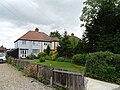
 Houses along High Road, North Weald Bassett - geograph.org.uk - 2926823.jpg 1,600 × 1,200; 592 KB
-
 Houses on Forest Glade, Woodside - geograph.org.uk - 4445367.jpg 1,024 × 768; 151 KB
-

-
 Houses on High Road, North Weald Bassett - geograph.org.uk - 6213908.jpg 800 × 600; 137 KB
-

-
 Houses on London Road (B1393) - geograph.org.uk - 5491077.jpg 640 × 480; 48 KB
-
 Houses on Pike Way, North Weald Bassett - geograph.org.uk - 4444275.jpg 1,024 × 768; 210 KB
-
 Houses on Tempest Mead - geograph.org.uk - 4444250.jpg 1,024 × 768; 217 KB
-
 Houses on Thornwood Road, Epping - geograph.org.uk - 5730400.jpg 2,048 × 1,536; 1.55 MB
-
 Houses on Upland Road - geograph.org.uk - 5491051.jpg 640 × 489; 69 KB
-
 Houses on Upland Road, Thornwood Common - geograph.org.uk - 5730402.jpg 2,014 × 1,490; 1.26 MB
-
 Houses on York Road, North Weald Bassett - geograph.org.uk - 6213890.jpg 800 × 600; 112 KB
-
 Junction 7 motorway sign, M11 - geograph.org.uk - 1978235.jpg 640 × 380; 77 KB
-
 Junction of The Woodyard and Epping Road - geograph.org.uk - 2926826.jpg 1,600 × 1,200; 555 KB
-

-
 Latton Priory Farm - geograph.org.uk - 5408820.jpg 640 × 424; 74 KB
-
 Latton Priory Farm Drive - geograph.org.uk - 5408843.jpg 640 × 424; 71 KB
-
 Leaving the M11 at J7 - geograph.org.uk - 5836723.jpg 2,521 × 1,890; 1.65 MB
-
-
 Lights on the roundabout over the M11 junction 7 - geograph.org.uk - 3509613.jpg 1,901 × 1,514; 1.13 MB
-
 Lineside view, Epping Ongar Railway - geograph.org.uk - 3995413.jpg 1,064 × 1,600; 389 KB
-
 Llamas ^ Ominous Sky - geograph.org.uk - 5473687.jpg 640 × 424; 82 KB
-

-

-
 London Road - geograph.org.uk - 4470032.jpg 4,000 × 3,000; 4.21 MB
-
 London Road looking towards the M11 - geograph.org.uk - 4470034.jpg 3,683 × 2,999; 2.24 MB
-
 London Road near Horseshoes Farm - geograph.org.uk - 4470038.jpg 4,000 × 3,000; 4.05 MB
-
 London Road near Horseshoes Farm - geograph.org.uk - 4470040.jpg 4,000 × 3,000; 4.44 MB
-
 London Road, Hastingwood - geograph.org.uk - 6210043.jpg 1,844 × 1,154; 1.17 MB
-
 London Road, Hastingwood - geograph.org.uk - 6363905.jpg 1,872 × 1,204; 1.07 MB
-
 London Road, Hastingwood - geograph.org.uk - 6363906.jpg 1,864 × 1,190; 989 KB
-
 Looking across the fields from Hastingwood Road - geograph.org.uk - 4542725.jpg 4,000 × 3,000; 4.25 MB
-
 M11 - Foster Street bridge - geograph.org.uk - 2640280.jpg 640 × 428; 98 KB
-
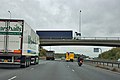
 M11 approaching Junction 7 northbound - geograph.org.uk - 3453631.jpg 1,644 × 1,015; 747 KB
-

-
 M11 at junction 7 - geograph.org.uk - 2640263.jpg 640 × 428; 72 KB
-
 M11 at junction 7 - geograph.org.uk - 2640270.jpg 640 × 428; 87 KB
-

-
 M11 bridge over Epping Road (B181) - geograph.org.uk - 6213885.jpg 800 × 600; 134 KB
-
 M11 half mile to Junction 7 A414 - geograph.org.uk - 3453626.jpg 1,695 × 1,018; 754 KB
-
 M11 Motorway bridge near Harlow - geograph.org.uk - 3453639.jpg 1,696 × 961; 764 KB
-
 M11 Motorway, Junction 7 - geograph.org.uk - 5488847.jpg 640 × 480; 52 KB
-
 M11 near Epping - geograph.org.uk - 3452528.jpg 1,641 × 1,030; 883 KB


_-_geograph.org.uk_-_1978239.jpg)
_-_geograph.org.uk_-_1978244.jpg)


_-_geograph.org.uk_-_5491064.jpg)


_-_geograph.org.uk_-_6213881.jpg)


_-_geograph.org.uk_-_4242555.jpg)


_-_geograph.org.uk_-_4243726.jpg)


_-_geograph.org.uk_-_6213886.jpg)


_-_geograph.org.uk_-_5491077.jpg)


_towards_Junction_7,_M11_Motorway_-_geograph.org.uk_-_5491067.jpg)
_towards_Junction_7,_M11_Motorway_-_geograph.org.uk_-_5491075.jpg)


_-_geograph.org.uk_-_6213885.jpg)


