Category:Northdown
area of Margate, Thanet, Kent, England | |||||
| Upload media | |||||
| Instance of | |||||
|---|---|---|---|---|---|
| Location | Margate, Thanet, Kent, South East England, England | ||||
| |||||
Northdown is the easternmost area of Margate, and is at its west conjoined to Cliftonville. Northdown is named after its Northdown Park, originally parkland attached to the still existing Northdown House.

Media in category "Northdown"
The following 59 files are in this category, out of 59 total.
-
 Botany Bay from cliff top - geograph.org.uk - 1030487.jpg 640 × 480; 207 KB
-
 Chalk cliffs behind Botany Bay - geograph.org.uk - 1031304.jpg 640 × 480; 168 KB
-

-
 Flint cottage on Queen Elizabeth Avenue - geograph.org.uk - 519857.jpg 426 × 640; 166 KB
-
 Foreness Point - geograph.org.uk - 459559.jpg 640 × 480; 81 KB
-
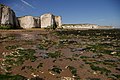 Foreness Point from Botany Bay (low tide) - geograph.org.uk - 248364.jpg 640 × 426; 152 KB
-

-
 Foreness Point, Cliftonville - geograph.org.uk - 528658.jpg 640 × 426; 108 KB
-
 Houses on Northdown Park Road - geograph.org.uk - 734219.jpg 640 × 480; 160 KB
-
 Houses on The Ridings - geograph.org.uk - 1473417.jpg 640 × 430; 131 KB
-

-

-

-

-
 Looking NW along Botany Bay - geograph.org.uk - 1031286.jpg 640 × 480; 104 KB
-

-
 Looking out to sea from Foreness Point - geograph.org.uk - 1030480.jpg 640 × 480; 206 KB
-

-

-

-
 Looking W on Long Nose Spit at low tide - geograph.org.uk - 1010848.jpg 640 × 480; 253 KB
-
 Monkton Gardens, Margate, Kent - geograph.org.uk - 928716.jpg 640 × 427; 67 KB
-
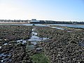
 Outfalls on Long Nose Spit - geograph.org.uk - 1010815.jpg 640 × 480; 161 KB
-
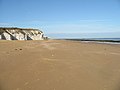
 Palm Bay.jpg 640 × 480; 116 KB
-
 Palm-bay-primary-school-margate.jpg 2,941 × 2,209; 2.76 MB
-
 Park to the side of Northdown House - geograph.org.uk - 735386.jpg 640 × 480; 205 KB
-
 Path across the cliff top - geograph.org.uk - 1031175.jpg 640 × 480; 187 KB
-

-

-
 Path towards Cliftonville - geograph.org.uk - 1030489.jpg 640 × 480; 201 KB
-
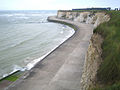
 Promenade and Sea wall, Palm Bay - geograph.org.uk - 1473347.jpg 640 × 430; 137 KB
-
 Promenade west of Foreness Point - geograph.org.uk - 1473368.jpg 640 × 430; 136 KB
-
 Promenade west of Foreness Point - geograph.org.uk - 1473378.jpg 640 × 430; 123 KB
-
 Road junction at Northdown - geograph.org.uk - 528650.jpg 640 × 426; 125 KB
-
 Sculpted chalk on the shore - geograph.org.uk - 1030482.jpg 640 × 480; 244 KB
-
 Shoreline at Foreness Point - geograph.org.uk - 1030479.jpg 640 × 480; 248 KB
-
 St Michaels Avenue, off Green Lane - geograph.org.uk - 734211.jpg 640 × 480; 132 KB
-
 Thanet Coast Path at Foreness Point - geograph.org.uk - 1473400.jpg 640 × 430; 150 KB
-
 Thanet Coast Path SE of Foreness Point - geograph.org.uk - 1473408.jpg 640 × 430; 109 KB
-
 Thanet Coast Path SE of Foreness Point - geograph.org.uk - 1473418.jpg 640 × 430; 127 KB
-
 Thanet Coast Path SE of Foreness Point - geograph.org.uk - 1473425.jpg 640 × 430; 134 KB
-
 Thanet Coast Path SE of Foreness Point - geograph.org.uk - 1473429.jpg 640 × 430; 140 KB
-
 The beach at Foreness Point - geograph.org.uk - 1030484.jpg 640 × 480; 137 KB
-

-
 The front of Northdown House - geograph.org.uk - 735391.jpg 640 × 480; 186 KB
-
 The last bits of land of Foreness Point - geograph.org.uk - 1030471.jpg 640 × 480; 181 KB
-

-

-
 The treatment works on Foreness Point - geograph.org.uk - 1030483.jpg 640 × 480; 170 KB
-
 The two outfalls on Long Nose Spit - geograph.org.uk - 1010862.jpg 640 × 480; 225 KB
-

-
 View along The Ridings - geograph.org.uk - 1032924.jpg 640 × 480; 192 KB
-
 View seaward along the two outfall pipes - geograph.org.uk - 1030481.jpg 640 × 480; 209 KB
-
 Wall and path near Northdown Park - geograph.org.uk - 734220.jpg 640 × 480; 225 KB
-
 Walled area near Northdown House - geograph.org.uk - 734218.jpg 640 × 480; 259 KB
-
 Water treatment plant, Foreness Point - geograph.org.uk - 1473405.jpg 640 × 430; 117 KB
-
 Wave cut platform east of Foreness Point - geograph.org.uk - 1473391.jpg 640 × 430; 150 KB
-
 Wave Cut Platform west of Foreness Point - geograph.org.uk - 1473361.jpg 640 × 430; 143 KB
-
 Wave Cut Platform west of Foreness Point - geograph.org.uk - 1473370.jpg 640 × 430; 135 KB


_-_geograph.org.uk_-_248364.jpg)


