Category:Northill
village and civil parish in Bedfordshire, UK  | |||||
| Upload media | |||||
| Instance of | |||||
|---|---|---|---|---|---|
| Location | Central Bedfordshire, Bedfordshire, East of England, England | ||||
| official website | |||||
 | |||||
English: Northill is a village in the county of Bedfordshire, England. It falls under the Northill and Blunham ward in the Central Bedfordshire local authority. As of 2001 Northill had a population of about 900 people. The village is also the administrative centre of the Parish of Northill, which as of 2001 had a population of 2,284.
Subcategories
This category has the following 10 subcategories, out of 10 total.
C
- The Crown, Northill (3 F)
H
- Hatch, Bedfordshire (5 F)
I
- Ickwell Bury (1 F)
L
- Lower Caldecote (3 F)
M
N
- Northill Grange (5 F)
T
- Thorncote Green (2 F)
U
Media in category "Northill"
The following 88 files are in this category, out of 88 total.
-
 1 Thorncote Road, Northill, August 2022.jpg 4,032 × 3,024; 6.82 MB
-
 10 and 12 Thorncote Road, Northill, August 2022.jpg 4,032 × 3,024; 3.68 MB
-
 19 Ickwell Road, Northill, February 2024.jpg 4,032 × 3,024; 3.32 MB
-
 3, 5 and 7 Thorncote Road, Northill, August 2022.jpg 4,032 × 3,024; 6.52 MB
-
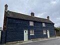
 4, 6 and 8 (Pax Cottage), Thorncote Road, Northill, August 2022.jpg 4,032 × 3,024; 3.44 MB
-
 A1, northbound - geograph.org.uk - 4660109.jpg 640 × 346; 37 KB
-
 A603 to Bedford - geograph.org.uk - 4988053.jpg 640 × 334; 51 KB
-
 A603 towards Bedford - geograph.org.uk - 4617132.jpg 640 × 480; 63 KB
-
 Bedford Road - geograph.org.uk - 5599001.jpg 640 × 480; 170 KB
-
 Bridleway into Ickwell - geograph.org.uk - 4619350.jpg 4,320 × 3,240; 2.94 MB
-
 Budna Road - geograph.org.uk - 5599014.jpg 640 × 480; 112 KB
-
 Byway, Brook End - geograph.org.uk - 4617061.jpg 640 × 480; 92 KB
-
 Caldecote Store - geograph.org.uk - 4620503.jpg 640 × 480; 60 KB
-
 Colemoreham Spinney - geograph.org.uk - 4391169.jpg 2,000 × 1,333; 994 KB
-
 Crop field off Hill Lane - geograph.org.uk - 4617027.jpg 640 × 480; 89 KB
-
 Entrance to Bedford Road Cemetery, Bedford Road, Northill, August 2023.jpg 3,024 × 4,032; 6.63 MB
-
 Farm track, Upper Caldecote - geograph.org.uk - 4617042.jpg 640 × 480; 93 KB
-
 Fields by the Bedford Road - geograph.org.uk - 5096058.jpg 1,600 × 1,066; 711 KB
-
 Fields north of Hill Lane - geograph.org.uk - 3350418.jpg 640 × 460; 40 KB
-
 Football at the sports ground. - geograph.org.uk - 117574.jpg 640 × 236; 51 KB
-
 Footpath and field entrance - geograph.org.uk - 4620947.jpg 640 × 480; 75 KB
-
 Footpath to Beeston Leasoes Farm - geograph.org.uk - 5096036.jpg 1,600 × 1,066; 458 KB
-
-
 Footpath, St Mary's churchyard - geograph.org.uk - 3633173.jpg 1,024 × 768; 158 KB
-
 Former A1 - geograph.org.uk - 3350427.jpg 640 × 452; 37 KB
-
 Former A1 at Sainsbury's at Biggleswade - geograph.org.uk - 3385723.jpg 640 × 480; 106 KB
-
 Former A1 at Sainsbury's at Biggleswade - geograph.org.uk - 3385724.jpg 640 × 480; 100 KB
-
 Greensand Ridge Walk - geograph.org.uk - 176287.jpg 640 × 480; 95 KB
-
 HGV's parked by the A1 - geograph.org.uk - 4660128.jpg 640 × 284; 48 KB
-
 Hill Lane (B658) - geograph.org.uk - 4620483.jpg 640 × 480; 50 KB
-
 Hill Lane (B658) - geograph.org.uk - 4620486.jpg 640 × 480; 58 KB
-
 Hill Lane (B658) - geograph.org.uk - 4620487.jpg 640 × 480; 65 KB
-

-
 Hill Lane eastwards - geograph.org.uk - 3350419.jpg 640 × 456; 54 KB
-
 Ickwell Bury, 1986 - geograph.org.uk - 5744986.jpg 1,024 × 683; 140 KB
-
 Ickwell May Day Morris Dancing 2023.jpg 2,048 × 1,536; 1.03 MB
-
 Ickwell Road - geograph.org.uk - 5598994.jpg 640 × 480; 180 KB
-
 Lakeview Cars - geograph.org.uk - 4660106.jpg 640 × 376; 39 KB
-
 Lane towards Moggerhanger - geograph.org.uk - 5599005.jpg 640 × 480; 208 KB
-
 Lane towards Moggerhanger - geograph.org.uk - 5599007.jpg 640 × 480; 180 KB
-
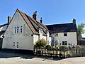
 Manor Cottage, Thorncote Road, Northill, August 2022.jpg 4,032 × 3,024; 4.68 MB
-
 Minor road towards Sandy - geograph.org.uk - 4617057.jpg 640 × 480; 72 KB
-
 Minor road towards Sandy - geograph.org.uk - 4620942.jpg 640 × 480; 89 KB
-
 New house, 15 Warden Road - geograph.org.uk - 4755214.jpg 640 × 480; 68 KB
-
 New Sainsbury's fuel - geograph.org.uk - 3350428.jpg 640 × 452; 42 KB
-
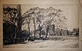 Northill 1891, Constance M. Pott etching.jpg 1,956 × 1,217; 820 KB
-

-
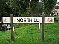 Northill Sign.JPG 3,472 × 2,604; 1.56 MB
-
 Old Sainsbury fuel - geograph.org.uk - 3350429.jpg 640 × 431; 47 KB
-
 Old Warden Airfield - geograph.org.uk - 638073.jpg 640 × 480; 64 KB
-
 Path towards Northill - geograph.org.uk - 3079327.jpg 1,600 × 1,068; 372 KB
-
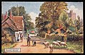 Picturesque Bedfordshire. Northill Village (NBY 439938).jpg 3,600 × 2,331; 2.31 MB
-
 Potato crop near Brook End - geograph.org.uk - 4617052.jpg 640 × 480; 90 KB
-
 River Ivel at Biggleswade - geograph.org.uk - 4869029.jpg 1,600 × 1,066; 548 KB
-
 Sainsbury's, A1 - geograph.org.uk - 4660095.jpg 640 × 359; 54 KB
-
 Sainsbury's, A1 - geograph.org.uk - 4660105.jpg 640 × 343; 42 KB
-
 Sewer Vent Pipe. - geograph.org.uk - 120337.jpg 482 × 640; 93 KB
-
 Shuttleworth Agricultural College. - geograph.org.uk - 120319.jpg 640 × 366; 92 KB
-
 Shuttleworth Airfield - geograph.org.uk - 276250.jpg 640 × 425; 157 KB
-
 Stubble field near Sandy - geograph.org.uk - 4617129.jpg 640 × 480; 61 KB
-
 Stubble field north of Hill Lane - geograph.org.uk - 4617023.jpg 640 × 480; 73 KB
-
 The road to Moggerhanger - geograph.org.uk - 5096064.jpg 1,600 × 1,066; 539 KB
-
 Thorncote Green - geograph.org.uk - 5599020.jpg 640 × 480; 140 KB
-
 Track through Sheerhatch Wood - geograph.org.uk - 5096041.jpg 1,066 × 1,600; 590 KB
-
 Track through Sheerhatch Wood - geograph.org.uk - 5096049.jpg 1,600 × 1,066; 602 KB
-
 Track-bridleway leaving Northill. - geograph.org.uk - 427147.jpg 640 × 480; 69 KB
-
 Vinegar Hill - geograph.org.uk - 4620935.jpg 640 × 480; 72 KB
-
 Well Cottage, Northill, August 2022 01.jpg 3,024 × 4,032; 4.64 MB
-
 Well Cottage, Northill, August 2022 02.jpg 3,024 × 4,032; 6.45 MB
-
 Well-hidden industry - geograph.org.uk - 3173094.jpg 1,978 × 1,395; 547 KB
-

-
 A sea of barley at Budna. - geograph.org.uk - 427132.jpg 640 × 480; 96 KB
-
 Another digger and a field - geograph.org.uk - 426249.jpg 640 × 480; 95 KB
-
 Bedford Road - geograph.org.uk - 181114.jpg 640 × 480; 74 KB
-
 Field near Grove Farm - geograph.org.uk - 426286.jpg 640 × 480; 99 KB
-
 Field near Thorncote Green - geograph.org.uk - 427139.jpg 640 × 480; 93 KB
-
 Fields - geograph.org.uk - 176274.jpg 640 × 480; 69 KB
-
 Greensand Walk sign - geograph.org.uk - 176291.jpg 640 × 480; 30 KB
-

-
 Maypole on Ickwell village green - geograph.org.uk - 120325.jpg 482 × 640; 117 KB
-
 Northill Cemetery - geograph.org.uk - 181115.jpg 489 × 640; 102 KB
-
-
 Shuttleworth Collection - geograph.org.uk - 276252.jpg 640 × 435; 114 KB
-
 Shuttleworth Collection - geograph.org.uk - 276254.jpg 640 × 382; 115 KB
-
 Track to Beeston Leasoes Farm - geograph.org.uk - 426202.jpg 640 × 480; 97 KB
-
 Waterlane Farm - geograph.org.uk - 117558.jpg 640 × 282; 80 KB
-
 Wet track - geograph.org.uk - 176278.jpg 640 × 480; 61 KB
-
 £2 Breakie Here^ - geograph.org.uk - 4660117.jpg 640 × 563; 57 KB


,_Thorncote_Road,_Northill,_August_2022.jpg)


_-_geograph.org.uk_-_4620940.jpg)


_-_geograph.org.uk_-_4620483.jpg)
_-_geograph.org.uk_-_4620486.jpg)
_-_geograph.org.uk_-_4620487.jpg)
_approaching_roundabout_-_geograph.org.uk_-_4620490.jpg)


.jpg)


