Category:Notre-Dame de Paris on the maps
Subcategories
This category has only the following subcategory.
1
Media in category "Notre-Dame de Paris on the maps"
The following 18 files are in this category, out of 18 total.
-
 Plan de Paris vers 1550 hotel-Dieu.jpg 258 × 378; 149 KB
-
 Ponts de l'ile de la Cité (1550).jpg 1,175 × 848; 381 KB
-
 Fulbert (2).jpg 361 × 523; 122 KB
-
 Plan de Belleforest - 1575 - Extrait île de la Cité.jpg 493 × 785; 220 KB
-
 Ile de la cite 1609.jpg 640 × 480; 251 KB
-
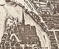 Cathédrale Notre-Dame de Paris in 1618.jpg 2,047 × 1,728; 1.59 MB
-

-
 Hôtel-Dieu sur le plan de Turgot.jpg 946 × 814; 346 KB
-
 Karta över Paris indelat i 20 distrikt, tryckt 1763 - Skoklosters slott - 86168.tif 5,658 × 3,510; 56.84 MB
-
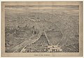 1860 Paris à vol d'oiseau.jpg 11,266 × 7,926; 22.95 MB
-
 Pictorial map of the city of Paris and its environs - Norman B. Leventhal Map Center.tif 8,205 × 6,195; 145.46 MB
-
 Pictorial map of the city of Paris and its environs.jpg 8,205 × 6,195; 25.42 MB
-
 Le Paris de l'exposition. Le nouveau boulevard Saint-Germain dans toute son étendue.jpg 4,805 × 3,156; 14.93 MB
-
 Map of Paris by Claes Jansz. Visscher - Harold B. Lee Library.jpg 20,207 × 13,139; 43.36 MB
-

-
 ParisCharlesV.jpg 1,600 × 1,242; 802 KB
-
 Plan du quartier de Notre-Dame 1150, 1550, 1750.jpg 4,163 × 2,789; 7.26 MB
-
 Testard, Aspect général de Paris 2, 1860.jpg 9,056 × 5,899; 28.28 MB

.jpg)
.jpg)


