Category:November 2008 in County Fermanagh
English: Images taken in County Fermanagh, Northern Ireland in this month of 2008 (not the date of the upload).
| Jan | Feb | Mar | Apr | May | Jun | Jul | Aug | Sep | Oct | Nov | Dec | ||
| ← | 7 | 0 | 0 | 10 | 15 | 9 | 20 | 122 | 1 | 0 | 36 | 1 | → |
|---|
Media in category "November 2008 in County Fermanagh"
The following 36 files are in this category, out of 36 total.
-
 A509 Derrylin Road - geograph.org.uk - 1053695.jpg 640 × 479; 39 KB
-
 A509 Derrylin Road - geograph.org.uk - 1053745.jpg 640 × 479; 47 KB
-
 B108 Road at Corraheen - geograph.org.uk - 1061024.jpg 640 × 479; 49 KB
-
 B108 Road at Strawgowna - geograph.org.uk - 1060966.jpg 640 × 479; 71 KB
-
 Ballintarsan Townland - geograph.org.uk - 1043821.jpg 640 × 479; 60 KB
-
 Belview Road - geograph.org.uk - 1043690.jpg 640 × 479; 89 KB
-
 Blunnick Townland - geograph.org.uk - 1061980.jpg 640 × 479; 61 KB
-
 Clondaval Townland - geograph.org.uk - 1053688.jpg 640 × 479; 55 KB
-
 Clondaval Townland - geograph.org.uk - 1053691.jpg 640 × 479; 43 KB
-
 Corragole Road - geograph.org.uk - 1053705.jpg 640 × 479; 46 KB
-
 Cultiagh Townland - geograph.org.uk - 1043815.jpg 640 × 479; 69 KB
-
 Derryheeny Townland - geograph.org.uk - 1044505.jpg 640 × 479; 62 KB
-
 Derryheeny Townland - geograph.org.uk - 1044535.jpg 640 × 479; 66 KB
-
 Derryinch One - geograph.org.uk - 1044464.jpg 640 × 479; 53 KB
-
 Derryinch Townland - geograph.org.uk - 1044469.jpg 640 × 479; 60 KB
-
 Derryvore Townland - geograph.org.uk - 1043675.jpg 640 × 479; 50 KB
-
 Derryvullan Road - geograph.org.uk - 1043885.jpg 640 × 479; 72 KB
-
 Derryvullan South Church of Ireland - geograph.org.uk - 1043837.jpg 640 × 479; 49 KB
-
 Drumcullion Townland - geograph.org.uk - 1043881.jpg 640 × 479; 75 KB
-
 Drumhirk Townland - geograph.org.uk - 1044528.jpg 640 × 479; 68 KB
-
 GAA Club, Corraheen - geograph.org.uk - 1061019.jpg 640 × 289; 25 KB
-
 GAA notice board, Corraheen - geograph.org.uk - 1061022.jpg 640 × 382; 39 KB
-
 Gortoral Road - geograph.org.uk - 1054580.jpg 640 × 479; 66 KB
-
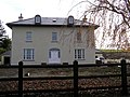 House at Derryvore - geograph.org.uk - 1043679.jpg 640 × 479; 75 KB
-
 Lane at Cam - geograph.org.uk - 1053810.jpg 640 × 479; 52 KB
-
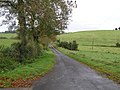
 Lane at Derryinch - geograph.org.uk - 1044467.jpg 640 × 479; 77 KB
-
 Plaque, Borderbusters - geograph.org.uk - 1054582.jpg 505 × 640; 131 KB
-
 Road at Blunnick - geograph.org.uk - 1061982.jpg 640 × 479; 68 KB
-
 Road at Clondaval - geograph.org.uk - 1053692.jpg 640 × 479; 62 KB
-
 Road at Cultiagh - geograph.org.uk - 1043819.jpg 640 × 479; 85 KB
-
 Road at Derryinch - geograph.org.uk - 1044462.jpg 640 × 479; 62 KB
-
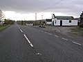
 Road at Drumbrughas (A509) - geograph.org.uk - 1044498.jpg 640 × 479; 51 KB
-
 Road at Drumhirk - geograph.org.uk - 1044529.jpg 640 × 479; 66 KB
-
 Strawgowna Road - geograph.org.uk - 1053829.jpg 640 × 271; 25 KB
-
 Strawgowna Road - geograph.org.uk - 1060970.jpg 640 × 479; 61 KB
-
 Strawgowna Townland - geograph.org.uk - 1053823.jpg 640 × 479; 68 KB


_-_geograph.org.uk_-_1044498.jpg)


