Category:November 2008 in Devon
Deutsch: Bilder, die im November 2008 in Devon aufgenommen worden sind. Bitte beachten Sie, dass dies weder das Datum des Uploads noch das Datum des Scannens eines Fotos ist.
English: Images/pictures taken in Devon during November 2008. Note this is not the date of the upload, nor the date a photo was scanned.
Español: Fotografías o imágenes tomadas en Devon durante noviembre 2008. No es la fecha de subida ni escaneo, sino la fecha en que las fotografías o imágenes se crearon.
Esperanto: Bildoj faritaj en Devon en novembro 2008. Tio ne estas la dato, kiam la bildoj estis alŝutitaj aŭ skanitaj.
Français : Photographies ou images prises en Devon durant novembre 2008. Ce n'est pas la date du téléchargement ou du scan.
Galego: Fotografías ou imaxes tomadas en Devon durante novembro 2008. Non é a data de subida nin escaneamento, senón a data na que se crearon as fotografías ou imaxes.
Italiano: Fotografie o immagini scattate a Devon nel novembre 2008. Nota bene: la data non si riferisce né a quella di upload né a quella in cui la foto è stata digitalizzata.
Norsk bokmål: Bilder tatt i Devon i løpet av november 2008. Merk at dette ikke er datoen for opplasting, eller når et bilde har blitt skannet.
Norsk nynorsk: Bilete teke i Devon i løpet av november 2008. Merk at dette ikkje er datoen for opplasting, eller når eit bilete har vorte skanna.
Русский: Изображения, сделанные в Devon в течение ноябрь 2008 (не дата загрузки изображения).
Українська: Зображення, зроблені в Devon протягом листопад 2008. Зауважте, що це не дата завантаження чи дата сканування фотографії.
| November 2007 | ← | November 2008 | → | November 2009 | |||||||
| Jan | Feb | Mar | Apr | May | Jun | Jul | Aug | Sep | Oct | Nov | Dec |
| 37 | 21 | 48 | 43 | 48 | 83 | 38 | 96 | 54 | 108 | 70 | 125 |
|---|---|---|---|---|---|---|---|---|---|---|---|
Subcategories
This category has the following 2 subcategories, out of 2 total.
Media in category "November 2008 in Devon"
The following 68 files are in this category, out of 68 total.
-
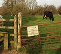 "Stay on footpath or stay home" - geograph.org.uk - 1059577.jpg 640 × 574; 128 KB
-
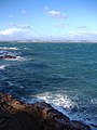
 'The Ridge' at Low Tide - geograph.org.uk - 1048663.jpg 640 × 480; 60 KB
-
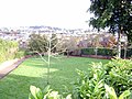 Ashfield Gardens - geograph.org.uk - 1042699.jpg 640 × 480; 145 KB
-
 Berry Head Hotel 1.jpg 1,728 × 2,304; 1.79 MB
-
 Berry Head Hotel 2.jpg 2,400 × 1,600; 1.43 MB
-
 Berry Head Hotel 3.jpg 2,304 × 1,728; 1.74 MB
-
 Hotels in Babbacombe - geograph.org.uk - 1033049.jpg 640 × 448; 55 KB
-

-
 Berachah Road, Torquay - geograph.org.uk - 1060525.jpg 640 × 478; 76 KB
-
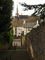
 Flight of steps, Torquay - geograph.org.uk - 1060343.jpg 640 × 480; 98 KB
-
 Steps to St Marychurch Road, Torquay - geograph.org.uk - 1060378.jpg 480 × 640; 89 KB
-
 Anstey's Cove - geograph.org.uk - 1058326.jpg 640 × 480; 103 KB
-
 Bishop's Walk - geograph.org.uk - 1058234.jpg 640 × 480; 114 KB
-
 Armada Park - geograph.org.uk - 1059626.jpg 640 × 480; 138 KB
-
 Arch Brook joins the River Teign - geograph.org.uk - 1189335.jpg 640 × 480; 58 KB
-
 Axminster Crossing - geograph.org.uk - 1059594.jpg 640 × 480; 74 KB
-
 Axminster Guildhall - geograph.org.uk - 1059561.jpg 640 × 480; 64 KB
-
 Brixham Harbour fisherman.jpg 2,304 × 1,728; 609 KB
-
 Brixham Harbour wall.jpg 2,304 × 1,728; 1.75 MB
-
 Castle Hill House, Axminster - geograph.org.uk - 1059615.jpg 640 × 480; 77 KB
-
 Cattle viewing Four Cross - geograph.org.uk - 1072303.jpg 640 × 480; 54 KB
-
 Cold East Cross - geograph.org.uk - 1031962.jpg 640 × 480; 52 KB
-

-
 Downhill towards Wyke Green - geograph.org.uk - 1068756.jpg 640 × 480; 149 KB
-
 Princesshay car park, Exeter - geograph.org.uk - 1057148.jpg 499 × 640; 47 KB
-
 ExeterAirportUK.jpg 640 × 480; 66 KB
-
 Farm Gate - geograph.org.uk - 1070207.jpg 640 × 480; 90 KB
-
 Footbridge over tributary of River Axe - geograph.org.uk - 1070201.jpg 640 × 480; 142 KB
-
 Footpath, Topsham Sports Ground - geograph.org.uk - 1572382.jpg 640 × 480; 115 KB
-
 Grazing land Uphay - geograph.org.uk - 1072273.jpg 640 × 480; 57 KB
-

-
 Hole Head, Holcombe - geograph.org.uk - 1062614.jpg 640 × 480; 89 KB
-
 JD with Acuspread AS85 multi-purpose spreader.jpg 1,214 × 763; 704 KB
-
 Level crossing, Axminster - geograph.org.uk - 1059584.jpg 640 × 441; 73 KB
-
 Looking towards Taunton - geograph.org.uk - 1065127.jpg 640 × 427; 89 KB
-
 Manchester St Exmouth - geograph.org.uk - 1039317.jpg 640 × 428; 76 KB
-
 Public footpath from Morton Way - geograph.org.uk - 1070189.jpg 640 × 480; 99 KB
-
 Public Footpath to Axminster - geograph.org.uk - 1070194.jpg 480 × 640; 114 KB
-
 Public Footpath to Fairacre - geograph.org.uk - 1070185.jpg 640 × 480; 95 KB
-
 Public Footpath to King's Farm - geograph.org.uk - 1068762.jpg 640 × 480; 57 KB
-
 Public Footpath to Wyke Green - geograph.org.uk - 1068587.jpg 640 × 480; 105 KB
-
 Public Footpath to Wyke Green - geograph.org.uk - 1068741.jpg 640 × 480; 99 KB
-
 Public Footpath, Axminster - geograph.org.uk - 1072873.jpg 640 × 480; 78 KB
-
 Rainbow over Fleet Mill valley - geograph.org.uk - 1062741.jpg 640 × 480; 81 KB
-
 Regent Hall, Axminster - geograph.org.uk - 1059623.jpg 640 × 480; 60 KB
-
 Remaining signs of Kingskerswell Station - geograph.org.uk - 1051058.jpg 640 × 480; 114 KB
-
 Remnants of a railway station... - geograph.org.uk - 1048135.jpg 640 × 427; 109 KB
-
 River Axe - geograph.org.uk - 1072923.jpg 640 × 480; 75 KB
-
 River Yarty - geograph.org.uk - 1055658.jpg 2,048 × 1,536; 1.2 MB
-
 Scrap metal transfer - geograph.org.uk - 1185150.jpg 640 × 480; 84 KB
-

-
 Site of former railway bridge - geograph.org.uk - 1048097.jpg 640 × 427; 112 KB
-
 Site of old Railway Station, Gara Bridge - geograph.org.uk - 1049016.jpg 640 × 427; 132 KB
-
 Spreading lime on a Devon field.jpg 3,101 × 2,066; 3.56 MB
-
 Sprey Point, near Teignmouth - geograph.org.uk - 1062270.jpg 640 × 480; 88 KB
-
 Teignmouth Pier at sunrise - geograph.org.uk - 1204398.jpg 640 × 480; 31 KB
-

-
 Templer Way crosses the River Lemon - geograph.org.uk - 1184954.jpg 640 × 480; 97 KB
-
 Templer Way meets Wharf Road - geograph.org.uk - 1185088.jpg 480 × 640; 67 KB
-
 The ford, Newton St Cyres - geograph.org.uk - 1065594.jpg 640 × 480; 76 KB
-
 The Parson and Clerk, Holcombe - geograph.org.uk - 1062607.jpg 640 × 463; 50 KB
-
 Torquay balloon.jpg 2,304 × 1,728; 1.75 MB
-
 Torquay footbridge.jpg 2,304 × 1,728; 1.44 MB
-
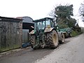 Tractor, at West Rowhorne - geograph.org.uk - 1065306.jpg 640 × 480; 71 KB
-
 Tree shadow, Princesshay car park - geograph.org.uk - 1059444.jpg 520 × 640; 95 KB
-
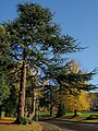 Trees, Exeter University - geograph.org.uk - 1039229.jpg 480 × 640; 118 KB
-
 Under a railway bridge, Newton Abbot - geograph.org.uk - 1184790.jpg 640 × 480; 79 KB
-
 Up Fourcross Hill - geograph.org.uk - 1072246.jpg 480 × 640; 122 KB


