Category:Nulland
| Object location | | View all coordinates using: OpenStreetMap |
|---|
neighborhood of Kerkrade, Netherlands  | |||||
| Upload media | |||||
| Instance of | |||||
|---|---|---|---|---|---|
| Location | Kerkrade, Limburg, Netherlands | ||||
 | |||||
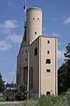
Nederlands: Nulland, voormalige ronde luchtschacht van de Domaniale Mijn
|
This is a category about rijksmonument number 23558
|
| Address |
|
Subcategories
This category has the following 4 subcategories, out of 4 total.
Media in category "Nulland"
The following 28 files are in this category, out of 28 total.
-

-
 Exterieur OVERZICHT - Nulland - 20264155 - RCE.jpg 799 × 1,200; 160 KB
-
 Exterieur OVERZICHT - Nulland - 20264156 - RCE.jpg 813 × 1,200; 143 KB
-
 Exterieur OVERZICHT - Nulland - 20264157 - RCE.jpg 1,200 × 796; 166 KB
-
 Exterieur OVERZICHT - Nulland - 20264158 - RCE.jpg 799 × 1,200; 173 KB
-
 Overzicht - Kerkrade - 20357546 - RCE.jpg 1,188 × 1,200; 319 KB
-
 Overzicht - Kerkrade - 20357547 - RCE.jpg 960 × 1,200; 243 KB
-
 Overzicht - Kerkrade - 20357548 - RCE.jpg 1,183 × 1,200; 331 KB
-
 Overzicht terrein met voormalig schachtgebouw - Nulland - 20357757 - RCE.jpg 774 × 1,200; 148 KB
-

-

-
 Overzicht voormalig schachtgebouw - Nulland - 20357758 - RCE.jpg 776 × 1,200; 136 KB
-
 Overzicht voormalig schachtgebouw - Nulland - 20357759 - RCE.jpg 801 × 1,200; 109 KB
-
 Overzicht, schacht Nulland - Nulland - 20170248 - RCE.jpg 788 × 1,200; 200 KB
-
 Schacht Nulland aan de Kipstraat - Nulland - 20170238 - RCE.jpg 1,200 × 788; 151 KB
-
 Schacht Nulland aan de Kipstraat - Nulland - 20170239 - RCE.jpg 788 × 1,200; 151 KB
-
 Schacht Nulland aan de Kipstraat - Nulland - 20170240 - RCE.jpg 788 × 1,200; 156 KB
-
 Schacht Nulland aan de Kipstraat - Nulland - 20170241 - RCE.jpg 788 × 1,200; 168 KB
-
 Schacht Nulland aan de Kipstraat - Nulland - 20170242 - RCE.jpg 1,200 × 788; 162 KB
-
 Schacht Nulland aan de Kipstraat interieur - Nulland - 20170243 - RCE.jpg 1,200 × 788; 167 KB
-
 Schacht Nulland aan de Kipstraat interieur - Nulland - 20170244 - RCE.jpg 1,200 × 795; 163 KB
-
 Schacht Nulland Kerkrade.jpg 780 × 1,172; 78 KB
-
 Schacht Nulland, overzicht - Nulland - 20170245 - RCE.jpg 1,200 × 788; 241 KB
-
 Schacht Nulland, overzicht - Nulland - 20170246 - RCE.jpg 788 × 1,200; 166 KB
-
 Schacht Nulland, overzicht - Nulland - 20170247 - RCE.jpg 1,200 × 788; 149 KB
-
 Schacht Nulland.jpg 2,658 × 4,676; 2.8 MB
-
 SchachtNulland Kerkrade.jpg 3,604 × 5,407; 3.63 MB
-
 Voorzijde - Nulland - 20170249 - RCE.jpg 792 × 1,200; 164 KB
_%27AFGEKNAPTE_ROOS%27_(ZEF_CLEMENT,_1978)_-_Kerkrade_-_20372833_-_RCE.jpg)


