Category:Nympsfield
village in Gloucestershire, England, UK  | |||||
| Upload media | |||||
| Instance of | |||||
|---|---|---|---|---|---|
| Location | Stroud, Gloucestershire, South West England, England | ||||
 | |||||
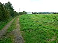
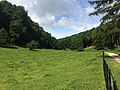
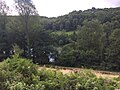
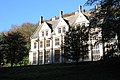
English: Nympsfield is a village and civil parish in the English county of Gloucestershire. It is located around six miles south-west of the town of Stroud. As well as Nympsfield village, the parish also contains the hamlet of Cockadilly.
Subcategories
This category has the following 5 subcategories, out of 5 total.
Media in category "Nympsfield"
The following 169 files are in this category, out of 169 total.
-
 A line of trees and bales, Woodchester Park - geograph.org.uk - 5641449.jpg 1,600 × 890; 655 KB
-
 A new stone wall by Tinkley Lane, Nympsfield - geograph.org.uk - 5857074.jpg 1,600 × 1,200; 695 KB
-
 An orchard, Nympsfield - geograph.org.uk - 2152436.jpg 1,024 × 681; 216 KB
-
 Approaching the top of Frocester Hill - geograph.org.uk - 1101629.jpg 640 × 480; 102 KB
-
 Autumn in Woodchester Park - geograph.org.uk - 3740625.jpg 1,024 × 680; 311 KB
-
 Autumn sunshine in Woodchester Park - geograph.org.uk - 3740635.jpg 680 × 1,024; 355 KB
-
 Belted Galloway cattle, Woodchester Park - geograph.org.uk - 5179208.jpg 1,024 × 768; 294 KB
-
 Berkeley Hunt, Nympsfield, Gloucestershire 1988 - geograph.org.uk - 5770437.jpg 2,543 × 1,574; 752 KB
-
 Berkeley Hunt, Nympsfield, Gloucestershire 1988 - geograph.org.uk - 5770439.jpg 2,592 × 1,045; 215 KB
-
 Boardwalk in Pontin's Plantation, Woodchester Park - geograph.org.uk - 5857039.jpg 1,200 × 1,600; 861 KB
-
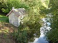
 Boat house and Middle Pond, Woodchester Park - geograph.org.uk - 5857044.jpg 1,600 × 1,200; 754 KB
-
 Boat house in Woodchester Park - geograph.org.uk - 5180708.jpg 1,024 × 768; 395 KB
-
 Boat house in Woodchester Park - geograph.org.uk - 6311104.jpg 768 × 1,024; 345 KB
-
 Boat house on Middle Pond, Woodchester Park - geograph.org.uk - 5857040.jpg 1,600 × 1,200; 867 KB
-
 Boathouse in Woodchester Park - geograph.org.uk - 1038196.jpg 426 × 640; 128 KB
-
 Break-Heart-Hill Wood - geograph.org.uk - 3740697.jpg 1,024 × 680; 352 KB
-
 Bus shelter, Nympsfield - geograph.org.uk - 1956324.jpg 1,024 × 768; 216 KB
-
 By Woodchester Mansion - geograph.org.uk - 2530938.jpg 1,024 × 768; 192 KB
-
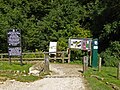
 Coaley Peak car park entrance - geograph.org.uk - 2128370.jpg 3,648 × 2,736; 3.74 MB
-
 Coaley Peak Viewpoint - geograph.org.uk - 2128149.jpg 3,648 × 2,736; 3.25 MB
-

-
 Communications mast and the road to Nympsfield - geograph.org.uk - 5857069.jpg 1,600 × 1,200; 601 KB
-
 Cotswold barns for sale Cockadilly - geograph.org.uk - 1734779.jpg 640 × 480; 56 KB
-
 Disused quarry in Woodchester Park - geograph.org.uk - 5464796.jpg 1,500 × 2,000; 1.47 MB
-
 Drain spout, Woodchester Mansion - geograph.org.uk - 5857058.jpg 1,600 × 1,200; 695 KB
-
 Drive in Woodchester Park - geograph.org.uk - 6311089.jpg 1,024 × 768; 376 KB
-
 Driveway in Woodchester Park - geograph.org.uk - 5179212.jpg 600 × 800; 208 KB
-
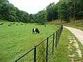 Driveway, Woodchester Park, and cattle - geograph.org.uk - 5464809.jpg 2,000 × 1,500; 1.07 MB
-
 Dry stone wall - geograph.org.uk - 193122.jpg 640 × 480; 132 KB
-
 Entrance to Cockadilly - geograph.org.uk - 4275244.jpg 640 × 480; 45 KB
-
 Entrance to Nymspfield Wind Turbine - geograph.org.uk - 3908343.jpg 600 × 800; 67 KB
-
 Entrance to picnic area, Nympsfield - geograph.org.uk - 3274118.jpg 1,600 × 1,172; 417 KB
-
 Entrance to Thistledown - geograph.org.uk - 2152429.jpg 1,024 × 681; 163 KB
-
 Entrance to Woodchester Park - geograph.org.uk - 4657244.jpg 640 × 480; 155 KB
-
 Entrance to Woodchester Park from the car park - geograph.org.uk - 5464789.jpg 2,000 × 1,451; 1,002 KB
-
 Farmland at Nympsfield - geograph.org.uk - 2152444.jpg 1,024 × 681; 190 KB
-
 Farmland near Nympsfield - geograph.org.uk - 2152465.jpg 1,024 × 681; 168 KB
-
 Field gateway - geograph.org.uk - 2152453.jpg 1,024 × 681; 199 KB
-
 Field south of Tinkley Farm - geograph.org.uk - 4267536.jpg 640 × 480; 64 KB
-
 Fields by footpath at Nympsfield - geograph.org.uk - 3926214.jpg 1,024 × 857; 203 KB
-
 Former quarry, Coaley Peak, Gloucestershire - 1.jpg 4,096 × 1,940; 3.28 MB
-
 Former quarry, Coaley Peak, Gloucestershire - 2.jpg 4,096 × 1,940; 3.06 MB
-
 Former quarry, Coaley Peak, Gloucestershire - 3.jpg 4,096 × 1,940; 3.07 MB
-
 Gargoyle - Woodchester Mansion - geograph.org.uk - 4697433.jpg 640 × 480; 89 KB
-
 Glider and tow-plane ^1 - geograph.org.uk - 5180723.jpg 800 × 600; 28 KB
-
 Glider and tow-plane ^2 - geograph.org.uk - 5180725.jpg 800 × 600; 16 KB
-

-

-
 Interesting building in Woodchester Park - geograph.org.uk - 5493611.jpg 3,264 × 2,448; 3.76 MB
-
 King George V Playing Fields - geograph.org.uk - 3336754.jpg 3,488 × 2,616; 2.17 MB
-
 Larch trees in Woodchester Park - geograph.org.uk - 1040076.jpg 426 × 640; 125 KB
-
 Lodge near Woodchester Mansion - geograph.org.uk - 2530916.jpg 1,024 × 768; 209 KB
-
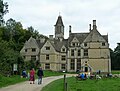
 Marist Centre - geograph.org.uk - 5708761.jpg 2,048 × 1,536; 1.19 MB
-
 Marist Convent - geograph.org.uk - 415971.jpg 640 × 480; 93 KB
-
 Marmontsflat Wood - geograph.org.uk - 5109116.jpg 1,024 × 683; 356 KB
-
 Marmontsflat Wood - geograph.org.uk - 5180718.jpg 800 × 450; 87 KB
-
 Middle Pond, Woodchester Park - geograph.org.uk - 6311107.jpg 1,024 × 768; 226 KB
-
 Middle Pond, Woodchester Park - geograph.org.uk - 931925.jpg 640 × 434; 130 KB
-
 Middle Pond, Woodchester Park ^1 - geograph.org.uk - 5180643.jpg 1,024 × 768; 245 KB
-
 Middle Pond, Woodchester Park ^2 - geograph.org.uk - 5180648.jpg 1,024 × 768; 243 KB
-
 Middle Pond, Woodchester Park ^3 - geograph.org.uk - 5180661.jpg 800 × 600; 131 KB
-
 Milestone, opposite Woodcock, nr Nympsfield (geograph 6613283).jpg 1,024 × 768; 725 KB
-
 National Trust car park, Woodchester Park - geograph.org.uk - 5857063.jpg 1,600 × 1,200; 783 KB
-
 Nympsfield Long Barrow - geograph.org.uk - 5493601.jpg 3,264 × 2,448; 3.55 MB
-
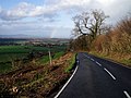
 Nympsfield Road - geograph.org.uk - 4267533.jpg 640 × 480; 52 KB
-
 Nympsfield Village Hall, Gloucestershire (geograph 6941306).jpg 1,200 × 1,600; 680 KB
-
 Nympsfield Village, Gloucestershire 2013 - geograph.org.uk - 5770441.jpg 1,805 × 1,126; 393 KB
-
 Nympsfield Working Men's Club - geograph.org.uk - 415972.jpg 640 × 480; 118 KB
-
 Old Boundary Marker beside the B4066 - geograph.org.uk - 6437084.jpg 768 × 1,024; 336 KB
-
 Old Pond, Woodchester Park - geograph.org.uk - 5180659.jpg 1,024 × 768; 297 KB
-
 Old Pond, Woodchester Park - geograph.org.uk - 5857045.jpg 1,600 × 1,200; 871 KB
-
 Old School, Nympsfield - geograph.org.uk - 1956323.jpg 1,024 × 768; 181 KB
-
 On Frocester Hill - geograph.org.uk - 1956331.jpg 1,024 × 768; 244 KB
-
 Panorama view from Coaley Peak - geograph.org.uk - 5179390.jpg 800 × 342; 57 KB
-

-
 Path across Pontin's Plantation, Woodchester Park - geograph.org.uk - 5857028.jpg 1,600 × 1,200; 744 KB
-
 Path through Woodchester Park - geograph.org.uk - 1038208.jpg 426 × 640; 136 KB
-
 Pick of the Peak - Nympsfield, Gloucestershire - geograph.org.uk - 5881144.jpg 1,024 × 700; 142 KB
-
-

-

-
 Road from Nympsfield to Horsley - geograph.org.uk - 2152459.jpg 1,024 × 681; 223 KB
-
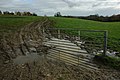
 Snow melt flooding a minor road near Woodchester Park - geograph.org.uk - 5641450.jpg 1,600 × 1,333; 963 KB
-
 St Bartholomew, Nympsfield - East end - geograph.org.uk - 3306482.jpg 558 × 843; 656 KB
-
 St Bartholomew, Nympsfield - Font - geograph.org.uk - 3306492.jpg 546 × 771; 560 KB
-
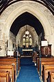
 St Bartholomew, Nympsfield - geograph.org.uk - 3306475.jpg 790 × 554; 499 KB
-
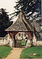 St Bartholomew, Nympsfield - Lychgate - geograph.org.uk - 3306479.jpg 586 × 817; 770 KB
-
 St Bartholomew, Nympsfield - Pulpit - geograph.org.uk - 3306487.jpg 596 × 861; 701 KB
-
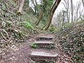 Steps leading to Frocester Hill Road - geograph.org.uk - 3446210.jpg 800 × 600; 194 KB
-
 Stoneshard Wood - geograph.org.uk - 2530957.jpg 1,024 × 768; 235 KB
-
 Sun shining on Woodchester Mansion - geograph.org.uk - 6304148.jpg 4,032 × 3,024; 2.77 MB
-
 The approach to Woodchester Mansion - geograph.org.uk - 4697437.jpg 640 × 480; 125 KB
-
 The B4066 - geograph.org.uk - 5489941.jpg 3,776 × 2,520; 4.2 MB
-
 The Cotswold Way alongside the B4066 - geograph.org.uk - 3445503.jpg 800 × 600; 140 KB
-
 The Cotswold Way at the B4066 - geograph.org.uk - 3446227.jpg 800 × 600; 160 KB
-
 The Cotswold Way leaves the B4066 - geograph.org.uk - 3446232.jpg 800 × 600; 207 KB
-
 The Cotswolds Way at Long Barrow - geograph.org.uk - 3445926.jpg 800 × 600; 158 KB
-
 The dam of the Middle Pond, Woodchester Park - geograph.org.uk - 5857020.jpg 1,200 × 1,600; 879 KB
-
 The drive to Woodchester Mansion - geograph.org.uk - 5856994.jpg 1,200 × 1,600; 805 KB
-
 The information board at Long Barrow - geograph.org.uk - 3445929.jpg 800 × 600; 178 KB
-
 The Middle Pond, Woodchester Park - geograph.org.uk - 5857019.jpg 1,600 × 1,200; 758 KB
-
 The Old Kennels - geograph.org.uk - 2530969.jpg 1,024 × 768; 312 KB
-
 The road from Nympsfield - geograph.org.uk - 2748156.jpg 2,592 × 1,944; 1.28 MB
-
 The Tower, Woodchester Park - geograph.org.uk - 5180694.jpg 1,024 × 768; 246 KB
-
 The track to Woodchester Mansion - geograph.org.uk - 4715855.jpg 1,333 × 1,000; 1.39 MB
-
 Thistledown Farm - geograph.org.uk - 5708759.jpg 2,048 × 1,536; 1.26 MB
-
 Tinkley Farm - geograph.org.uk - 4267531.jpg 640 × 480; 62 KB
-
 Tinkley Farm - geograph.org.uk - 5857085.jpg 1,600 × 1,200; 652 KB
-
 Tinkley Lane - geograph.org.uk - 4267540.jpg 640 × 480; 78 KB
-
 Tinkley Lane and Lynch Knoll Wind Turbine - geograph.org.uk - 5857081.jpg 1,600 × 1,200; 606 KB
-
 Tower on Break-Heart-Hill Wood - geograph.org.uk - 3740691.jpg 1,024 × 680; 287 KB
-
 Track crossing a dam, Woodchester Park - geograph.org.uk - 5180710.jpg 800 × 600; 152 KB
-
 Track in Woodchester Park - geograph.org.uk - 5493607.jpg 3,264 × 2,448; 2.95 MB
-
 Track through Northside Wood - geograph.org.uk - 3740619.jpg 1,024 × 680; 341 KB
-
 Track through Woodchester Park - geograph.org.uk - 3740630.jpg 680 × 1,024; 309 KB
-
 Track through Woodchester Park - geograph.org.uk - 3740652.jpg 680 × 1,024; 254 KB
-
 Track through Woodchester Park - geograph.org.uk - 931891.jpg 640 × 480; 149 KB
-
 Track to car park, Woodchester Park - geograph.org.uk - 1040828.jpg 640 × 426; 75 KB
-
 Track to Partfield Farm near Nympsfield - geograph.org.uk - 931349.jpg 640 × 480; 127 KB
-
 Track to Woodchester Mansion - geograph.org.uk - 5179354.jpg 800 × 600; 175 KB
-
 Tree in Woodchester Park - geograph.org.uk - 1039918.jpg 426 × 640; 134 KB
-
 Trees and Middle Pond, Woodchester Park - geograph.org.uk - 931938.jpg 640 × 480; 177 KB
-
 Valley at Woodchester Park - geograph.org.uk - 5493605.jpg 3,264 × 2,448; 3.14 MB
-
 Valley floor, Woodchester - geograph.org.uk - 4715848.jpg 1,333 × 1,000; 1.09 MB
-
 View from a path through Woodchester Park - geograph.org.uk - 931917.jpg 640 × 480; 201 KB
-
 View information, Coaley Peak - geograph.org.uk - 3739887.jpg 1,024 × 680; 209 KB
-
 View of The Tower, Woodchester Park - geograph.org.uk - 5180698.jpg 800 × 600; 84 KB
-
 View over Coaley and the Vale of Berkeley - geograph.org.uk - 5179384.jpg 1,024 × 768; 189 KB
-
 View over Middle Pond - geograph.org.uk - 5497717.jpg 3,264 × 2,448; 2.88 MB
-
 Wind turbine - geograph.org.uk - 2746724.jpg 769 × 1,024; 74 KB
-
 Wind Turbine - Nympsfield - geograph.org.uk - 2169037.jpg 1,600 × 1,019; 218 KB
-
 Wind turbine at Lynch Knoll - geograph.org.uk - 2152434.jpg 681 × 1,024; 157 KB
-
 Wind Turbine at Nympsfield - geograph.org.uk - 18641.jpg 640 × 480; 65 KB
-
 Wind Turbine at Nympsfield - geograph.org.uk - 3337048.jpg 640 × 480; 83 KB
-
 Wind turbine, Nympsfield - geograph.org.uk - 931339.jpg 640 × 480; 40 KB
-
 Woodchester - The Mansion - Southern façade - geograph.org.uk - 4679396.jpg 1,333 × 1,000; 964 KB
-
 Woodchester Lake Boathouse - geograph.org.uk - 1805743.jpg 1,944 × 2,592; 5.49 MB
-
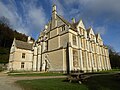
 Woodchester Mansion - geograph.org.uk - 3740662.jpg 1,024 × 680; 189 KB
-
 Woodchester Mansion - geograph.org.uk - 3740672.jpg 1,024 × 680; 217 KB
-
 Woodchester Mansion - geograph.org.uk - 4657261.jpg 640 × 480; 88 KB
-
 Woodchester Mansion - geograph.org.uk - 5109105.jpg 1,024 × 683; 185 KB
-
 Woodchester Mansion - geograph.org.uk - 5109108.jpg 1,024 × 683; 182 KB
-
 Woodchester Mansion - geograph.org.uk - 5179360.jpg 800 × 600; 117 KB
-
 Woodchester Mansion - geograph.org.uk - 5179364.jpg 800 × 600; 103 KB
-
 Woodchester Mansion - geograph.org.uk - 5179368.jpg 800 × 600; 143 KB
-
 Woodchester Mansion - walled picnic area - geograph.org.uk - 4715875.jpg 1,369 × 1,000; 1.02 MB
-
 Woodchester Mansion - Western façade - geograph.org.uk - 4715867.jpg 1,321 × 1,000; 1,016 KB
-
 Woodchester Mansion from the drive - geograph.org.uk - 5857061.jpg 1,600 × 1,200; 792 KB
-
 Woodchester Mansion reflected in a puddle - geograph.org.uk - 3740658.jpg 680 × 1,024; 216 KB
-

-

-
 Woodchester Park, Nympsfield - geograph.org.uk - 3377959.jpg 640 × 416; 259 KB
-
 Woodchester upper lake. - geograph.org.uk - 1805749.jpg 2,592 × 1,944; 4.93 MB
-
 Woodland walk, Woodchester Park - geograph.org.uk - 1040070.jpg 426 × 640; 148 KB
-

-
 Bridleway and Coaley wood - geograph.org.uk - 196262.jpg 435 × 600; 93 KB
-

-
 Cam Long Down - geograph.org.uk - 196273.jpg 600 × 450; 65 KB
-
 Cotswold edge - geograph.org.uk - 196236.jpg 600 × 450; 55 KB
-
 Field Farm - geograph.org.uk - 193110.jpg 640 × 480; 67 KB
-

-
 Frocester Hill - geograph.org.uk - 316712.jpg 640 × 480; 111 KB
-
 Frocester Hill Viewpoint - geograph.org.uk - 28447.jpg 640 × 480; 89 KB
-
 Livestock scene - geograph.org.uk - 193118.jpg 640 × 480; 66 KB
-
 Lone Generator at Lynch Knoll - geograph.org.uk - 22540.jpg 360 × 288; 9 KB
-
 Looking up Frocester Hill - geograph.org.uk - 421693.jpg 640 × 456; 402 KB
-
 Reservoir - geograph.org.uk - 192486.jpg 640 × 480; 145 KB
-
 Thunder clouds - geograph.org.uk - 196247.jpg 600 × 450; 71 KB
-


.jpg)


.jpg)


