Category:Oakhill, Djurgården
| Object location | | View all coordinates using: OpenStreetMap |
|---|
building in Stockholm Municipality, Stockholm County, Sweden  | |||||
| Upload media | |||||
| Instance of | |||||
|---|---|---|---|---|---|
| Location | Stockholm Municipality, Stockholm County, Sweden | ||||
| Architect | |||||
| Inception |
| ||||
 | |||||
Media in category "Oakhill, Djurgården"
The following 21 files are in this category, out of 21 total.
-
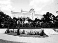
 Djurgården, Östermalm, Stockholm, Sweden - panoramio (89).jpg 4,897 × 2,756; 9.94 MB
-
 Italian Embassy in Stockholm Sweden.jpg 3,504 × 2,336; 4.83 MB
-
 Oak Hill april 2013.jpg 4,208 × 2,980; 2.95 MB
-
 Oakhill 1.jpg 834 × 549; 167 KB
-
 Oakhill 1910-tal.jpg 768 × 567; 159 KB
-
 Oakhill 2.jpg 1,794 × 1,305; 650 KB
-
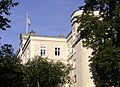
 Oakhill 2010.jpg 3,264 × 2,448; 2.55 MB
-
 Oakhill 2017.jpg 4,380 × 3,165; 4.28 MB
-
 Oakhill 3.jpg 2,526 × 1,773; 1.34 MB
-
 Oakhill Idun 1910.jpg 2,568 × 1,968; 1.43 MB
-
 Oakhill, 2017z.jpg 4,715 × 3,300; 4.56 MB
-
 Oakhill, bil.jpg 3,032 × 2,048; 1.57 MB
-
 Oakhill, Bobergs skiss.jpg 1,308 × 888; 425 KB
-
 Oakhill, Maria, 1910.JPG 893 × 673; 176 KB
-
 Oakhill, Trapphall (1).jpg 3,125 × 2,340; 2.43 MB
-
 Oakhill, Trapphall.jpg 2,568 × 3,156; 2.26 MB
-
 Oakhill, vardagsrum.jpg 870 × 592; 164 KB
-
 Oakhill, vykort.jpg 1,496 × 1,029; 904 KB
-
 Stockholm 111 (31438116545).jpg 2,816 × 2,112; 2.3 MB
-
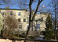
 Stockholm 2009 PD 139.JPG 4,272 × 2,848; 4.7 MB
-
 Södra Djurgården 1866 (Jenny Hill).jpg 619 × 408; 177 KB
.jpg)


.jpg)


.jpg)

.jpg)