Category:Oat fields in the United Kingdom

Media in category "Oat fields in the United Kingdom"
The following 86 files are in this category, out of 86 total.
-
 A crop of oats - geograph.org.uk - 896255.jpg 480 × 640; 188 KB
-
 A field of rather flattened oats - geograph.org.uk - 507132.jpg 640 × 480; 99 KB
-
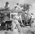
 Binder at Work - geograph.org.uk - 249887.jpg 640 × 507; 269 KB
-
 Crop of oats - geograph.org.uk - 895281.jpg 640 × 480; 96 KB
-
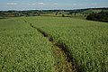
 Cut path through a field of oats - geograph.org.uk - 486530.jpg 640 × 480; 94 KB
-
 Farmer getting his oats - geograph.org.uk - 1437649.jpg 640 × 423; 128 KB
-
 Farmland near Winterbourne Stoke - geograph.org.uk - 489491.jpg 640 × 480; 117 KB
-
 Farmland, East Garston - geograph.org.uk - 497738.jpg 640 × 480; 237 KB
-
 Farmland, East Garston - geograph.org.uk - 497744.jpg 640 × 480; 260 KB
-
 Farmland, East Garston - geograph.org.uk - 893025.jpg 640 × 480; 169 KB
-
 Farmland, East Garston - geograph.org.uk - 893050.jpg 640 × 480; 132 KB
-
 Farmland, Great Durnford - geograph.org.uk - 513122.jpg 640 × 480; 136 KB
-
 Farmland, Great Shefford - geograph.org.uk - 892975.jpg 640 × 480; 145 KB
-
 Farmland, Mere Down - geograph.org.uk - 907068.jpg 640 × 480; 161 KB
-
 Farmland, Ramsbury - geograph.org.uk - 857291.jpg 640 × 480; 127 KB
-
 Farmland, Woodlands Park - geograph.org.uk - 875477.jpg 640 × 480; 137 KB
-
 Farmland, Woodlands Park - geograph.org.uk - 875486.jpg 640 × 480; 136 KB
-
 Field headland, Little Shoddesden - geograph.org.uk - 920879.jpg 640 × 480; 112 KB
-
 Field of Oats - geograph.org.uk - 1402610.jpg 640 × 427; 100 KB
-
 Field of oats - geograph.org.uk - 908635.jpg 640 × 480; 102 KB
-
 Field of oats - geograph.org.uk - 924804.jpg 640 × 480; 114 KB
-
 Field of oats above Cassey Compton - geograph.org.uk - 882444.jpg 640 × 426; 90 KB
-
 Field of oats, Munderfield Row - geograph.org.uk - 457483.jpg 640 × 426; 142 KB
-
 Footpath by a Field of Oats - geograph.org.uk - 1397749.jpg 640 × 427; 106 KB
-
 Footpath through the oats - geograph.org.uk - 187566.jpg 480 × 640; 108 KB
-
 Harvested oats - geograph.org.uk - 534162.jpg 640 × 480; 87 KB
-
 Harvesting at Mount Barton, Devon, England, 1942 D10307.jpg 1,843 × 1,772; 1,002 KB
-
 Harvesting at Mount Barton, Devon, England, 1942 D10313.jpg 800 × 774; 111 KB
-
 Harvesting at Mount Barton, Devon, England, 1942 D10329.jpg 800 × 774; 89 KB
-
 Harvesting at Mount Barton, Devon, England, 1942 D10334.jpg 1,823 × 1,772; 1,005 KB
-

-
 Oak and oats - geograph.org.uk - 908651.jpg 640 × 380; 44 KB
-
 Oat crop north of Bromsash - geograph.org.uk - 901101.jpg 640 × 480; 110 KB
-
 Oat Field - geograph.org.uk - 1344764.jpg 640 × 480; 107 KB
-
 Oat field - geograph.org.uk - 482323.jpg 480 × 640; 131 KB
-
 Oat Field - geograph.org.uk - 891295.jpg 640 × 424; 75 KB
-
 Oat Field and Iron Works - geograph.org.uk - 918000.jpg 427 × 640; 227 KB
-
 Oat field by the B4218 - geograph.org.uk - 895344.jpg 640 × 339; 63 KB
-
 Oat field margin - geograph.org.uk - 911517.jpg 640 × 480; 95 KB
-
 Oat field off swineham Lane - geograph.org.uk - 891311.jpg 640 × 424; 84 KB
-
 Oat field on the downs above Postling - geograph.org.uk - 1414735.jpg 640 × 480; 263 KB
-
 Oat field on the machair - geograph.org.uk - 713390.jpg 640 × 480; 71 KB
-
 Oat harvest on the machair at Solas - geograph.org.uk - 1516678.jpg 640 × 480; 122 KB
-
 Oats - geograph.org.uk - 1423241.jpg 640 × 427; 116 KB
-
 Oats at Cassey Compton - geograph.org.uk - 882449.jpg 640 × 426; 113 KB
-
 Oats beside a dismantled railway - geograph.org.uk - 1393104.jpg 640 × 428; 93 KB
-
 Oats in Grendon Bishop - geograph.org.uk - 202456.jpg 640 × 427; 88 KB
-
 Oats in Pendomer - geograph.org.uk - 903306.jpg 480 × 640; 90 KB
-
 Oats, East Garston - geograph.org.uk - 892986.jpg 640 × 480; 138 KB
-
 Oats, Pirnhill - geograph.org.uk - 201698.jpg 640 × 478; 202 KB
-
 Oats, Pirnhill - geograph.org.uk - 201701.jpg 640 × 478; 191 KB
-
-
 Orchardbank - geograph.org.uk - 222236.jpg 640 × 427; 254 KB
-
 Pheasants near Coarsewell Cross - geograph.org.uk - 1381334.jpg 640 × 399; 105 KB
-
 Restricted byway, White Waltham - geograph.org.uk - 875487.jpg 640 × 480; 120 KB
-
 Shetland oats, Northdale - geograph.org.uk - 2827309.jpg 800 × 532; 270 KB
-
 South east from A3102 at Pillars Lodge - geograph.org.uk - 1421716.jpg 640 × 475; 120 KB
-
 Spraying oats near Boveney Lock - geograph.org.uk - 897466.jpg 640 × 479; 73 KB
-
 Stoodleigh, towards Oakford - geograph.org.uk - 186504.jpg 640 × 427; 226 KB
-
 Storm damaged Oats - geograph.org.uk - 903291.jpg 640 × 480; 131 KB
-
 Sunset at Shelland - geograph.org.uk - 850223.jpg 640 × 427; 60 KB
-
 The stooks are stacked, Northdale - geograph.org.uk - 994845.jpg 640 × 426; 130 KB
-
 Towards Bishop Wilton - geograph.org.uk - 211260.jpg 640 × 479; 70 KB
-
 Upper Darley - geograph.org.uk - 555628.jpg 640 × 427; 247 KB
-
 View south-east from Highfield Farm - geograph.org.uk - 870884.jpg 640 × 480; 57 KB
-
 View towards Duddo Hill - geograph.org.uk - 499595.jpg 640 × 480; 108 KB
-
 Wind blown oats - geograph.org.uk - 497734.jpg 640 × 480; 207 KB
-
 A Field of Oats - geograph.org.uk - 990486.jpg 640 × 427; 283 KB
-
 Barn Ham - geograph.org.uk - 1413898.jpg 640 × 480; 90 KB
-
 Farm track near Upper House Farm - geograph.org.uk - 492513.jpg 640 × 480; 128 KB
-
 Field oats at Dunshill - geograph.org.uk - 565210.jpg 640 × 426; 151 KB
-
 Field of oats - geograph.org.uk - 451975.jpg 640 × 480; 413 KB
-
 Field of Oats near Docklow - geograph.org.uk - 202459.jpg 640 × 480; 48 KB
-
 Flattened oats - geograph.org.uk - 534165.jpg 640 × 480; 89 KB
-
 Greeve Dingle, near Munderford Row - geograph.org.uk - 457485.jpg 640 × 426; 118 KB
-
 Hilltop House and a field of Oats - geograph.org.uk - 217194.jpg 640 × 427; 106 KB
-
 Oat crop near Queenswood - geograph.org.uk - 527416.jpg 640 × 480; 109 KB
-
 Oat crop with sentinel - geograph.org.uk - 451571.jpg 640 × 479; 519 KB
-
 Oat crop, Linton Hill - geograph.org.uk - 474985.jpg 640 × 480; 395 KB
-
 Oat field and pylon line - geograph.org.uk - 498529.jpg 640 × 469; 118 KB
-
 Oat field at Hill Farm - geograph.org.uk - 457939.jpg 640 × 480; 144 KB
-
 Oat field by Norwich Road, Swaffham - geograph.org.uk - 475746.jpg 640 × 480; 102 KB
-
 Oat straw - geograph.org.uk - 218594.jpg 640 × 480; 100 KB
-
 Oats near Maidenhyde Farm - geograph.org.uk - 202511.jpg 640 × 480; 85 KB
-
 Oats, Edge - geograph.org.uk - 515564.jpg 640 × 480; 103 KB
-
 Oats, Leinthall - geograph.org.uk - 206215.jpg 640 × 480; 103 KB


