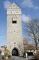
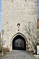
Category:Oberes Tor (Münnerstadt)
| Object location | | View all coordinates using: OpenStreetMap |
|---|
Gate in Münnerstadt, Germany  | |||||
| Upload media | |||||
| Instance of | |||||
|---|---|---|---|---|---|
| Location | Münnerstadt, Bad Kissingen, Lower Franconia, Bavaria, Germany | ||||
| Street address |
| ||||
| Heritage designation | |||||
 | |||||
Media in category "Oberes Tor (Münnerstadt)"
The following 19 files are in this category, out of 19 total.
-
 Muennerstadt 2011 024.jpg 2,048 × 1,536; 1.1 MB
-
 MÜN oberesTor 2014-04.jpg 1,208 × 1,812; 803 KB
-

-

-

-
 Münnerstadt Oberes Tor.jpg 3,264 × 2,448; 3.04 MB
-
 Münnerstadt von Osten, Oberes Tor-001.jpg 4,928 × 3,264; 11.1 MB
-
 Münnerstadt, Obertor-001.jpg 3,155 × 4,763; 9.76 MB
-
 Münnerstadt, Obertor-002.jpg 3,264 × 4,928; 9.51 MB
-
 Münnerstadt, Obertor-003.jpg 3,264 × 4,928; 8.12 MB
-
 Münnerstadt, Obertor-004.jpg 3,264 × 4,928; 9.01 MB
-
 Münnerstadt, Obertor-005.jpg 3,264 × 4,928; 6.36 MB
-
 Oberes tor 1.jpg 772 × 1,526; 159 KB
-
 Oberes Tor 2.jpg 530 × 1,101; 98 KB
-
 Oberes Tor i Münnerstadt - TEK - TEKA0117798.tif 3,543 × 3,522; 23.84 MB
-
 Oberes Tor, Münnerstadt - TEK - TEKA0117803.tif 2,819 × 3,543; 19.08 MB
-
 Oberes Tor25112016.JPG 3,220 × 4,830; 10.1 MB
-
 Veit-Stoß-Straße 45, Oberes Tor Münnerstadt 20191220 001.jpg 5,409 × 3,611; 11.06 MB
-
 Veit-Stoß-Straße 45, Oberes Tor Münnerstadt 20191220 002.jpg 3,593 × 5,382; 11.64 MB


-Stadttor_-Oberes_Tor-_Feldseite_mit_Durchfahrt_und_steinerner_Fallgatterf%C3%BChrung-04082012.JPG)
-Stadttor_-Oberes_Tor-_Feldseite-oberes_Geschoss_mit_Wurferker_im_Detail-04082012.JPG)
-Stadttor_-Oberes_Tor-_von_Feldseite_(S%C3%BCd)_in_%C3%9Cbersicht-04082012.JPG)


