Category:Oberferdinandsdorf
| Object location | | View all coordinates using: OpenStreetMap |
|---|
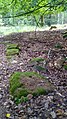
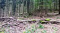
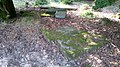
Around 1850 dissolved hamlet, which together with Unterferdinandsdorf formed the municipality of Ferdinandsdorf.   | |||||
| Upload media | |||||
| Instance of | |||||
|---|---|---|---|---|---|
| Part of | |||||
| Location |
| ||||
 | |||||
Media in category "Oberferdinandsdorf"
The following 12 files are in this category, out of 12 total.
-
 Gebäudereste Oberferdinandsdorf 2.jpg 4,608 × 2,592; 4.92 MB
-
 Gebäudereste Oberferdinandsdorf 3.jpg 4,608 × 2,592; 4.28 MB
-
 Gebäudereste Oberferdinandsdorf 4.jpg 1,944 × 3,456; 1.96 MB
-
 Gebäudereste Oberferdinandsdorf.jpg 4,608 × 2,592; 4.29 MB
-
 Lage von Ober- und Unterferdinandsdorf.jpg 1,487 × 793; 561 KB
-
 Lesesteinriegel auf Winterhauch.jpg 3,840 × 2,160; 5.11 MB
-
 Reste Dorfbrunnen Oberferdinandsdorf.jpg 4,608 × 2,592; 3.99 MB
-
 Siedlungsrest Lesesteinriegel Oberferdinandsdorf.jpg 5,376 × 3,024; 8.71 MB
-
 Siedlungsreste Oberdinandsdorf.jpg 4,608 × 3,456; 5.94 MB
-
 Siedlungsspuren Oberferdinandsdorf.jpg 4,608 × 3,456; 6.99 MB
-
 Verfüllter Brunnen bei Oberferdinandsdorf 2.jpg 4,608 × 3,456; 6.9 MB
-
 Verfüllter Brunnen bei Oberferdinandsdorf.jpg 3,456 × 4,608; 7.82 MB


