Category:October 2008 on the Isle of Wight
English: Images/pictures taken on the Isle of Wight during October 2008. Note this is not the date of the upload, nor the date a photo was scanned.
| October 2007 | ← | October 2008 | → | October 2009 | |||||||
| Jan | Feb | Mar | Apr | May | Jun | Jul | Aug | Sep | Oct | Nov | Dec |
Subcategories
This category has only the following subcategory.
Media in category "October 2008 on the Isle of Wight"
The following 68 files are in this category, out of 68 total.
-
 Yarmouth (IOW) Railway Station.jpg 640 × 427; 113 KB
-
 Appley Road - geograph.org.uk - 1047881.jpg 640 × 480; 81 KB
-
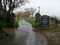
 Arreton, Gore cemetery - geograph.org.uk - 1035290.jpg 640 × 480; 112 KB
-
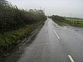 B3327 heading to Wroxall - geograph.org.uk - 1034033.jpg 640 × 480; 58 KB
-
 B3327 heads south out of Wroxall - geograph.org.uk - 1034077.jpg 640 × 480; 63 KB
-
 Bembridge Airport - geograph.org.uk - 1047468.jpg 640 × 480; 64 KB
-
 Bembridge Fort - geograph.org.uk - 1047507.jpg 640 × 480; 58 KB
-
 Bembridge Harbour Beach - geograph.org.uk - 1048024.jpg 640 × 480; 67 KB
-
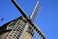 Bembridge Windmill - geograph.org.uk - 1000858.jpg 640 × 427; 64 KB
-
 Blackgang Chine - geograph.org.uk - 1040542.jpg 640 × 480; 78 KB
-
 Blackwater Hollow bus stop flag.JPG 2,004 × 2,172; 1.53 MB
-
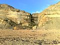
 Bouldnor Cliff - geograph.org.uk - 1027398.jpg 640 × 427; 164 KB
-
 Bouldnor Cliff - geograph.org.uk - 1096726.jpg 640 × 427; 109 KB
-
 Bouldnor Cliff - geograph.org.uk - 1096733.jpg 640 × 427; 158 KB
-
 Bouldnor Cliff - geograph.org.uk - 1096744.jpg 640 × 427; 194 KB
-
 Bouldnor Sea Wall - geograph.org.uk - 1049352.jpg 640 × 480; 62 KB
-
 Brading church - geograph.org.uk - 1011258.jpg 446 × 640; 62 KB
-
 Brading station - geograph.org.uk - 1039610.jpg 640 × 480; 52 KB
-
 Byway BS76 - geograph.org.uk - 1041545.jpg 640 × 480; 115 KB
-
 Chain bridge arriving at East Cowes - geograph.org.uk - 1011231.jpg 640 × 438; 66 KB
-
 Church of St Mary the Virgin - geograph.org.uk - 1047787.jpg 640 × 480; 63 KB
-
 Coastal Footpath S27 - geograph.org.uk - 1045406.jpg 640 × 480; 130 KB
-
 Coastal path - geograph.org.uk - 1033948.jpg 640 × 480; 125 KB
-
 Coastal Path - geograph.org.uk - 1045446.jpg 640 × 480; 95 KB
-
 Coastal Path - geograph.org.uk - 1045467.jpg 640 × 480; 89 KB
-
 Coastal Path - geograph.org.uk - 1050715.jpg 640 × 480; 62 KB
-
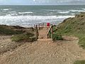
 Coastal path above Fishing Cove - geograph.org.uk - 1029954.jpg 640 × 480; 72 KB
-
 Coastal path heading to Spring Vale - geograph.org.uk - 1038488.jpg 640 × 480; 87 KB
-

-
 Coppins Bridge Roundabout sign.JPG 2,304 × 3,072; 2.14 MB
-
 Cottage across the field - geograph.org.uk - 1041853.jpg 640 × 480; 100 KB
-
 Cowleaze Chine 2009.jpg 2,592 × 1,944; 1.06 MB
-
 Cowleaze Chine2.jpg 2,592 × 1,944; 1.58 MB
-
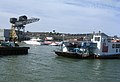
 Crane at Cowes - geograph.org.uk - 1087273.jpg 640 × 427; 148 KB
-
 Crane at Cowes - geograph.org.uk - 1087276.jpg 427 × 640; 209 KB
-
 Dinosaur Footprint - geograph.org.uk - 1018758.jpg 640 × 427; 90 KB
-
 Entrance to Amazon world - geograph.org.uk - 1038166.jpg 640 × 480; 77 KB
-
 Entrance to Appuldurcombe house - geograph.org.uk - 1034046.jpg 640 × 480; 90 KB
-
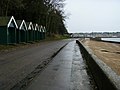 Esplanade East Cowes - geograph.org.uk - 1034273.jpg 640 × 480; 64 KB
-
 Field and hedgerow - geograph.org.uk - 1041773.jpg 640 × 480; 53 KB
-
 Field by Military road - geograph.org.uk - 1040810.jpg 640 × 480; 80 KB
-
 Field off Whitwell road - geograph.org.uk - 1035105.jpg 640 × 480; 57 KB
-
 Field to Barnes High - geograph.org.uk - 1040785.jpg 640 × 480; 107 KB
-
 Footpath across the field - geograph.org.uk - 1038140.jpg 640 × 480; 101 KB
-
 Footpath across the railway line - geograph.org.uk - 1039620.jpg 640 × 480; 94 KB
-
 Footpath to Coastal path - geograph.org.uk - 1041515.jpg 640 × 480; 87 KB
-
 Footpath to Roud - geograph.org.uk - 1035150.jpg 640 × 480; 112 KB
-
 Footpath to Strathwell park - geograph.org.uk - 1035061.jpg 640 × 480; 74 KB
-
 Footpath up Gore Down - geograph.org.uk - 1040566.jpg 640 × 480; 83 KB
-
 All Saints Church Godshill - geograph.org.uk - 1042840.jpg 640 × 480; 77 KB
-
 Havenstreet Station - geograph.org.uk - 1045232.jpg 640 × 480; 85 KB
-
 Howgate Road - geograph.org.uk - 1048059.jpg 640 × 480; 85 KB
-
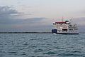 Isle of Wight ferry - geograph.org.uk - 1104694.jpg 640 × 427; 134 KB
-
 Looking across the River Yar - geograph.org.uk - 1049201.jpg 640 × 425; 65 KB
-
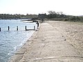 Looking down to the jetty - geograph.org.uk - 1038321.jpg 640 × 480; 86 KB
-
 Merstone station - geograph.org.uk - 1035274.jpg 640 × 480; 86 KB
-
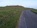
 Old Castle Point - geograph.org.uk - 1034280.jpg 640 × 480; 87 KB
-
-
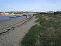
 Beach at St Helens - geograph.org.uk - 1038335.jpg 640 × 480; 73 KB
-
 Shippards Chine - geograph.org.uk - 1048125.jpg 640 × 480; 65 KB
-
 Shippards Chine.jpg 2,592 × 1,944; 1.25 MB
-
 Southern Vectis 304 rear.JPG 1,847 × 1,311; 444 KB
-
 Southern Vectis 304.JPG 2,278 × 1,292; 567 KB
-
 St Catherine's Lighthouse - geograph.org.uk - 1050744.jpg 640 × 425; 57 KB
-
 St Catherines Lighthouse - geograph.org.uk - 1018766.jpg 427 × 640; 34 KB
-
 Thorness Bay.jpg 2,592 × 1,944; 642 KB
-
 Ventnor botanic gardens - geograph.org.uk - 1034141.jpg 640 × 480; 111 KB
-
 Whale Chine - geograph.org.uk - 1039687.jpg 640 × 480; 82 KB
_Railway_Station.jpg)


