Category:October 2011 in York
Ok
Deutsch: Bilder, die im Oktober 2011 in York aufgenommen worden sind. Bitte beachten Sie, dass dies weder das Datum des Uploads noch das Datum des Scannens eines Fotos ist.
English: Images/pictures taken in York during October 2011. Note this is not the date of the upload, nor the date a photo was scanned.
Español: Fotografías o imágenes tomadas en York durante octubre 2011. No es la fecha de subida ni escaneo, sino la fecha en que las fotografías o imágenes se crearon.
Esperanto: Bildoj faritaj en York en oktobro 2011. Tio ne estas la dato, kiam la bildoj estis alŝutitaj aŭ skanitaj.
Français : Photographies ou images prises en York durant octobre 2011. Ce n'est pas la date du téléchargement ou du scan.
Galego: Fotografías ou imaxes tomadas en York durante outubro 2011. Non é a data de subida nin escaneamento, senón a data na que se crearon as fotografías ou imaxes.
Italiano: Fotografie o immagini scattate a York nel ottobre 2011. Nota bene: la data non si riferisce né a quella di upload né a quella in cui la foto è stata digitalizzata.
Norsk bokmål: Bilder tatt i York i løpet av oktober 2011. Merk at dette ikke er datoen for opplasting, eller når et bilde har blitt skannet.
Norsk nynorsk: Bilete teke i York i løpet av oktober 2011. Merk at dette ikkje er datoen for opplasting, eller når eit bilete har vorte skanna.
Русский: Изображения, сделанные в York в течение октябрь 2011 (не дата загрузки изображения).
Українська: Зображення, зроблені в York протягом жовтень 2011. Зауважте, що це не дата завантаження чи дата сканування фотографії.
| October 2010 | ← | October 2011 | → | October 2012 | |||||||
| Jan | Feb | Mar | Apr | May | Jun | Jul | Aug | Sep | Oct | Nov | Dec |
| 50 | 252 | 183 | 313 | 144 | 78 | 194 | 416 | 162 | 361 | 60 | 237 |
|---|---|---|---|---|---|---|---|---|---|---|---|
Media in category "October 2011 in York"
The following 200 files are in this category, out of 361 total.
(previous page) (next page)-
 16-40 race - geograph.org.uk - 2638441.jpg 640 × 480; 110 KB
-
 185 146 Enters York from the North.jpg 3,052 × 1,836; 859 KB
-

-
 90 028 runs round at York - 6203793641.jpg 2,364 × 1,628; 605 KB
-
 90 028 runs round at York.jpg 2,262 × 2,118; 574 KB
-
 A1036 towards York - geograph.org.uk - 2649932.jpg 1,600 × 1,200; 261 KB
-
 A1036 towards York - geograph.org.uk - 2649941.jpg 1,600 × 1,200; 460 KB
-
 A59 - viewed from Hodgson Lane - geograph.org.uk - 2659673.jpg 640 × 480; 43 KB
-
 A59 - viewed from Hodgson Lane - geograph.org.uk - 2659675.jpg 640 × 480; 45 KB
-
 A64 bridge over Top Lane - geograph.org.uk - 2649926.jpg 1,600 × 1,200; 444 KB
-
 A64 eastbound - geograph.org.uk - 2650011.jpg 1,600 × 1,200; 487 KB
-
 A64 towards Leeds - geograph.org.uk - 2648499.jpg 1,600 × 1,200; 232 KB
-
 A64 towards Leeds - geograph.org.uk - 2650047.jpg 1,024 × 616; 91 KB
-
 Acacia Grove - Oaken Grove - geograph.org.uk - 2669738.jpg 640 × 480; 42 KB
-
 All Saints Church - Hodgson Lane - geograph.org.uk - 2659651.jpg 640 × 480; 110 KB
-

-
 Allotments - Station Road - geograph.org.uk - 2669561.jpg 640 × 480; 65 KB
-
 Allotments off Bishopthorpe Road - geograph.org.uk - 2649990.jpg 1,600 × 1,200; 402 KB
-
 Apartments off Bishopthorpe Road - geograph.org.uk - 2649984.jpg 1,600 × 1,200; 782 KB
-
 Apple Garth - Dikelands Lane - geograph.org.uk - 2660382.jpg 640 × 480; 71 KB
-
 Arenhall Close - Kirkcroft - geograph.org.uk - 2670668.jpg 640 × 480; 44 KB
-
 Aroma Coffee Shop - The Village - geograph.org.uk - 2671382.jpg 640 × 480; 72 KB
-
 Ascot Road - Mill Lane - geograph.org.uk - 2670584.jpg 640 × 480; 65 KB
-
 Back Lane - Greenshaw Drive - geograph.org.uk - 2671168.jpg 640 × 444; 56 KB
-
 Back Lane, Copmanthorpe - geograph.org.uk - 2649906.jpg 1,600 × 1,200; 225 KB
-
 Bankside Close - Springfield Road - geograph.org.uk - 2660687.jpg 640 × 480; 103 KB
-
 Barclays - The Village - geograph.org.uk - 2671350.jpg 640 × 480; 63 KB
-
 Barley View - Wheatfield Lane - geograph.org.uk - 2670643.jpg 640 × 480; 56 KB
-
 Barn, Woodside Farm - geograph.org.uk - 2648641.jpg 1,600 × 1,200; 597 KB
-
 Beech Grove - Hodgson Lane - geograph.org.uk - 2659655.jpg 640 × 480; 103 KB
-
 Beech Way - Dikelands Lane - geograph.org.uk - 2660385.jpg 640 × 480; 67 KB
-
 Bell Close - Green Dike - geograph.org.uk - 2670619.jpg 640 × 480; 56 KB
-
 Bishopthorpe Road heading north - geograph.org.uk - 2649976.jpg 1,600 × 1,200; 315 KB
-
 Bishopthorpe Road heading south - geograph.org.uk - 2649979.jpg 1,600 × 1,200; 473 KB
-
 Bishopthorpe Road heading south - geograph.org.uk - 2649996.jpg 1,600 × 1,200; 641 KB
-
 Bishopthorpe Road heading south - geograph.org.uk - 2650009.jpg 1,600 × 1,200; 642 KB
-
 Black Dike Lane - off A59 - geograph.org.uk - 2659680.jpg 640 × 480; 75 KB
-
 Black Dike Lane - Station Road - geograph.org.uk - 2659763.jpg 640 × 480; 84 KB
-
 Boots Chemists - The Village - geograph.org.uk - 2671239.jpg 640 × 480; 90 KB
-
 Bowling Green - off Main Street - geograph.org.uk - 2659202.jpg 640 × 480; 46 KB
-

-
 Brackenhills - Dikelands Lane - geograph.org.uk - 2660379.jpg 640 × 480; 53 KB
-
 Bridge Close - Eastfield Avenue - geograph.org.uk - 2672220.jpg 640 × 480; 51 KB
-
 Bridge over the A64 - geograph.org.uk - 2650058.jpg 1,600 × 884; 147 KB
-
 Bridge Road, Bishopthorpe - geograph.org.uk - 2648565.jpg 1,600 × 1,200; 432 KB
-
 Briergate - Eastfield Avenue - geograph.org.uk - 2672221.jpg 640 × 441; 46 KB
-
 Briergate - Oak Tree Lane - geograph.org.uk - 2672225.jpg 640 × 480; 52 KB
-
 Broad Acres - Eastfield Avenue - geograph.org.uk - 2672218.jpg 640 × 480; 53 KB
-
 Broad Oak Lane - Greenshaw Drive - geograph.org.uk - 2671158.jpg 640 × 480; 44 KB
-
 Burlands Lane - A59 - geograph.org.uk - 2659738.jpg 640 × 480; 56 KB
-
 Burrill Drive - Walmer Carr - geograph.org.uk - 2670594.jpg 640 × 457; 49 KB
-
 Butt Hill - Walmer Carr - geograph.org.uk - 2670602.jpg 640 × 480; 57 KB
-
 Butters Close - Walmer Carr - geograph.org.uk - 2670599.jpg 640 × 480; 56 KB
-
 Calf Close - Station Road - geograph.org.uk - 2669559.jpg 640 × 480; 44 KB
-
 Calf Close - York Road - geograph.org.uk - 2672166.jpg 640 × 480; 58 KB
-
 Carmires Avenue - Windmill Way - geograph.org.uk - 2669708.jpg 640 × 480; 57 KB
-
 Chaloners Road - geograph.org.uk - 2649950.jpg 1,600 × 1,200; 613 KB
-
 Chantry Gap - Dikelands Lane - geograph.org.uk - 2660384.jpg 640 × 480; 50 KB
-
 Chantry Gap - Main Street - geograph.org.uk - 2659435.jpg 640 × 480; 61 KB
-
 Chantry Green - Main Street - geograph.org.uk - 2659432.jpg 640 × 480; 66 KB
-
 Chantry Grove - Chantry Gap - geograph.org.uk - 2659438.jpg 640 × 480; 54 KB
-
 Church Lane (footpath) - Greenshaw Drive - geograph.org.uk - 2671135.jpg 480 × 640; 128 KB
-
 Church Lane - The Village - geograph.org.uk - 2670561.jpg 640 × 480; 52 KB
-

-
 Churchfield Drive - Kirkcroft - geograph.org.uk - 2671106.jpg 640 × 487; 54 KB
-
 Cinema complex, Blackburn - geograph.org.uk - 2639625.jpg 3,888 × 2,592; 3.93 MB
-
 Copwood Grove - Barley View - geograph.org.uk - 2670653.jpg 640 × 480; 52 KB
-
 Corban Way - Walmer Carr - geograph.org.uk - 2670601.jpg 640 × 480; 59 KB
-
 Corner Close - Mill Lane - geograph.org.uk - 2670592.jpg 640 × 480; 48 KB
-
 Cycle path towards York - geograph.org.uk - 2649934.jpg 1,600 × 1,200; 587 KB
-
 Cycle track towards York - geograph.org.uk - 2648557.jpg 1,600 × 1,200; 577 KB
-
 Cycle track towards York on Naburn Bridge - geograph.org.uk - 2648542.jpg 1,600 × 1,200; 274 KB
-
 Cyprus Grove - Oaken Grove - geograph.org.uk - 2669742.jpg 640 × 480; 44 KB
-
 Dealtry Avenue - Kirkcroft - geograph.org.uk - 2670659.jpg 640 × 480; 46 KB
-
 Designer Outlet access road - geograph.org.uk - 2648511.jpg 1,600 × 1,200; 607 KB
-
 Designer Outlet car park - geograph.org.uk - 2648503.jpg 1,600 × 1,200; 294 KB
-
 Designer Outlet car park - geograph.org.uk - 2648508.jpg 1,600 × 1,200; 443 KB
-
 Dikelands Close - Dikelands Lane - geograph.org.uk - 2660377.jpg 640 × 480; 56 KB
-
 Dikelands Lane - Long Ridge Lane - geograph.org.uk - 2660376.jpg 640 × 480; 102 KB
-
 Dikelands Lane - Main Street - geograph.org.uk - 2659411.jpg 640 × 480; 67 KB
-
 Disused railway bridge over Naburn Lane - geograph.org.uk - 2648521.jpg 1,600 × 1,200; 594 KB
-
 Dutch Nurseries - The Village - geograph.org.uk - 2671242.jpg 640 × 480; 61 KB
-

-

-

-
 Eastfield Avenue - York Road - geograph.org.uk - 2672251.jpg 640 × 480; 45 KB
-
 Easthorpe Drive - Allerton Drive - geograph.org.uk - 2660730.jpg 640 × 480; 57 KB
-
 Easthorpe Drive - Allerton Drive - geograph.org.uk - 2660731.jpg 640 × 480; 70 KB
-
 Easthorpe Drive - Millfield Lane - geograph.org.uk - 2660745.jpg 640 × 480; 54 KB
-
 Ebor Way (Roman road) towards Copmanthorpe - geograph.org.uk - 2649894.jpg 1,600 × 1,200; 656 KB
-
 Ebor Way - Allerton Drive - geograph.org.uk - 2660703.jpg 640 × 451; 55 KB
-
 Ebor Way - Allerton Drive - geograph.org.uk - 2660705.jpg 640 × 480; 62 KB
-
 Ebor Way - Dikelands Lane - geograph.org.uk - 2660388.jpg 640 × 480; 65 KB
-
 Ebor Way - Millfield Lane - geograph.org.uk - 2660760.jpg 640 × 480; 45 KB
-
 Electricity Substation - Dikelands Lane - geograph.org.uk - 2660386.jpg 640 × 480; 125 KB
-
 Electricity Substation - Station Road - geograph.org.uk - 2660373.jpg 640 × 480; 118 KB
-
 Electricity Substation - York Road - geograph.org.uk - 2672167.jpg 640 × 480; 103 KB
-
 Elm Tree Avenue - Apple Garth - geograph.org.uk - 2660383.jpg 640 × 470; 61 KB
-
 Elm Tree Avenue - Ebor Way - geograph.org.uk - 2660389.jpg 640 × 480; 52 KB
-

-
 Face to Face at York.jpg 2,312 × 2,277; 3.44 MB
-
 Falcon Close - Windmill Way - geograph.org.uk - 2669577.jpg 640 × 480; 47 KB
-
 Farm track (footpath) off Ebor Way - geograph.org.uk - 2649884.jpg 1,600 × 1,200; 781 KB
-
 Farmland near Acaster Malbis - geograph.org.uk - 2648602.jpg 1,600 × 1,200; 315 KB
-
 Farmland near Bishopthorpe - geograph.org.uk - 2648552.jpg 1,600 × 1,200; 571 KB
-
 Farmland near Bishopthorpe - geograph.org.uk - 2648568.jpg 1,600 × 1,200; 298 KB
-
 Farmland near Copmanthorpe - geograph.org.uk - 2649888.jpg 1,600 × 1,200; 578 KB
-
 Farmland near Copmanthorpe - geograph.org.uk - 2649892.jpg 1,600 × 1,200; 609 KB
-
 Farmland Northmoor Gate - geograph.org.uk - 2648570.jpg 1,600 × 1,200; 439 KB
-
 Farmland off Temple Lane - geograph.org.uk - 2648622.jpg 1,600 × 1,200; 466 KB
-
 Farmland off the A64 - geograph.org.uk - 2648496.jpg 1,600 × 1,200; 296 KB
-
 Farmland, Acaster Malbis Moor - geograph.org.uk - 2648635.jpg 1,600 × 1,200; 450 KB
-
 Farmland, Cowslip Hill - geograph.org.uk - 2670031.jpg 800 × 488; 39 KB
-
 Farmland, Woodside Farm - geograph.org.uk - 2648639.jpg 1,600 × 1,200; 356 KB
-
 Ferryman's Walk - Main Street - geograph.org.uk - 2659176.jpg 640 × 480; 78 KB
-
 Flowers ^ Hearts - The Village - geograph.org.uk - 2671262.jpg 480 × 640; 64 KB
-
 Footpath - Church Lane to Millfield Lane - geograph.org.uk - 2661093.jpg 480 × 640; 126 KB
-
 Footpath - Dikelands Lane - geograph.org.uk - 2659414.jpg 480 × 640; 109 KB
-
 Footpath - Eastfield Avenue - geograph.org.uk - 2672244.jpg 480 × 640; 115 KB
-
 Footpath - Greenshaw Drive - geograph.org.uk - 2671139.jpg 480 × 640; 112 KB
-
 Footpath - Kirkcroft - geograph.org.uk - 2670663.jpg 480 × 640; 46 KB
-
 Footpath - Kirkcroft - geograph.org.uk - 2670664.jpg 480 × 640; 65 KB
-
 Footpath - Main Street - geograph.org.uk - 2659178.jpg 480 × 640; 69 KB
-
 Footpath - Main Street - geograph.org.uk - 2659189.jpg 480 × 640; 97 KB
-
 Footpath - Main Street - geograph.org.uk - 2659426.jpg 480 × 640; 130 KB
-
 Footpath - The Village - geograph.org.uk - 2671238.jpg 480 × 640; 122 KB
-
 Forest Close - Green Dike - geograph.org.uk - 2670614.jpg 640 × 480; 53 KB
-
 Forestgate - Oak Tree Lane - geograph.org.uk - 2672210.jpg 640 × 480; 52 KB
-
 Fox Garth - Church Lane - geograph.org.uk - 2661076.jpg 640 × 480; 77 KB
-
 Foxcroft - Eastfield Avenue - geograph.org.uk - 2672245.jpg 640 × 480; 52 KB
-
 Gary's Sandwich Bar - The Village - geograph.org.uk - 2671372.jpg 640 × 480; 81 KB
-
 Gas Installation - Station Road - geograph.org.uk - 2660375.jpg 640 × 480; 96 KB
-

-
 George Street - geograph.org.uk - 2680816.jpg 640 × 480; 130 KB
-
 Glebe Way - Greenshaw Drive - geograph.org.uk - 2671114.jpg 640 × 480; 47 KB
-
 Goodramgate, York (6306394721).jpg 2,200 × 3,107; 3.31 MB
-
 Grange Farm - Hodgson Lane - geograph.org.uk - 2659663.jpg 640 × 480; 149 KB
-

-

-
 Greystone Court - Eastfield Avenue - geograph.org.uk - 2672246.jpg 640 × 480; 49 KB
-
 Hall Rise - Station Road - geograph.org.uk - 2669553.jpg 640 × 480; 117 KB
-
 Hambleton View - off The Village - geograph.org.uk - 2670566.jpg 640 × 480; 65 KB
-
 Hawker Hurricane 01.jpg 2,592 × 1,944; 735 KB
-
 Hawker Hurricane 02.jpg 2,592 × 1,944; 850 KB
-
 Hawker Hurricane 03.jpg 2,592 × 1,944; 1,012 KB
-
 Hawthorne Avenue - Oaken Grove - geograph.org.uk - 2669730.jpg 640 × 480; 43 KB
-
 Haxby Ambulance Station - York Road - geograph.org.uk - 2672158.jpg 640 × 480; 53 KB
-
 Haxby Butchers - The Village - geograph.org.uk - 2671389.jpg 480 × 640; 77 KB
-
 Haxby Level Crossing - York Road - geograph.org.uk - 2672261.jpg 640 × 480; 62 KB
-
 Haxby Library - Station Road - geograph.org.uk - 2669555.jpg 640 × 480; 61 KB
-

-
-
 Hilbra Avenue - York Road - geograph.org.uk - 2672257.jpg 640 × 480; 76 KB
-
 Hillcrest Avenue - Church Lane - geograph.org.uk - 2661085.jpg 640 × 480; 68 KB
-
 Hodgson Lane - Main Street - geograph.org.uk - 2659441.jpg 640 × 480; 77 KB
-
 Hodgson Lane - viewed from A59 - geograph.org.uk - 2659670.jpg 640 × 480; 85 KB
-
 Holly Tree Lane - Oak Tree Lane - geograph.org.uk - 2672195.jpg 640 × 480; 44 KB
-
 Holly Tree Lane - York Road - geograph.org.uk - 2672171.jpg 640 × 480; 56 KB
-
 Honey Pots Nursery - Millfield Lane - geograph.org.uk - 2660764.jpg 640 × 459; 62 KB
-
 House on Temple Lane - geograph.org.uk - 2648614.jpg 1,600 × 1,200; 343 KB
-
 Houses on Chaloners Road - geograph.org.uk - 2649944.jpg 1,600 × 1,200; 416 KB
-
 Houses on School Lane, Copmanthorpe - geograph.org.uk - 2649899.jpg 1,600 × 1,200; 307 KB
-
 Houses on Thanet Road - geograph.org.uk - 2649952.jpg 1,600 × 1,200; 407 KB
-
 Hutton Close - Millfield Lane - geograph.org.uk - 2660756.jpg 640 × 480; 78 KB
-

-
 Jet Filling Station - Station Road - geograph.org.uk - 2669564.jpg 640 × 480; 43 KB
-
 Kilburn House - Church Lane - geograph.org.uk - 2661080.jpg 640 × 509; 58 KB
-
 Kirkcroft - Green Dike - geograph.org.uk - 2670617.jpg 640 × 480; 69 KB
-
 Kirkcroft - Greenshaw Drive - geograph.org.uk - 2671110.jpg 640 × 480; 51 KB
-
 Lancar Close - Walmer Carr - geograph.org.uk - 2670595.jpg 640 × 469; 53 KB
-
 Larch Way - Oaken Grove - geograph.org.uk - 2669727.jpg 640 × 480; 42 KB
-
 Level Crossing - Station Road - geograph.org.uk - 2659748.jpg 640 × 480; 80 KB
-
 Level Crossing - Station Road - geograph.org.uk - 2669568.jpg 640 × 480; 47 KB
-
 Limegarth - Main Street - geograph.org.uk - 2659428.jpg 640 × 480; 79 KB
-
 Linton Road - Long Ridge Lane - geograph.org.uk - 2660735.jpg 640 × 480; 98 KB
-
 Littlefield Close - Allerton Drive - geograph.org.uk - 2660696.jpg 640 × 480; 77 KB
-
 Lockey Croft - Kirkcroft - geograph.org.uk - 2670662.jpg 640 × 480; 86 KB
-
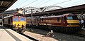 Loco changes at York, Tees Goblin, 90 028, 67 012, 66122.jpg 2,796 × 1,380; 667 KB
-
 Loco changes at York, Tees Goblin, 90 028, 67 012.jpg 3,004 × 1,600; 769 KB
-
 Londis - Oak Tree Lane - geograph.org.uk - 2672208.jpg 640 × 480; 55 KB
-
 Long Furrow - Wheatfield Lane - geograph.org.uk - 2670640.jpg 640 × 480; 47 KB
-
 Long Ridge Lane - Millfield Lane - geograph.org.uk - 2660737.jpg 640 × 480; 40 KB
-
 Long Ridge Lane - Station Road - geograph.org.uk - 2659769.jpg 640 × 480; 87 KB
-
 Lowfield Drive - Oaken Grove - geograph.org.uk - 2669725.jpg 640 × 480; 40 KB
-
 Lund Close - Green Dike - geograph.org.uk - 2670624.jpg 640 × 480; 71 KB
-

-
 Mallard Way - Station Road - geograph.org.uk - 2669572.jpg 640 × 480; 53 KB
-
 Mancroft - Wheatfield Lane - geograph.org.uk - 2670628.jpg 640 × 480; 49 KB
-
 Manor Garth - Green Dike - geograph.org.uk - 2670621.jpg 640 × 480; 58 KB
-
 Martin's Newsagents - The Village - geograph.org.uk - 2671378.jpg 640 × 480; 52 KB
-
 Middle Banks - Green Dike - geograph.org.uk - 2670613.jpg 640 × 480; 49 KB
-
 Middlethorpe Hall (hotel) - geograph.org.uk - 2650003.jpg 1,600 × 1,200; 607 KB
-
 Midway Avenue - Allerton Drive - geograph.org.uk - 2660729.jpg 640 × 480; 80 KB
-
 Midway Avenue - Easthorpe Drive - geograph.org.uk - 2660749.jpg 640 × 480; 63 KB
-
-
 Millfield Gardens - Millfield Lane - geograph.org.uk - 2660751.jpg 640 × 480; 73 KB
-

-

-

-
 Minor road towards Acaster Malbis - geograph.org.uk - 2648572.jpg 1,600 × 1,200; 633 KB


_-_Greenshaw_Drive_-_geograph.org.uk_-_2671135.jpg)


_towards_Copmanthorpe_-_geograph.org.uk_-_2649894.jpg)


_off_Ebor_Way_-_geograph.org.uk_-_2649884.jpg)


.jpg)


_-_geograph.org.uk_-_2650003.jpg)


