Category:October 2013 in Nevada
English: Images/pictures taken in Nevada during October 2013. Note this is not the date of the upload, nor the date a photo was scanned.
States of the United States: Alabama · Alaska · Arizona · Arkansas · California · Colorado · Connecticut · Delaware · Florida · Georgia · Hawaii · Idaho · Illinois · Indiana · Iowa · Kentucky · Louisiana · Maine · Maryland · Massachusetts · Michigan · Minnesota · Missouri · Montana · Nebraska · Nevada · New Hampshire · New Jersey · New Mexico · New York · North Carolina · North Dakota · Ohio · Oklahoma · Oregon · Pennsylvania · Rhode Island · South Carolina · South Dakota · Tennessee · Texas · Utah · Vermont · Virginia · Washington · West Virginia · Wisconsin · Wyoming – Washington, D.C.
Puerto Rico
Puerto Rico
| October 2012 | ← | October 2013 | → | October 2014 | |||||||||
| Jan | Feb | Mar | Apr | May | Jun | Jul | Aug | Sep | Oct | Nov | Dec | ||
| ← | 40 | 7 | 66 | 119 | 50 | 263 | 467 | 330 | 607 | 219 | 20 | 22 | → |
|---|---|---|---|---|---|---|---|---|---|---|---|---|---|
Subcategories
This category has the following 4 subcategories, out of 4 total.
Media in category "October 2013 in Nevada"
The following 200 files are in this category, out of 215 total.
(previous page) (next page)-

-
 2013-10-01 18 20 27 National Weather Service Forecast Office in Elko, Nevada.JPG 3,264 × 2,448; 1.66 MB
-

-

-
 2013-10-06 13 27 37 Mileage to destinations sign on Lamoille Canyon Road.JPG 3,264 × 2,448; 3.24 MB
-
 2013-10-06 13 34 56 No Winter Maintenance sign on Lamoille Canyon Road.JPG 3,264 × 2,448; 3.1 MB
-

-

-

-
 2013-10-06 14 36 48 Sign for Terraces Picnic Site.JPG 3,264 × 2,448; 4.35 MB
-
 2013-10-06 14 37 03 View up Lamoille Creek from the Terraces Picnic Site.JPG 3,264 × 2,448; 2.74 MB
-
 2013-10-06 14 38 48 Panorama from the parking lot at Terraces Picnic Site.JPG 14,144 × 2,048; 22.66 MB
-
 2013-10-06 14 49 07 Treasures of Lamoille Canyon Nature Trail broshure front cover.JPG 2,448 × 3,264; 1.8 MB
-
 2013-10-06 14 49 22 Treasures of Lamoille Canyon Nature Trail broshure pages 2 and 3.JPG 3,264 × 2,448; 2.3 MB
-
 2013-10-06 14 49 30 Treasures of Lamoille Canyon Nature Trail broshure pages 4 and 5.JPG 3,264 × 2,448; 2.2 MB
-
 2013-10-06 14 49 38 Treasures of Lamoille Canyon Nature Trail broshure pages 7 and 8.JPG 3,264 × 2,448; 2.05 MB
-
 2013-10-06 14 49 46 Treasures of Lamoille Canyon Nature Trail broshure pages 9 and 10.JPG 3,264 × 2,448; 2.25 MB
-
 2013-10-06 14 49 56 Treasures of Lamoille Canyon Nature Trail broshure pages 11 and 12.JPG 3,264 × 2,448; 1.85 MB
-
 2013-10-06 14 50 04 Treasures of Lamoille Canyon Nature Trail broshure back page.JPG 2,448 × 3,264; 1.61 MB
-
 2013-10-06 15 14 46 Sign for Thomas Canyon Campground.JPG 3,264 × 2,448; 4.05 MB
-
 2013-10-06 15 22 33 View down Lamoille Creek above Lamoille Falls.JPG 3,264 × 2,448; 3.73 MB
-

-
 2013-10-06 15 26 16 View down Lamoille Canyon from Moraine Overlook.JPG 3,264 × 2,448; 2.9 MB
-
 2013-10-06 15 26 27 View up Right Fork Lamoille Canyon from Moraine Overlook.JPG 3,264 × 2,364; 4.56 MB
-

-

-

-

-
-
 2013-10-06 15 39 02 Welcome to Lamoille Canyon descriptive sign at the Entrance Overlook.JPG 2,448 × 3,264; 2.38 MB
-
 2013-10-06 15 43 17 Power House Picnic Site sign.JPG 3,264 × 2,448; 3.21 MB
-
 2013-10-06 15 44 37 View up Lamoille Creek at the Power House Picnic Site.JPG 3,264 × 2,448; 4.37 MB
-
 2013-10-06 15 44 59 View down Lamoille Creek at the Power House Picnic Site.JPG 3,264 × 2,448; 4.61 MB
-
 2013-10-06 15 47 35 Cottonwoods at the Power House Picnic Site in Lamoille Canyon.JPG 3,264 × 2,448; 4.85 MB
-
 2013-10-06 15 48 48 Cottonwoods at the Power House Picnic Site in Lamoille Canyon.JPG 3,060 × 2,448; 6.56 MB
-
 2013-10-06 15 49 48 Cottonwoods at the Power House Picnic Site in Lamoille Canyon.JPG 3,264 × 2,448; 4.52 MB
-
 2013-10-06 15 49 52 Cottonwoods at the Power House Picnic Site in Lamoille Canyon.JPG 3,264 × 2,448; 5.02 MB
-
 2013-10-06 15 52 02 Cottonwoods along Lamoille Creek at the entrance of Lamoille Canyon.JPG 3,264 × 2,448; 4.88 MB
-
 2013-10-07 18 26 53 Sunset in Elko, Nevada.JPG 3,264 × 2,448; 1.59 MB
-
 2013-10-08 12 35 56 Ruby Dome viewed from Lamoille Highway.JPG 3,264 × 2,448; 2.75 MB
-

-
 2013-10-08 14 35 20 View up Lamoille Canyon from the Roads End trailhead.JPG 3,264 × 2,448; 2.33 MB
-

-

-
 2013-10-08 14 44 31 Avalanche chute near the Watershed Overlook in Lamoille Canyon.JPG 3,264 × 2,448; 3.32 MB
-
 2013-10-08 14 46 31 Full 360 degree panorama from the Watershed Overlook in Lamoille Canyon.JPG 16,716 × 2,084; 27.66 MB
-

-
 2013-10-08 14 53 55 Chokecherry at Thomas Canyon Campground in Lamoille Canyon.JPG 3,264 × 2,448; 4.24 MB
-

-

-

-

-

-

-
 2013-10-08 15 01 34 Panorama from Moraine Overlook in Lamoille Canyon.JPG 10,784 × 2,424; 16.63 MB
-

-
 2013-10-08 15 03 08 View down Lamoille Canyon from Glacier Overlook.JPG 3,264 × 2,448; 3 MB
-
 2013-10-08 15 09 16 View up Lamoille Canyon from Entrance Overlook.JPG 3,264 × 2,448; 3.01 MB
-
 2013-10-08 15 10 28 View down Lamoille Canyon from Entrance Overlook.JPG 3,264 × 2,448; 2.95 MB
-
 2013-10-08 15 10 30 Full 360 degree panorama from Entrance Overlook in Lamoille Canyon.JPG 16,140 × 2,257; 25.96 MB
-

-
-

-
 2013-10-11 12 49 31 Panorama from Glacier Overlook in Lamoille Canyon.JPG 10,416 × 2,260; 15.38 MB
-
 2013-10-11 12 50 50 View up Lamoille Canyon Road near Lamoille Falls.JPG 3,264 × 2,448; 3.35 MB
-
 2013-10-11 13 12 27 Aspen grove near the Lamoille Number 3 SnoTel.JPG 3,264 × 2,448; 4.49 MB
-
 2013-10-11 13 12 55 Aspens near the Lamoille Number 3 SnoTel.JPG 3,264 × 2,448; 4.66 MB
-
 2013-10-11 13 15 18 Lamoille Canyon SnoTel.JPG 3,264 × 2,448; 4.93 MB
-
 2013-10-11 13 16 20 Lamoille Canyon SnoTel.JPG 3,264 × 2,448; 4.82 MB
-
 2013-10-11 13 17 10 Lamoille Canyon SnoTel.jpg 3,264 × 2,448; 4.5 MB
-
 2013-10-11 13 17 55 Lamoille Canyon SnoTel.JPG 2,448 × 3,264; 4.95 MB
-
 2013-10-11 13 18 07 Lamoille Canyon SnoTel.JPG 3,728 × 2,558; 6.08 MB
-
 2013-10-11 13 19 07 Lamoille Canyon SnoTel.JPG 3,264 × 2,448; 4.72 MB
-
 2013-10-11 13 19 15 Lamoille Canyon SnoTel.JPG 2,448 × 3,264; 3.67 MB
-
 2013-10-11 13 19 29 Lamoille Canyon SnoTel.JPG 3,824 × 2,480; 6.04 MB
-
 2013-10-11 13 21 19 Lamoille Canyon SnoTel snow pillow.JPG 3,264 × 2,448; 4.85 MB
-
 2013-10-11 13 21 49 Lamoille Canyon SnoTel temperature and snow depth sensors.JPG 3,264 × 2,448; 2.87 MB
-
 2013-10-11 13 21 55 Lamoille Canyon SnoTel snow pillow.JPG 3,264 × 2,448; 4.82 MB
-
 2013-10-11 13 25 22 Aspens near the Lamoille Number 3 SnoTel.JPG 3,264 × 2,448; 3.15 MB
-
 2013-10-11 13 25 31 Aspens near the Lamoille Number 3 SnoTel.JPG 3,264 × 2,448; 4.61 MB
-
 2013-10-11 13 25 39 Aspens near the Lamoille Number 3 SnoTel.JPG 3,264 × 2,448; 5.01 MB
-
 2013-10-11 13 29 31 Aspen grove along Lamoille Canyon Road below the nature trail.JPG 3,264 × 2,448; 4.21 MB
-
 2013-10-11 13 29 36 Aspen grove along Lamoille Canyon Road below the nature trail.JPG 3,264 × 2,448; 4.18 MB
-
 2013-10-11 13 29 40 Aspen grove along Lamoille Canyon Road below the nature trail.JPG 3,264 × 2,448; 4.36 MB
-

-
 2013-10-11 13 31 40 Aspens along Lamoille Canyon Road.JPG 3,264 × 2,448; 4.89 MB
-
 2013-10-11 13 31 56 Aspens along Lamoille Canyon Road.JPG 3,264 × 2,448; 4.9 MB
-
 2013-10-11 13 35 47 Aspens just east of the entrance to Thomas Canyon in Lamoille Canyon.JPG 3,264 × 2,448; 3.01 MB
-
-
 2013-10-11 13 42 30 Sign at the entrance to Camp Lamoille.JPG 3,264 × 2,448; 2.84 MB
-
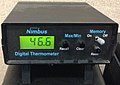 2013-10-14 11 06 12 Nimbus electronic thermometer display.JPG 2,122 × 1,498; 846 KB
-
 2013-10-14 12 27 14 National Weather Service snow board and snow measuring stick.JPG 3,264 × 2,448; 2.96 MB
-
 2013-10-14 12 27 21 Nimbus electronic temperature sensor housing.JPG 2,448 × 3,264; 3.08 MB
-
 2013-10-14 12 27 49 National Weather Service Standard Rain Gauge.JPG 2,448 × 3,264; 2.94 MB
-
 2013-10-14 12 27 56 National Weather Service Standard Rain Gauge with funnel on.JPG 3,264 × 2,448; 2.3 MB
-

-
 2013-10-14 12 33 44 National Weather Service Cooperative Observer site.JPG 3,264 × 2,448; 3.48 MB
-

-
 2013-10-14 13 53 18 Fischer & Porter recording precipitation gauge.JPG 2,448 × 3,264; 2.96 MB
-
 2013-10-14 13 58 31 Nimbus temperature sensor interior.JPG 3,264 × 2,448; 2.02 MB
-
 2013-10-14 15 58 39 Radiosonde Surface Observing Instrumentation System display.JPG 2,448 × 3,264; 2.15 MB
-
 2013-10-14 16 00 23 Upper Air (weather balloon) inflation building.JPG 3,264 × 2,448; 2.09 MB
-
 2013-10-14 16 01 24 Radiosonde ready for release.JPG 3,264 × 2,448; 2.8 MB
-
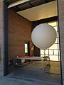 2013-10-14 16 02 16 Weather balloon ready for release.JPG 2,448 × 3,264; 1.96 MB
-
 2013-10-14 16 03 08 Weather balloon just after release.JPG 2,448 × 3,264; 1.73 MB
-
 2013-10-14 16 05 17 Radiosonde Surface Observing Instrumentation System.JPG 2,448 × 3,264; 2.54 MB
-
 2013-10-14 18 03 06 Sunset in Elko, Nevada.JPG 3,264 × 2,448; 1.47 MB
-
 2013-10-14 18 03 26 National Weather Service Forecast Office in Elko, Nevada.JPG 3,264 × 2,448; 2.09 MB
-
 2013-10-15 13 21 54 Road leading into Power House Picnic Site in Lamoille Canyon.JPG 3,264 × 2,448; 2.74 MB
-
 2013-10-15 13 22 25 View up Lamoille Creek in Power House Picnic Site.JPG 3,264 × 2,448; 4.09 MB
-

-
 2013-10-15 13 24 40 Aspen and dogwood at Power House Picnic Site in Lamoille Canyon.JPG 3,264 × 2,448; 4.65 MB
-
 2013-10-15 13 24 53 View up Lamoille Creek in Power House Picnic Site.JPG 3,264 × 2,448; 3.66 MB
-
 2013-10-15 13 26 56 View up Lamoille Creek in Power House Picnic Site.JPG 3,264 × 2,448; 4.63 MB
-
 2013-10-15 13 28 16 View up Lamoille Creek in Power House Picnic Site.JPG 3,264 × 2,448; 3.44 MB
-

-
 2013-10-15 13 31 44 Aspen and dogwood at Power House Picnic Site in Lamoille Canyon.JPG 3,264 × 2,448; 4.5 MB
-
 2013-10-15 13 33 40 View up Lamoille Creek in Power House Picnic Site.JPG 3,264 × 2,448; 4.6 MB
-
 2013-10-15 13 34 01 Dogwoods at Power House Picnic Site in Lamoille Canyon, Nevada.jpg 3,264 × 2,448; 2.99 MB
-
-

-
 2013-10-15 13 36 50 Dogwoods at Power House Picnic Site in Lamoille Canyon, Nevada.jpg 3,264 × 2,448; 4.23 MB
-
 2013-10-15 13 38 03 Dogwoods at Power House Picnic Site in Lamoille Canyon, Nevada.jpg 3,264 × 2,448; 3.4 MB
-
 2013-10-15 13 38 12 Rose bushes at Power House Picnic Site in Lamoille Canyon.JPG 2,448 × 3,264; 3.75 MB
-
 2013-10-15 13 40 52 USGS stream gauge along Lamoille Creek at Power House Picnic Site.JPG 2,448 × 3,264; 4.19 MB
-

-
 2013-10-15 13 50 41 Sign for the Humboldt National Forest along Lamoille Canyon Road.JPG 3,264 × 2,448; 2.32 MB
-
 2013-10-15 14 10 41 Aspens along Lamoille Canyon Road below Terraces Picnic Site.JPG 3,264 × 2,448; 4.11 MB
-
 2013-10-15 14 10 47 Aspens along Lamoille Canyon Road below Terraces Picnic Site.JPG 3,264 × 2,448; 4.05 MB
-
 2013-10-17 06 57 12 Sunrise in Elko, Nevada.JPG 3,264 × 2,448; 1.57 MB
-
 2013-10-18 06 56 14 Sunrise in Elko, Nevada.JPG 3,264 × 2,448; 1.86 MB
-

-

-

-
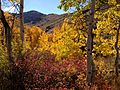
 2013-10-20 13 49 46 Aspens on the west side of Harrison Pass.JPG 3,264 × 2,448; 3.18 MB
-
 2013-10-20 13 52 48 View south from Harrison Pass.JPG 3,264 × 2,448; 2.2 MB
-

-

-

-

-
-

-

-
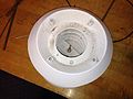
 2013-10-20 14 19 03 Maximum and Minimum Thermometers within a Cotton Region Shelter.jpg 3,264 × 2,448; 2.4 MB
-
 2013-10-20 14 20 39 Anemometer used to measure for wind movement at an evaporation pan.JPG 2,448 × 3,264; 4.09 MB
-
 2013-10-20 14 21 47 Entrance sign at Ruby Lake National Wildlife Refuge.JPG 3,264 × 2,448; 2.84 MB
-

-
 2013-10-20 14 39 19 Aspens on the east side of Harrison Pass.JPG 2,448 × 3,264; 4 MB
-
 2013-10-20 14 40 04 Aspens on the east side of Harrison Pass.JPG 2,448 × 3,264; 4.16 MB
-
 2013-10-20 14 40 17 Aspens on the east side of Harrison Pass.JPG 3,264 × 2,448; 4.03 MB
-
 2013-10-20 14 44 25 Aspens on the east side of Harrison Pass.JPG 3,264 × 2,448; 4.29 MB
-
 2013-10-20 14 44 59 Aspens on the east side of Harrison Pass.JPG 3,264 × 2,448; 3.67 MB
-
 2013-10-20 14 59 07 Aspens on the east side of Harrison Pass.JPG 3,264 × 2,448; 3.82 MB
-
 2013-10-20 15 00 00 Aspens on the east side of Harrison Pass.JPG 3,264 × 2,448; 2.95 MB
-
 2013-10-20 15 00 05 Aspens on the east side of Harrison Pass.JPG 3,264 × 2,448; 3.37 MB
-
 2013-10-20 15 00 18 Aspens on the east side of Harrison Pass.JPG 3,264 × 2,448; 4.02 MB
-
 2013-10-20 15 00 57 Aspens on the east side of Harrison Pass.JPG 3,264 × 2,448; 3.02 MB
-
 2013-10-20 15 01 20 Aspens on the east side of Harrison Pass.JPG 3,264 × 2,448; 3.53 MB
-
 2013-10-20 15 01 27 Aspens on the east side of Harrison Pass.JPG 3,264 × 2,448; 3.49 MB
-
 2013-10-20 15 01 32 Aspens on the east side of Harrison Pass.JPG 3,264 × 2,448; 3.59 MB
-
 2013-10-20 15 01 40 Aspens on the east side of Harrison Pass.JPG 3,264 × 2,448; 3.1 MB
-
 2013-10-20 15 01 42 Aspens on the east side of Harrison Pass.JPG 3,264 × 2,448; 3.58 MB
-
 2013-10-20 15 01 48 Aspens on the east side of Harrison Pass.JPG 3,264 × 2,448; 3.56 MB
-
 2013-10-20 15 02 18 Aspens on the east side of Harrison Pass.JPG 3,264 × 2,448; 3.31 MB
-
 2013-10-20 15 07 02 View east from Harrison Pass.JPG 3,264 × 2,448; 3.13 MB
-
 2013-10-20 15 07 30 Panorama east from Harrison Pass.JPG 8,096 × 2,544; 13.11 MB
-

-

-
 2013-10-20 15 10 52 View west from Harrison Pass.JPG 3,264 × 2,448; 2.66 MB
-
 2013-10-20 15 11 08 Panorama west from Harrison Pass.JPG 6,720 × 2,412; 10.32 MB
-

-

-

-
 2013-10-20 15 18 01 Aspens on the west side of Harrison Pass.JPG 3,264 × 2,448; 2.77 MB
-
 2013-10-20 15 18 34 Aspens on the west side of Harrison Pass.JPG 3,264 × 2,448; 3.05 MB
-
 2013-10-20 15 18 54 Aspens on the west side of Harrison Pass.JPG 3,264 × 2,448; 3.99 MB
-
 2013-10-20 15 19 17 Aspens on the west side of Harrison Pass.JPG 2,448 × 3,264; 4.2 MB
-
 2013-10-20 15 20 14 Aspens on the west side of Harrison Pass.JPG 3,264 × 2,448; 2.78 MB
-
 2013-10-20 15 21 49 Aspens on the west side of Harrison Pass.JPG 3,264 × 2,448; 3.21 MB
-
 2013-10-20 15 24 51 Aspens on the west side of Harrison Pass.JPG 3,264 × 2,448; 2.87 MB
-

-

-

-
 2013-10-20 15 37 03 View south along Elko County Route 717 (Jiggs Road).JPG 3,264 × 2,448; 3.03 MB
-
 2013-10-20 15 37 09 View north along Elko County Route 717 (Jiggs Road).JPG 3,264 × 2,448; 3.15 MB
-

-
-
 2013-10-20 15 43 18 Helecoptor transporting cargo near Jiggs, Nevada.JPG 2,448 × 3,264; 2.73 MB
-
 2013-10-20 15 43 53 View north from the south end of Nevada State Route 228.JPG 3,264 × 2,448; 2.97 MB
-
 2013-10-20 15 44 55 View north along Nevada State Route 228 just south of Jiggs.JPG 3,264 × 2,448; 2.81 MB
-
 2013-10-20 15 46 04 View north along Nevada State Route 228 in Jiggs.JPG 3,264 × 2,448; 2.8 MB
-
 2013-10-20 15 47 12 View south along Nevada State Route 228 entering Jiggs.JPG 3,264 × 2,448; 2.97 MB
-
 2013-10-20 15 49 10 View south along Nevada State Route 228 just north of Jiggs.JPG 3,264 × 2,448; 2.78 MB
-
 2013-10-20 15 53 37 View south along Nevada State Route 228 north of Jiggs.JPG 3,264 × 2,448; 2.93 MB
-
 2013-10-20 15 58 19 View of Ruby Dome from Nevada State Route 228.JPG 3,264 × 2,448; 3.14 MB
-

-

-

-

-


_inflation_building.JPG)


_2.4_miles_east_of_Elko_County_Route_717_(Jiggs_Road).JPG)
_2.4_miles_east_of_Elko_County_Route_717_(Jiggs_Road).JPG)


.JPG)
.JPG)
_where_it_intersects_Elko_County_Route_788_(Ruby_Valley_Road).JPG)


_north_of_the_headquarters_of_Ruby_Lake_National_Wildlife_Refuge.JPG)


_at_Harrison_Pass.JPG)
_at_Harrison_Pass.JPG)

_just_west_of_Harrison_Pass.JPG)
_at_the_beginning_of_pavement_just_west_of_Harrison_Pass.JPG)
_at_the_end_of_pavement_just_west_of_Harrison_Pass.JPG)


_towards_the_south_end_of_Elko_County_Route_717_(Jiggs_Road).JPG)
_towards_the_west_end_of_Elko_County_Route_718_(Harrison_Pass_Road).JPG)
.JPG)
.JPG)
_towards_Nevada_State_Route_228.JPG)


_towards_the_west_end_of_Elko_County_Route_718_(Harrison_Pass_Road).JPG)
_towards_Harrison_Pass.JPG)