Category:October 2018 in Norfolk, England
Ceremonial counties of England: Berkshire · Buckinghamshire · Cheshire · Cornwall · Derbyshire · Devon · Dorset · East Riding of Yorkshire · East Sussex · Essex · Gloucestershire · Greater London · Greater Manchester · Hampshire · Kent · Lancashire · Leicestershire · Lincolnshire · Merseyside · Norfolk · North Yorkshire · Northumberland · Nottinghamshire · Oxfordshire · Shropshire · Somerset · South Yorkshire · Staffordshire · Suffolk · Surrey · Tyne and Wear · Warwickshire · West Midlands · West Sussex · West Yorkshire · Wiltshire ·
City-counties: Bristol ·
Former historic counties:
Other former counties:
City-counties: Bristol ·
Former historic counties:
Other former counties:
Deutsch: Bilder, die im Oktober 2018 in Norfolk, England aufgenommen worden sind. Bitte beachten Sie, dass dies weder das Datum des Uploads noch das Datum des Scannens eines Fotos ist.
English: Images/pictures taken in Norfolk, England during October 2018. Note this is not the date of the upload, nor the date a photo was scanned.
Español: Fotografías o imágenes tomadas en Norfolk, England durante octubre 2018. No es la fecha de subida ni escaneo, sino la fecha en que las fotografías o imágenes se crearon.
Esperanto: Bildoj faritaj en Norfolk, England en oktobro 2018. Tio ne estas la dato, kiam la bildoj estis alŝutitaj aŭ skanitaj.
Français : Photographies ou images prises en Norfolk, England durant octobre 2018. Ce n'est pas la date du téléchargement ou du scan.
Galego: Fotografías ou imaxes tomadas en Norfolk, England durante outubro 2018. Non é a data de subida nin escaneamento, senón a data na que se crearon as fotografías ou imaxes.
Italiano: Fotografie o immagini scattate a Norfolk, England nel ottobre 2018. Nota bene: la data non si riferisce né a quella di upload né a quella in cui la foto è stata digitalizzata.
Norsk bokmål: Bilder tatt i Norfolk, England i løpet av oktober 2018. Merk at dette ikke er datoen for opplasting, eller når et bilde har blitt skannet.
Norsk nynorsk: Bilete teke i Norfolk, England i løpet av oktober 2018. Merk at dette ikkje er datoen for opplasting, eller når eit bilete har vorte skanna.
Русский: Изображения, сделанные в Norfolk, England в течение октябрь 2018 (не дата загрузки изображения).
Українська: Зображення, зроблені в Norfolk, England протягом жовтень 2018. Зауважте, що це не дата завантаження чи дата сканування фотографії.
| October 2017 | ← | October 2018 | → | October 2019 | |||||||
| Jan | Feb | Mar | Apr | May | Jun | Jul | Aug | Sep | Oct | Nov | Dec |
| 8 | 10 | 117 | 165 | 366 | 193 | 312 | 322 | 348 | 681 | 472 | 476 |
|---|---|---|---|---|---|---|---|---|---|---|---|
Subcategories
This category has the following 2 subcategories, out of 2 total.
Media in category "October 2018 in Norfolk, England"
The following 200 files are in this category, out of 679 total.
(previous page) (next page)-
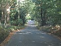
 -2018-10-01 Cromer Road, Trimingham, Norfolk.JPG 5,152 × 3,864; 6.69 MB
-
 -2018-10-01 Pedestrian-related warning road sign, Trimingham, Norfolk.JPG 3,864 × 5,152; 6.94 MB
-
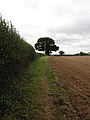
 -2018-10-01 Sandy Lane, West Runton.JPG 5,152 × 3,864; 6.37 MB
-
 -2018-10-01 Street name sign, Sandy Lane, West Runton.JPG 5,152 × 3,864; 6.71 MB
-
 -2018-10-02 Footpath sign post, Paston Way, Gimingham (1).JPG 5,152 × 3,864; 8.54 MB
-
 -2018-10-02 Footpath sign post, Paston Way, Gimingham (2).JPG 3,864 × 5,152; 5.8 MB
-
 -2018-10-02 Gimingham Hall, Hall Road, Gimingham (1).JPG 5,152 × 3,864; 6.38 MB
-
 -2018-10-02 Gimingham Hall, Hall Road, Gimingham (2).JPG 5,152 × 3,864; 7.31 MB
-
 -2018-10-02 Gimingham Hall, Hall Road, Gimingham (3).JPG 5,152 × 3,864; 7.56 MB
-
 -2018-10-02 Hall Road, Gimingham.JPG 5,152 × 3,864; 5.96 MB
-
 -2018-10-02 Hedge trimming, Hall Road, Gimingham.JPG 5,152 × 3,864; 8.05 MB
-
 -2018-10-02 Looking east along Hall Road, Gimingham.JPG 5,152 × 3,864; 7.61 MB
-
 -2018-10-02 Name sign, Gimingham Hall, Hall Road, Gimingham.JPG 5,152 × 3,864; 7.97 MB
-
 -2018-10-02 Norfolk Tawny cheese and chive scone, Norfolk (1).JPG 5,152 × 3,864; 4.17 MB
-
 -2018-10-02 Norfolk Tawny cheese and chive scone, Norfolk (2).JPG 5,152 × 3,864; 4.53 MB
-
 -2018-10-02 Paston Way, Gimingham (1).JPG 5,152 × 3,864; 6.15 MB
-
 -2018-10-02 Paston Way, Gimingham (2).JPG 3,864 × 5,152; 8.11 MB
-
 -2018-10-02 Paston Way, Gimingham (3).JPG 3,864 × 5,152; 5.96 MB
-
 -2018-10-02 Paston Way, Gimingham (4).JPG 3,864 × 5,152; 5.96 MB
-
 -2018-10-02 Paston Way, Gimingham (5).JPG 3,864 × 5,152; 5.58 MB
-
 -2018-10-02 Paston Way, Gimingham (6).JPG 3,864 × 5,152; 5.6 MB
-
 -2018-10-02 Pond next to Paston Way, Gimingham.JPG 5,152 × 3,864; 6.62 MB
-
 -2018-10-02 Southrepps Road, Gimingham (1).JPG 5,152 × 3,864; 5.04 MB
-
 -2018-10-02 Southrepps Road, Gimingham (2).JPG 5,152 × 3,864; 6.19 MB
-
 -2018-10-03 Free range pigs, Southrepps (1).JPG 5,152 × 3,864; 6.29 MB
-
 -2018-10-03 Free range pigs, Southrepps (2).JPG 5,152 × 3,864; 5.86 MB
-
 -2018-10-03 Free range pigs, Southrepps (3).JPG 5,152 × 3,864; 5.64 MB
-
 -2018-10-03 Free range pigs, Southrepps (4).JPG 5,152 × 3,864; 5.61 MB
-
 -2018-10-03 Southrepps parish church tower.JPG 5,152 × 3,864; 4.56 MB
-
 -2018-10-04 Abandoned Ford Transit minibus, Sidestrand (1).JPG 5,152 × 3,864; 7.21 MB
-
 -2018-10-04 Abandoned Ford Transit minibus, Sidestrand (2).JPG 5,152 × 3,864; 7.33 MB
-
 -2018-10-04 Bench on the Norfolk coast path, Overstrand.JPG 5,152 × 3,864; 7.64 MB
-
 -2018-10-04 Coast erosion on the route of Norfolk coast path, Overstrand.JPG 5,152 × 3,864; 9.24 MB
-
 -2018-10-04 Coast erosion, Overstrand.JPG 5,152 × 3,864; 5.18 MB
-
 -2018-10-04 Coast Road, Overstrand.JPG 5,152 × 3,864; 5.67 MB
-
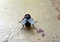 -2018-10-04 Common House Fly (Musca domestica), Trimingham (1).JPG 2,524 × 1,782; 877 KB
-
 -2018-10-04 Common House Fly (Musca domestica), Trimingham (2).JPG 2,628 × 1,917; 900 KB
-
 -2018-10-04 Fuchsia in flower (Fuchsia magellanica), Overstrand.JPG 3,864 × 5,152; 5.03 MB
-
 -2018-10-04 National Air Traffic Services (NATS) radar station, Overstrand.JPG 5,152 × 3,864; 5.12 MB
-
 -2018-10-04 Norfolk coast path, Overstrand.JPG 3,864 × 5,152; 7.65 MB
-
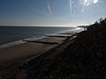
 -2018-10-04 Overstrand beach (1).JPG 5,152 × 3,864; 6.32 MB
-
 -2018-10-04 Overstrand beach (2).JPG 5,152 × 3,864; 3.08 MB
-
 -2018-10-04 Overstrand beach (3).JPG 5,152 × 3,864; 7.88 MB
-
 -2018-10-04 Quirky shed, High street, Overstrand.JPG 5,152 × 3,864; 5.8 MB
-
 -2018-10-04 Street name sign, Coast Road, Overstrand.JPG 3,683 × 2,613; 1.47 MB
-
 -2018-10-04 Street name sign, High street, Overstrand.JPG 5,152 × 3,864; 7.42 MB
-
 -2018-10-05 Field footpath in the parish of Sidestrand.JPG 3,864 × 5,152; 7.65 MB
-
 -2018-10-05 Houses in the parish of Sidestrand (1).JPG 5,152 × 3,864; 4.28 MB
-
 -2018-10-05 Houses in the parish of Sidestrand (2).JPG 5,152 × 3,864; 5.19 MB
-
 -2018-10-05 Houses in the parish of Sidestrand (3).JPG 5,152 × 3,864; 5.47 MB
-
 -2018-10-05 Norfolk Coast Path in the parish of Sidestrand.JPG 3,864 × 5,152; 6.86 MB
-
 -2018-10-05 Overstrand beach from the Norfolk Coast Path in Sidestrand.JPG 3,864 × 5,152; 5.63 MB
-
 -2018-10-05 Overstrand from the Norfolk Coast Path in Sidestrand.JPG 5,152 × 3,864; 5.75 MB
-

-

-
 -2018-10-05 Waymarker on the Norfolk Coast Path in Sidestrand.JPG 3,864 × 5,152; 8.43 MB
-
 -2018-10-06 Broccoli, Trimingham (1).JPG 5,152 × 3,864; 5.97 MB
-
 -2018-10-06 Broccoli, Trimingham (2).JPG 5,152 × 3,864; 4.55 MB
-
 -2018-10-06 Fruit on Varity 'Sub Arctic Plenty' Tomato Plants, Trimingham.JPG 5,152 × 3,864; 6.15 MB
-
 -2018-10-06 Radishes, Trimingham.JPG 5,152 × 3,864; 7 MB
-
 -2018-10-07 Caterpillar, large cabbage white butterfly, Trimingham, Norfolk (1).JPG 3,945 × 2,753; 2.58 MB
-
 -2018-10-07 Caterpillar, large cabbage white butterfly, Trimingham, Norfolk (2).JPG 2,652 × 1,807; 1.25 MB
-
 -2018-10-07 Caterpillar, large cabbage white butterfly, Trimingham, Norfolk (3).JPG 4,219 × 2,899; 3.3 MB
-
 -2018-10-07 Cement mixer, North Walsham and Dilham Canal.JPG 5,152 × 3,864; 8.93 MB
-
 -2018-10-07 Cows next to North Walsham and Dilham Canal, Norfolk (1).JPG 5,152 × 3,864; 9.77 MB
-
 -2018-10-07 Cows next to North Walsham and Dilham Canal, Norfolk (2).JPG 5,152 × 3,864; 9.4 MB
-
 -2018-10-07 Ebridge lock, North Walsham and Dilham Canal (1).JPG 5,152 × 3,864; 8.35 MB
-
 -2018-10-07 Ebridge lock, North Walsham and Dilham Canal (2).JPG 3,864 × 5,152; 7.84 MB
-
 -2018-10-07 Ebridge lock, North Walsham and Dilham Canal (3).JPG 3,864 × 5,152; 6.06 MB
-
 -2018-10-07 Ebridge Mill pond weir, North Walsham and Dilham Canal (1).JPG 5,152 × 3,864; 5.88 MB
-
 -2018-10-07 Ebridge Mill pond weir, North Walsham and Dilham Canal (2).JPG 5,152 × 3,864; 5.42 MB
-
 -2018-10-07 Ebridge Mill pond, North Walsham and Dilham Canal (1).JPG 5,152 × 3,864; 5.39 MB
-
 -2018-10-07 Ebridge Mill pond, North Walsham and Dilham Canal (2).JPG 5,152 × 3,864; 4.63 MB
-
 -2018-10-07 Ebridge Mill, North Walsham and Dilham Canal (1).JPG 5,152 × 3,864; 4.95 MB
-
 -2018-10-07 Ebridge Mill, North Walsham and Dilham Canal (2).JPG 5,152 × 3,864; 5.05 MB
-
 -2018-10-07 Ebridge Mill, North Walsham and Dilham Canal (3).JPG 5,152 × 3,864; 6.5 MB
-
 -2018-10-07 Ebridge Mill, North Walsham and Dilham Canal (4).JPG 5,152 × 3,864; 7.4 MB
-
 -2018-10-07 Ebridge Mill, North Walsham and Dilham Canal (5).JPG 3,864 × 5,152; 5.87 MB
-
 -2018-10-07 Ebridge Mill, North Walsham and Dilham Canal, Norfolk.JPG 3,864 × 5,152; 5.4 MB
-
 -2018-10-07 Name sign, Ebridge Mill, North Walsham and Dilham Canal.JPG 5,152 × 3,864; 6.18 MB
-
 -2018-10-07 North Walsham and Dilham Canal (1).JPG 5,152 × 3,864; 5.51 MB
-
 -2018-10-07 North Walsham and Dilham Canal (2).JPG 5,152 × 3,864; 6.69 MB
-
 -2018-10-07 North Walsham and Dilham Canal (3).JPG 5,152 × 3,864; 5.57 MB
-
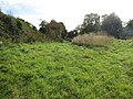
 -2018-10-07 WWI pillbox in a field overlooking the North Walsham and Dilham Canal.JPG 5,152 × 3,864; 7.7 MB
-
 -2018-10-08 Anchor road, North Walsham and Dilham Canal.JPG 5,152 × 3,864; 6.18 MB
-
 -2018-10-08 Anchor road, North Walsham.JPG 3,864 × 5,152; 6.45 MB
-
 -2018-10-08 Bacton Mill canal arm, North Walsham and Dilham Canal, Norfolk.JPG 5,152 × 3,864; 4.98 MB
-
 -2018-10-08 Bacton Wood bridge, North Walsham and Dilham Canal (1).JPG 5,152 × 3,864; 5.11 MB
-
 -2018-10-08 Bacton Wood bridge, North Walsham and Dilham Canal (2).JPG 5,152 × 3,864; 8.13 MB
-
 -2018-10-08 Bacton Wood bridge, North Walsham and Dilham Canal (3).JPG 5,152 × 3,864; 7.91 MB
-
 -2018-10-08 Bacton Wood bridge, North Walsham and Dilham Canal (4).JPG 5,152 × 3,864; 6.24 MB
-
 -2018-10-08 Bacton Wood bridge, North Walsham and Dilham Canal (5).JPG 5,152 × 3,864; 9.07 MB
-
 -2018-10-08 Bacton Wood bridge, North Walsham and Dilham Canal (7).JPG 5,152 × 3,864; 9.02 MB
-
 -2018-10-08 Bacton wood Lock, North Walsham and Dilham Canal, Norfolk (1).JPG 5,152 × 3,864; 8.39 MB
-
 -2018-10-08 Bacton wood Lock, North Walsham and Dilham Canal, Norfolk (10).JPG 5,152 × 3,864; 5.88 MB
-
 -2018-10-08 Bacton wood Lock, North Walsham and Dilham Canal, Norfolk (11).JPG 5,152 × 3,864; 7.37 MB
-
 -2018-10-08 Bacton wood Lock, North Walsham and Dilham Canal, Norfolk (12).JPG 5,152 × 3,864; 5.82 MB
-
 -2018-10-08 Bacton wood Lock, North Walsham and Dilham Canal, Norfolk (2).JPG 5,152 × 3,864; 7.8 MB
-
 -2018-10-08 Bacton wood Lock, North Walsham and Dilham Canal, Norfolk (3).JPG 5,152 × 3,864; 7.42 MB
-
 -2018-10-08 Bacton wood Lock, North Walsham and Dilham Canal, Norfolk (4).JPG 5,152 × 3,864; 6.54 MB
-
 -2018-10-08 Bacton wood Lock, North Walsham and Dilham Canal, Norfolk (5).JPG 5,152 × 3,864; 5.61 MB
-
 -2018-10-08 Bacton wood Lock, North Walsham and Dilham Canal, Norfolk (6).JPG 3,864 × 5,152; 6.57 MB
-
 -2018-10-08 Bacton wood Lock, North Walsham and Dilham Canal, Norfolk (7).JPG 3,864 × 5,152; 4.52 MB
-
 -2018-10-08 Bacton wood Lock, North Walsham and Dilham Canal, Norfolk (8).JPG 3,864 × 5,152; 5.9 MB
-
 -2018-10-08 Bacton wood Lock, North Walsham and Dilham Canal, Norfolk (9).JPG 5,152 × 3,864; 7.76 MB
-
 -2018-10-08 Bacton wood Lock, North Walsham and Dilham Canal, Norfolk.JPG 5,152 × 3,864; 8.57 MB
-
 -2018-10-08 Bacton wood staithe, North Walsham and Dilham Canal (2).JPG 5,152 × 3,864; 6.75 MB
-
 -2018-10-08 Bacton wood staithe, North Walsham and Dilham Canal (3).JPG 5,152 × 3,864; 7.35 MB
-
 -2018-10-08 Bacton wood Staithe, North Walsham and Dilham Canal, Norfolk (1).JPG 5,152 × 3,864; 7 MB
-
 -2018-10-08 Bacton wood Staithe, North Walsham and Dilham Canal, Norfolk (2).JPG 5,152 × 3,864; 7.33 MB
-
 -2018-10-08 Bacton wood staithe, North Walsham and Dilham Canal.JPG 5,152 × 3,864; 7.39 MB
-
-
-
 -2018-10-08 Diesel water pump, Bacton Wood staithe, North Walsham and Dilham Canal.JPG 5,152 × 3,864; 9.1 MB
-
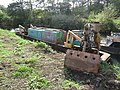 -2018-10-08 Dredging boat, North Walsham and Dilham Canal, Norfolk.JPG 5,152 × 3,864; 9.59 MB
-
 -2018-10-08 Dry section of the North Walsham and Dilham Canal, Norfolk (1).JPG 5,152 × 3,864; 6.87 MB
-
 -2018-10-08 Dry section of the North Walsham and Dilham Canal, Norfolk (2).JPG 5,152 × 3,864; 8.11 MB
-
 -2018-10-08 Dry section of the North Walsham and Dilham Canal, Norfolk (4).JPG 5,152 × 3,864; 6.88 MB
-
 -2018-10-08 Dry section of the North Walsham and Dilham Canal, Norfolk (5).JPG 5,152 × 3,864; 6.31 MB
-
 -2018-10-08 Hymac excavator, Bacton Wood staithe, North Walsham and Dilham Canal (1).JPG 5,152 × 3,864; 10.05 MB
-
 -2018-10-08 Hymac excavator, Bacton Wood staithe, North Walsham and Dilham Canal (2).JPG 5,152 × 3,864; 9.34 MB
-
 -2018-10-08 Hymac excavator, Bacton Wood staithe, North Walsham and Dilham Canal (3).JPG 5,152 × 3,864; 6.47 MB
-
 -2018-10-08 Mill road, Bacton.JPG 3,864 × 5,152; 7.66 MB
-
 -2018-10-08 North Walsham and Dilham Canal, Bacton Wood staithe (1).JPG 5,152 × 3,864; 6.5 MB
-
 -2018-10-08 North Walsham and Dilham Canal, Bacton Wood staithe (2).JPG 5,152 × 3,864; 6.74 MB
-
 -2018-10-08 North Walsham and Dilham Canal, Bacton Wood staithe (3).JPG 3,864 × 5,152; 5.39 MB
-
 -2018-10-08 Street name sign, Anchor road, North Walsham.JPG 3,855 × 2,775; 3.51 MB
-
 -2018-10-08 Street name sign, Mill road, Bacton.JPG 5,152 × 3,864; 9.32 MB
-
-
-
 -2018-10-09 Abat-sons, Parish church of Saint Giles, Bradfield, Norfolk.JPG 3,864 × 5,152; 8.63 MB
-
 -2018-10-09 Antingham Hill Level Crossing, Antingham, Norfolk (1).JPG 5,152 × 3,864; 4.78 MB
-
 -2018-10-09 Antingham Hill Level Crossing, Antingham, Norfolk (2).JPG 5,152 × 3,864; 5.53 MB
-
 -2018-10-09 Antingham Hill Level Crossing, Antingham, Norfolk (3).JPG 3,864 × 5,152; 6.89 MB
-
 -2018-10-09 Antingham Hill Level Crossing, Antingham, Norfolk (4).JPG 5,152 × 3,864; 5.39 MB
-
 -2018-10-09 Antingham Hill, Norfolk (1).JPG 3,864 × 5,152; 8.02 MB
-
 -2018-10-09 Antingham Hill, Norfolk (2).JPG 3,864 × 5,152; 7.5 MB
-
 -2018-10-09 Baptismal font, Saint Giles, Bradfield, Norfolk.JPG 3,864 × 5,152; 4.33 MB
-
 -2018-10-09 Bench-end, Parish church of Saint Giles, Bradfield, Norfolk.JPG 3,864 × 5,152; 4.33 MB
-
 -2018-10-09 Bittern Line Crossing, Antingham, Norfolk (1).JPG 5,152 × 3,864; 6.03 MB
-
 -2018-10-09 Bittern Line Crossing, Antingham, Norfolk (2).JPG 5,152 × 3,864; 6.19 MB
-
 -2018-10-09 Chancel, Saint Giles, Bradfield, Norfolk.JPG 3,864 × 5,152; 4.22 MB
-
 -2018-10-09 Crossing cottage, Antingham, Norfolk.JPG 5,152 × 3,864; 6.12 MB
-
 -2018-10-09 Drainage ditch next to small holding, Antingham.JPG 3,864 × 5,152; 8.89 MB
-
 -2018-10-09 Eagle lecterns, Parish church of Saint Giles, Bradfield, Norfolk.JPG 3,864 × 5,152; 4.3 MB
-
 -2018-10-09 Entrance porch, Saint Giles, Bradfield, Norfolk.JPG 5,152 × 3,864; 6.37 MB
-
 -2018-10-09 Flowering shrub next to footpath, Antingham.JPG 3,864 × 5,152; 8.21 MB
-
 -2018-10-09 Flowers, Trimingham, Norfolk (1).JPG 5,152 × 3,864; 5.07 MB
-
 -2018-10-09 Flowers, Trimingham, Norfolk (2).JPG 5,152 × 3,864; 7.51 MB
-
 -2018-10-09 Footbridge over River Ant, Antingham Hill, Norfolk (2).JPG 5,152 × 3,864; 6.03 MB
-
 -2018-10-09 Footbridge over River Ant, Antingham Hill, Norfolk.JPG 5,152 × 3,864; 6.64 MB
-
 -2018-10-09 Footpath alonside railway line, Antingham (1).JPG 3,864 × 5,152; 6.78 MB
-
 -2018-10-09 Footpath alonside railway line, Antingham (2).JPG 3,864 × 5,152; 6.41 MB
-
 -2018-10-09 Greenhouse and vegetable garden , Antingham.JPG 5,152 × 3,864; 7.33 MB
-
 -2018-10-09 Main door, Parish church of Saint Giles, Bradfield, Norfolk.JPG 3,864 × 5,152; 3.83 MB
-
 -2018-10-09 Nave, Saint Giles, Bradfield, Norfolk (1).JPG 3,864 × 5,152; 4.47 MB
-
 -2018-10-09 Nave, Saint Giles, Bradfield, Norfolk (3).JPG 3,864 × 5,152; 4.33 MB
-
 -2018-10-09 Parish church of Saint Giles, Bradfield, Norfolk (1).JPG 3,864 × 5,152; 7.03 MB
-
 -2018-10-09 Parish church of Saint Giles, Bradfield, Norfolk (2).JPG 3,864 × 5,152; 6.47 MB
-
 -2018-10-09 Parish church of Saint Giles, Bradfield, Norfolk (3).JPG 3,864 × 5,152; 6.99 MB
-
 -2018-10-09 Parish church of Saint Giles, Bradfield, Norfolk (4).JPG 5,152 × 3,864; 6.94 MB
-
 -2018-10-09 Pinnacle, Parish church of Saint Giles, Bradfield, Norfolk.JPG 3,864 × 5,152; 5.07 MB
-
 -2018-10-09 Plaque above entrance porch, Saint Giles, Bradfield, Norfolk.JPG 3,864 × 5,152; 7.6 MB
-
 -2018-10-09 Pulpit, Parish church of Saint Giles, Bradfield, Norfolk.JPG 3,864 × 5,152; 3.62 MB
-
 -2018-10-09 Reredoses, Parish church of Saint Giles, Bradfield, Norfolk.JPG 5,152 × 3,864; 4.23 MB
-
 -2018-10-09 River Ant, Antingham Hill, Norfolk (1).JPG 3,864 × 5,152; 7.77 MB
-
 -2018-10-09 River Ant, Antingham Hill, Norfolk (3).JPG 3,864 × 5,152; 5.67 MB
-
 -2018-10-09 Square tracery window, Parish church of Saint Giles, Bradfield, Norfolk.JPG 3,864 × 5,152; 7.49 MB
-
 -2018-10-09 Stone cross, Parish church of Saint Giles, Bradfield, Norfolk.JPG 3,864 × 5,152; 4.2 MB
-
 -2018-10-09 Stop sign, Antingham Hill Level Crossing, Antingham, Norfolk (1).JPG 3,864 × 5,152; 5.64 MB
-
 -2018-10-09 Telephone, Antingham Hill Level Crossing, Antingham, Norfolk.JPG 3,864 × 5,152; 6.37 MB
-
 -2018-10-09 Warning sign, Antingham Hill Level Crossing, Antingham, Norfolk.JPG 3,864 × 5,152; 3.1 MB
-
 -2018-10-09 Warning signs, Antingham Hill Level Crossing, Antingham, Norfolk.JPG 5,152 × 3,864; 5.42 MB
-
 -2018-10-09 Window, south elevation, Saint Giles, Bradfield, Norfolk.JPG 3,864 × 5,152; 6.96 MB
-
 -2018-10-09 Window, West elevation, Bradfield, Norfolk.JPG 3,864 × 5,152; 6.22 MB
-
 -2018-10-09 WWI memorial plaque, Parish church of Saint Giles, Bradfield, Norfolk (1).JPG 2,373 × 3,124; 1.09 MB
-
 -2018-10-09 WWI memorial plaque, Parish church of Saint Giles, Bradfield, Norfolk (2).JPG 3,864 × 5,152; 2.51 MB
-
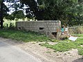
 -2018-10-09 WWI pill box, Common Road, Bradfield.JPG 5,152 × 3,864; 9.24 MB
-
 -2018-10-10 A line of Second World War anti-tank obstacles, Mundesley beach.JPG 5,152 × 3,864; 5.78 MB
-
 -2018-10-10 Archway, Fishermen's Hospital, Great Yarmouth.jpg 800 × 598; 125 KB
-
 -2018-10-10 Back to Backs Pub, Row 46, Sewell’s Row, Great Yarmouth.jpg 800 × 558; 102 KB
-

-
 -2018-10-10 Barber shop, King Street, Great Yarmouth (1).jpg 800 × 583; 117 KB
-
 -2018-10-10 Barber shop, King Street, Great Yarmouth.jpg 800 × 582; 129 KB
-
 -2018-10-10 Bargain Buy (closed), Great Yarmouth.jpg 800 × 589; 146 KB
-
 -2018-10-10 Bench on Cardiac Hill beach footpath, Mundesley Beach (1).JPG 5,152 × 3,864; 8.52 MB
-
 -2018-10-10 Bench on Cardiac Hill beach footpath, Mundesley Beach (2).JPG 5,152 × 3,864; 3.72 MB
-
 -2018-10-10 Boats morred on the River Bure, Norfolk, England.jpg 800 × 574; 101 KB
-
 -2018-10-10 Building on King Street, Great Yarmouth.jpg 800 × 590; 106 KB
-

-

-

-
 -2018-10-10 Buskers, King Street, Great Yarmouth.jpg 800 × 584; 115 KB
-
 -2018-10-10 Café, St George's Square, Great Yarmouth.jpg 800 × 573; 122 KB
-
 -2018-10-10 Cardiac Hill beach footpath, Mundesley Beach (1).JPG 3,864 × 5,152; 8.28 MB
-
 -2018-10-10 Cardiac Hill beach footpath, Mundesley Beach (2).JPG 5,152 × 3,864; 5.92 MB
-
 -2018-10-10 Christchurch Methodist church, Great Yarmouth.jpg 800 × 593; 118 KB
-
 -2018-10-10 Courtyard, Fishermen's Hospital, Great Yarmouth.jpg 800 × 595; 121 KB
-

-


.JPG)
.JPG)
.JPG)
.JPG)
.JPG)


.JPG)
.JPG)
.JPG)
.JPG)
.JPG)
.JPG)
.JPG)
.JPG)

.JPG)
.JPG)
.JPG)
.JPG)
.JPG)
.JPG)


,_Trimingham_(1).JPG)
,_Trimingham_(2).JPG)
,_Overstrand.JPG)
_radar_station,_Overstrand.JPG)

.JPG)
.JPG)
.JPG)


.JPG)
.JPG)
.JPG)


.JPG)
.JPG)

.JPG)
.JPG)


.JPG)
.JPG)
.JPG)

.JPG)
.JPG)
.JPG)
.JPG)
.JPG)
.JPG)
.JPG)
.JPG)
.JPG)
.JPG)
.JPG)
.JPG)
.JPG)
.JPG)


.JPG)
.JPG)
.JPG)


.JPG)
.JPG)
.JPG)
.JPG)
.JPG)
.JPG)
.JPG)
.JPG)
.JPG)
.JPG)
.JPG)
.JPG)
.JPG)
.JPG)
.JPG)
.JPG)
.JPG)
.JPG)

.JPG)
.JPG)
.JPG)
.JPG)


.JPG)


.JPG)
.JPG)
.JPG)
.JPG)
.JPG)
.JPG)
.JPG)

.JPG)
.JPG)
.JPG)


.JPG)
.JPG)

.JPG)
.JPG)
.JPG)
.JPG)
.JPG)
.JPG)


.JPG)
.JPG)


.JPG)
.JPG)
.JPG)

.JPG)
.JPG)


.JPG)
.JPG)
.JPG)
.JPG)
.JPG)
.JPG)


.JPG)
.JPG)


.JPG)


.JPG)
.JPG)


.jpg)

,_Great_Yarmouth.jpg)
.JPG)
.JPG)


.jpg)


.JPG)
.JPG)


.JPG)
.JPG)